
NWP skills for operational meteorologist
Listed here are other resources related to "NWP skills for operational meteorologist" tag:
Note: click on an image to open the Resource
Pia Isolahtenmaki (stepping in for Robert Makitie) presents how FCI proxy data help in differentiating cloud types in low-cloud conditions.
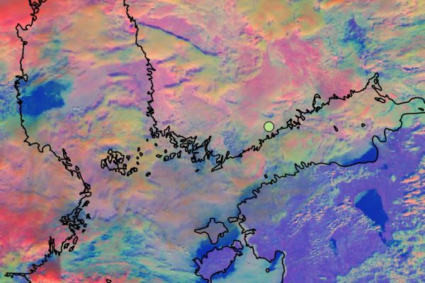
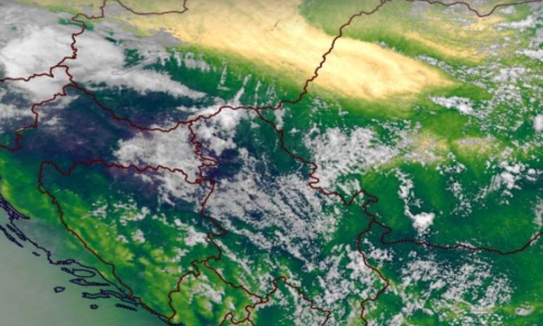
On the 11th of September an almost stationary frontal system occurred over southern Finland leading to development of a large fog cloud over the Gulf of Finland and the Baltic Sea. The fog later moved slowly over southern Finland, where Finland’s busiest airport, Helsinki-Vantaa airport, is located. The fog cloud that occurred over the Gulf of Finland was hard to spot from SEVIRI images due to different layers of middle and high clouds. When thinking about the future, the question arises, would the FCI have spotted something more in this situation?
Johannes Häkkinen presents forecasting different precipitation types and using satellites together with weather models in aviation.
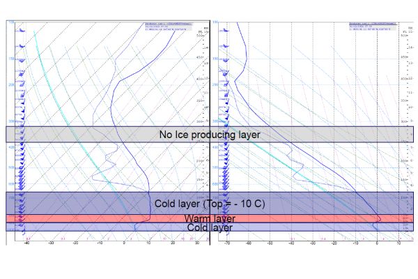
The presentation will go through different precipitation types, forecasting the precipitation types, and supporting the weather model with satellite images. The precipitation types are estimated from a model sounding by top-down method. Satellite imagery is mainly used for estimation of the cloud top. The focus is on aviation weather and short-term forecasts.
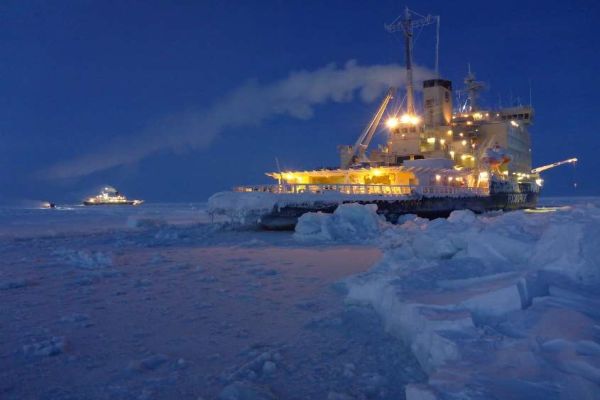
Robert Hausen describes his journey in the Arctic during the MOSAIC project.
The presentation is about the Multidisciplinary drifting Observatory for the Study of Arctic Climate (MOSAiC) from a forecaster’s perspective. As kind of an experience report this talk gives some impressions from the preparation before the expedition started up to the uncertain outcome of Leg 3 of 6 due to the Corona Crisis and other circumstances.

Vojtěch Bližňák presents how the satellite cloud data helps forecasting road surface temperature in Czechia.
The goal of the contribution is to assess an impact of extrapolated cloud cover derived from satellite observations on forecasts of road surface temperature (RST) performed by the road weather model (RWM) FORTE. Based on road weather station measurements and forecasts of the ALADIN numerical weather prediction (NWP) model, which are used as inputs to prepare initial and boundary conditions, the RWM generates a linearly continuous forecast of RST on selected Czech highways. The work will compare the evaluation of RST forecasts generated by two model runs using NWP and satellite-derived cloud cover estimation.
Virve Karsisto shows the road model FMI uses to forecast road conditions.
Finnish Meteorological Institute’s (FMI) road weather model has been in operational use over 20 years. The forecasts help in the road maintenance decision making and give useful information for road users about the driving conditions. Recently, a shadowing algorithm has been implemented to the model to take in to account the shadowing caused by the surrounding objects. This helps to make more localized forecasts, as shadowing can cause great differences in road temperature even between different lanes.
Minna Haikonen explains how FMI collaborates with customers in delivering important warnings.
Finnish Meteorological Institute produces weather services for land traffic and shipping to ensure safety and cost effective planning on everyday decision making for customers and stakeholders. FMI produces wide range of weather services including weather and road weather forecasts, observation services and warnings that can be tailored according to customer needs. One example of these a tailored weather services is a so called pre warning service for rail traffic operation and maintenance which is based on meteorological consultation via email or video conference system all around the year. FMI`s meteorologists monitor weather 24/7 basis and issue pre warnings according to the customer needs. There are several parameters that need to be monitored and the pre warning is issued whenever it seems likely that a predefined threshold will be met. During wintertime these pre warnings are proven to be very important especially before heavy snowfall cases not to mention if there is also low temperatures and hard winds appearing at the same time.
Becky Hemingway present ECMWF's Precipitation Type and Extreme Forecast Index products.
ECMWF produces a vast array of global forecast data on a daily basis. In order to make this data useable a large number of products are created and made available to ECMWF Member and Cooperating States and the wider meteorological community via OpenCharts and ecCharts. This presentation will focus on two products which help forecasters in forecasting extreme precipitation, Precipitation Type and the Extreme Forecast Index (EFI). Both products are generally well liked by forecasters and are seen to verify well. The talk will detail how the products are created using the ECMWF Ensemble Forecast System, discuss how to use the products and provide case studies of cold weather events including from the high-latitude regions.
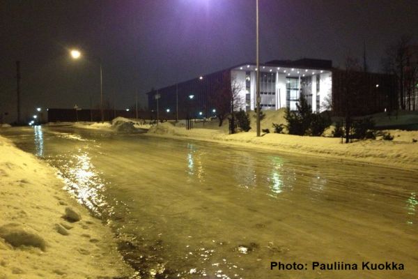
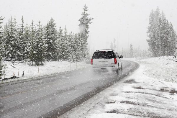
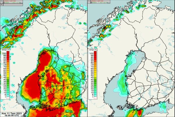
Marjo Hippi explains how FMI deals with slipperiness during winter.
Icy and snowy sidewalks are very typical phenomena in Finland during winter. Near zero temperatures and slipperiness due to ice and snow on sidewalks increases the pedestrians' slip risk. Almost every second person slips annually in Finland and around 50 000 persons (1 % of Finnish population) are injured needing medical attention. Slip injuries cause huge economic losses, long sick leaves, and human suffering. The Finnish Meteorological Institute (FMI) has developed a numerical weather model that predicts the sidewalk slipperiness from pedestrians' point of view. The model classifies the sidewalk slipperiness into three classes: normal, slippery, and very slippery. Very slippery sidewalk condition mean that the slip risk is increased. Typical situations for very difficult sidewalk situations are packed snow, freezing or ice layer covered by water or snow. The model is a tool for duty meteorologists when issuing warning about slippery sidewalk condition.
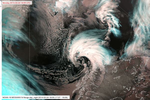
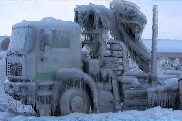
Gunnar Noer explains and showcases the nature of polar lows.
Polar lows are small but fairly intense low pressure systems that form in the Arctic marine regions during the winter season. They form in unstable air masses associated with cold air outbreaks from the Arctic ice cap. Polar Lows give rise to gale or storm force winds which, in combination with heavy snowfall, cause widespread traffic disruptions. In recent years, polar lows have caused several fatal incidents with snow avalanches. This lecture focuses on the key processes and the methodology for forecasting polar lows.
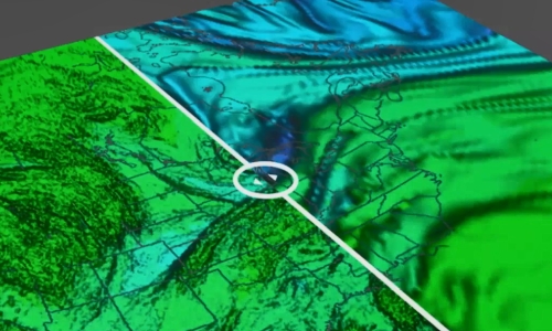
Bryan Guarante (University of Wisconsin) uses a COMET course to explain the usefulness of analysing water vapour images with a goal of assessing the NWP fields.
In dynamically-active regions of the atmosphere, water vapour imagery approximates the same surface as the 1.5PVU height or pressure surface. Because of this, we can take advantage of the WV channels to find areas of mismatch between the NWP and the real atmosphere to adjust our synoptic scale forecasts.
Pieter Groenemeijer (ESSL) presents his findings in using low-level moisture proxy data from polar orbiting satellites at European Severe Storms Laboratory training events.
In preparation for MTG data, ESSL is carrying out a series of expert workshops and Testbeds in collaboration with EUMETSAT. At both event types, the increased capabilities of detecting low-level moisture from geostationary orbit, which the MTG program will enable, have received a high amount of attention. In our presentation, we will discuss a number of convective storm cases that were studied using proxy data from polar-orbiting instruments, such as MODIS. One of the ways to visualize low-level moisture is by depicting the ratio of the 0.91 and 0.85 μm channels with an intuitive color scale. We will discuss to what extent this and other proxies for low-level humidity can be used to anticipate the presence of a crucial ingredient for severe deep, moist convection...
Wilfried Jacobs (DWD) introduces the water vapour channels in the 2022 EUMeTrain Water Vapour Event Week.
The target group of this presentation is participants that are not familiar or do not feel familiar enough for understanding the presentations during the entire week. The first presentation deals with basics of vapour water channels in satellite products. First, the principle of radiation and radiation transfer will be outlined briefly and put in relation to wave lengths of imagers and vertical sounders by considering weighting functions. The second part deals with some examples by using single channels. Finally, corresponding composites (RGBs) and their applications will explained in detail.