Public weather service
Listed here are other resources related to Public weather service tag:
Note: click on an image to open the Resource
Stefan Stapelberg introduces Level 2 products from EUMETSAT's IRS intstrument.
The Infrared Sounder (IRS) aboard Europe’s new meteorological satellite offers highresolution, frequent atmospheric observations to enhance weather forecasting. Using EUMETSAT’s piecewise linear regression method, it retrieves detailed temperature, humidity, and ozone profiles with uncertainty estimates. These data, combined with cloud information and Instability indices, are expected to improve the performance of numerical weather prediction (NWP) models, particularly in the context of severe storm forecasting.
Go to lecture slides
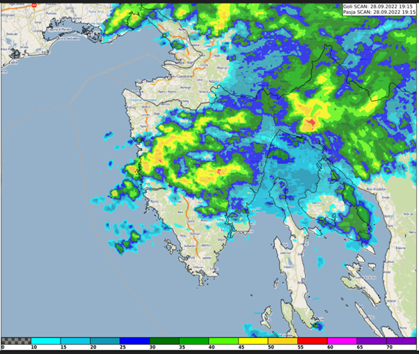
Case study about the extreme precipitation event in Rijeka, Croatia on 28 September 2022. The study focuses on the special case of convective development that caused the severe event.
This study accompanies the simulator.
Georg Pistotnik covers the topic of drylines, shows it's relevance in severe weather development.
Drylines are boundaries separating warmer and drier from cooler and moister air, usually resulting from differential diurnal heating and therefore vertical mixing. The most common and distinct dryline in the Alpine region is the boundary between Foehn winds (dynamically driven) and upvalley/upslope circulations (thermally driven). Thunderstorms often form along drylines and intensify when they move onto their moist side, where CAPE and vertical wind shear are systematically enhanced and favor convective organization. This presentation highlights how station and readiosonde data, high-resolution satellite imagery and even webcam images can be integrated into the nowcasting of drylines and resulting thunderstorms, using some prominent cases of the past few years in the eastern Alpine region.
Lecture slides
Katarina Katušić talks about Croatian Met Service work principles and schedules, case study and satellite products used during operational shift work.
The Weather and Marine Analysis and Forecasting Sector is a part of the Croatian Meteorological and Hydrological Service (DHMZ), and it is in charge of weather forecasts and warnings for the public and numerous companies. Over the years, we have gone through many challenges. Quite recently, during the lockdown, the earthquake severely damaged our headquarters, and even with those difficulties the work did not stop. We also prepare and present weather forecasts for national television. Furthermore, this presentation will cover the usage of weather satellite products in daily operational work.
Lecture slides
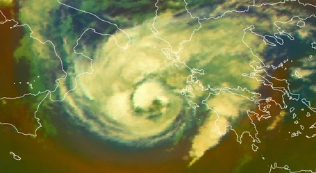
A new conceptual model on Mediterranean hurricanes - "Medicanes".
Medicanes are rare, intense and destructive warm-core cyclones occasionally generated in Mediterranean Basin.
Compared with tropical cyclones, medicanes are weaker and smaller in size, with diameters under 300 km, while the diameter of a hurricane is larger than 1000 km. Hurricanes move in general from east to west due to easterly winds, while medicanes generally (but not always) move from west to east due to the mid-latitude westerlies.
Medicanes mostly occur in the western Mediterranean and in the region extending from the Ionian Sea to the North African coast. There is strong variability from year to year without any significant trends.
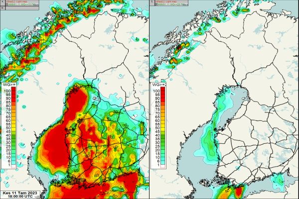
Minna Haikonen explains how FMI collaborates with customers in delivering important warnings.
Finnish Meteorological Institute produces weather services for land traffic and shipping to ensure safety and cost effective planning on everyday decision making for customers and stakeholders. FMI produces wide range of weather services including weather and road weather forecasts, observation services and warnings that can be tailored according to customer needs. One example of these a tailored weather services is a so called pre warning service for rail traffic operation and maintenance which is based on meteorological consultation via email or video conference system all around the year. FMI`s meteorologists monitor weather 24/7 basis and issue pre warnings according to the customer needs. There are several parameters that need to be monitored and the pre warning is issued whenever it seems likely that a predefined threshold will be met. During wintertime these pre warnings are proven to be very important especially before heavy snowfall cases not to mention if there is also low temperatures and hard winds appearing at the same time.
Irene Schicker taks about wind forecasts needed to efficiently operate wind turbines.
With the increase in wind energy production being fed into the power grid accurate high frequency predictions of the estimate d power for the next hours and days ahead are needed to schedule feed-in rates and secure power grid stability. To achieve this a combination of different kinds of information and data sets are needed. Here, statistical and machine learning methods proved to be a suitable tool. However, a thorough selection of input data is needed as well as considering extreme events (upper and lower tails) in model training and avoiding smoothed forecasts.
A brief introduction into post-processing for wind energy applications using statistics and machine learning, including useful tools/methods/data, will be given.
Sabine Zerobin recaps the steps necessary to plan, construct and operate wind turbines.
A reliable wind measurement is the basis for the successful accomplishment of wind power projects and the profitable operation of wind farms. Therefore, the current presentation gives an overview about the steps that are necessary to develop a wind power project from the green field, starting with a well-defined measurement campaign. Besides constraints originating from the conditions on site, pros and cons of different measurement techniques as well as the corresponding technical standards have to be kept in mind.
Reaching the measurement target therefore means, that sufficient data in a good quality is available to be used for further evaluations andassessments of the regarded site, which are then used to determine whether a project can be realised in terms of profit as we ll as from the technical point of view.
Even after a successful realisation of a project, wind measurements still play an important role, especially when it comes to the verification of the plant performance.
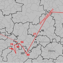
Tomas Pucik gives a presentation on the severe tornado that took place in southern Moravia in June 2021.
Violent (F4 - F5) tornadoes are extremely rare in Europe, which makes it almost impossible for local forecasters or surveyors to build experience with such events. This makes appropriate training for dealing with such events very important. After providing a brief overview of the climatology of tornadoes across Europe, we concentrate on violent tornadoes from three perspectives. The first perspective is typical damage associated with tornadoes of such strength, as documented from a field survey of the Moravian tornado. The second perspective is a contrast of precautions needed to take in such an event compared to the standard set of precautions mentioned in the standard severe wind warnings. The third perspective is an overview of contemporary procedures on forecasting and nowcasting such events compared to the environment and evolution of the 24th June case.
Lukas Tüchler presents a method to detect downdrafts from thunderstorms out of Doppler-radar data.
Convective downdrafts are one of the major thunderstorm hazards which lead to frequent damage. But the prediction of these events is a challenge for the forecasters. Can radar data help in the warning of severe convective wind? Some prediction methods to estimate the potential downdraft wind speed from radar data are discussed.
Wilfried Jacobs discusses summer convection seen in Doppler-radar wind products.
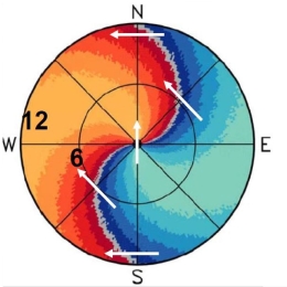
Only summer convection will be discussed. In the first part, basics of the Doppler-products‘ interpretation will be outlined (radial wind components, folding, convergences, divergences, rotations (meso-cyclones) and gusts estimation). Especially, the interpretation of PPI-products (plan position indicator) will be discussed, also in respect to fronts and temperature advection. The second part deals with instructive examples and a short overview of automatically derived nowcasting products at DWD.
Kathrin Baumann-Stanzer discusses the pros and cons of wind measurements principles and gives a historical overview.
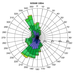
First efforts to observe the wind profile within the lowest kilometres above ground go back to the 1920s. The development of radio transmission led, among other things, to an upswing in the area of radiosondes and captive balloons. The invention of ground-based remote sensing made it possible to monitor continuously the wind profile without costly deployment of personnel. The advantages and disadvantages of measurement principles are discussed based on selected examples from measurement campaigns.

