
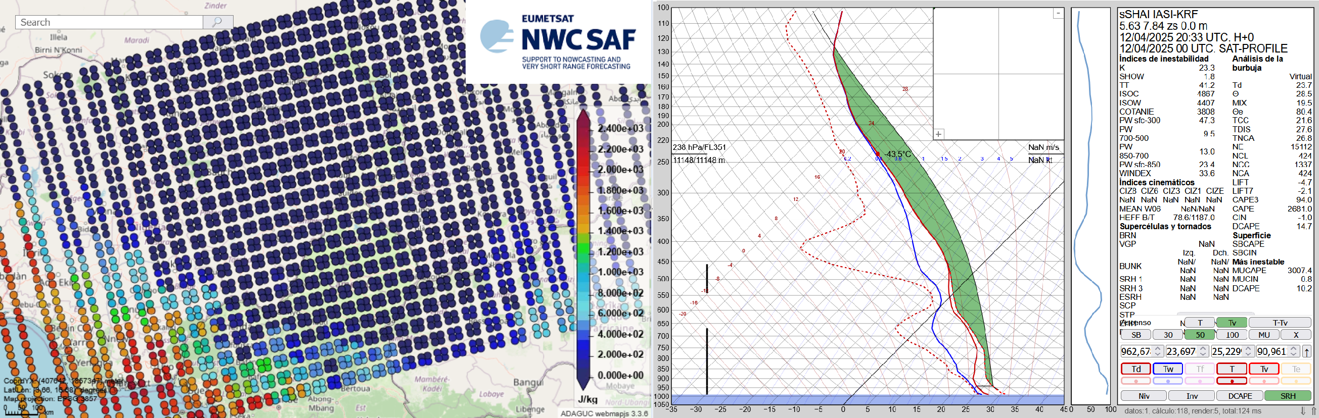
The Nowcasting SAF is planning a new software package dedicated to the new geostationary MTG-S Infrared Sounder instrument (IRS). This new software package will generate Satellite Humidity And Instability…
Meteorological Satellite Data Training
Explore a collection of product tutorials, case studies, simulators, training modules & courses
on the use satellite data for meteorological
applications & more.
Latest News
How to create or adapt an RGB scheme
Manuscript on "How to create or adapt an RGB scheme" is the latest addition to our resource library and is now available here.

Extended Guide to Cloud Type RGB
A new extended guide on Cloud Type RGB is now available here.

Atmospheric Rivers CM
A new conceptual model on Atmospheric Rivers is now available here.

Air Quality Training Module
The new Air Quality Training Module is now available here.
Extended guide to the Cloud Phase RGB
An extended guide to the Cloud Phase RGB by Mária Putsay is now available here.
Latest Publications
This document summarizes how to create a new RGB scheme and how to adapt an existing RGB for a new imager.
Categories:
Training Module

Learn more about:
- cloud classification scheme
- recognizing cloud types in satellite imagery
- a satellite product that provides cloud type information
- how cloud top…
Categories:
Training Module

This guide is about the Cloud Type RGB, a new product for European users of GEO satellite data, which can be constructed using data from the Flexible Combined Imager (FCI) on the…
Categories:
Product Tutorial