
Identify cloud types and their characteristics
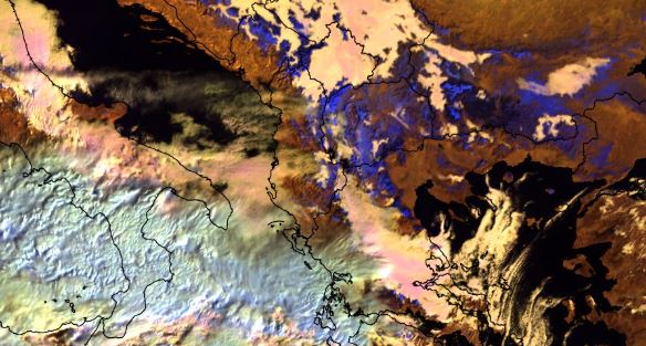
Maria Putsay discusses convective clouds that form over wildfires, focusing on Pyrocumulonimbus clouds and their detection in satellite imagery.
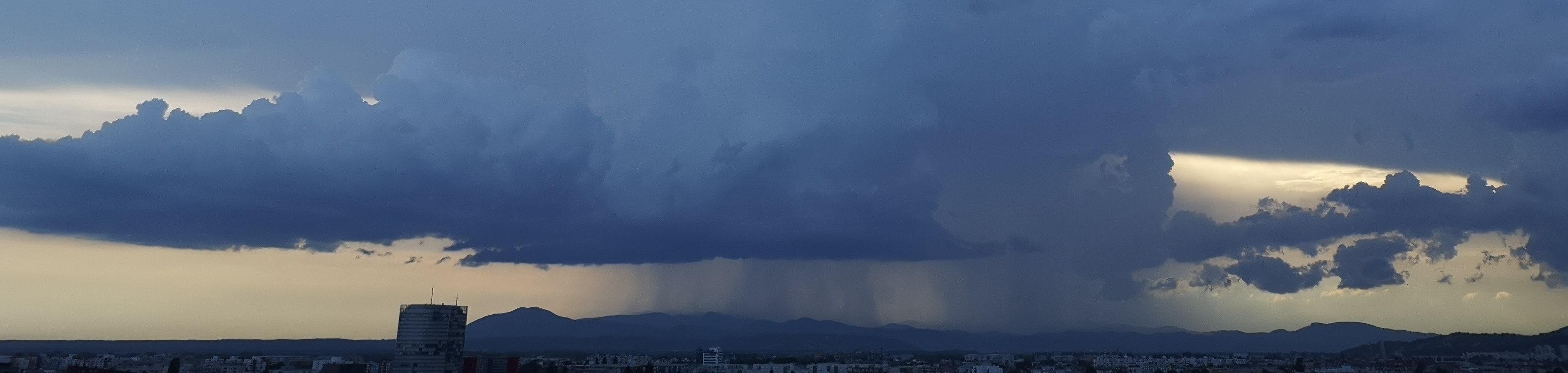
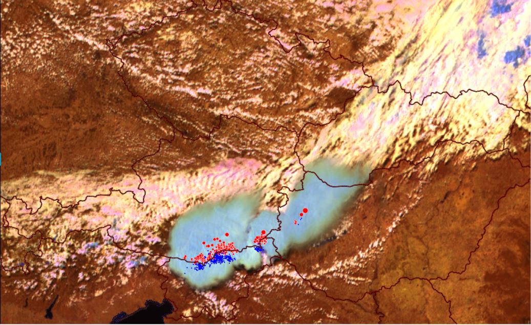
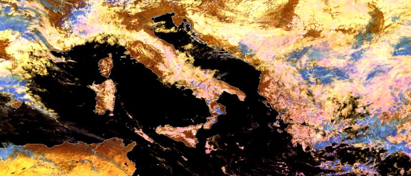
Pyrocumulonimbus (pyro-Cb) clouds can form above wildfires. These are fire-aided or fire-caused convective clouds with considerable vertical development. Large amounts of smoke particles are injected into these clouds. The increased number of condensation nuclei causes extremely small ice crystals on the cloud tops. That is why the typical colors of these clouds vary in several RGBs. The cloud top color may help to identify pyro-Cb clouds, which might be dangerous by causing extreme low-level winds, and hence increasing fire spread.
This mini-module is part of a series of MTG mini modules produced by EUMETSAT/EUMeTrain with the aim of providing quick and useful learning experience about the new satellite products.
In this exercise you are giving forecast for a shipment route that could be affected by a convective event.
Enter the mini-module.
This mini-module is part of a series of MTG mini modules produced by EUMETSAT/EUMeTrain with the aim of providing quick and useful learning experience about the new satellite products.
In this exercise you will learn how to use LI data together with ground based measurements.
Enter the mini-module.
This mini-module is part of a series of MTG mini modules produced by EUMETSAT/EUMeTrain with the aim of providing quick and useful learning experience about the new satellite products.
In this exercise you will learn how using MTG products can help you recognize convective initiation.
Enter the mini-module.
This mini-module is part of a series of MTG mini modules produced by EUMETSAT/EUMeTrain with the aim of providing quick and useful learning experience about the new satellite products.
In this exercise you will learn how to detect fog and low clouds by using FCI products.
Enter the mini-module.
This mini-module is part of a series of MTG mini modules produced by EUMETSAT/EUMeTrain with the aim of providing quick and useful learning experience about the new satellite products.
In this exercise you will learn about detection of supercooled droplets which pose a problem for the air traffic.
Enter the mini-module.
This mini-module is part of a series of MTG mini modules produced by EUMETSAT/EUMeTrain with the aim of providing quick and useful learning experience about the new satellite products.
In this exercise you will learn about the improvements in fog & low cloud detection using the new FCI products.
Enter the mini-module.
This mini-module is part of a series of MTG mini modules produced by EUMETSAT/EUMeTrain with the aim of providing quick and useful learning experience about the new satellite products.
In this exercise you will learn about different MTG products for severe weather forecasting.
Enter the mini-module.
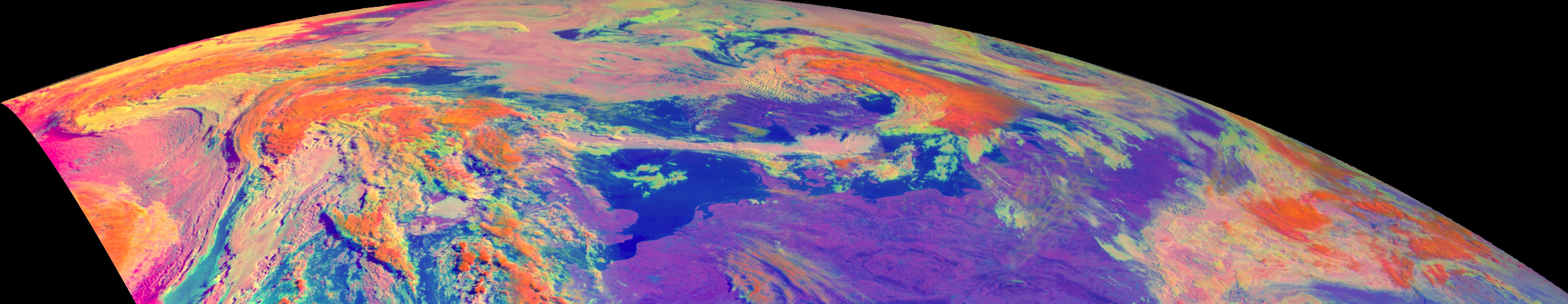
This training module shows the unique challenges that forecasters face when using satellite imagery in high latitude regions. Using a lot of examples and fun exercises, it compares different types of satellites (geostationary, polar) and different generations of satellites as well as benefits and drawbacks of each. It also explains different phenomena that occur in these high latitude regions due to viewing geometry and much more.
This resource was created in order for users to be able to access Weather Briefings page via resources search.
To access the Weather Briefings recordings, click here.
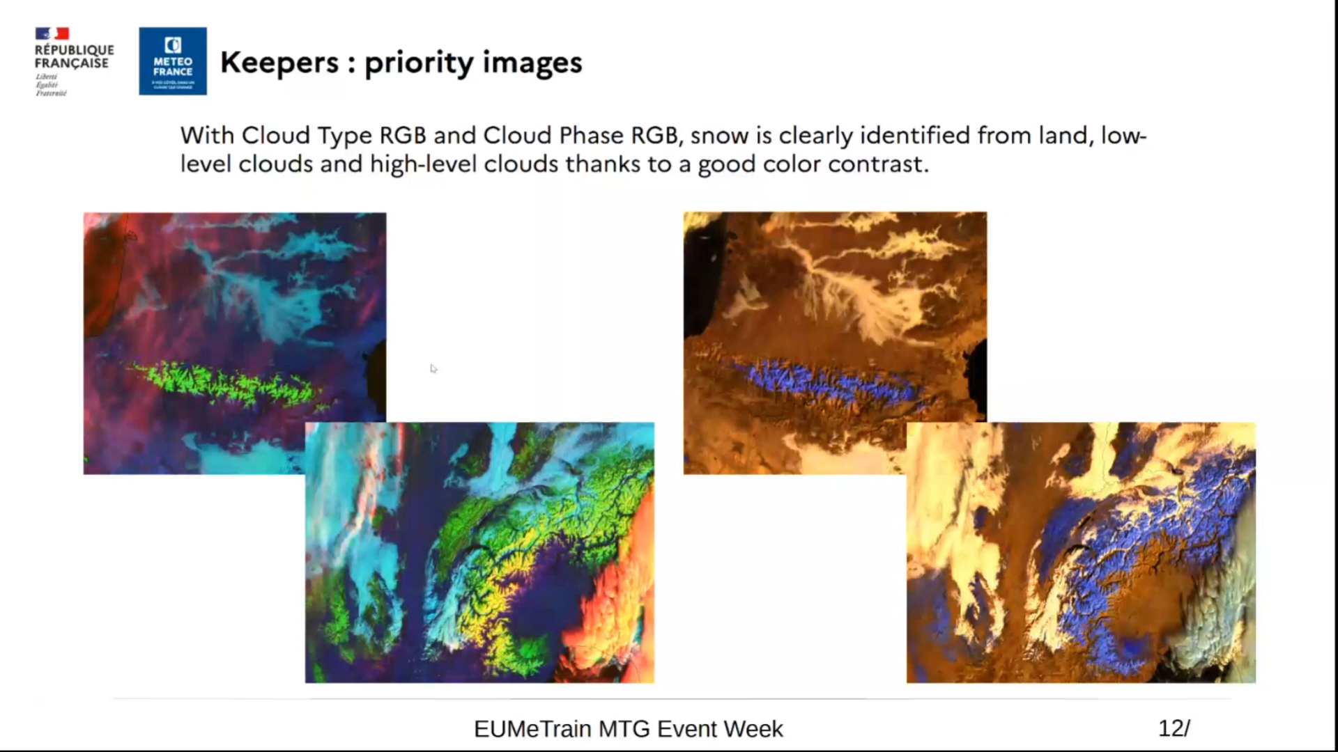
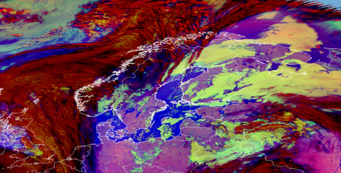
Roxane Desire shows the best RGBs for detection of typical winter weather phenomena: snow, ice and supercooled water clouds.
With the operational deployment of MTG, there are now various methods available for detecting snow on the ground. RGB products, in particular, provide high-contrast images that help distinguish snow on the ground from the underlying surface, low clouds, or ice clouds. We will also explore some important nuances to consider. Finally, still in the context of winter-related issues, we will discuss how these same RGB products can be used to detect supercooled water clouds, which can be responsible for ground ice formation or aircraft icing.
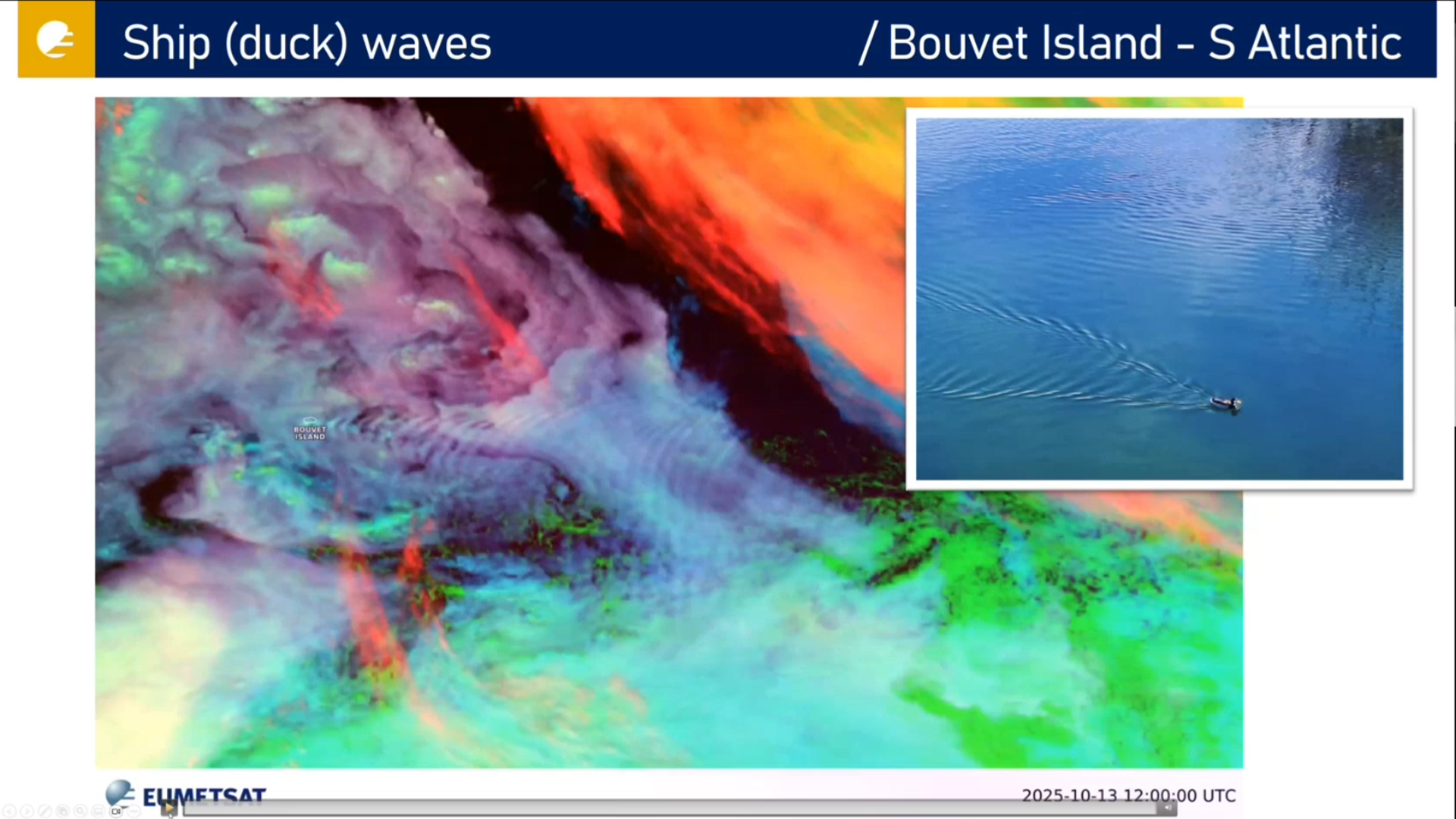
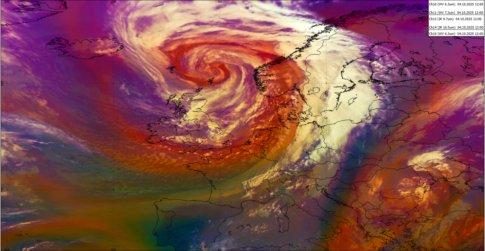
Ivan Smiljanic talks about turbulence and waves, showing many different examples.
Turbulence and waves in the atmosphere, like in other fluids, are signatures of usually dynamically strong processes that cause these disturbances. Also, they can be very dangerous on their own and can propagate to different parts of the atmosphere. Waves and turbulence behave differently in different fluids, and are seen differently with different spectral channels, thus not always easy to identify through satellite data. In this short lecture we will show you how these regular and irregular atmospheric motions are after all captured by advanced FCI instrument, and how that makes our everyday lives safer.