
Atmospheric Composition
Julian Meyer-Arnek, by using the wildfire example, explains how to access atmospheric data and analyse it with SpatioTemporal Asset Catalogue (STAC) and Jupyter Notebooks.
Trace gas column information derived from Metop/GOME-2 instruments provides comprehensive insight into fire episodes by analysing the resulting trace gas plume downwind of the fires. This demonstration focuses on the fast and simplified discovery and access to the AC SAF Level 3 trace gas information via state-of-the-art machine-to-machine interfaces (SpatioTemporal Asset Catalogue, STAC) and their time-series analysis using Jupyter Notebooks.
Download Jupyter Notebook and Instructions
Rita Durão explains the FRP's potential as an early smoke indicator and shows the connection with higher air pollutant emissions.
The intensity of a wildfire can be assessed by integrating fire radiative power (FRP) measurements over time. Since FRP is proportional to the amount of burned biomass, higher FRP values are associated with more severe fires, with higher smoke levels and, consequently, higher air pollutant emissions. Thus, the goal of this work is to assess FRP's potential as an early smoke indicator, leveraging the very high-resolution MTG data (10-minute temporal resolution). PMx and CO emitted during the August 2025 wildfires in Iberia are analyzed to illustrate the relationship between air pollutant levels and fire intensity over the affected areas.
Anu-Maija Sundstrom talks about atmospheric composition data used to monitor emissions from forest fires.
This presentation provides an introduction to satellite-based observations of atmospheric emissions from fires provided by AC SAF. It highlights key satellite products used to detect and monitor fire-related pollution, including the Absorbing Aerosol Index from GOME-2 for identifying smoke plumes, carbon monoxide (CO) observations from IASI, and the potential use of other trace gases, including GOME-2 NO₂. Together, these measurements offer complementary insights into the composition, distribution, and evolution of fire emissions, supporting air quality monitoring.
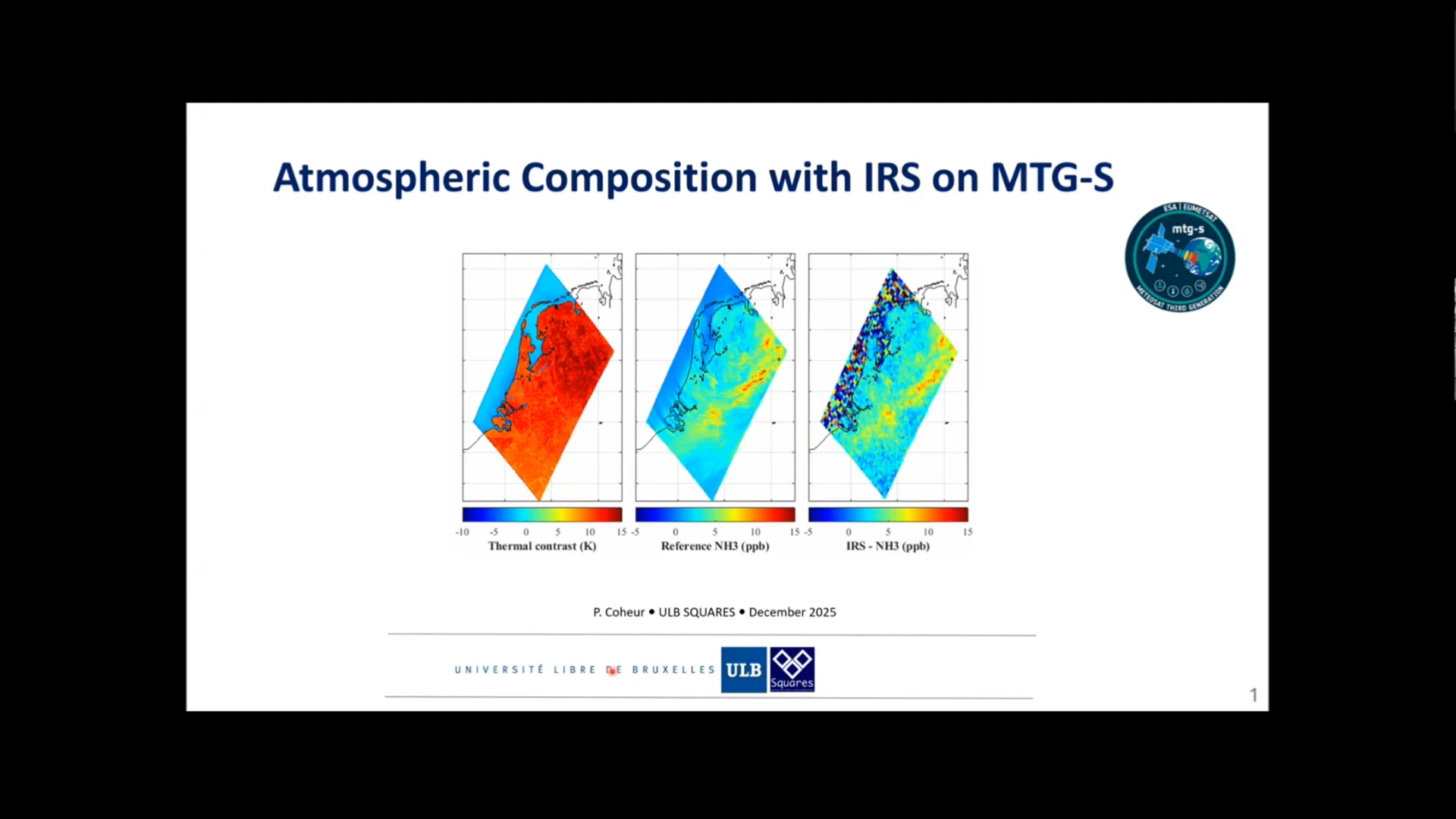
Pierre Coheur talks about the uses of IRS instrument for atmospheric composition.
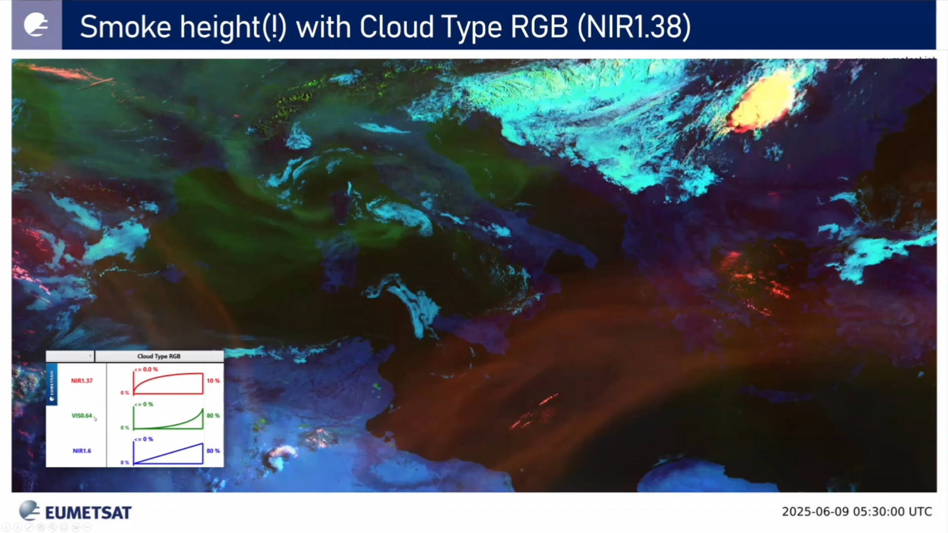
Ivan Smiljanic talks about aerosol detection with the new FCI instrument. Higher number of spectral channels coupled with increased spatial resolution make detection of aerosol better than ever.
Drawing from enhanced spectral coverage of the MTG FCI instrument (comparing with MSG SEVIRI), enhanced capabilities of aerosol detection are expected. Major improvements are during daytime related to existence of new channels with shorter wavelengths (namely VIS0.44 and VIS0.55), and to existence of new NIR1.38 that is specifically designed for detection of higher level features (including aerosols). During night time (ie 24h), enhanced spatial and radiometric resolution of IR channels offer better sensitivity to aerosols with larger particles like dust, volcanic ash or even a pollen.
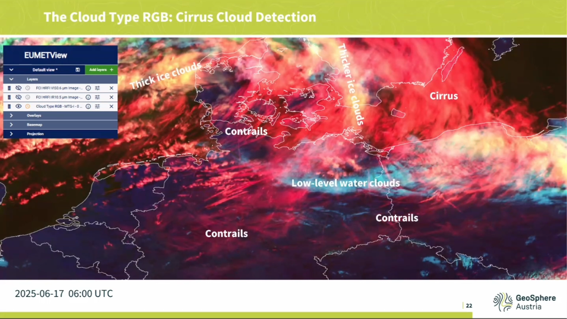
Andreas Wirth shows the benefits and drawbacks of new RGBs that are now possible with FCI and how to use them.
Besides better temporal and horizontal resolution, the FCI sensor on-board MTG-I also offers additional spectral bands mainly in the short infrared and visible range. These new channels were used to create RGB composite images such as the Cloud Type RGB, the Cloud Phase RGB, the Fire RGB and the True Color RGB. This presentation will highlight the benefits coming from these new RGB types. Application examples will be given and the impact of the new channels will be explained. The focus of this presentation will lay on the information provided by the new RGB types as well as on the limitations and challenges forecasters are confronted with when using them.
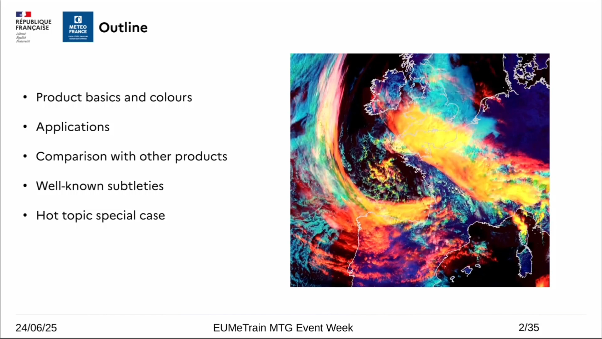
Roxane Desire gives a complete overview on the new Cloud Type RGB.
While it may seem simple to use at first glance, with its very distinctive and contrasting colors, the Cloud Type RGB product is nonetheless full of subtleties. A review of everything it is capable of and a comparison with other products.
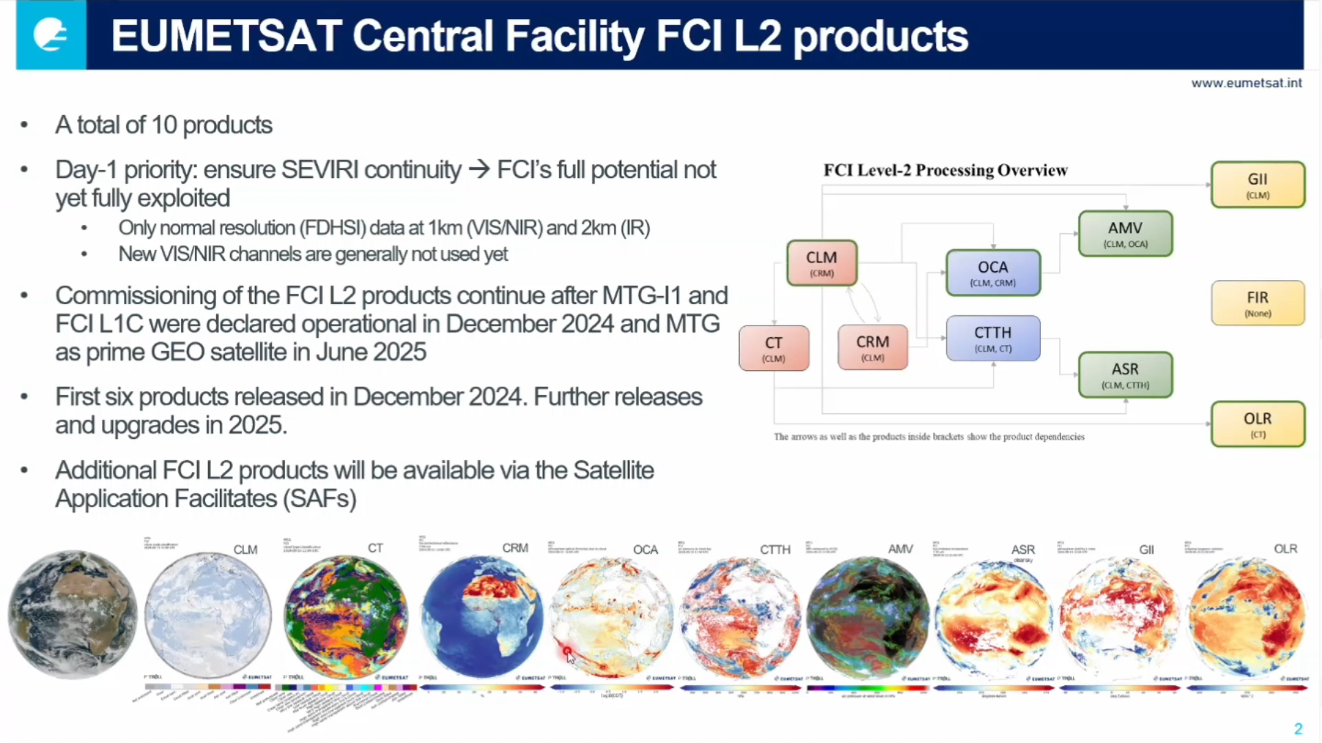
Johan Strandgren talks about the EUMETSAT Level-2 Products.
This presentation outlines the MTG-I FCI Level-2 (L2) products generated at the EUMETSAT Central Facility and disseminated to users. These products support applications such as cloud analysis, atmospheric instability, fire detection, atmospheric motion vectors, and all-sky radiances, serving data assimilation, nowcasting, and research communities. We will present early validation results from the ongoing L2 commissioning and plans for future enhancements.
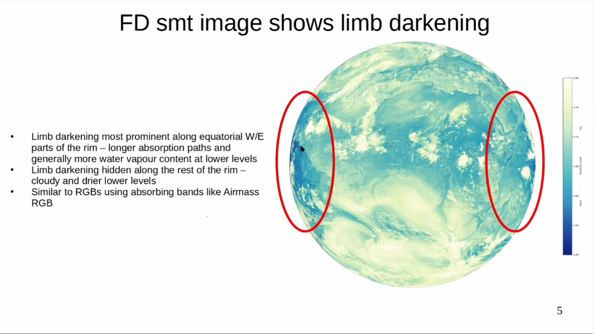
Hans Peter Roesli talks about a new product for low level moisture detection using the new 0.9 channel present on the FCI instrument.
Go to lecture slides
Sven-Erik Enno talks about the Lightning Imager instrument onboard MTG-I1 satellite.
The Meteosat Third Generation (MTG) Lightning Imager (LI) was declared operational on October 31, 2024. This brand-new European Instrument is devoted to the real-time monitoring and characterization of lightning activity over Europe, Africa, and a large portion of the Atlantic Ocean. This presentation will demonstrate LI observational capabilities from individual lightning flashes to hemisphere-scale statistics and present the outcome of the latest LI performance assessments.
Go to lecture slides
Vesa Nietosvaara gives an overview on the MTG programme and discusses FCI instrument and it's uses onboard the MTG-I1.
The complete constellation of Meteosat Third Generation (MTG) consists of three spacecraft: two imaging satellites and one sounding satellite. The first imaging satellite, MTG-I1 is now operational under the name Meteosat 12. The satellite carries two important instruments – Flexible Combined Imager (FCI), a successor of SEVIRI on MSG, and a Lightning Imager (LI), the first space-based instrument monitoring lightning occurrence over Europe, Africa and South America from geostationary orbit. In this talk, we will focus on the FCI and how it can help monitoring the weather and improving nowcasting. Forecasters will now be able to track the development of storms in near-real time with better accuracy, issue more precise and timely warnings about severe and dangerous weather events but also monitor fog development and dissipation, dust outbreaks, forest fires and many other features.
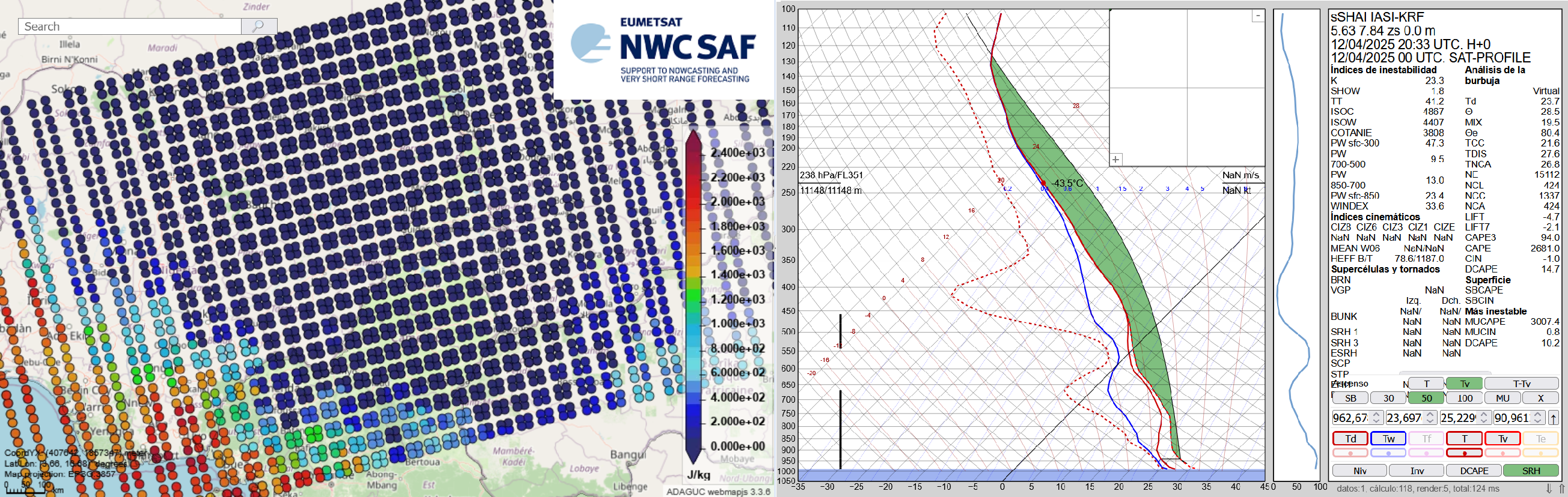
The Nowcasting SAF is planning a new software package dedicated to the new geostationary MTG-S Infrared Sounder instrument (IRS). This new software package will generate Satellite Humidity And Instability products (sSHAI) that will be key in Nowcasting using the IRS instrument. It will also deliver services to make the best use of MTG-IRS channels and combine its virtues with those of the MTG imager FCI.
In this Workshop you will learn about these revolutionary product and services. You will also have a taste of what will come in a few months with MTG-IRS by using in real world applications the prototype product obtained from the polar orbiting IASI instrument.
The Workshop is comprised of 4 presentations:
Part 1. X. Calbet (AEMET) - Introduction GEO-S
Part 2. N. Peinado-Galán (AEMET) - sSHAI prototype
Part 3. N. Peinado-Galán (AEMET) and X. Calbet (AEMET) - Practical cases with course attendants using SHAI on the EWC
Part 4. Miguel-Ángel Martínez (AEMET) - Other services from the GEO-S package: quickIRS, sSHAI_ES and Remapping tool