
Climate
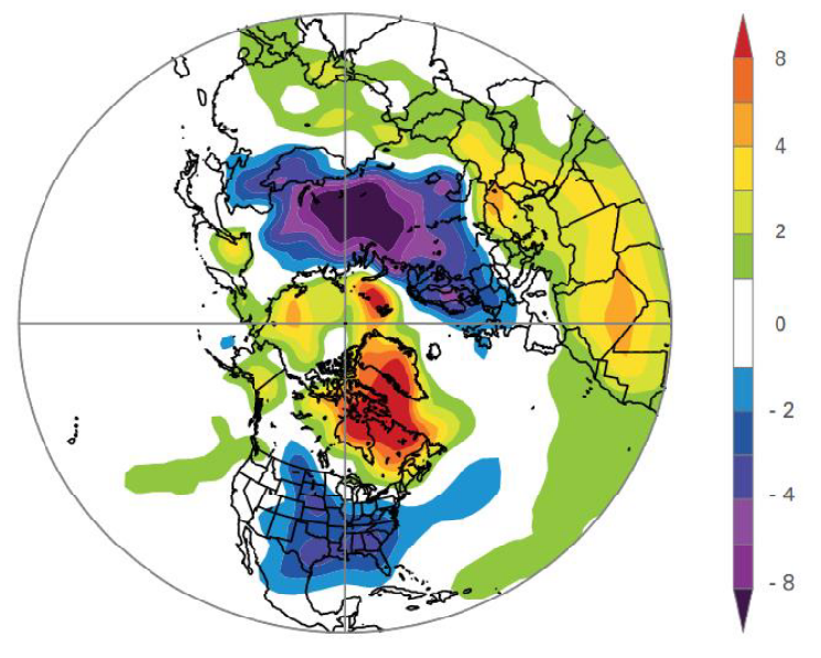
Ivan Guettler discusses climate extremes in the context of observed climate change.
Length: 30 minutes
Climate extremes were discussed in the context of the observed climate change and associated trends. The issue of attributing specific weather extreme to climate change was stressed. Several impacts on human activities was presented and estimated economical and human losses due to the weather and climate extremes were compared over different regions.
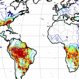
Overview on the H SAF satellite derived precipitation products.
The EUMETSAT Satellite Application Facility for Operational Hydrology and Water Management (H SAF) provides satellite products and user services in support to Operational Hydrology, Meteorology, Risk Management and Water Management. Since 2005, H SAF science and research bridge into operations through the development and dissemination of soil moisture, precipitation and snow products based on the exploitation of primary EUMETSAT missions. During the fourth Continuous Development and Operations Phase (CDOP-4, from 2022 to 2027), H SAF products will be primarily based on the Meteosat Third Generation (MTG) and the EUMETSAT Polar System -Second Generation (EPS-SG) missions. Current products are based on the use of the full constellation of microwave (MW) radiometers for Level 2 passive microwave (MW) precipitation products and for MW/IR combined products for near-real time applications over the Meteosat Second Generation (MSG) full disk area. The presentation will provide a full overview of the current status and future development of the operational precipitation product portfolio as well as the product quality assessment strategy and results. Examples of applications for specific case studies will be also presented.
Lecture slides (Panegrossi)...
Humberto Barbosa presents a study which provides a comprehensive evaluation of extreme drought events in terms of occurrence, persistence, spatial extent, severity, and impacts on streamflow and soil moisture over different time windows between 1980 and 2020.
The São Francisco River Basin (SFRB) plays a key role for the agricultural and hydropower sectors in Northeast Brazil (NEB). The purpose of this study is to provide a comprehensive evaluation of extreme drought events in terms of occurrence, persistence, spatial extent, severity, and impacts on streamflow and soil moisture over different time windows between 1980 and 2020. The Standardized Precipitation-Evapotranspiration Index (SPEI) and Standardized Streamflow Index (SSI) at 3- and 12- month time scales derived from ground data were used as benchmark drought indices. The selfcalibrating Palmer Drought Severity Index (scPDSI) and the Soil Moisture and Ocean Salinity-based Soil Water Deficit Index (SWDIS) were used to assess the agricultural drought. The Water Storage Deficit Index (WSDI) and the Groundwater Drought Index (GGDI) both derived from the Gravity Recovery and Climate Experiment (GRACE) were used to assess the hydrological drought. The SWDISa and WSDI showed the best performance in assessing agricultural and hydrological droughts across the whole SFRB.
Tommaso Abrate presents the efforts of WMO to coordinate with its Expert Network on updating the satellite data and product requirements for Flood Forecasting and seasonal and long term hydrological forecasts.
In order to better capture the complexity of interlinked natural phenomena related to the atmosphere, ocean, hydrosphere and cryosphere, WMO has adopted a holistic Earth System monitoring approach. The operational implementation of this approach is supported by WMO Congress decisions related to the establishment of a global basic observing network GBON, and the adoption of a unified data policy, aimed at improving the sharing and interoperability of data among users, contributing to better numerical weather prediction and more accurate flood and drought forecasts. To achieve these results, it is important to benefit from emerging approaches in order to combine different data sources such as satellites, citizen observations, low-cost devices, Internet of Things, Big Data. This approach also allows ensuring at least partial information overt hose vast areas of the world where conventional state-funded monitoring approaches are insufficient. WMO is developing technical solution (standards, best practices) to overcome the discrepancies in data quality and the multiplication of different data format. In this context satellite. WMO, in coordination with its Expert Network is working on updating the satellite data and product requirements for Flood Forecasting and seasonal and long term hydrological forecasts and outlook.
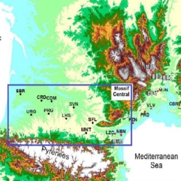
Jean-Christophe Calvet presents a neural network that has been trained using the modelled surface soil moisture (SSM), soil temperature, rainwater interception by leaves, and satellite-derived LAI observations from Copernicus.
In the context of climate warming, the frequency and the intensity of extreme events such as droughts is increasing, and better modelling the response of vegetation to climate is needed. Monitoring the impact of extreme events on terrestrial surfaces involves a number of variables of the soil-plant system such as surface albedo, the soil water content and the vegetation leaf area index (LAI). These variables can be monitored by either using the unprecedented amount of data from the Earth observation satellite fleet, or using land surface models. Another solution consists in combining all available sources of information by assimilating satellite observations into models. In this work, level 1 ASCAT backscatter values (sigma0) are assimilated in the ISBA land surface model of Meteo-France using the LDAS-Monde tool. First, an observation operator is built using machine learning. A neural network (NN) is trained using the modelled surface soil moisture (SSM), soil temperature, rainwater interception by leaves, and satellite-derived LAI observations from Copernicus. The NN is then used for simulating sigma0, making LDAS-Monde capable of assimilating ASCAT sigma0 observations. It is shown that the assimilation of sigma0 alone is able to markedly improve the simulated LAI and soil moisture.
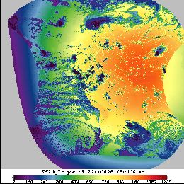
Presentation on OSI SAF radiative fluxes Products and Services.
This short presentation on OSI SAF radiative fluxes Products and Services is given by Pierre Le Borgne from Meteo-France. Two main products that are described here are Surface Solar Irradiance (SSI) product and Downward Longwave Irradiance (DLI) product. For SSI product, physical parametrization is applied and for DLI product bulk parametrization. What is derived from satellite is the visible channel for SSI and cloud precipitation DLI. Hourly SSI and DLI products and the flux validation results are also shown in this lecture.
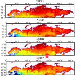
Presentation during the event week on Snow in January 2010.
Jouni Pulliainen from FMI will present research results and snow products for climate research purposes.
Another speaker from FMI, Panu Lahtinen, will give a short overview of the four snow products being developed in the Eumetsat Satellite application facility on water management and hydrology (H-SAF). The ongoing developments on these products are discussed, and the future goals are shown. Also, some validation results will be shown.
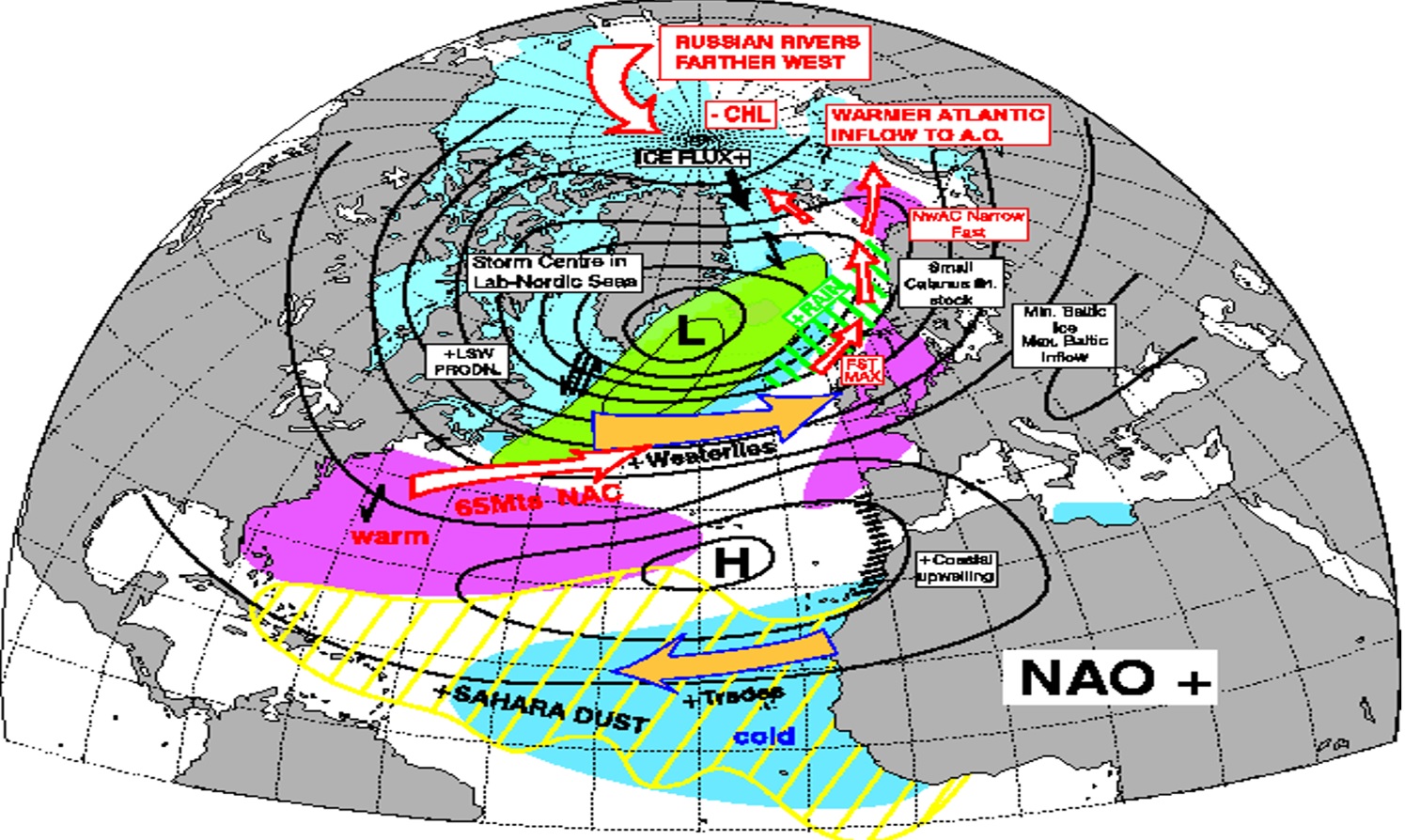
Humberto Barbosa focusses in his weather briefing on climate variability and teleconnection processes. He explains how weather anomalies like El Nino affect distant regions.
Length: 55 min
Author: Humberto Barbosa
Humberto A. Barbosa received his BS in Meteorology at the University Federal of Campina Grande (1995), and his MS in Remote Sensing from the Brazilian Institute for Spatial Research (INPE) – São José dos Campos (1998) and his PhD in Soil, Water and Environmental Sciences from the University of Arizona – Tucson (2004). Currently, he is an adjunct professor III of the Federal University of Alagoas. He has experience in the area of Geosciences, with emphasis in Climatology, concentrating mainly on the following subjects: interactions atmosphere-biosphere, satellite- and ground-based remote sensing of agricultural and environmental areas for extraction of soil and vegetation biophysical parameters and remote sensing techniques.
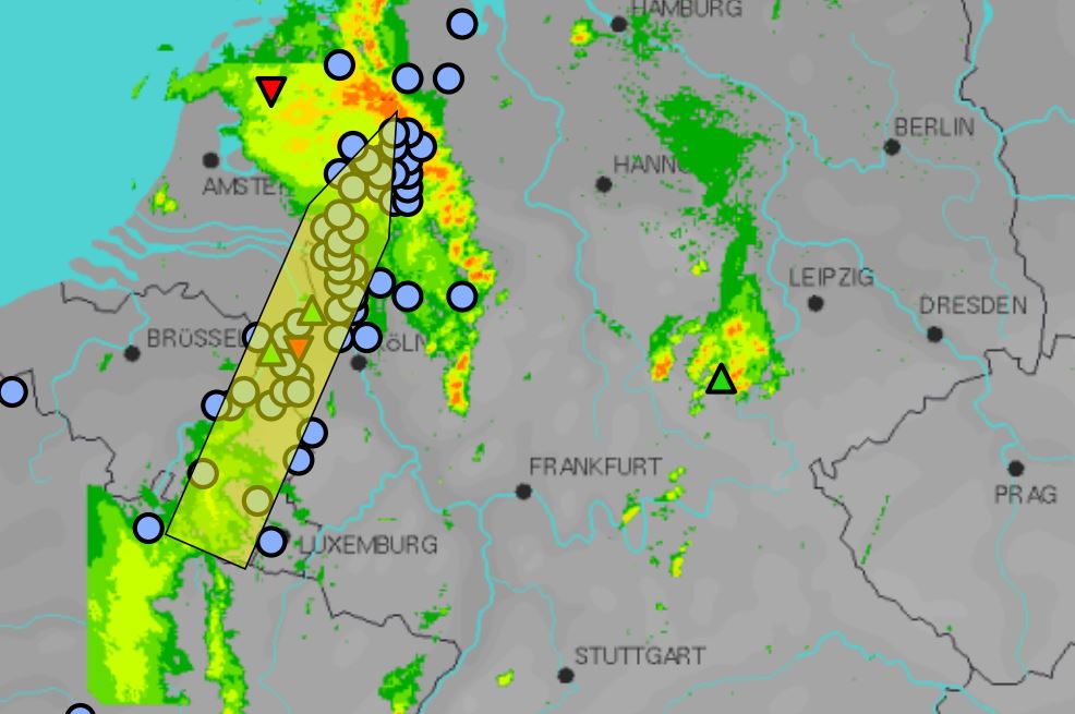
Christoph Gatzen gives an overview of cold-season derechos that occurred across Central Europe between 1997 and 2014.
Length: 30 min
Author: Christoph Gatzen (MeteoGroup)
The presentation gives an overview of cold-season derechos that occurred across Central Europe between 1997 and 2014. The environmental conditions leading to persistent, intense thunderstorms and associated long-track high wind events are analyzed using reanalysis data and proximity soundings. A focus is the development of deep moist convection in initially stable air masses due to synoptic-scale processes.
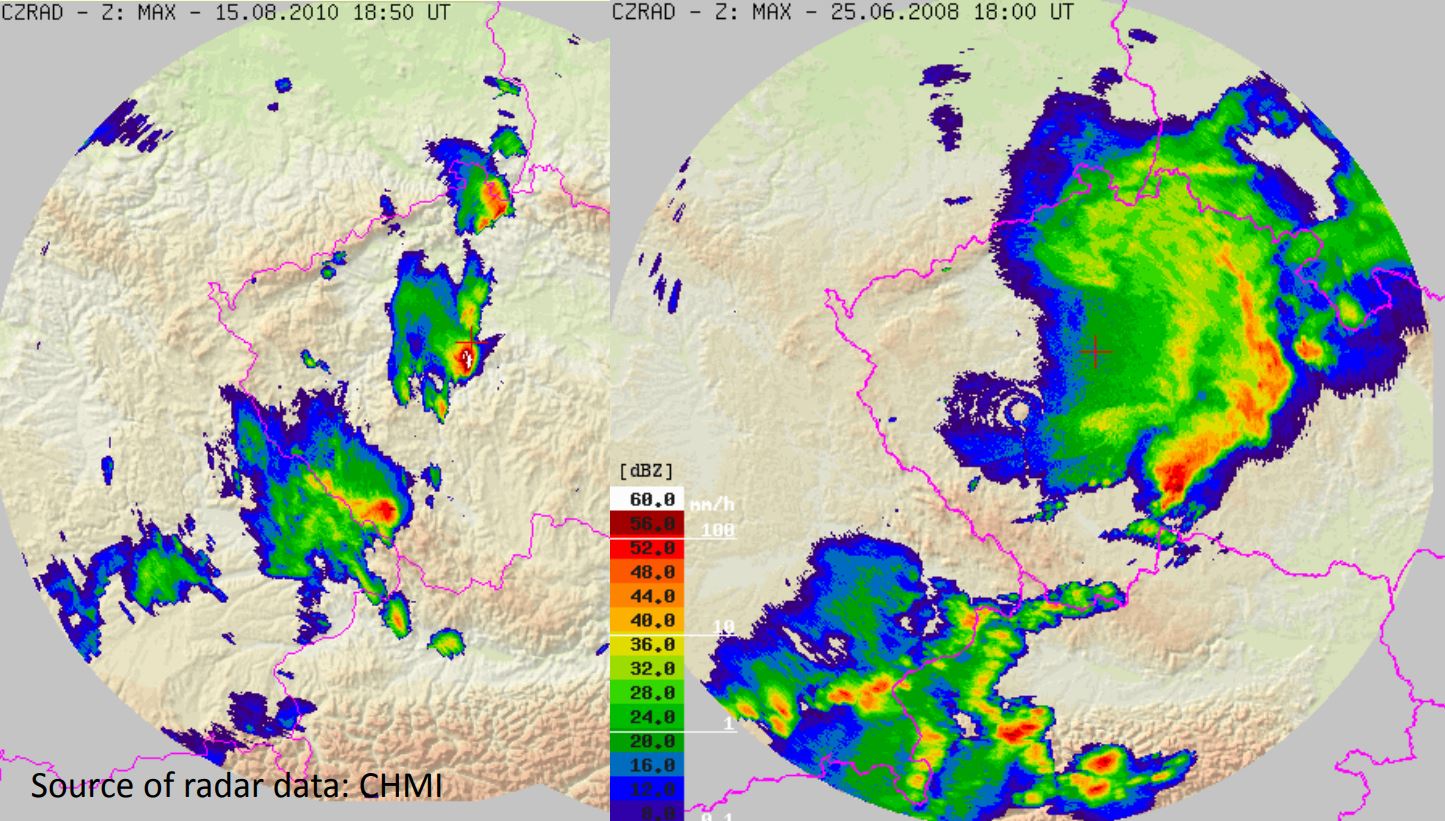
Tomas Pucik presents a study of the environments of non-severe and severe thunderstorms in Central Europe.
Length: 30 min
Author: Tomaš Pučik (ESSL)
The environments of non-severe and severe thunderstorms in Central Europe were studied using 16421 proximity soundings acquired in the period from December 2007 to December 2013. In this presentation, we will concentrate on different sounding-derived parameters and how their values change with the increasing severity of thunderstorm-related hazards (large hail, severe wind gusts, tornadoes, excessive precipitation). For example, we show that probability of these hazards as a function of CAPE and 0-6 km bulk shear is different for each hazard. We also present implications for forecasters, such as that area of parameter space with the highest probability of particular hazard may not collocate with the area where it is most frequent.
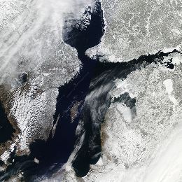
In this module you will learn how snow cover and snow water equivalent are determined by satellite instruments and how this data can be applied for regional climate studies.
Snow cover is an important climate variable on both local and global scales. It affects the planetary radiation budget through high albedo values. It influences the hydrological cycle globally and locally, and for many locations it is an important source of water. In this module you will learn how snow cover and snow water equivalent are determined by satellite instruments and how this data can be applied for regional climate studies.
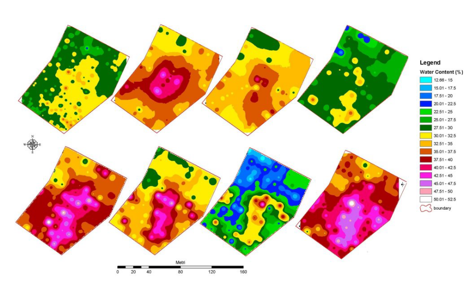
Simone Gabellani and Fabio Delogu describe how soil moisture estimated trough satellite can be compared and validated with other sources of information.
Length: 38+39 minutes.
Soil Moisture is a crucial variable in hydrological applications. It can be measured and estimates in different way and along different spatial and temporal scale. The presentation describes how soil moisture estimated trough satellite can be compared and validated with other sources of information; theoretical basis and practical example will be showed.