Climate
Beatriz Martinez shows how climate data records analysis can be used to monitor drought affected areas.
The scientific community requires consistent long-term data records with well-characterized uncertainty and suitable for modelling terrestrial ecosystems changes as consequence of current climate impact at global scales. The vegetation climate data records (CDRs) of FAPAR (LSA-426) and FVC (LSA-422) are freely available within the EUMESAT LSA SAF (http://lsa-saf.eumetsat.int). These CDRs offer more than fifteen years (2005- present) of homogeneous and continuous 10-day time series for climate and environmental applications. The main goal of this lecture is to present a few examples CDRs analysis to monitor and characterize areas mainly affected by severe drought events. Moreover, the potential in the assessment of ecosystem response to rainfall deficit events is also presented using the last operational product included in the VEGA portfolio, the 10-day gross primary production (GPP; MGPP LSA-411). The robustness of this product is evaluated at both site and regional scales across the MSG disk using eddy covariance (EC) GPP measurements and Earth Observing (EO)-based GPP products, respectively, over a short period of three years.
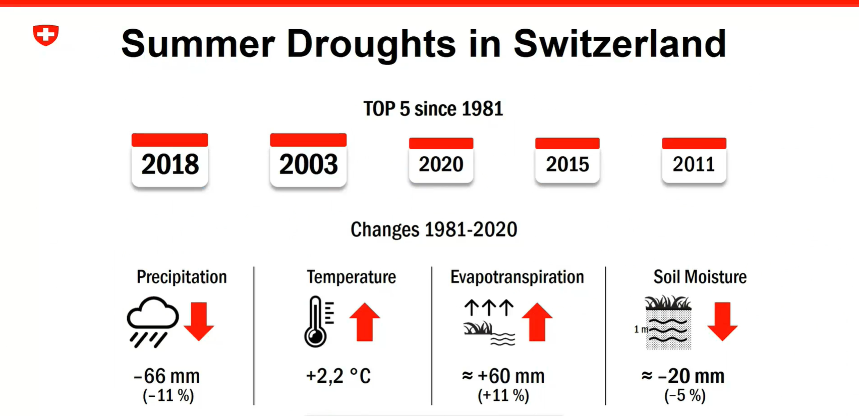
Anke Duguay-Tetzlaff and Vincent Humphrey present about the recent Swiss drought monitoring project and use of EUMETSAT satellite data for drought monitoring.
The Swiss government has started a drought monitoring project in 2023. The goal is to set an operational drought monitoring and warning system in the upcoming years. In a pre-study we have analyzed the potential of EUMETSAT satellite data for climatological drought monitoring in Switzerland. We will present possibilities and shortcomings of the different analyzed soil moisture, land surface temperature and evaporation data and provide an outlook on how we plan to integrate EUMETSAT data in the system.
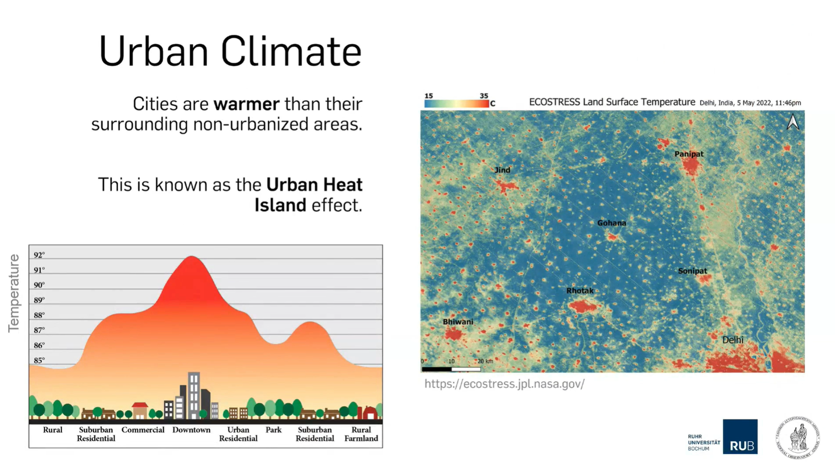
Panagiotis Sismanidis provides insight into urban heat islands including its drivers and impacts.
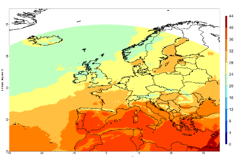
Cities are generally warmer than their surroundings. This phenomenon is known as the Urban Heat Island (UHI) and is one of the clearest examples of human-induced climate modification. UHIs increase the cooling energy demand, aggravate the feeling of thermal discomfort, and influence air quality. In this talk we will discuss the drivers and impacts of UHIs and showcase how to characterize the urban landscape in Local Climate Zones. We will also discuss the discrepancies between remotely-sensed land surface temperatures (LST) and near-surface air temperatures when studying the urban climate.
João Martins talks about using Land Surface Temperature (LST) in heatwave monitoring using LSA SAF datasets.
Heat and water stress leave clear signatures on land surface variables that can be monitored from space. The LSA SAF has been providing satellite datasets and products that allow the characterization of the surface energy budget and the monitoring of vegetation growth and stress. We will show that combining information on the surface temperature diurnal cycle and on vegetation state provides a different perspective on the spatial extent and time evolution of droughts and heatwaves, and reveals underlying soil vegetation-atmosphere feedbacks.
Ryan Teuling talks about soil moisture and land surface energy balance.
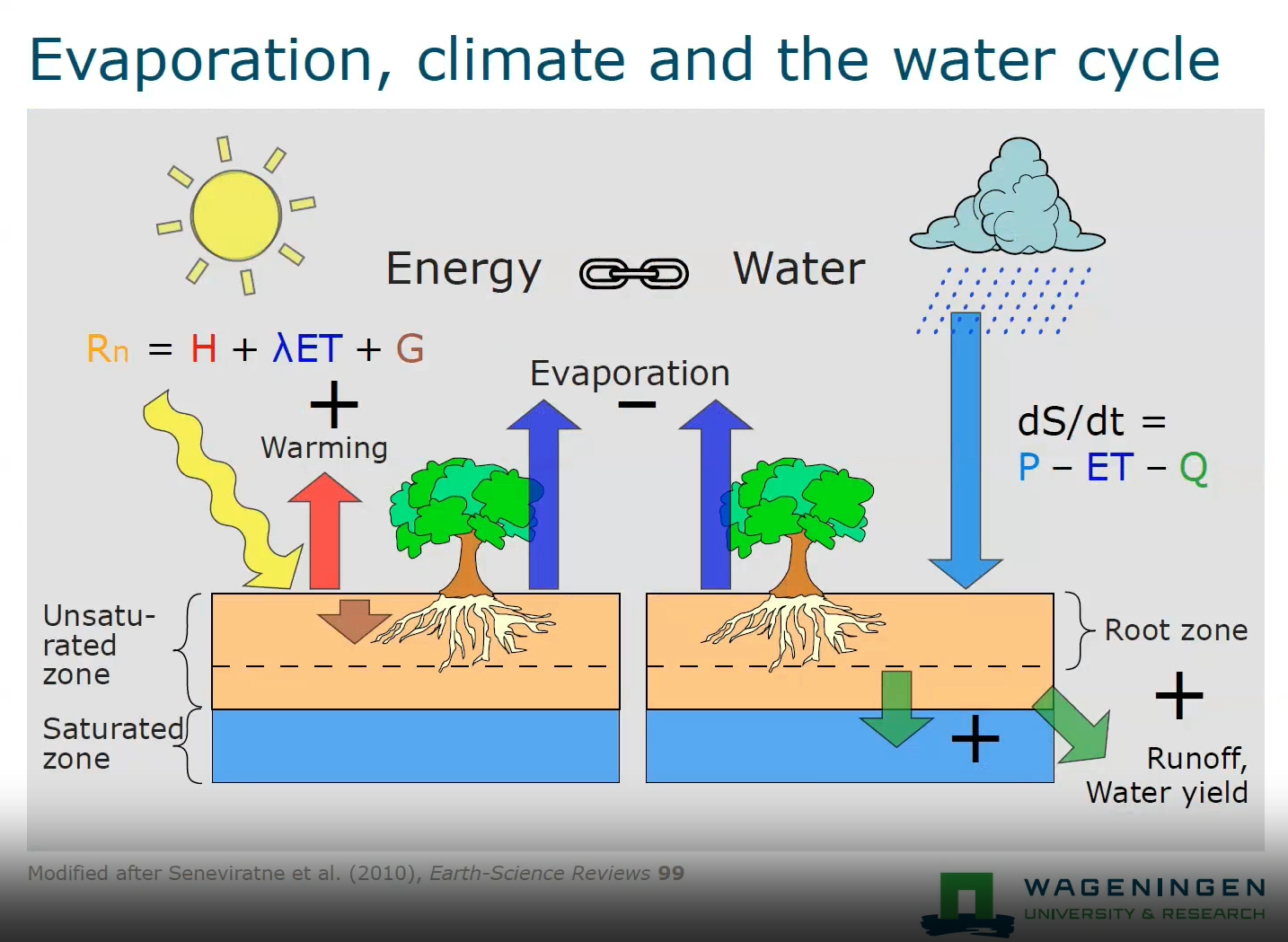
Heatwaves and droughts are often strongly linked due to the increased sensible heat fluxes at the land surface warming the atmosphere above. In this talk, I will discuss how soil moisture depletion changes the land surface energy balance, and how the evolution of changes in the land surface energy balance is different for different land cover types (i.e., forest and short vegetation). The use of high-resolution satellite soil moisture data for drought monitoring is also discussed.
Izolda Marcinoniene gives a talk on the synoptic background for strong winds in Lithuania.
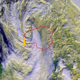
In Lithuania, very strong winds (≥28m/s) are usually caused by Atlantic cyclones. Fifty-five cases in 173 sites have been registered during the period 1961–2021. Even a few cases with very powerful winds (>40 m/s) were observed. According to statistics, most events occur during the cold season and bring significant damage. Thus, a short summary will be presented. Additionally, the typical cyclone track and synoptic situation will be shown in this presentation.
Lothar Schueller gives an overview on the SAF structure and the generated products.
Length: 30 minutes.
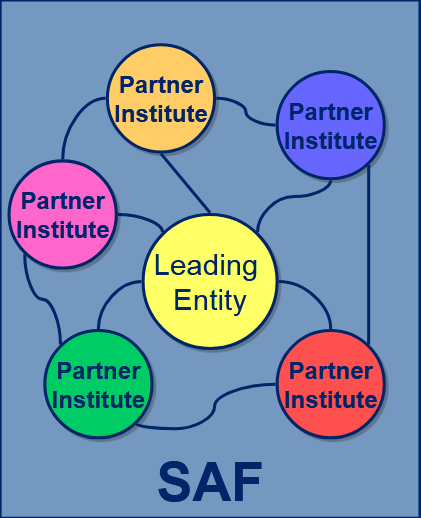
SAFs are dedicated centres of excellence for processing satellite data, achieved by utilising specialist expertise from the Member States. SAFs generate and disseminate operational EUMETSAT products and services and are an integral part of the distributed EUMETSAT Application Ground Segment.
Each SAF is led by the National Meteorological Service (NMS) of a EUMETSAT Member State, in association with a consortium of EUMETSAT Member States and Cooperating States, government bodies and research institutes. The lead NMS is responsible for the management of each complete SAF project. The research, data and services provided by the SAFs complement the standard meteorological products delivered by EUMETSAT’s central facilities in Darmstadt, Germany.
Zanita Avotniece gives a brief presentation on the use of satellite data for climate applications and introduces an online satellite-based climate viewer.
Length: 30 minutes.
Zanita Avotniece gave a brief presentation on the use of satellite data for climate applications and introduced an online satellite-based climate viewer that has been published recently.
Ivan Guettler discusses climate extremes in the context of observed climate change.
Length: 30 minutes
Climate extremes were discussed in the context of the observed climate change and associated trends. The issue of attributing specific weather extreme to climate change was stressed. Several impacts on human activities was presented and estimated economical and human losses due to the weather and climate extremes were compared over different regions.
Overview on the H SAF satellite derived precipitation products.
The EUMETSAT Satellite Application Facility for Operational Hydrology and Water Management (H SAF) provides satellite products and user services in support to Operational Hydrology, Meteorology, Risk Management and Water Management. Since 2005, H SAF science and research bridge into operations through the development and dissemination of soil moisture, precipitation and snow products based on the exploitation of primary EUMETSAT missions. During the fourth Continuous Development and Operations Phase (CDOP-4, from 2022 to 2027), H SAF products will be primarily based on the Meteosat Third Generation (MTG) and the EUMETSAT Polar System -Second Generation (EPS-SG) missions. Current products are based on the use of the full constellation of microwave (MW) radiometers for Level 2 passive microwave (MW) precipitation products and for MW/IR combined products for near-real time applications over the Meteosat Second Generation (MSG) full disk area. The presentation will provide a full overview of the current status and future development of the operational precipitation product portfolio as well as the product quality assessment strategy and results. Examples of applications for specific case studies will be also presented.
Lecture slides (Panegrossi)...
Humberto Barbosa presents a study which provides a comprehensive evaluation of extreme drought events in terms of occurrence, persistence, spatial extent, severity, and impacts on streamflow and soil moisture over different time windows between 1980 and 2020.
The São Francisco River Basin (SFRB) plays a key role for the agricultural and hydropower sectors in Northeast Brazil (NEB). The purpose of this study is to provide a comprehensive evaluation of extreme drought events in terms of occurrence, persistence, spatial extent, severity, and impacts on streamflow and soil moisture over different time windows between 1980 and 2020. The Standardized Precipitation-Evapotranspiration Index (SPEI) and Standardized Streamflow Index (SSI) at 3- and 12- month time scales derived from ground data were used as benchmark drought indices. The selfcalibrating Palmer Drought Severity Index (scPDSI) and the Soil Moisture and Ocean Salinity-based Soil Water Deficit Index (SWDIS) were used to assess the agricultural drought. The Water Storage Deficit Index (WSDI) and the Groundwater Drought Index (GGDI) both derived from the Gravity Recovery and Climate Experiment (GRACE) were used to assess the hydrological drought. The SWDISa and WSDI showed the best performance in assessing agricultural and hydrological droughts across the whole SFRB.
Tommaso Abrate presents the efforts of WMO to coordinate with its Expert Network on updating the satellite data and product requirements for Flood Forecasting and seasonal and long term hydrological forecasts.
In order to better capture the complexity of interlinked natural phenomena related to the atmosphere, ocean, hydrosphere and cryosphere, WMO has adopted a holistic Earth System monitoring approach. The operational implementation of this approach is supported by WMO Congress decisions related to the establishment of a global basic observing network GBON, and the adoption of a unified data policy, aimed at improving the sharing and interoperability of data among users, contributing to better numerical weather prediction and more accurate flood and drought forecasts. To achieve these results, it is important to benefit from emerging approaches in order to combine different data sources such as satellites, citizen observations, low-cost devices, Internet of Things, Big Data. This approach also allows ensuring at least partial information overt hose vast areas of the world where conventional state-funded monitoring approaches are insufficient. WMO is developing technical solution (standards, best practices) to overcome the discrepancies in data quality and the multiplication of different data format. In this context satellite. WMO, in coordination with its Expert Network is working on updating the satellite data and product requirements for Flood Forecasting and seasonal and long term hydrological forecasts and outlook.

