
Identify and interpret atmospheric phenomena
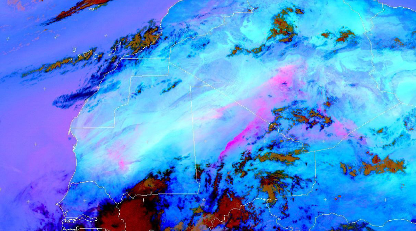
Hamidou Hama highlights the major socio-economic and environmental impacts of dust, focuses on the meteorological processes at various scales that are responsible for raising dust/sand storms in the arid Sahara Desert and the semi arid Sahel at its fringes.
Length: 40 minutes.
This presentation, after highlighting the major socio-economic and environmental impacts of dust, focuses on the meteorological processes at various scales that are responsible for raising dust/sand storms in the arid Sahara Desert and the semi arid Sahel at its fringes. The challenges facing the weather forecaster in forecasting such high impact weather phenomena and the importance of satellite remote sensing in their monitoring were also addressed here.
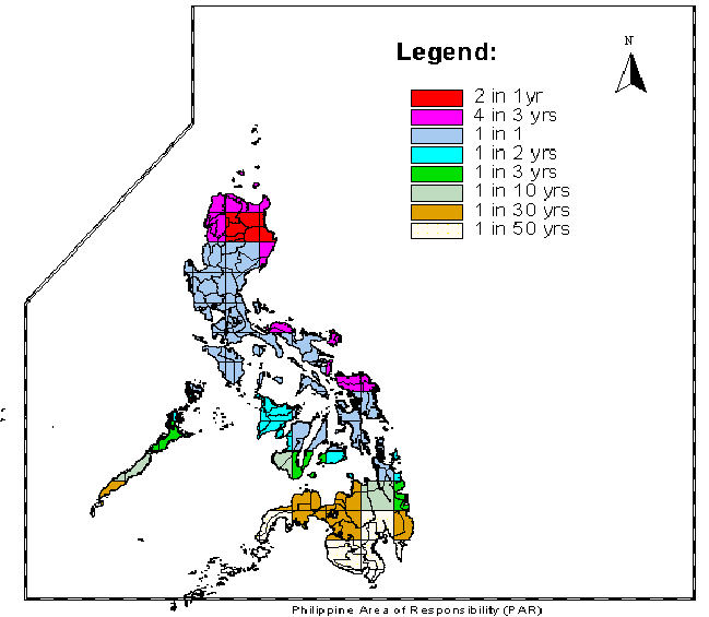
Christopher Perez gives an insight into Typhoons and their features.
Length: 35 minutes.
Christopher Perez, a weather forecaster of the Philippine Atmospheric, Geophysical, and Astronomical Services Administration (PAGASA) will gave an insight into Typhoons and their features. Specifically, he presented the chronology of events regarding Typhoon "Haiyan", one of the strongest tropical cyclones ever recorded, which devastated portions of Southeast Asia, particularly the Philippines, on November 8, 2013.
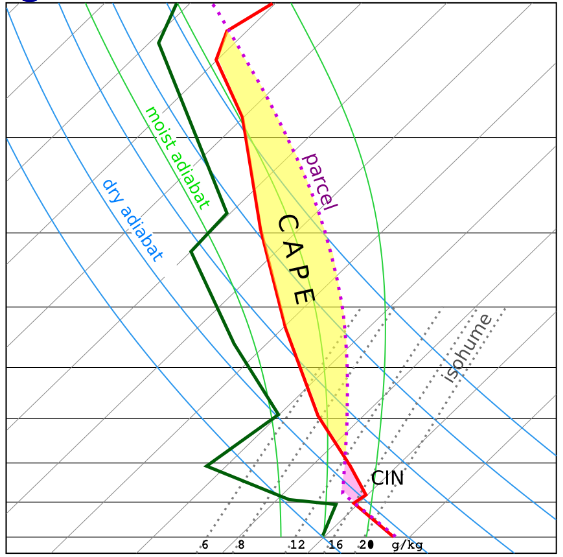
Helge Tuschy's talk offered an insight into the ingredients-based forecasting method, which assists an operational forecaster in preparing well ahead of an active thunderstorm day.
Length: 60 minutes.
This talk offered an insight into the ingredients-based forecasting method, which assists an operational forecaster in preparing well ahead of an active thunderstorm day. Mr. Tuschy also gave an overview about certain ingredients which could result in heavy rainfall and flash flooding (due to deep moist convection). He ended his talk with a short overview about ESTOFEX, the European Storm Forecast Experiment.
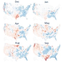
Hamidreza Mosaffa presents a study that aims 1) to develop the long-term climatological SM2RAIN datasets for the period of 1998–2020 by merging two rainfall SM2RAIN products including SM2RAIN-CCI and SM2RAIN-ASCAT, and 2) to the analysis of drought based on standardized precipitation index over the USA.
Investigation of drought variability requires long term rainfall dataset with high spatial and temporal resolution. The goal of this study are as follow: 1) to develop the long-term climatological SM2RAIN datasets for the period of 1998–2020 at 0.25° spatial and monthly temporal resolution by merging two rainfall SM2RAIN products including SM2RAIN-CCI and SM2RAIN-ASCAT, and 2) to the analysis of drought based on standardized precipitation index over the USA. Results indicated that the most significant decreases in the monthly rainfall trends appear in November. In addition, drought occurred during 2003, 2007, and 2012 over most parts of the USA.
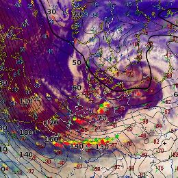
The presenter gives an overview into the mechanisms of convective lines connected to winter storms such as Emma.
Convective lines in connection with intense cyclogenesis hit Middle and Western Europe almost every winter season. These lines move very quickly and are often connected with thunderstorms, heavy gusts and graupel or even hail. In this presentation the related conceptual model and the preconvective environment will be explained. Based upon different satellite products and additional data two examples will be discussed.
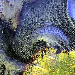
The presenter is senior forecaster at the Norwegian Met-Institute in Tromso. He refers on the synoptic aspects of Polar Lows.
The forecasting of Polar Lows is one of the most challenging tasks in weather forecasting in the arctic. The lecture will give a demonstration of basic forecasting methodology at the Norwegian Meteorological Institute, and show some typical signatures of the polar low as seen from satellite IR/visible imagery, from ASCAT and from other observational data. A climatologic survey is also given by the presenter.
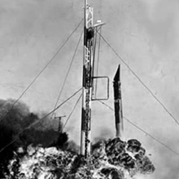
The invention of weather satellites has opened a new area in weather forecasting. This presentation will give you an introduction from the early starts to the future with the third generation of satellites.
The invention of weather satellites has opened a new area in weather forecasting. Satellite observations enable to continuously monitor the weather regimes on the whole globe. Therefore they provide a powerful tool in weather forecasting. The first lecture of the satellite course leads from the invention of weather satellites to technical inventions and the current operational satellites.

Presentation on some of the typical convective scenarios with the focus on the usage of the background NWP fields and convective parameters in combination with satellite imagery.
Zoltan Polyanszky from the Hungarian Meteorological Institute, presents some of the typical convective scenarios with the focus on the usage of the background NWP fields and convective parameters. The role of the operational work of the forecaster who is responsible for issuing warnings is highlighted and concluding a reflection is discussed on what has been learned from the situations over the recent years.
Presentation during the event week on Convection in June 2011 by Helge Tuschy on the European Forecasting Experiment (ESTOFEX).
Presentation by Helge Tuschy from Deutscher Wetterdienst (DWD). He is one of the forecasters producing the valuable ESTOFEX forecasts and this lecture is on the basics of convection and how the convective outlooks in ESTOFEX are prepared.
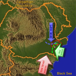
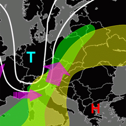
Webcast on the influence of the the Black Sea on the initiation of convective storms in South Eastern Romania.
Presentation by Aurora Bell on the influence of the the Black Sea on the initiation of convective storms in South Eastern Romania. Several cases with Doppler radar and satellite images were presented in combination with other integrated data. The presentation was oriented towards forecasters and Aurora explained the role of the sea breeze in bringing together the right ingredients.
Presentation on the use of the MPEF Divergence Product for diagnosing the divergence associated with upper-level wind field disturbances that produces forcing for ascent and favours the development of deep moist convection.
Presentation by Christo Georgiev during the Event Week on Convection in June 2011. The presentation concentrates on the use of the MPEF Divergence Product for diagnosing the divergence associated with upper-level wind field disturbances that produces forcing for ascent and favours the development of deep moist convection.
Webcast on the detection and monitoring of convective storms by using MSG imagea and products.
Aydin Erturk (TSMS) present on the "Detection and Monitoring Convective Storms by Using MSG Image and Products". The MSG SEVIRI is crucial data source for the nowcasting applications. Storm top features with IR imagery were well defined and published. MSGView software being operationally used for detection and monitoring convective storms at Turkish State Meteorological Service. Two case studies (a cold U/V and a cold ring shape) were demonstrated and discussed in this presentation.