
Climate services
Listed here are other resources related to Climate services tag:
Note: click on an image to open the Resource
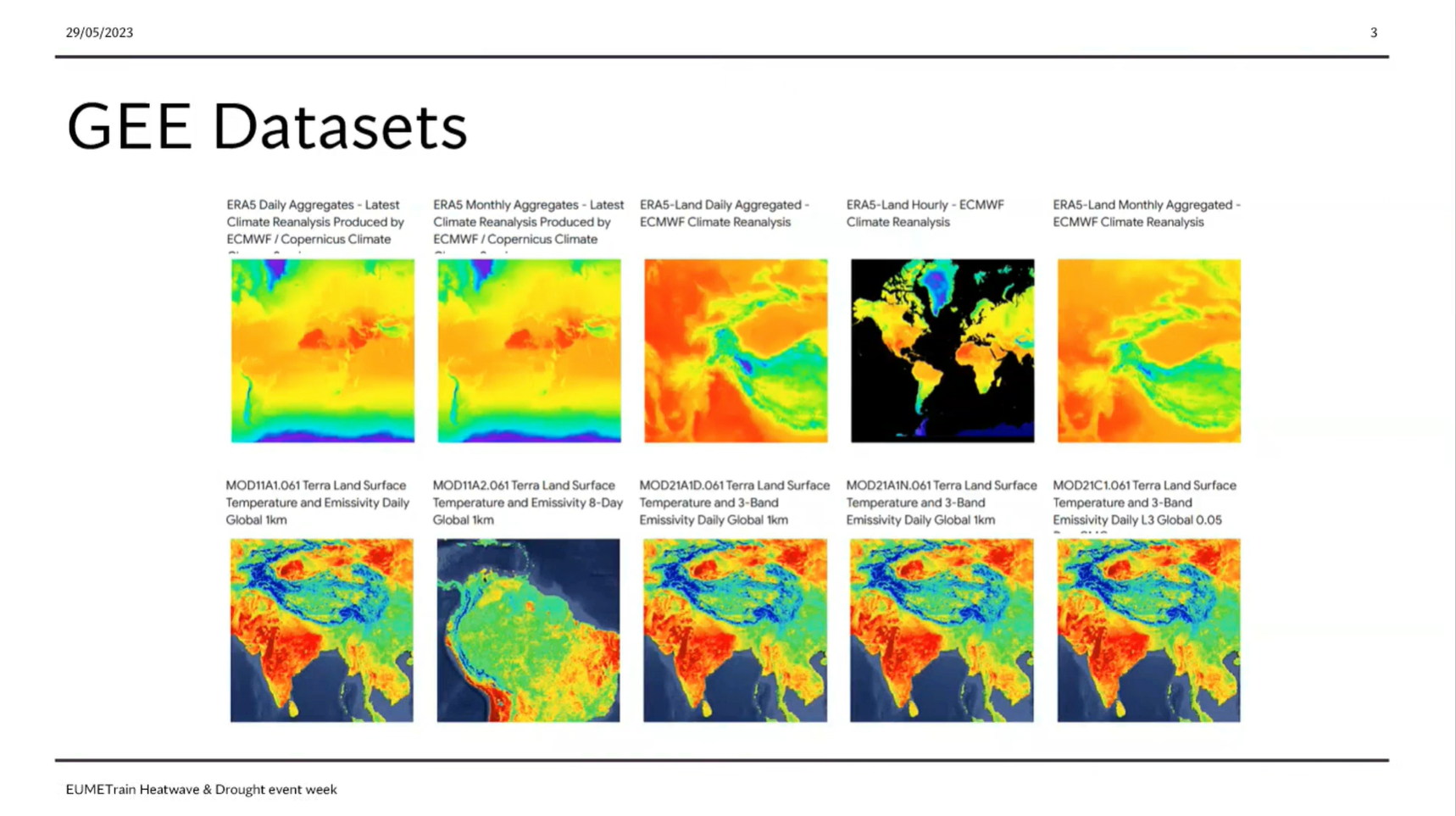
Sofia Ermida showcases the use of Google Earth Engine in Heatwaves and Drought monitoring
The Google Earth Engine (GEE) is a powerful tool for researchers providing easy access to a large array of environmental datasets, particularly from remote sensing, and the computational resources to analyzed them. Here we present an overview of the capabilities and datasets of the GEE useful for the study of heatwaves and droughts and provide some examples of applications.
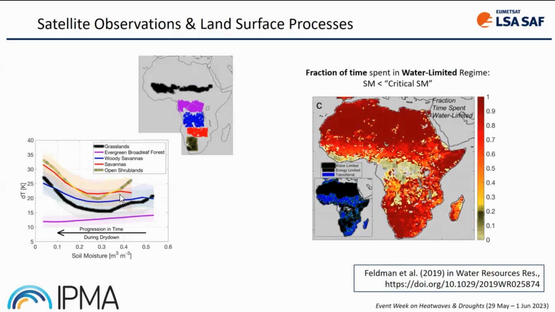
Isabel Trigo provides insight into LSA SAF datasets and its usage.
Heat and water stress leave clear signatures on land surface variables that can be monitored from space. The LSA SAF has been providing satellite datasets and products that allow the characterization of the surface energy budget and the monitoring of vegetation growth and stress. We will show that the combination of information on the surface temperature diurnal cycle and on vegetation state provides a different perspective on the spatial extent and time evolution of droughts and heatwaves, and reveals underlying soil vegetation-atmosphere feedbacks.
Izolda Marcinoniene gives a talk on the synoptic background for strong winds in Lithuania.
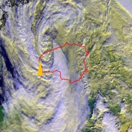
In Lithuania, very strong winds (≥28m/s) are usually caused by Atlantic cyclones. Fifty-five cases in 173 sites have been registered during the period 1961–2021. Even a few cases with very powerful winds (>40 m/s) were observed. According to statistics, most events occur during the cold season and bring significant damage. Thus, a short summary will be presented. Additionally, the typical cyclone track and synoptic situation will be shown in this presentation.
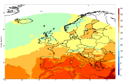
Zanita Avotniece gives a brief presentation on the use of satellite data for climate applications and introduces an online satellite-based climate viewer.
Length: 30 minutes.
Zanita Avotniece gave a brief presentation on the use of satellite data for climate applications and introduced an online satellite-based climate viewer that has been published recently.
Ivan Guettler discusses climate extremes in the context of observed climate change.
Length: 30 minutes
Climate extremes were discussed in the context of the observed climate change and associated trends. The issue of attributing specific weather extreme to climate change was stressed. Several impacts on human activities was presented and estimated economical and human losses due to the weather and climate extremes were compared over different regions.
Christine Träger-Chatterjee presents the prototype Data Cube for Drought and Vegetation Monitoring, and tools to manipulate the data in the cube.
EUMETSAT provides a prototype Data Cube for Drought and Vegetation Monitoring, and tools to manipulate the data in the cube. This prototype consists of long-term data records on a regular latitude / longitude grid and in CF-compliant NetCDF via THREDDS.
The prototype seeks to explore how well EUMETSAT and partners can bring together data from multiple sources and from multiple grids to ease barriers to use of the data for thematic applications.
This presentation reports on the lessons learnt as regards the creation, provision and use of the data cube.
Humberto Barbosa focusses in his weather briefing on climate variability and teleconnection processes. He explains how weather anomalies like El Nino affect distant regions.
Length: 55 min
Author: Humberto Barbosa
Humberto A. Barbosa received his BS in Meteorology at the University Federal of Campina Grande (1995), and his MS in Remote Sensing from the Brazilian Institute for Spatial Research (INPE) – São José dos Campos (1998) and his PhD in Soil, Water and Environmental Sciences from the University of Arizona – Tucson (2004). Currently, he is an adjunct professor III of the Federal University of Alagoas. He has experience in the area of Geosciences, with emphasis in Climatology, concentrating mainly on the following subjects: interactions atmosphere-biosphere, satellite- and ground-based remote sensing of agricultural and environmental areas for extraction of soil and vegetation biophysical parameters and remote sensing techniques.
In this module you will learn how snow cover and snow water equivalent are determined by satellite instruments and how this data can be applied for regional climate studies.
Snow cover is an important climate variable on both local and global scales. It affects the planetary radiation budget through high albedo values. It influences the hydrological cycle globally and locally, and for many locations it is an important source of water. In this module you will learn how snow cover and snow water equivalent are determined by satellite instruments and how this data can be applied for regional climate studies.
Lauryna Sidlauskaite talks about the challenges of winter road weather forecasts in view of climate change.
Length: 39 minutes.
Climate change is almost literally the "hot" topic of today. Scientists agree that cars with combustion engines are one of the main sources of greenhouse gasses, however, with such vastly growing world economy, transportation of goods and people is essential. Thus, certain measures must be and are being made to reduce their negative effect on climate.
Humanity has reached a point in time, when even if greenhouse gas emissions could be reduced to pre-industrial times it will not stop the human-induced climate change and the effects of it will be felt for decades or even centuries to come. Therefore, we’re compelled to know and understand what to expect from road weather, especially in winter seasons.
In this session, the problem of lack of specific climate forecasts for winter road weather will be discussed and future climate projections for road weather patterns will be presented with Lithuania as an example. The study in question involved regular climate forecasts for 21st century for several RCPs, downscaling of data to fit Lithuania and formation several statistical indices, that better describe road weather for road maintenance workers and road users. Using the indices allows a better understanding on what’s to come and how climate change will impact road weather in the 21st century.
Yulia Mishenina presents the results of studies of the characteristics of snow cover for the territories of Western and Eastern Siberia.
The report presents the results of studies of the characteristics of snow cover for the territories of Western and Eastern Siberia. The research period is from 1976 to 2020.
The report describes the duration of persistent snow cover, the time intervals between the first snowfall and stable snow cover and between the destruction and disappearance, a number of characteristics of the snow cover: duration of occurrence, thickness and water content.

Sven Kotlarski summarizes current research on the fate of surface snow cover and its implications for climate.
The presence of snow cover on the land surface is closely linked to the prevailing climate. Moreover, by modulating surface energy fluxes snow cover is interactively linked to the atmosphere and constitutes an important component of global and regional climate systems. Available observations show a retreat of snow cover on hemispheric scales as a response to global warming, and climate projections consistently indicate a further decrease. Focusing on Europe and especially on the European Alps, this contribution summarizes current research on the fate of surface snow cover and its implications.
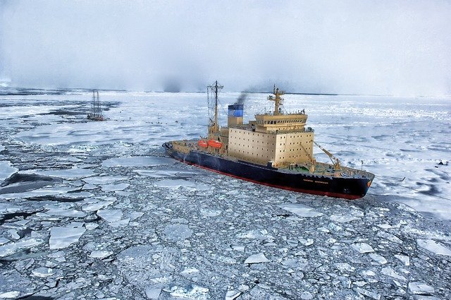
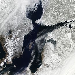
Steinar Eastwood presents the OSI-SAF products and shows climatological applications of the data.
The sea ice products from the EUMETSAT Ocean and Sea Ice Satellite Application Facility are widely used. In this presentation the sea ice products will be presented and examples of use in operational numerical weather and ocean modelling will be given.