
Marine
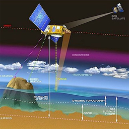
Retrieval of wave parameters with Altimeter; Wind and wave from radar altimetry satellites: measurements and uses.
Radar altimetry satellites have been measuring the Earth’s ocean since 1991. Currently Jason-2, Envisat and Jason-1 are operational. If the main objective of those are the measurement of sea surface height, wind speed (modulus) and significant wave heights are very useful - bonuses - to these techniques. The presentation will explain how these quantities are retrieved from the altimeter measurements, and how they are used in meteorology, climatology and oceanography.
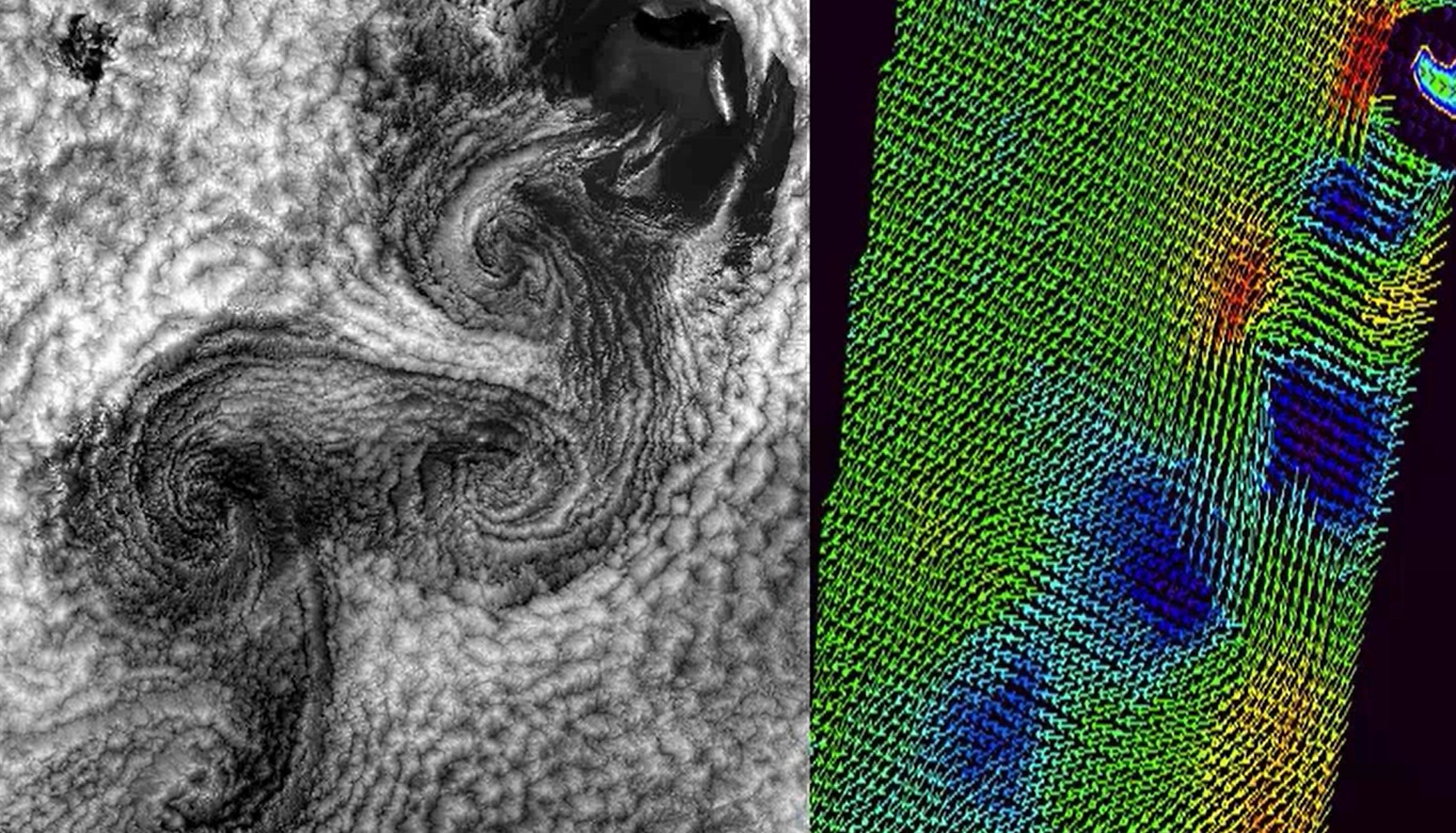
Presentation on SAR image analysis and on the interpretation of oceanic and atmospheric phenomena, with examples of signatures of downbursts, convective cells and sea/land breezes. Also, the retrieval of high resolution wind speed with SAR will be addressed.
Synthetic-aperture radar (SAR) is a form of radar whose defining characteristic is its use of relative motion between an antenna and its target region to provide distinctive long-term coherent-signal variations that are exploited to obtain finer spatial resolution than is possible with conventional beam-scanning means. It originated as an advanced form of side-looking airborne radar (SLAR).
SAR is usually implemented by mounting, on a moving platform such as an aircraft or spacecraft, a single beam-forming antenna from which a target scene is repeatedly illuminated with pulses of radio waves at wavelengths anywhere from a meter down to millimeters. The many echo waveforms received successively at the different antenna positions are coherently detected and stored and then post-processed together to resolve elements in an image of the target region.
Current airborne systems provide resolutions to about 10 cm, ultra-wideband systems provide resolutions of a few millimeters, and experimental terahertz SAR has provided sub-millimeter resolution in the laboratory.
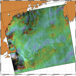
SAR images have wide applications in remote sensing and mapping of the surfaces. In this presentation the applications for monitoring the ocean surfaces are discussed.
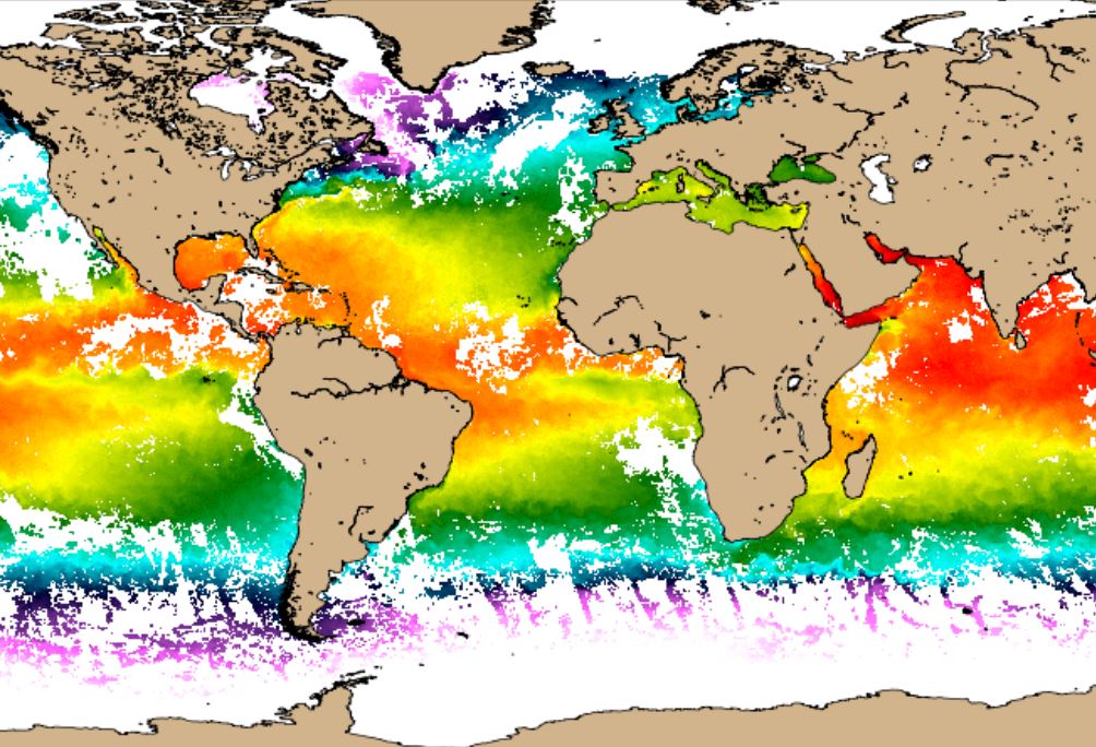
In this Training Module you will learn more about how the sea surface temperature is measured from satellite instruments.
Sea surface temperatures have been measured for over one hundred years, first using in situ instruments, which provide limited spatial and temporal coverage, and since the 70's from satellite. Depending on the satellite operating wavelength range, the temperature estimations correspond to distinct ocean depths. This tutorial is focused in the temperature of the surface emitting layer of ~ 10-20 μm depth, estimated from infrared measurements, the so-called Skin Sea Surface Temperature (SST). There are several SST providers and the choice of the most suitable product depends on the user application. In this tutorial several examples of SST datasets are shown, as well as some applications of this product.
This lecture introduces the wave model products, eg. wave height and mean propagation direction, wave spectrum analysis, long swell forecasts, etc.
Length: 55 min
Author: Jean Bidlot (ECMWF)
Starting from the basics, this lecture introduces the students to wave model products (eg. wave height and mean propagation direction), wave spectrum analysis, long swell forecasts, extreme forecast index etc. Since these outputs (alongside data from the bouys) are the basic material marine forecasters have for forecasting and nowcasting waves in seas and especially in oceans, explaining the positive and negative sides of model outputs is very important for understanding and thus correctly using the products marine forecasters use.
The lecture dels with the characteristics of satellites carrying instruments for measuring winds and with the logic behind the calculations of winds using satellites.
Length: 51 min
Author: Ad Stoffelen (KNMI)
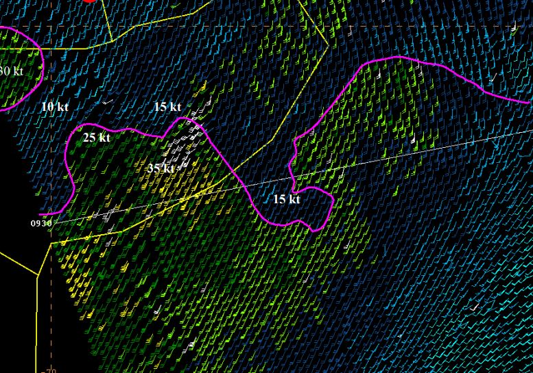
The lecture deals with modelled winds and winds derived from instruments onboard satellites like Metop-A and Metop-B in low orbits around the Earth (polar orbits). Today's models are evolving at a rate that is faster than the increase of density of observations and that presents a problem for forecasts. Here stands the question 'Will meteorology continue to develop and improve?'. The lack of observed data is thus filled with the data from satellites, although this data also has its own constraints due to the way it is derived. In the lecture the characteristics of the satellites carrying instruments for measuring winds and waves will be explained and the logic behind the calculations of winds using satellites will be discussed.
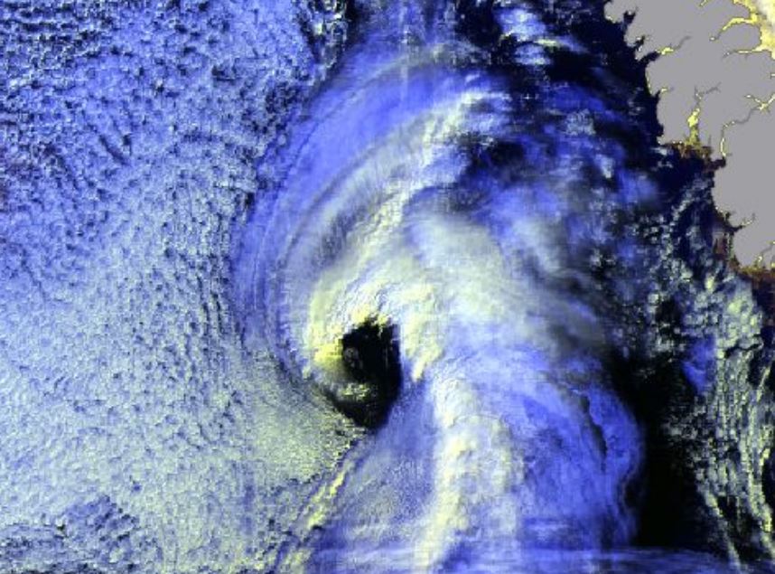
Gunnar Noer presents facts on Polar Lows, how they are forecasted, and gives examples of interpretation of satellite imagery.
Length: 55 min
Author: Gunnar Noer (MetNo)
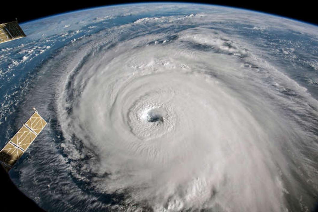
Polar Lows can be seen as small Arctic hurricanes, and they have a severe impact on shipping and coastal communities in Scandinavia. They are most common in the Barents Sea and the Norwegian Sea, but are also known to occur in the central North Sea and surrounding coastal areas. Polar lows are the most intense type of wintery convection weather phenomenon in this area. Thus, a familiarity with Polar Lows will also increase our ability to forecast the more common snow shower events in the winter season. This talk will present some facts on Polar Lows, how they are forecasted, and give examples of interpretation of satellite imagery.
Ben Loveday focusses on using new satellite products to identify the precursors of extra-tropical transition of tropical cyclones.
Length: 45 min
Author: Ben Loveday (PML, EUMETSAT)
This talk will focus on using new satellite products and techniques to identify the precursors of extratropical transition of tropical cyclones and applying new lightning products to address marine convection and the potential for significant winds. Some of these products have been used in Europe for years, but they are relatively new to the U.S. The Satellite Proving Ground for GOES-R and JPSS have allowed forecasters and researchers to use these same products and develop new integrated ways to apply them to the forecast challenges.
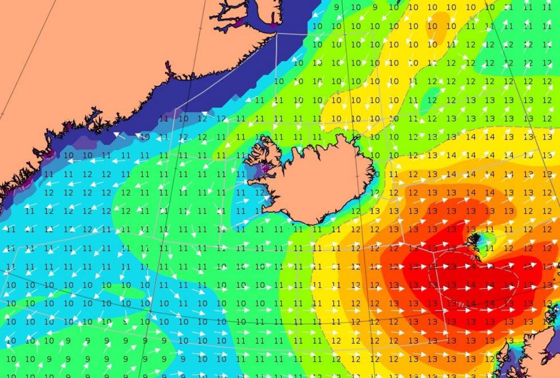
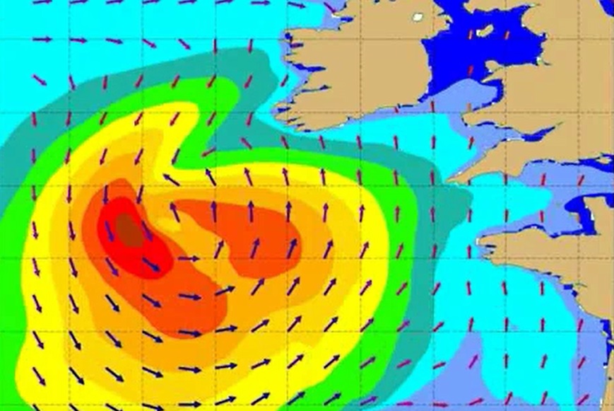
Björn Einarsson analyzes a storm moving south-east of Iceland.
Length: 30 min
Author: Björn Einarsson
Case 1. Between April 2. and April 4. 2018, gale to storm force winds from the west propagated from Cape Farewell, the southernmost point of Greenland over 1000 nautical miles across the Atlantic towards and past the Faroes Islands with high waves. This type of eastward wind/wave field propagation south of Iceland happens few times a year with varying intensity. Case 2. A showcase of the westerly Greenland tip jet creating large waves – but looking at the forecasted winds and waves versus observations, they seem contradictory, making the forecaster think twice.
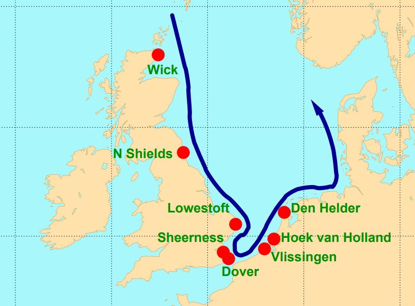
Hans De Vries focusses in his presentation on the situation in The Netherlands, where storm surge forecasts are generated by WMCN and KNMI.
Length: 45 min
Author: Hans de Vries (KNMI)
Several countries along the North Sea have densely populated areas and major political and economic activities close to the coast - places that are vulnerable to storm surges. To protect these areas coastal defence requires continuous attention. Several storm surge barriers have been constructed over the last decades that can be closed if the water level rises too high. Examples are the Thames Barrier in London and the Maeslantkering near Rotterdam. To alert local authorities and to operate the movable barriers efficiently, good and timely storm surge forecasts are essential. These forecasts make use of state-of-the-art meteorological forecasts and techniques like ensemble forecasting. This presentation will focus on the situation in The Netherlands, where storm surge forecasts are generated in close cooperation between the Water Management Centre Netherlands (WMCN) of Rijkswaterstaat and the Royal Netherlands Meteorological Institute (KNMI).
Carlos Ramalho presents some tropical and extra-tropical cyclones that affected the Azores and the challenges forecasters face in this situations.
Length: 30 min
Author: Carlos Ramalho (IPMA)
Due to the Azores geographical location, this archipelago is occasionally affected by strong Extratropical cyclones and Tropical cyclones. Extratropical cyclones are more frequent in winter and are often associated with strong winds, heavy precipitation and heavy waves which can be damaging and contribute to social and economic distress. Tropical cyclones, on the other hand occur mostly in September and October and in the past have caused loss of lives and property damage. Forecasting this type of systems is very challenging, mostly because a small variation in path can cause large difference in the impacts. This talk presents some tropical and extratropical cyclones that affected the Azores and also the challenges that forecasters face in this situations.
Annika Hjelmsten reports about the challenges in ship routing.
Length: 25 min
Author: Annika Hjelmsten (SMHI)
In a world where vessels grow larger and larger and the fuel prices are steadily increasing, finding ways to minimizing the fuel consumption is of the outermost importance for the shipping industry. By optimizing the routes with respect to meteorological and oceanographic parameters, as well as the parameters set by individual vessels characteristics, we can significantly reduce the fuel consumption. This is most beneficial not only for our clients who save money, but also for the environmental. As different kinds of vessels have very different characteristics, the job requires an extensive knowledge of both the ships and the shipping industry, as well as in meteorology and oceanography.
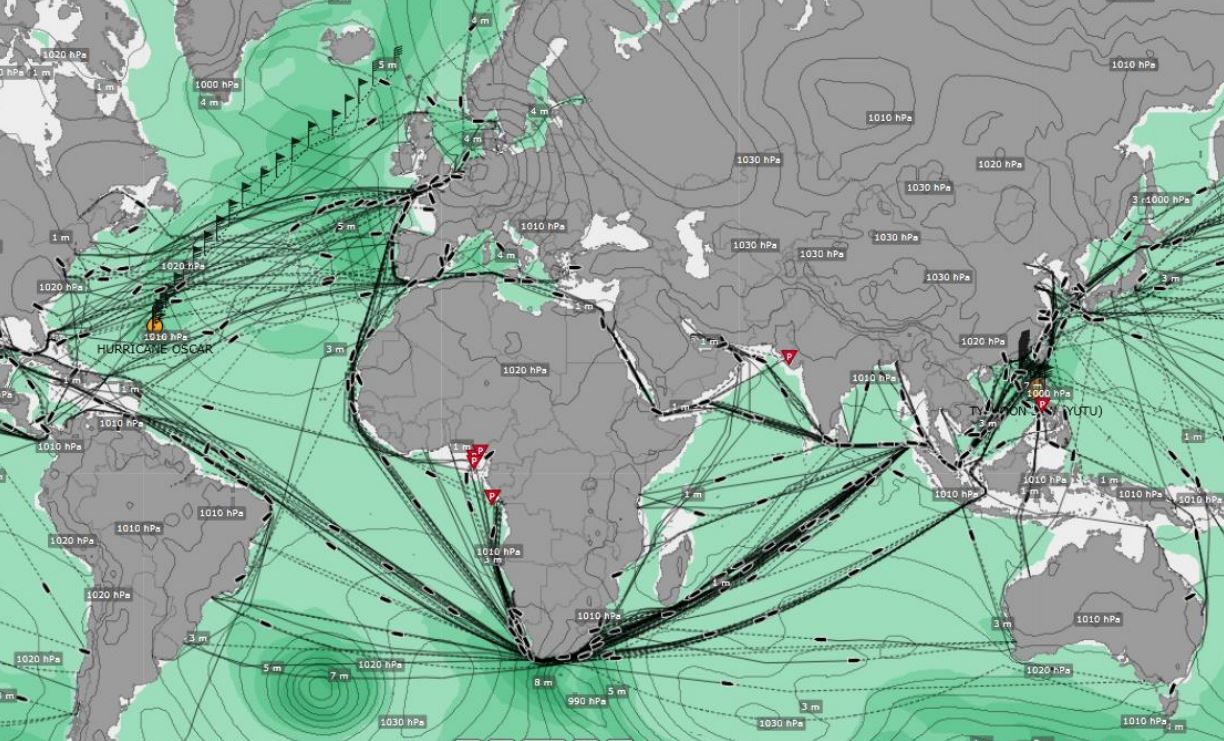
Joseph Sienkiewicz discusses forecasting challenges for large ocean areas along with the application of satellite winds and waves.
Length: 60 min
Author: Joseph Sienkiewicz (NOAA)
The NOAA Ocean Prediction Center (OPC) is responsible for weather warnings and forecasts for the western North Atlantic and eastern and central North Pacific Oceans. The oceans remain relatively data sparse for observed conditions. To compensate, OPC has successfully used winds from scatterometers and wave heights from altimeters to better understand and predict hazardous conditions over the waters of responsibility. Weather forecasting challenges for large ocean areas will be discussed along with the application of satellite winds and waves.