
Identify and interpret atmospheric phenomena
Identify and locate aerosols and particulate pollution.
This module teaches you how to use satellite data to observe and analyze atmospheric phenomena. It will show you which products can be used to identify dust storms, smoke, fires, precipitation, etc.
To access the resource click here.
Note: all resources are provided as an external link which redirects you to https://eumetcal.eu where you will need to create a user account in order to gain access to the course

Identify and locate moisture features, precipitation types and amounts.
This module teaches you how to use satellite data to observe and analyze atmospheric phenomena. It will show you which products can be used to identify dust storms, smoke, fires, precipitation, etc.
To access the resource click here.
Note: all resources are provided as an external link which redirects you to https://eumetcal.eu where you will need to create a user account in order to gain access to the course
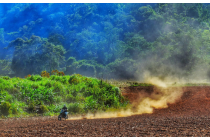
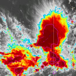
Learn to distinguish between dust and smoke.
This module teaches you how to use satellite data to observe and analyze atmospheric phenomena. It will show you which products can be used to identify dust storms, smoke, fires, precipitation, etc.
To access the resource click here.
Note: all resources are provided as an external link which redirects you to https://eumetcal.eu where you will need to create a user account in order to gain access to the course

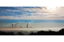
Identify and locate fires and smoke.
This module teaches you how to use satellite data to observe and analyze atmospheric phenomena. It will show you which products can be used to identify dust storms, smoke, fires, precipitation, etc.
To access the resource click here.
Note: all resources are provided as an external link which redirects you to https://eumetcal.eu where you will need to create a user account in order to gain access to the course
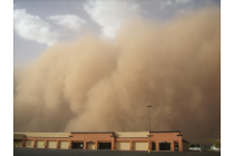
Identify and locate dust and sand storms and plumes and areas of raised dust.
This module teaches you how to use satellite data to observe and analyze atmospheric phenomena. It will show you which products can be used to identify dust storms, smoke, fires, precipitation, etc.
To access the resource click here.
Note: all resources are provided as an external link which redirects you to https://eumetcal.eu where you will need to create a user account in order to gain access to the course
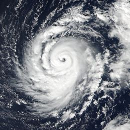
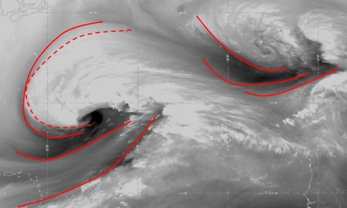
This case study describes the evolution and the life cycle of hurricanes in general and the evolution of hurricane Ophelia (2017) in particular.
This module and the adjoined simulator treat the hurricane Ophelia that threatened Europe in 2017 and hit the coast of Ireland in October that year.
In this module, you will learn more about hurricanes in general and about the evolution of Ophelia in particular from the very beginning over the Atlantic until its final stage over Ireland.
In the adjoined simulator, you will forecast the warnings related to hurricane Ophelia and the dangers that arose with this weather situation.
Jean-Marc Moisselin and Frédéric Autones talk about rapidly developing thunderstorms (RDT and applications available for forecasting them.
RDT-CW (Rapid Development Thunderstorm Convection Warning) product is an object-oriented diagnostic for convective clouds or cells. RDT-CW is mainly based on satellite data. RDT-CW software tracks clouds, identifies those that are convective (discrimination), and provides some descriptive attributes for their dynamics. Year after year many attributes have been added to the convection object. These improvements offer end-users the possibility to focus on specific parameters according to their center of interest: dynamic of the system (cooling rate, motion vector) lightning activity, rainfall, main cloud phase of the cell, etc. These attributes may come from various sources such as NWP data, other PGEs (Product Generation Element), lightning network. In the v2013 release, an overshooting top detection inside RDT cell is proposed to users. This new attribute allows to focus on potentially hazardous areas.
In the future releases the description of convective cells will be enriched, giving a high priority to the use of other SAFNWC products. A nowcast of RDT up to one hour will be implemented.
Several SAFNWC processing chains are implemented at Meteo-France over various geographical areas: those covered by MSG of course, but also those covered by other geostationary satellites, like overseas territory where Meteo-France centers are still implemented. Forecasters in these centers are the main users to benefit from RDT as an additional product. Productions over Europe and Africa benefit to Aeronautical forecasters from Meteo-France’s National Forecast center, to French Army, and also to ACMAD, Niamey.
A target visualization tool with nowcasting capabilities will be presented, which allows taking advantage from RDT end-product. Presentation of RDT for various situations and over various areas will also be undertaken, and the latest development implemented in v2013 release will be highlighted.
Vesa Nietosvaara showcases how the MTG's FCI instrument will improve the quality of satellite data, especially for users in high latitudes.
The first Meteosat Third Generation (MTG-I) satellite with Flexible Combined Instrument (FCI) was launched at the end of 2022. It will be followed later in 2024 by MTG-S Satellite with Infrared Sounder onboard. MTG will carry novelty instruments – Infrared Sounder, Lightning Imager and Ultraviolet Visible Near-infrared (UVN) Spectrometer - in the GEO orbit. Meteosat Third Generation aims to secure continuity and to increase the capabilities of the Meteosat satellites in response to requirements of the future forecast/nowcast systems. Altogether, the new and enhanced capabilities will allow us to make a huge step in better monitoring of our environment, and allowing development of new applications.
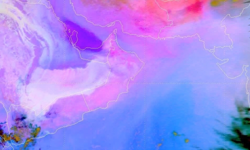
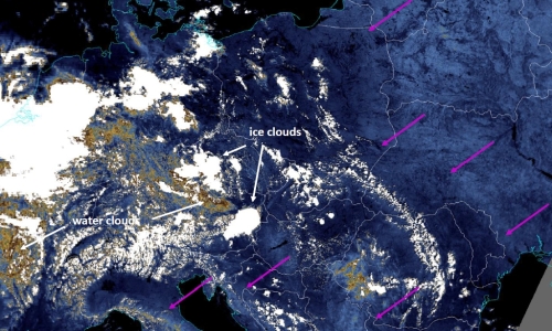
Nataša Strelec-Mahović (EUMETSAT) shows and analyses several cases of water vapour structures in the atmosphere using satellite imagery.
Features occurring in the WV6.2μm images indicate the processes going on in the atmosphere, since these dark (dry) and white (moist) structures result from a combination of vertical motion, moisture advection and horizontal deformation within the mid and upper troposphere. Frequently, water vapour images reveal structures such as dark stripes, mountain wave signatures, or circular or spiral formations known as water vapour eyes, eddies or vortices. We will look at how these features can be used as tracers of three-dimensional atmospheric motions on the meso- and synoptic scale and how they relate to e.g. jet-streams, upper-level lows or turbulence.
Ivan Smiljanić (EUMETSAT) shows how the current MSG satellites can see low-level moisture and how does the moisture affect the weather.
High humidity in the air, close to the ground, could make you feel soggy in the summer but otherwise you won’t notice it. So why is it important to know all about it – is there a lot or very little moisture, where is it, what are dynamics of the moisture field? Well, moisture is really a key ingredient for many features in the atmosphere that can affect our daily lives to a high degree, from thunderstorm clouds to a fog or rime. In this session we will see how water vapour becomes a fuel for features in atmosphere to form, through a few real examples.
Ivan Smiljanić (EUMETSAT) presents water vapour channels that will become available with the launch of the third generation of Meteosat satellites.
Water vapour molecules, i.e. a water gas in the atmosphere, absorbs radiation in different parts of spectrum. With present geostationary satellite, MSG, this fact is mostly utilised in the spectral region around 6 or 7 microns, i.e. in the Infra-red region. With the next generation of geostationary satellite, MTG, it will be possible to observe the processes of WV absorption in the solar part of the spectrum, namely around 900 and 1300 nm. A bit different processes of absorption, but also scattering are happening around those wavelengths – we will take a look what is exactly happening there, and how to utilise these processes to detect different features in the atmosphere.
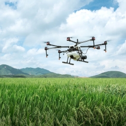
Norman Wildmann presents a wind measurement technique based on the use of UAS, a.k.a. drones.
Exchange and transport processes in the ABL are driven by turbulence on a wide range of scales. Their adequate parameterization in numerical models is essential. In heterogenous and complex terrain, the common simplification of turbulence to statistical models does not necessarily hold. Coherent structures such as convective cells, gusts, slope and valley flows, but also turbulence in cities or behind wind turbines are features which are not well represented in models. A reason for the lack of understanding is the challenge to adequately sample their spatio-temporal structure. Small unmanned aerial systems (UAS, a.k.a. drones) are increasingly used to measure meteorological quantities, including the three-dimensional wind vector in the ABL. In this talk, methods and results will be shown how UAS, either fixed-wing or rotary-wing, can be used to obtain in-situ measurements and thus help to understand complex flows.