
Weather
Izidor Pelajic focuses on NWC-SAF precipitation products derived from EUMETSAT MSG SEVIRI satellite data with the aid of numerical weather predictions from ECMWF and/or ALADIN models.
Length: 30 min
Author: Izidor Pelajic (DHMZ)
EUMETSAT satellite derived or satellite-NWP combined precipitation estimators like Multi-Sensor Precipitation Estimate (MPE) and Nowcasting SAF Convective Rainfall Rate (PGE05 CRR) or Cloud Physical Properties Convective Rainfall Rate (PGE14 CRPh) are best used for precipitation diagnostic and analysis in convective environment. Full benefit of those products is best demonstrated in the regions with none or poor meteorological radars coverage. As with any satellite derived estimator/product, there are both benefits and limitations.
Here we will focus on Nowcasting SAF precipitation products derived from EUMETSAT MSG SEVIRI BS satellite data with the aid of numerical weather predictions from ECMWF and/or ALADIN models. Those products are being used operationally at DHMZ.
Remi Roca explains the functioning of the retrievals and emphases on the characterization of the errors and uncertainties associated with the satellite products.
Length: 30 min
Author: Remi Roca (OMP / LEGOS)
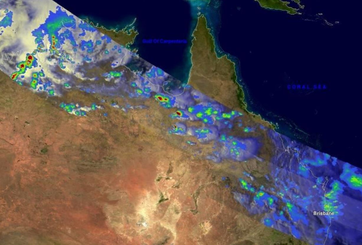
In this lecture, I will focus on the rainfall in the tropical regions and I will present the multi-platforms precipitation products that are available. I will explain the functioning of the retrievals and will put the emphasis on the characterization of the errors and uncertainties associated with the satellite products. Time will be devoted to the introduction of the passive microwave Global Precipitation Measurements constellation with emphasis on the Megha-Tropiques mission. An effort will be made to showcase what the end user can expect from the products developed in many centers worldwide with examples from various validation campaigns. I will end the lecture with a brief presentation of the activity and available resources of the International Precipitation Working Group from WMO/CGMS.
Jochen Grandell introduces the new LI instrument on MTG.
Length: 30 min
Author: Jochen Grandell (EUMETSAT)
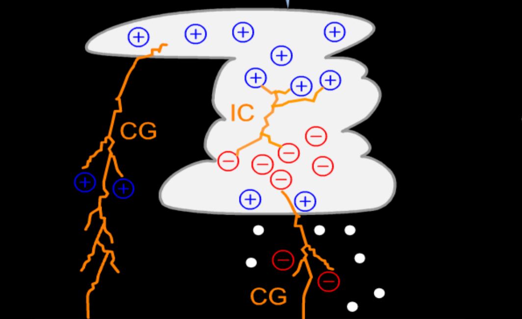
The Meteosat Third Generation Imaging satellite will include in addition to the Flexible Combined Imager (FCI), which is a continuation of the imaging mission, a Lightning Imager (LI) which is a completely new mission. The MTG LI will complement existing ground based capabilities for the detection and location of lightning with information on cloud-to-ground (CG) and cloud-to-cloud or intracloud (CC/IC) discharges, i.e. total lightning. The presentation will cover the background for lightning detection from space, including the detection and processing principles, and will concentrate on the meteorological products from the lightning imager. These include lightning flashes as well as accumulated lightning products.
Geoffrey Stano gives a presentation on total lightning observations from ground-based lightning mapping arrays.
Length: 30 min
Author: Geoffrey Stano (NASA SPoRT)
NASA’s Short-term Prediction Research and Transition (SPoRT) center has been a leader in transitioning total lightning observations from ground-based lightning mapping arrays (LMAs) to operational forecasters. This effort began in 2003 with a single, NASA-owned LMA and has since expanded to include multiple LMAs focusing on warning decision support, lightning safety, and aviation forecast needs. This presentation will cover SPoRT’s total lightning activities, focusing on operational applications both with the LMAs directly and in preparation for the GOES-R Geostationary Lightning Mapper.
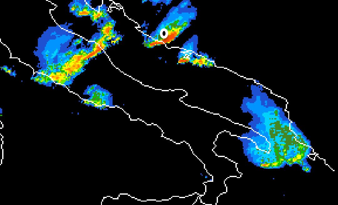
Izidor Pelajic gives a presentation on the evaluation of precipitation products from the NWC-SAF.
Length: 30 min
Author: Izidor Pelajić (DHMZ)
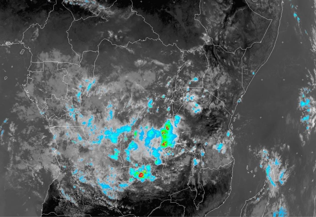
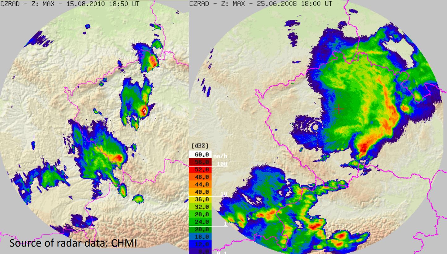
Croatian Adriatic coast is one of the rainiest areas in Europe. Large parts of the coast are not covered by the Croatian Radar network. The Croatian Weather Service (DHMZ) uses data from the NWC-SAF precipitation products to complement Radar data. Results from a validation campaign, using Radar and rain gauge data, will be shown in this presentation.
Jean-Marc Moisselin gives a presentation on the RDT product of the NowCasting SAF.
Length: 30 min
Author: Jean-Marc Moisselin (Meteo France)
The Rapidly Developing Thunderstorm product provides in object-mode information about significant convective systems. Various attributes describe the convective system: cloud-top temperature and height, overshooting tops, morphological attributes. The product uses the satellite brightness temperature of various channels and optional data like NWP data, lightning data and other NWCSAF products. A nowcast of convective systems is developed for 2016.
A new NWCSAF product (Convection Initiation – the probability of a cloudy pixel to become a thunderstorm) will be developed for 2016.
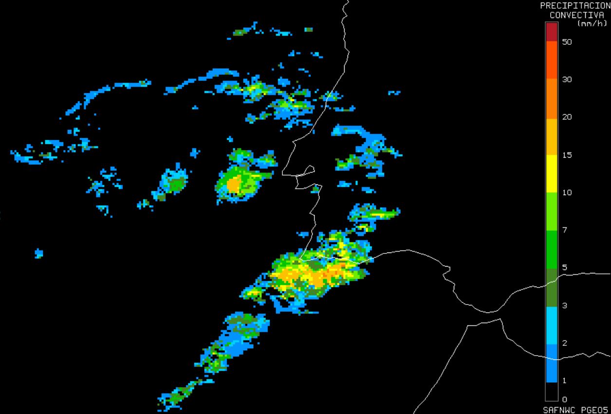
Cecilia Marcos gives a presentation on the Convective Rainfall Rate product of the NowCasting SAF.
Length: 30 min
Author: Cecilia Marcos (AEMet)
The Convective Rainfall Rate (CRR) product, included in the NWCSAF/MSG software package, estimates rain rates on convective and to convection associated stratiform events. The current version of the package includes estimations of rain intensities through two different approaches. A detailed explanation of them will be presented. Also a comparison, focusing on the weakness and strength of the results provided by both algorithms, will be shown.
Christoph Gatzen gives an overview of cold-season derechos that occurred across Central Europe between 1997 and 2014.
Length: 30 min
Author: Christoph Gatzen (MeteoGroup)
The presentation gives an overview of cold-season derechos that occurred across Central Europe between 1997 and 2014. The environmental conditions leading to persistent, intense thunderstorms and associated long-track high wind events are analyzed using reanalysis data and proximity soundings. A focus is the development of deep moist convection in initially stable air masses due to synoptic-scale processes.
Tomas Pucik presents a study of the environments of non-severe and severe thunderstorms in Central Europe.
Length: 30 min
Author: Tomaš Pučik (ESSL)
The environments of non-severe and severe thunderstorms in Central Europe were studied using 16421 proximity soundings acquired in the period from December 2007 to December 2013. In this presentation, we will concentrate on different sounding-derived parameters and how their values change with the increasing severity of thunderstorm-related hazards (large hail, severe wind gusts, tornadoes, excessive precipitation). For example, we show that probability of these hazards as a function of CAPE and 0-6 km bulk shear is different for each hazard. We also present implications for forecasters, such as that area of parameter space with the highest probability of particular hazard may not collocate with the area where it is most frequent.
Thomas Krennert presents the Trusted Spotter Network Austria (TSN).
Length: 30 min
Author: Thomas Krennert (ZAMG)
TSN-Trusted Spotter Network Austria (www.zamg.ac.at/tsn_en) was established to build up a reliable network between storm - spotters and chasers, operational forecasters and scientists. TSN in its current state constitutes the collaboration between the Austrian meteorological service ZAMG (www.zamg.ac.at), SKYWARN AUSTRIA with its various partner organizations and the European Severe Storms Laboratory ESSL with its EUROPEAN SEVERE WEATHER DATABASE ESWD. One aim of this collaboration was a standardization of severe weather reports from the partners according to ESWD standards. We want to introduce the Trusted Spotter Network Austria and its MO, also the performance of ESWD reports from Austria relating to heavy rain, severe wind gusts, hail and other parameters will be shown in our presentation.
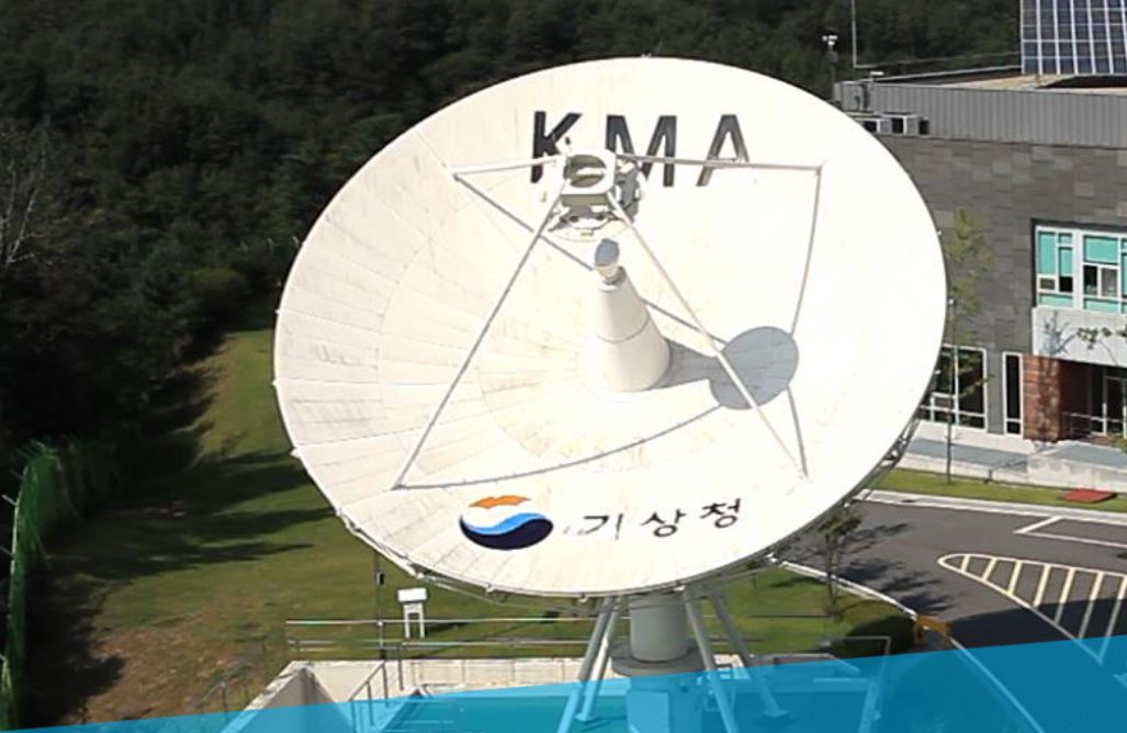
Eunha Sohn gives a presentation on NWC-SAF products adapted to the Korean COMS satellite.
Length: 30 min
Author: Eunha Son (KMA)
Firstly, the characteristics of synoptic weather which convective cloud occurs over eastern Asian region will be mentioned and the thunderstorm monitoring system with radar data which KMA forecasters use will be also introduced. And then I will present our convective cases and explain them with satellite, radar and other NWP data.
Ralph Petersen discusses a new forecast tool.
Length: 30 min
Author: Ralph Petersen (University of Wisconsin)
Delineating areas where convection is most/least likely to develop can be difficult, especially in the next 3-9 hours. Knowing how forecasts can extend the usefulness of SEVIRI products from observations to forecasts can be equally challenging. This talk discusses a new forecast tool that addresses a number of questions: How can SEVIRI products be used to monitor and predict areas that are becoming more/less supportive for development of convection? Will the details in the SEVIRI observations be retained by short-range forecast tool? How do the derived SEVIRI forecast products relate to standard satellite forecasting conventions? Can IR satellite observations still be useful after convection has begun and clouds have formed? Are the SEVIRI projections useful for monitoring NWP performance?