Understand NWP outputs
Liliane Hofer presents alpine pumping as a major mechanism for convection related to orography.
Length: 30 min
Author: Liliane Hofer (ZAMG)
Mountainous regions tend to be the starting point for convective developments due to their elevated heat sources, the topographic amplifying factor or their role as a flow obstacle. In this presentation different synoptic situations and the consequent convection will be analyzed in the Alpine region on the hand of case studies.
Georg Pistotnik talks about the role of vertical wind shear in storm organization.
Length: 30 min
Author: Georg Pistotnik (ZAMG)
Next to sufficient instability, strong vertical wind shear is the main driver that promotes thunderstorms to organize into multicells, supercells or lines, which are more probable to attain a longer lifetime and to produce severe weather phenomena like hail or wind gusts. The role of vertical wind shear in storm organization is explained in this presentation, and selected case studies illustrate how favorable conditions for severe storms can evolve either by large-scale processes or, more challenging for forecasters, by local modifications of the wind systems and associated temperature and humidity changes.
In meteorology vertical cross-sections are used because they give additional information compared to the information gained from the analysis on horizontal levels.
Not immediately related to satellite meteorology but often presented in the EUMeTrain material are cross sections. In meteorology vertical cross-sections are used because they give additional information compared to the information gained from the analysis on horizontal levels. The basics on cross sections and what can be derived are discussed and tested in the CAL module.
This training Module will present you with examples and exercises on the monitoring of NWP models using satellite imagery.
Numerical Weather Prediction (NWP) is a fundamental part of the modern forecasting. The importance of NWP in the forecasting process is so obvious that we often forget the restrictions and limitations of NWP. Models do have errors, even a lot of them. Even with ever improving performance the NWP models still have many problems in predicting many weather elements precisely.
It is of extreme importance that the forecaster can be able to evaluate the performance of NWP in a daily operational environment, and not be misled by the NWP output.
This module will concentrate on one aspect in model error correction: the subjective monitoring the NWP output with the help of satellite images. The purpose of the module is to help forecaster to use selected satellite products for a quick analysis of how the NWP model is able to catch the features in the weather chart.
The target users for this module are operational forecasters and developers. The pre-requisites for completing this module are general knowledge of meteorology, some experience in forecasting and a basic knowledge of the satellite images and image techniques.
This lecture introduces the wave model products, eg. wave height and mean propagation direction, wave spectrum analysis, long swell forecasts, etc.
Length: 55 min
Author: Jean Bidlot (ECMWF)
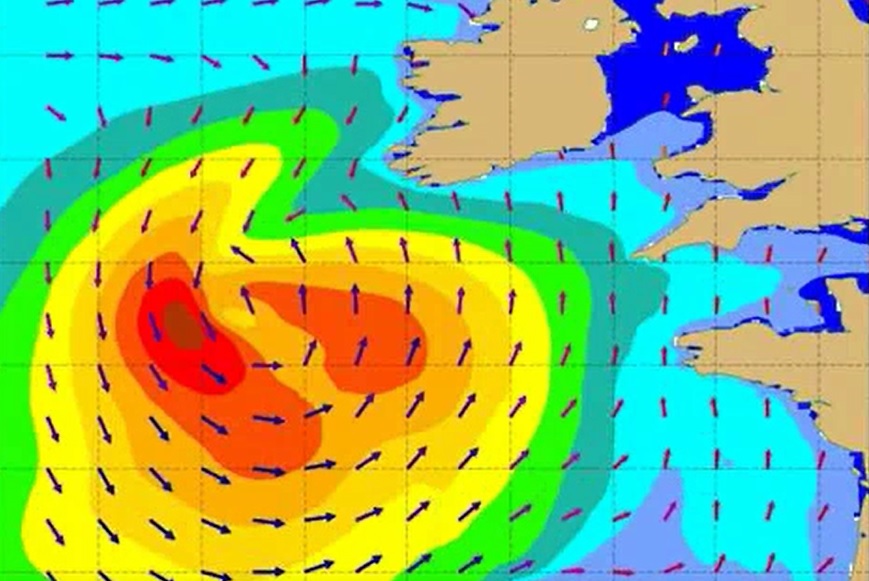
Starting from the basics, this lecture introduces the students to wave model products (eg. wave height and mean propagation direction), wave spectrum analysis, long swell forecasts, extreme forecast index etc. Since these outputs (alongside data from the bouys) are the basic material marine forecasters have for forecasting and nowcasting waves in seas and especially in oceans, explaining the positive and negative sides of model outputs is very important for understanding and thus correctly using the products marine forecasters use.
David Fairbairn discusses the theory behind the near-real-time and data record RZSM products.
Length: 25 minutes.
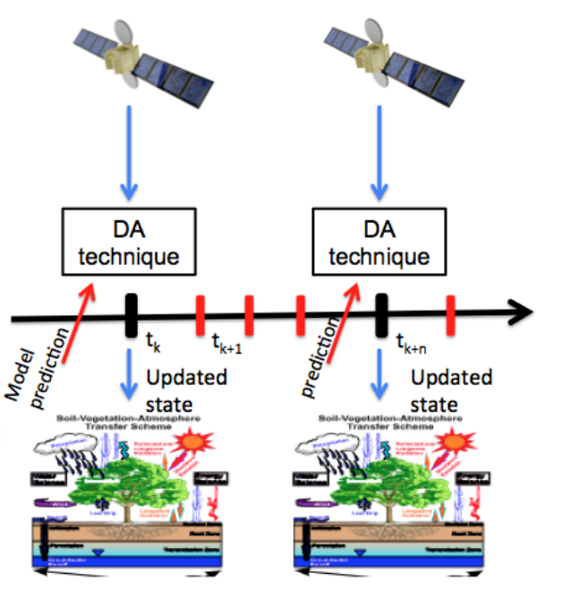
ECMWF provides the core root-zone soil moisture (SM) products for H SAF through an Extended Kalman filter assimilation system, running independently of the NWP system. Space borne scatterometer-derived surface SM observations are assimilated into the root-zone (0-1 m) SM of the H-TESSEL land surface model. In this presentation, the theory behind the near-real-time and data record products is discussed.
Simone Gabellani and Fabio Delogu describe how satellite soil moisture can be used in hydrological modelling trough data assimilation.
Length: 37+27 minutes.
The reliable estimation of hydrological variables in space and time is of fundamental importance in hydrology to improve the flood predictions and hydrological cycle description. Nowadays remotely sensed data can offer a chance to improve hydrological models especially in environments with scarce ground-based data. The presentation describes how satellite soil moisture can be used in hydrological modelling trough data assimilation.
Estibaliz Gascon presents the IFS ensemble forecasts from ECMWF that provides an instantaneous precipitation type output variable.
Length: 37 minutes.
One of the greatest difficulties facing forecasters during the cool season is the correct determination of precipitation type, especially with temperatures close to freezing point. There are numerous sources of uncertainty in precipitation type forecasts which is why mixed phases are not well predicted. These uncertainties are difficult to reduce but can potentially be quantified by the use of ensembles.
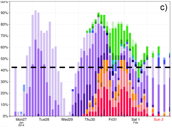
The Integrated Forecast System (IFS) ensemble forecasts (ENS) from ECMWF provide an instantaneous precipitation type (ptype) output variable that describes 6 types of precipitation at the surface: rain, freezing rain, snow, wet snow, sleet or ice pellets (plus dry). As part of ECMWF's contribution to the ANYWHERE European project, two new products were developed. These are the most probable precipitation type, shown on map format, and the instantaneous probabilities of different types, shown for a given site. The first of these shows which type is most probable whenever the probability of some precipitation is >50%. The second product depicts the temporal evolution of probabilities for a specific location in bar chart format, classified also according to three categories of instantaneous precipitation rate. These new instantaneous probabilistic products will be shown through an experiment reproducing the freezing rain case study in Slovenia in 2014.
Andreas Frank gives a short overview about ZAMG special products for winter road conditions.
Length: 26 minutes.
During winter season we have a lot of additional products dealing with road weather, especially road conditions (snow, ice, hoarfrost,...). The talk will give a short overview about our special products, what are the differences to a normal forecast and point out some problems in forecasting special parameters in the alpine region. Additionally you will get some information about our special training services for road maintainance workers and also you will get a short overview about our internet portal, which we provide for our customers.
Elina Tuhkalainen treats the formation and dissipation of fog at airports in Finland.
Length: 35 min
Author: Elina Tuhkalainen (FMI)
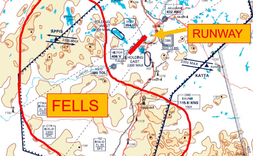
In this presentation formation and dissipation of fog and stratus will be treated. The presenters will also address how these phenomena occur around the year and how they affect the services at the airports in Finland.
The presentation shows a possibility of turbulence diagnostics with aid of the Turbulence Kinetic Energy (TKE).
Length: 50 min
Author: André Simon, Péter Salavec (OMSZ)
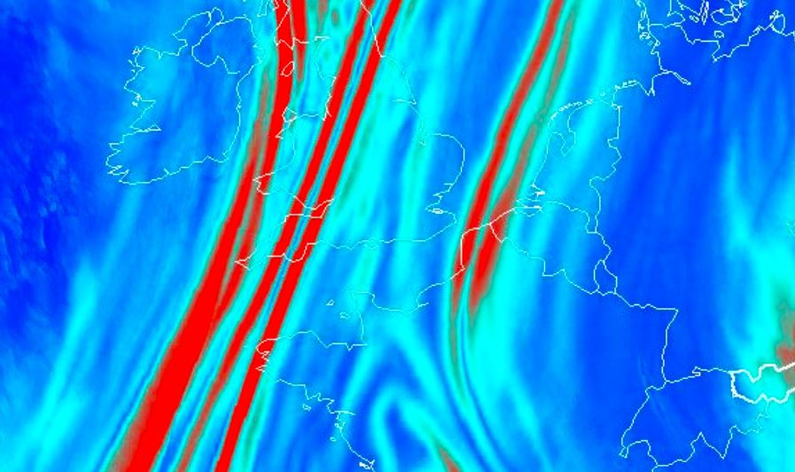
Turbulence is a hazardous weather phenomenon for aviation and a challenge for a forecaster. It is typically a small-scale phenomenon and its direct observations and measurements are relatively sparse, except of the surface layer of the atmosphere. The presentation shows a possibility of turbulence diagnostics with aid of the Turbulence Kinetic Energy (TKE) calculated from a high-resolution non-hydrostatic model AROME. This parameter is calculated from a prognostic equation and it is only rarely applied as an end-product in operational forecasting. We studied the distribution of TKE in various meteorological situations, with focus on the Visual Flight Rules (VFR) conditions. Both advantages and limits of the TKE diagnostics are discussed. High attention is also given to forecasting of mountain waves, which can have both positive and negative impact on the flight. A development work based on this theory is in progress at the Unit of Aviation Meteorology resulting in new products for the mountain wave gliding branch of sport aviation.
Alexander Jann and Andreas Wirth present the new aviation products of ASII-NG (Next Generation).
Length: 30 min
Author: Alexander Jann, Andreas Wirth (ZAMG)
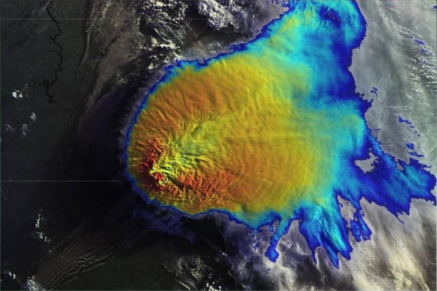
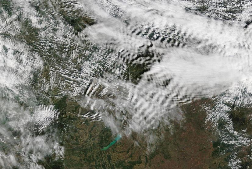
Two new satellite-derived products related to turbulence analysis have been developed recently in the frame of the Nowcasting-SAF. The first product (ASII-GW”Automatic Satellite Image Interpretation – Gravity Waves”) objectively detects grating patterns in the water vapor 7.3 imagery which point to the presence of gravity waves. The second product (ASII-TF “Automatic Satellite Image Interpretation – Tropopause Folding”) identifies the location of tropopause folds from satellite and NWP data. The algorithm is based on the logistic regression method.
In this presentation, we will talk about the selected algorithms and present cases from the official Nowcasting-SAF validation reports (to be released shortly) to illustrate the product performance.


