
Land
Presentation 10 in the Environment Event Week 2016
Length: 30 min
Author: Jose Prieto (EUMETSAT)
Not only smoke tells you where the fire is. Small active fires 20 meters across, a minute fraction of the pixel size, are sensed by Meteosat from its lofty orbit. We explain how to spot them without burning your fingers. Thresholds, channels and future composite products might ignite your interest.
Presentation 11 in the Environment Event Week 2016
Length: 30 min
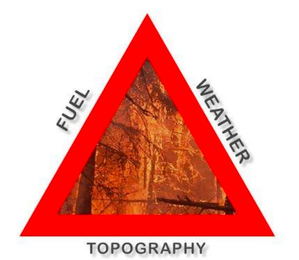
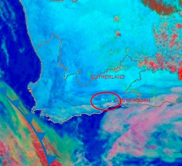
Author: Lee-Ann Simpson (SAWS)
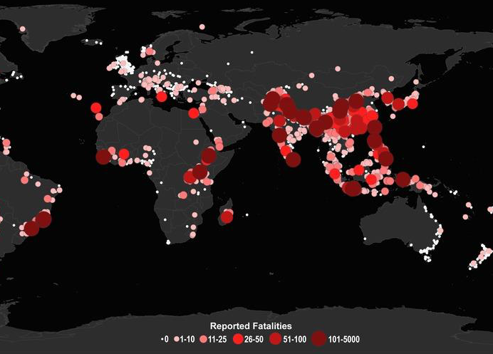
South Africa is by nature a dry country, which has very short wet periods, mainly confined to the coastal areas and eastern half of the country. During the dry season, the hot, windy conditions result in a favourable environment for fires to spread uncontrollably and cause large scale damage to the local vegetation and to infrastructure. To be able to anticipate and forecast the risk of runaway fires in South Africa, a forecaster needs to have many sources of information, ranging from precipitation amounts to an understanding of the local vegetation. The inclusion of satellite imagery interpretation is an invaluable part of the forecasting process and the monitoring of fires can be done accurately and on a 24hour basis. This presentation will outline the risk the fires pose within South Africa and our forecasting processes dealing with this environmental hazard.
Jose Prieto talks about solar channels, how to use them, what are the differences and where they are used for.
Length: 67 minutes
Author: Jose Prieto
In the session Jose talks generally about the solar channels, how to use them, what are the differences and where they are used. Later on the talk is about monitoring the vegetation and soil properties using the available solar and near-infrared channels. The presentation ends with examples of products for detecting dust and smoke.
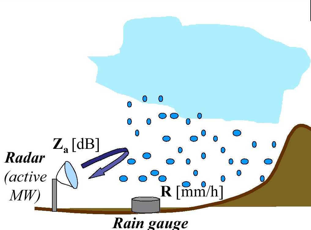
Simone Gabellani presents a merging approach of rain gauge data with remote precipitation retrieval to improve flood modelling.
Length: 68 minutes
Multi-sensor data fusion prove that combining data from rain gauges and remote retrievals represents the best way to obtain an enhanced and more reliable evaluation of Quantitative Precipitation Estimation (QPE) that improve hydrological modelling for river discharge estimation. Although remote sensors produce an observation of precipitation subject to several sources of uncertainty, they capture the general covariance structure of the precipitation field. Thus, the information provided by remote sensors may be used to condition the information from rain gauges, which is limited in terms of spatial representativeness. In this way, an estimate of the rainfall field containing a more realistic spatial structure constrained to the rain gauges data can be produced. The presentation will describe the theoretical background and examples for merging satellite and gauge rainfall data for improving discharge modelling. A Modified Conditional Merging (MCM) approach, developed from the original Conditional Merging proposed by Sinclair and Pegram (2005), will be illustrated.
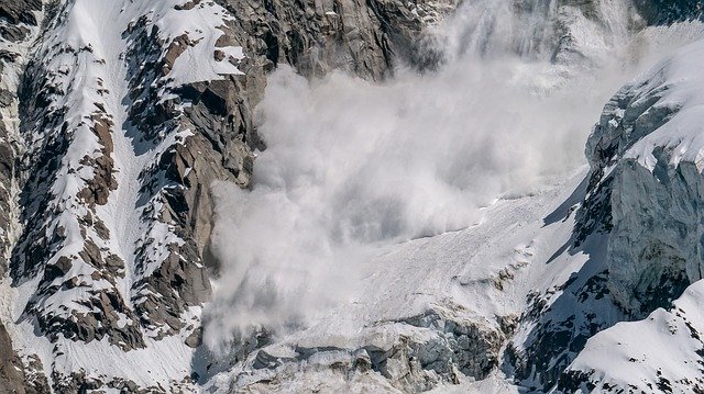
Luca Ciabatta describes the theoretical background and some examples for using satellite rainfall data for landslides prediction analysis.
Length: 22 minutes
Rainfall-induced landslides are one of the most frequent and dangerous natural hazards, occurring every year and causing fatalities and significant economic losses. Their impact is expected to increase in the next decades due to climate changing. In these premises, several countries have developed and implemented operational early warning systems for rainfall-induced landslides. The main tool for the prediction of landslides is represent by rainfall thresholds. Usually, these empirical thresholds use rainfall characteristics, i.e. intensity and duration, to define the conditions that likely triggered the landslide based on the analysis of historical events. Satellite rainfall data can be beneficial in this application as they provide information over large areas without the need of setting up and maintain a monitoring network. This presentation will describe the theoretical background and some examples for using satellite rainfall data for landslides prediction analysis.
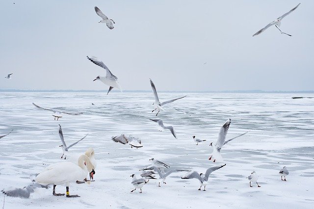
Yulia Mishenina presents the results of studies of the characteristics of snow cover for the territories of Western and Eastern Siberia.
The report presents the results of studies of the characteristics of snow cover for the territories of Western and Eastern Siberia. The research period is from 1976 to 2020.
The report describes the duration of persistent snow cover, the time intervals between the first snowfall and stable snow cover and between the destruction and disappearance, a number of characteristics of the snow cover: duration of occurrence, thickness and water content.
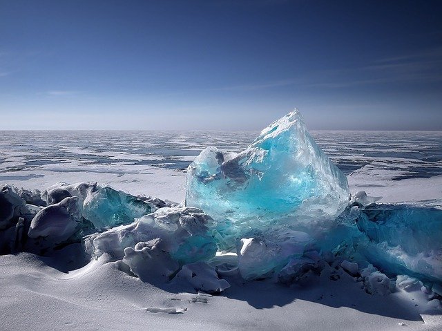
Ákos Horvath talks about ice formation on Lake Balaton and the dependence from local wind and weather.
Lake Balaton is the largest lake in the Carpathian Basin. The shallow lake (with 3.5 m mean depth) responds to the weather rapidly: in hot summers the water temperature increases above 25 °C, and at colder winters thick ice (20-40 cm) appears on the lake surface. The formation of the ice depends very much on the weather. Glassy ice forms when after a cold front passage in the night the wind and waves calm down and the previously mixed up and supercooled water freezes rapidly. During longer cold and windy weather period, ice appears in forms of ice floes, frozen to each other. This presentation tries to give an overview of the metamorphosis and special dynamic of the Balaton ice.
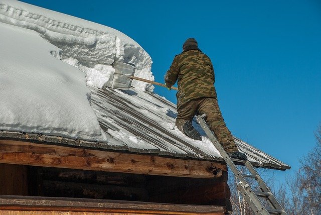
Michael Winkler puts heavily burdened roofs in the spotlight by presenting recent efforts in updating the Austrian snow load standard and showing an actual example of snow load monitoring and hazard management.
Snowy winters lead to heavy snow loads on buildings and constructions. Surprisingly often, the snow load assessment basis of international and national standards are regionally reached or exceeded. Damages or even collapses do occur, cause expenses and threaten human lives. However, extreme snow loads only rarely are considered as natural hazards. This talk puts heavily burdened roofs in the spotlight by presenting recent efforts in updating the Austrian snow load standard and showing an actual example of snow load monitoring and hazard management.
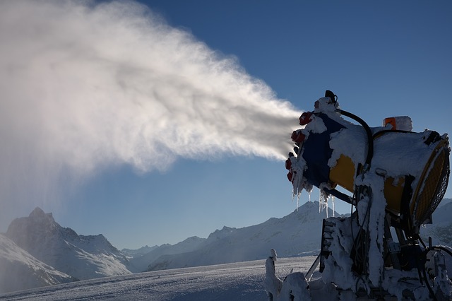
Michael Rothleitner discusses economic and ecological aspects of winter tourism in the Alpine region.
At the beginning, the economic interrelationships of winter tourism in the Alpine region, Austria and finally Tyrol are highlighted. The dependence of value creation on a reliable snow situation in winter therefore forces snow management, the economic and above all ecological tasks of which will be presented. The participants will get to know the essential problems and the existing approaches to solving them.

Sven Kotlarski summarizes current research on the fate of surface snow cover and its implications for climate.
The presence of snow cover on the land surface is closely linked to the prevailing climate. Moreover, by modulating surface energy fluxes snow cover is interactively linked to the atmosphere and constitutes an important component of global and regional climate systems. Available observations show a retreat of snow cover on hemispheric scales as a response to global warming, and climate projections consistently indicate a further decrease. Focusing on Europe and especially on the European Alps, this contribution summarizes current research on the fate of surface snow cover and its implications.
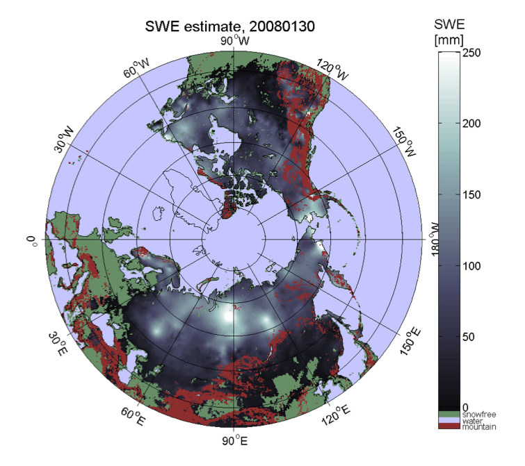
Kari Luojus shows the basic approach to apply passive microwave radiometer data for retrieval of terrestrial snow water equivalent.
The presentation shows the basic approach to apply passive microwave radiometer data for retrieval of terrestrial snow water equivalent. It describes the GlobSnowmethodology to combine satellite-based radiometer data with ground-based snow depth observations and a bias-correction approach to improve the satellite-based retrievals. It also presents the historical satellite-based reconstruction of Northern Hemisphere snow mass, from 1980 to present day (published on Nature, Pulliainen et al. 2020). Pulliainen, J., Luojus, K., Derksen, C. et al. Patterns and trends of Northern Hemisphe re snow mass from 1980 to 2018. Nature 581, 294–298 (2020). https://doi.org/10.1038/s41586-020-2258-0
Veronika Hatvan and Andreas Gobiet present model-based tools used at ZAMG for operational avalanche warning services and local avalanche commissions.
While the usage of models for weather forecasting has been long established, the application of snow cover models for operational avalanche warning purposes is still quite novel. In Austria, the national weather service, ZAMG, develops model-based tools for operational avalanche warning services and local avalanche commissions. In particular, a model-chain consisting of a snow cover model and an ensemble of weather models to operationally assess and predict avalanche hazard in a local context is currently developed. The model-chain provides regional avalanche forecasters and local avalanche commissions with continuous, detailed information about the snow cover from the near-past to the nearfuture. This is to enable early warning of exceptional snow cover situations. In this talk we will give an overview on model-based tools for avalanche services and present the local avalanche prediction model and preliminary results of a first test season in more detail.