
Weather
In this CAL module you will learn to detect areas with the risk for Clear Air Turbulence (CAT). This will be done with the help of satellite images, soundings, flight reports and analyses of the airflow.
Clear Air Turbulence is one of the most frequent hazards for civil aviation. It is also one of the biggest challenges for forecasters to detect and warn for possible Clear Air Turbulence occurrence.
In this CAL module you will learn to detect areas with a high risk for Clear Air Turbulence (CAT). This will be done with the help of satellite images, soundings, flight reports and analyses of the airflow. Practical examples will show you how to apply your knowledge.
This CAL module deals with applications of MSG water vapour images in operational forecast departments. It focusses on the analysis of WV imagery in view of turbulence, cyclogenesis, convection and deformation zones.
This training module gives an overview on applications of MSG water vapour channels for operational weather forecasting. It handles the concept of potential vorticity which is a key feature to understand the dynamic processes in the higher Troposphere such as cyclogenesis. The CAL module also shows practical applications of the WV images from the geostationary satellites for locating tropopause foldings, clear air turbulence and deformation zones. It handles the effects of WV boundaries on the initiation of convective processes and finally presents some meteorological products heavily based on WV imagery.
An intensive training module on the operational use of RGBs in the forecasting room.
The new generation satellite data contains more and more information offering increased insight into cloud and air mass characteristics. This poses a challenge: figuring out how to extract, distill and package the data into products that are easy for forecasters to interpret and use.
One might create numerous different kinds of RGB images. Satellite experts developed some optimally tuned RGB types for highlighting specific features. These are the so called standard RGBs recommended by EUMETSAT. The advantage of using standard RGBs is their easy comparability.
The aim of creating RGBs is to provide fast, easily understandable VISUAL information. A 'good' RGB should convey information that would be difficult or time consuming to assess visually from one or more individual single channel images. RGB image should be unambiguous and use intuitive colours to help highlighting important meteorological and surface features. RGBs provide useful information to forecasters, in particular when looking at animated image sequences. They preserve the "natural" look-and-feel of "traditional" satellite images, e.g. they preserve texture, and the patterns are continuous in time.
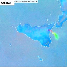
In this module you will learn more about the EUMETSAT standard RGBs: HRV Fog RGB, Snow RGB, Night Microphysics RGB and the Ash RGB.
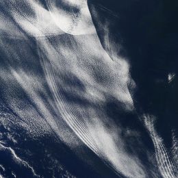
This module treats all kinds of atmospheric gravity waves over land and over the oceans.
This module treats all kinds of atmospheric wave phenomena, starting with Lee Waves and ending with Vortex Streets. The physical background of Gravity Waves in general and Lee Waves in special will be highlighted and special cases, such as Foehn clouds, treated in more details. Gravity waves over the oceans build another focal point of this module. At the end of each chapter, exercises will help you to check the acquired knowledge.
The purpose of this training module is to give an overview on the different RGB types created from the AVHRR instrument.
This training module describes MetOp AVHRR (Advanced Very High Resolution Radiometer) RGB schemes that are based on EUMETSAT recommendations. The 'recipes' were tuned to create high quality MetOp/AVHRR RGB images as similar as possible to the SEVIRI RGB schemes recommended by EUMETSAT.
The main aim of the training module is to help the users (weather forecasters and/or other experts) understand and use these RGB types by giving them background information, examples and exercises.
The module takes the following structure:
- The aim of the RGB type
- Physical background
- How to create the given RGB type
- Typical colors
- Examples of interpretation
- Benefits and limitations
- Comparisons with other RGB types and/or single channel images
- Exercise
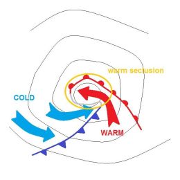
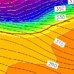
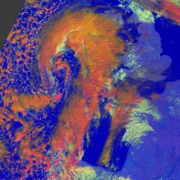
In this Training Module, the two major mid-latitude cyclone models, the Norwegian cyclone model and the Shapiro-Keyser cyclone model will be explained in detail.
In this module, the two major mid-latitude cyclone models, the Norwegian cyclone model and the Shapiro-Keyser cyclone model, will be explained in detail. The intention of the module is to point out the main differences in the life cycles of cyclones of the Norwegian type and the Shapiro-Keyser (S-K) type. Special focus will be placed on the synoptic preconditions that lead to the formation of cyclones.
Finally, sting jets, which often appear in the context of Shapiro-Keyser cyclones, will be briefly introduced.
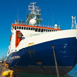
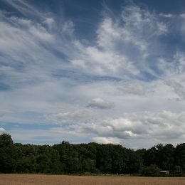
In this Training Module you can follow the voyage of the research vessel Polarstern across the Atlantic and observe various atmospheric phenomena.
Follow the voyages of the research vessel Polarstern through different climate zones and weather situations in three oceans - Arctic, Atlantic and Antarctic. Learn more about fog, winds and convection, the globel circulation and climate zones. See how satellite images help you observe the atmospheric phenomena.
In this Training Module you will learn more about the genesis and the development of cyclones at the downwind side of the Alps.
This training module treats the developement of cyclones at the downwind side of a mountain range with a special focus on the Alps. The module deals with the physical facts that lead to the creation of a lee cyclone, from its very beginning as a low-level vortex in the vicinity of a mountain range until its final stage as a mesoscale cyclone. The module tries to give an answer, why some of the lee vortices never develop into a full-grown cyclone and instead remain a local wind phenomenon or at best a low-level vortex that soon dissipates when leaving the downwind area by looking at the triggers that form cyclones. Local winds like the Bora and the Mistral are often linked to Lee Cyclogenesis in the Gulf of Genua. They will be treated at the end of the module.
Anna Cinzia Marra presents applications of the H-SAF precipitation products.
Length: 29 minutes.
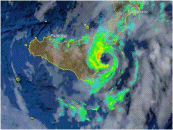
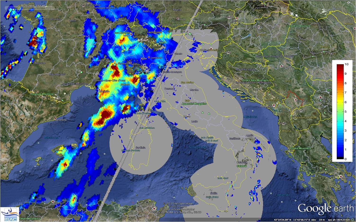
The Mediterranean region is often impacted by heavy precipitation events, that are responsible for damages and sometimes casualties, especially over the coastal areas. Because of its peculiar geographical characteristics, conventional ground-based instruments, such as raingauge and radar networks, cannot be fully exploited for the monitoring, characterization and forecasting of severe events, in particular during their offshore development. For these reasons in the last decades satellite observations, both over geostationary and Leo platforms, have been recognized as a powerful tool to overcome the limitations of ground-based observations
In this presentation we analyze severe events that have recently affected the Mediterranean area, causing damages at the ground, and have challenged observational and forecasting capabilities. Heavy precipitation systems are described and analyzed here by exploiting active and passive microwave measurements and state-of-the-art precipitation products available in the HSAF project during the Global Precipitation Measurement (GPM) mission era. We highlight how the HSAF satellite products specifically developed for the European area, and thus tailored for the Mediterranean region, show better performances than algorithms designed for global application. We also show few strategies to blend satellite data and products with conventional meteorological data, with the aim to increase the knowledge of severe systems in the Mediterranean area and to support operational forecasting activities in a climate change perspective.
Davide Melfi presents the H-SAF precipitation products.
Length: 24 minutes.
The EUMETSAT Satellite Application Facility in Support to Operational Hydrology and Water Management (HSAF) generates and archives high quality products for operational hydrological applications. HSAF focuses on geophysical products of precipitation, soil moisture and snow parameters and the exploitation of these datasets to mitigate hazards and natural disasters such as flash floods, forest fires and landslides, and to monitor drought conditions, improving water resources management.
HSAF promotes the systematic and periodic products review with the continuous refinement of algorithms, validating results during calibration campaign, implementing operational driven procedures and services monitoring accordingly user requirement.
The current status of the Precipitation Cluster and the challenges for the future, looking at MTG and EPS-SG in particular, are presented.
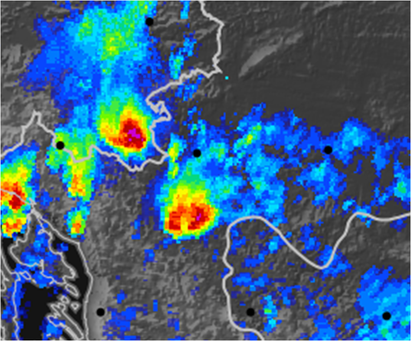
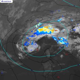
Jana Campa investigates the development and the impact of a convective situation on 8 June 2018.
Length: 42 minutes.
In early summer 2018 Central Europe was affected by several severe thunderstorms, many producing large hail. One of the most severe storms struck the town of Črnomelj, Slovenia. Interestingly, this storm did not look more severe in the remote sensing data than other storms on the same day. The presentation will investigate its development and impact. In addition, the preconvective environment of this and other severe storms of the last summer will be investigated with the help of satellite sounding data.
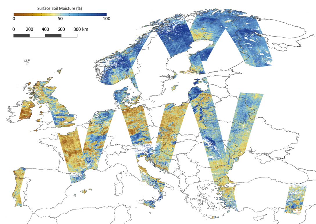
The presenters show the effects of soil moisture on future convective developments for the eastern parts of Austria.
Length: 30 minutes.
Soil moisture is supposed to be a key parameter in triggering convection as it influences the lower boundary conditions of the atmosphere and the partitioning of energy between sensible and latent heat fluxes. Using the convection-permitting numerical weather prediction model AROME, we try to quantify this impact by investigating sensitivity studies, hence estimating the potential of satellite-based soil moisture measurements to improve the forecast of convective events.