
Identify and interpret broad scale, synoptic and mesoscale systems
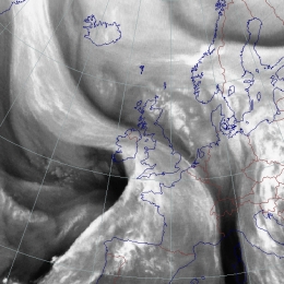
A Cold Air Development describes the increase of a Comma to a synoptic scale cloud spiral having similarities with an Occlusion stage.
A Cold Air Development is represented by a cloud spiral at the rear side of a frontal system. As the name already indicatees it is bound to cold air advection. Cold Air Developments often result of enlargening comma systems. Like the comma system they are linked to a PVA maximum. The intensive moving PVA maxima is regarded as the reason for cyclogenesis taking place within the cold air mass.
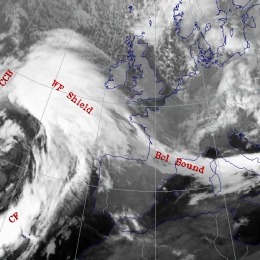
A Baroclinic Boundary is accompanied by a stationary front-like cloud band situated at synoptic positions which are not typical for classical fronts.
Baroclinicity means that in the atmosphere surfaces of constant pressure intersect surfaces of constant temperature (or density), implying that on a surface of constant pressure there exists a temperature gradient. Consequently a horizontal stream on a pressure surface causes a change in temperature. In general the atmosphere is in a baroclinic state. But there are self contained areas with stronger baroclinicity like i.e. fronts. A Baroclinic Boundary has no significant propagation. The Baroclinic Boundary to the rear of a synoptic scale trough is the most frequent type and will therefore serve as an example.
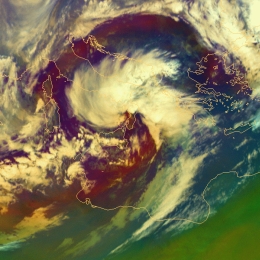
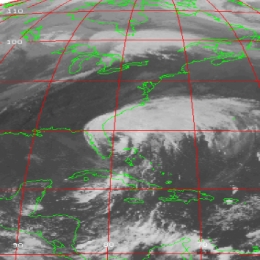
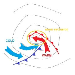
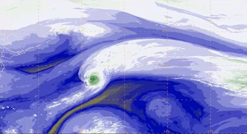
A Back-Bent Occlusion is that part of an Occlusion cloud spiral which reforms into a Cold Front band with some cyclonic curvature with the approach of a cold air mass.
The concept Back Bent Occlusion refers to a part of a warm occluded front that changes its direction of motion and turns into a Cold Front. This back bending is due to remarkable cold air advection at the rear side. The bending back of an occluded front can be seen from the curvature of TFP field around the Occlusion.The surface pressure gradient is relatively weak near the centre of the low, and often elongated in the direction of the occluded front.
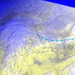
Arctic Fronts are accompanied by mostly low and some mid-level clouds.
Arctic Fronts form in the Arctic region, and move southwards in southerly flows. When they reach Northern Europe, they have usually travelled over an open sea, and convective cloudiness has developed. The appearance of an Arctic Cold Fronts is then, essentially, that of a shallow Cold Front. Arctic Cold Fronts are usually so far north that Meteosat images alone are inadequate to recognize them. The final check is best made using a loop of AVHRR images with the help of numerical model parameter fields.
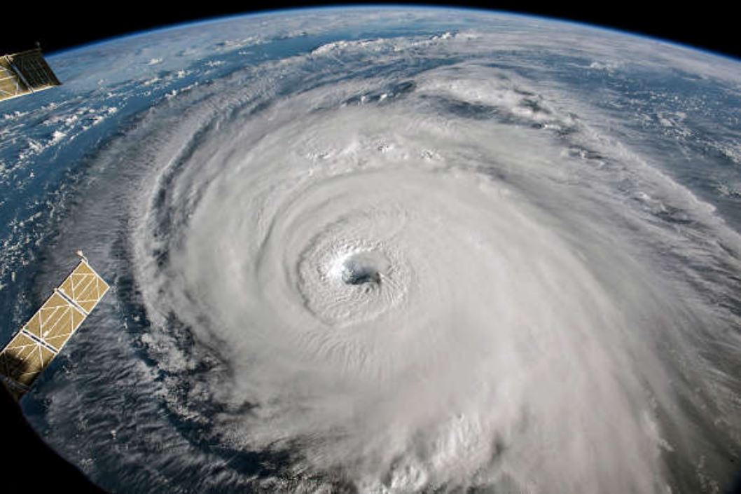
The extra tropical transition (ETT) of Hurricanes over the Atlantic is something that happens about 5 times a year and can severely disrupt the weather forecast.
The extra tropical transition (ETT) of Hurricanes over the Atlantic is something that happens about 5 times a year and can severely disrupt the weather forecast. In this CAL the important features of ETT are addressed and physical theories are presented. After each chapter several exercises allow you to test the theory.
In this Training Module, the two major mid-latitude cyclone models, the Norwegian cyclone model and the Shapiro-Keyser cyclone model will be explained in detail.
In this module, the two major mid-latitude cyclone models, the Norwegian cyclone model and the Shapiro-Keyser cyclone model, will be explained in detail. The intention of the module is to point out the main differences in the life cycles of cyclones of the Norwegian type and the Shapiro-Keyser (S-K) type. Special focus will be placed on the synoptic preconditions that lead to the formation of cyclones.
Finally, sting jets, which often appear in the context of Shapiro-Keyser cyclones, will be briefly introduced.
In this Training Module you will learn more about the genesis and the development of cyclones at the downwind side of the Alps.
This training module treats the developement of cyclones at the downwind side of a mountain range with a special focus on the Alps. The module deals with the physical facts that lead to the creation of a lee cyclone, from its very beginning as a low-level vortex in the vicinity of a mountain range until its final stage as a mesoscale cyclone. The module tries to give an answer, why some of the lee vortices never develop into a full-grown cyclone and instead remain a local wind phenomenon or at best a low-level vortex that soon dissipates when leaving the downwind area by looking at the triggers that form cyclones. Local winds like the Bora and the Mistral are often linked to Lee Cyclogenesis in the Gulf of Genua. They will be treated at the end of the module.
Georg Pistotnik talks about how convective cells organise to single-cells, multi-cells and super-cells.
Length: 31 minutes.
According to their degree of organization, thunderstorms can conceptually be divided into single cells, multicells and supercells. Organized storms, in particular supercells, are responsible for the large majority of severe convective weather like large hail and damaging wind gusts. They are favored by high latent instability and/or strong vertical wind shear and exhibit characteristic behavior in radar and satellite data. For nowcasting purposes and timely weather warnings, it is therefore crucial to recognize organized and severe thunderstorms in remote sensing data. This presentation focuses on key properties of this distinction and illustrates some characteristic examples.
Carlos Ramalho presents some tropical and extra-tropical cyclones that affected the Azores and the challenges forecasters face in this situations.
Length: 30 min
Author: Carlos Ramalho (IPMA)
Due to the Azores geographical location, this archipelago is occasionally affected by strong Extratropical cyclones and Tropical cyclones. Extratropical cyclones are more frequent in winter and are often associated with strong winds, heavy precipitation and heavy waves which can be damaging and contribute to social and economic distress. Tropical cyclones, on the other hand occur mostly in September and October and in the past have caused loss of lives and property damage. Forecasting this type of systems is very challenging, mostly because a small variation in path can cause large difference in the impacts. This talk presents some tropical and extratropical cyclones that affected the Azores and also the challenges that forecasters face in this situations.
Ioannis Pytharoulis shows past cases of Medicanes, the description of their structure and characteristics.
Length: 50 min
Author: Ioannis Pytharoulis (Aristotle University of Thessaloniki)
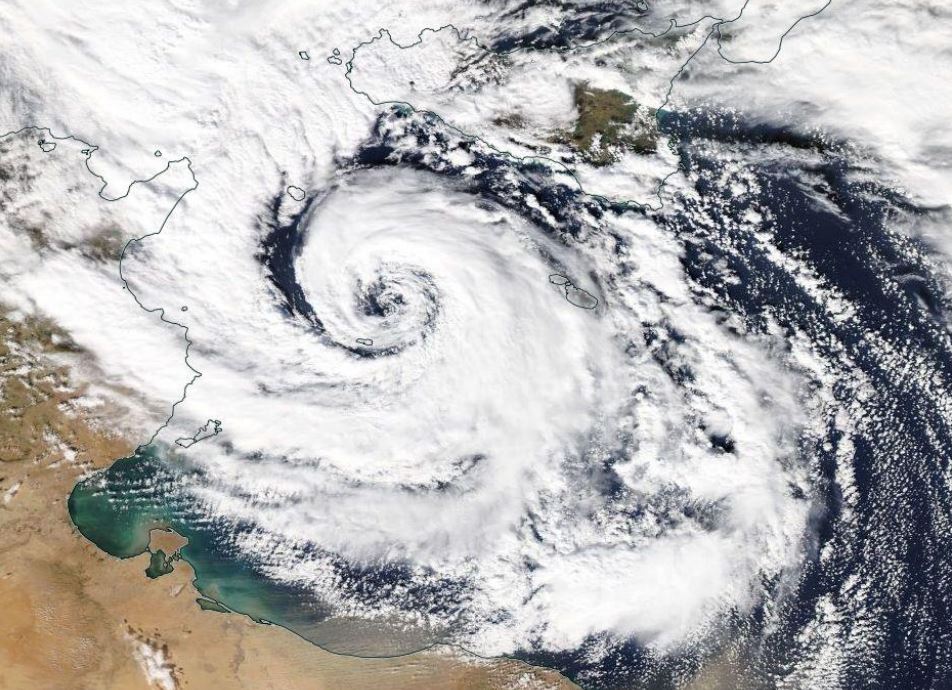
The Mediterranean tropical-like cyclones are intense sub-synoptic maritime lows with strong winds, axisymmetric warm-core structure and tropical cyclone features, such as a cloud-free eye and spiral deep convection. They are frequently referred to as medicanes (MEDIterranean hurriCANES) due to their resemblance to tropical cyclones. Despite their low frequency (of about 1.1-1.6 systems per year), medicanes constitute a serious natural hazard to life, property and the environment of the coastal regions of the Mediterranean basin and the Black Sea. Their accurate prediction is a challenge for the numerical weather prediction models. This presentation includes some past cases of medicanes, the description of their structure and characteristics, criteria that are used to define them, the development mechanisms, climatology, consequences and finally a detailed case study of medicane Qendresa (November 2014).
Michael Folmer presents examples of relevant applications of Sentinel-3A data.
Length: 55 min
Author: Michael Folmer (NOAA)
The EUMETSAT-operated Copernicus Sentinel-3A satellite has been providing near-real time data to the marine community since mid-2016, and will be soon be joined in operations by its sister, Sentinel-3B. This presentation will give an overview of the available Sentinel-3 marine products, with a primary focus on data streams associated by the altimeter (SRAL) and sea surface temperature radiometer (SLSTR). Examples of the relevant applications will be presented, along with a discussion of how users can best access data and monitor its quality.
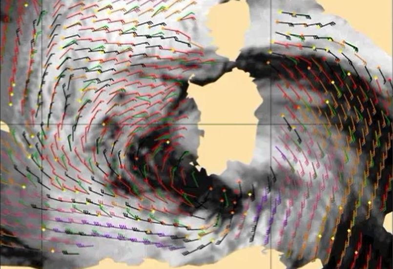
Ad Stoffelen focuses on scatterometer winds, how good they are and what aspects need attention.
Length: 60 min
Author: Ad Stoffelen (KNMI)
Winds over sea are essential for marine forecasting and used in nowcasting and numerical weather prediction (NWP) to aid in off-shore activities (energy sector, transport, fisheries and recreation), particularly to secure safety of life and property. Winds over sea are observed by satellites and available from NWP model forecasts. Most satellite winds over sea are provided by scatterometers; they provide swath fields of both wind speed and wind direction from polar satellites. Currently, winds from EUMETSAT’s MetOp-A, MetOpB and the Indian ScatSat-1 are operationally available and provide good coverage around 9:00 and 21:00 local solar time (LST). Very soon they will be complemented by a few more. The lecture focuses on what scatterometer winds really represent, how good they are and what aspects need attention when applying these winds in your routine operations alongside with NWP model winds.