
Satellite skills and knowledge for operational meteorologist
Listed here are other resources related to Satellite skills and knowledge for operational meteorologist tag:
Note: click on an image to open the Resource
This mini-module is part of a series of MTG mini modules produced by EUMETSAT/EUMeTrain with the aim of providing quick and useful learning experience about the new satellite products.
In this exercise you will learn about features in LI data as well as some limitations.
Enter the mini-module.
This training module shows the unique challenges that forecasters face when using satellite imagery in high latitude regions. Using a lot of examples and fun exercises, it compares different types of satellites (geostationary, polar) and different generations of satellites as well as benefits and drawbacks of each. It also explains different phenomena that occur in these high latitude regions due to viewing geometry and much more.
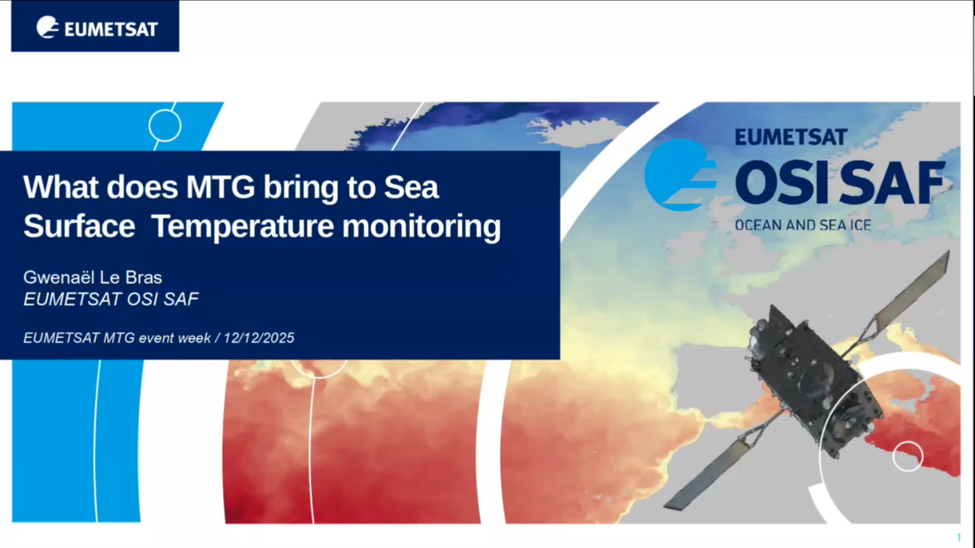
Gwenaël LE BRAS shows what MTG means in context of SST monitoring.
The MTG-I1 launch introduced the Flexible Combined Imager (FCI), boosting spatial and temporal resolution for Sea Surface Temperature (SST) retrievals. OSI SAF focused first on maintaining service continuity by developing a new Level 3 product matching current MSG resolutions. Higher input resolution from FCI enhances product quality, especially through improved cloud masking. Research is also underway to create a new high-resolution SST product leveraging FCI’s advanced capabilities. The MTG-S1 recent launch will further expand SST coverage, with the processing of the new InfraRed Sounder (IRS) data.
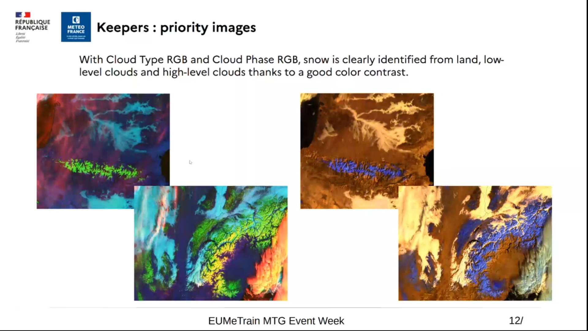
Roxane Desire shows the best RGBs for detection of typical winter weather phenomena: snow, ice and supercooled water clouds.
With the operational deployment of MTG, there are now various methods available for detecting snow on the ground. RGB products, in particular, provide high-contrast images that help distinguish snow on the ground from the underlying surface, low clouds, or ice clouds. We will also explore some important nuances to consider. Finally, still in the context of winter-related issues, we will discuss how these same RGB products can be used to detect supercooled water clouds, which can be responsible for ground ice formation or aircraft icing.
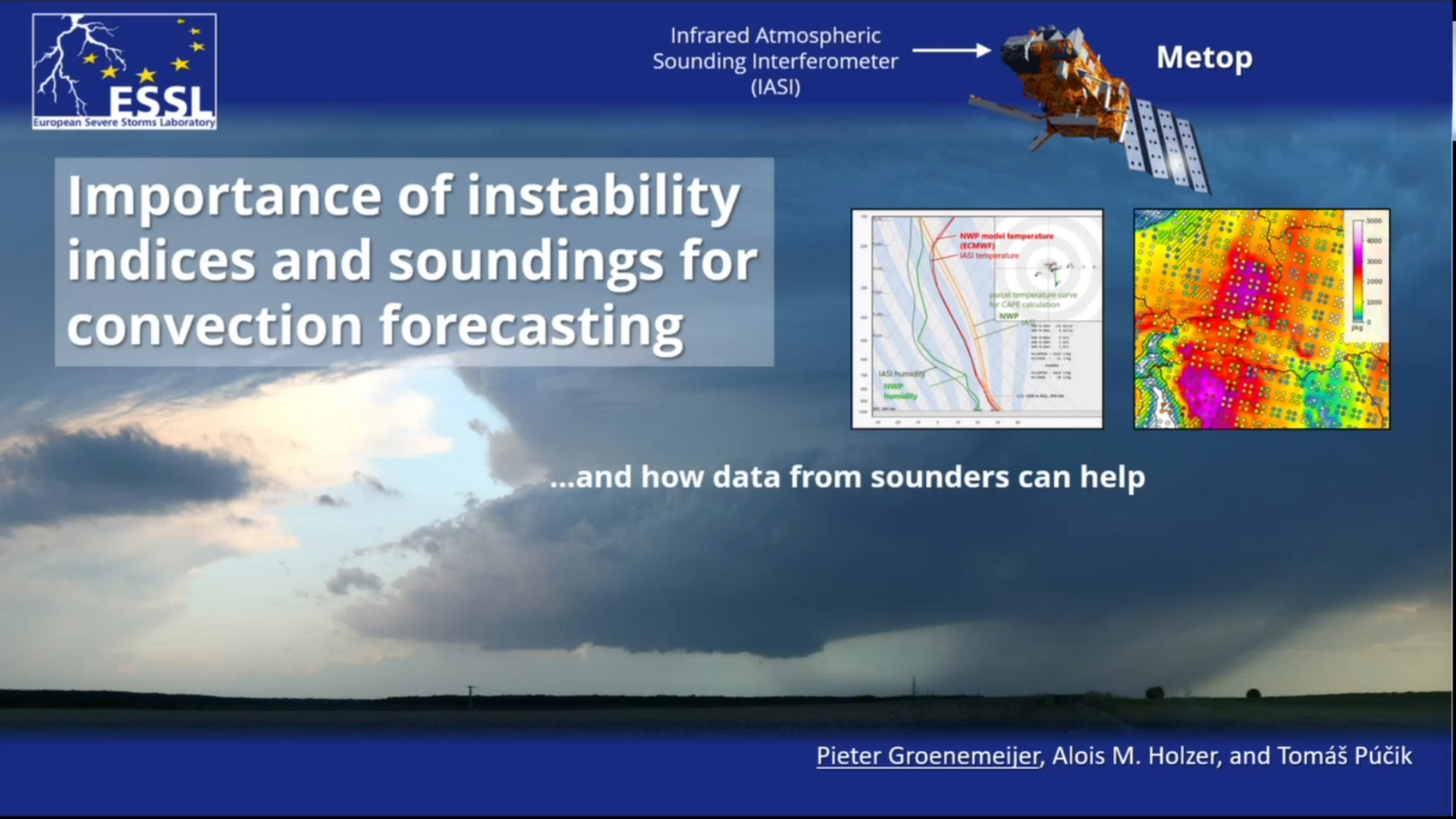
Pieter Gröenemeijer talks about using the IRS data in the context of convection forecasting.
Go to lecture slides
Ivan Smiljanic talks about turbulence and waves, showing many different examples.
Turbulence and waves in the atmosphere, like in other fluids, are signatures of usually dynamically strong processes that cause these disturbances. Also, they can be very dangerous on their own and can propagate to different parts of the atmosphere. Waves and turbulence behave differently in different fluids, and are seen differently with different spectral channels, thus not always easy to identify through satellite data. In this short lecture we will show you how these regular and irregular atmospheric motions are after all captured by advanced FCI instrument, and how that makes our everyday lives safer.
Djorjde Gencic shows the most useful RGBs for fog and low cloud detection, and mentions some "under development" products as well.
This presentation focuses on the detection of fog and low clouds with the Flexible Combined Imager (FCI) on Meteosat Third Generation. It highlights the significant advancements over SEVIRI — particularly the improvements in spatial, temporal, spectral, and radiometric resolution — that greatly enhance the ability to identify, monitor, and characterize fog and low cloud dynamics.
Go to lecture slides
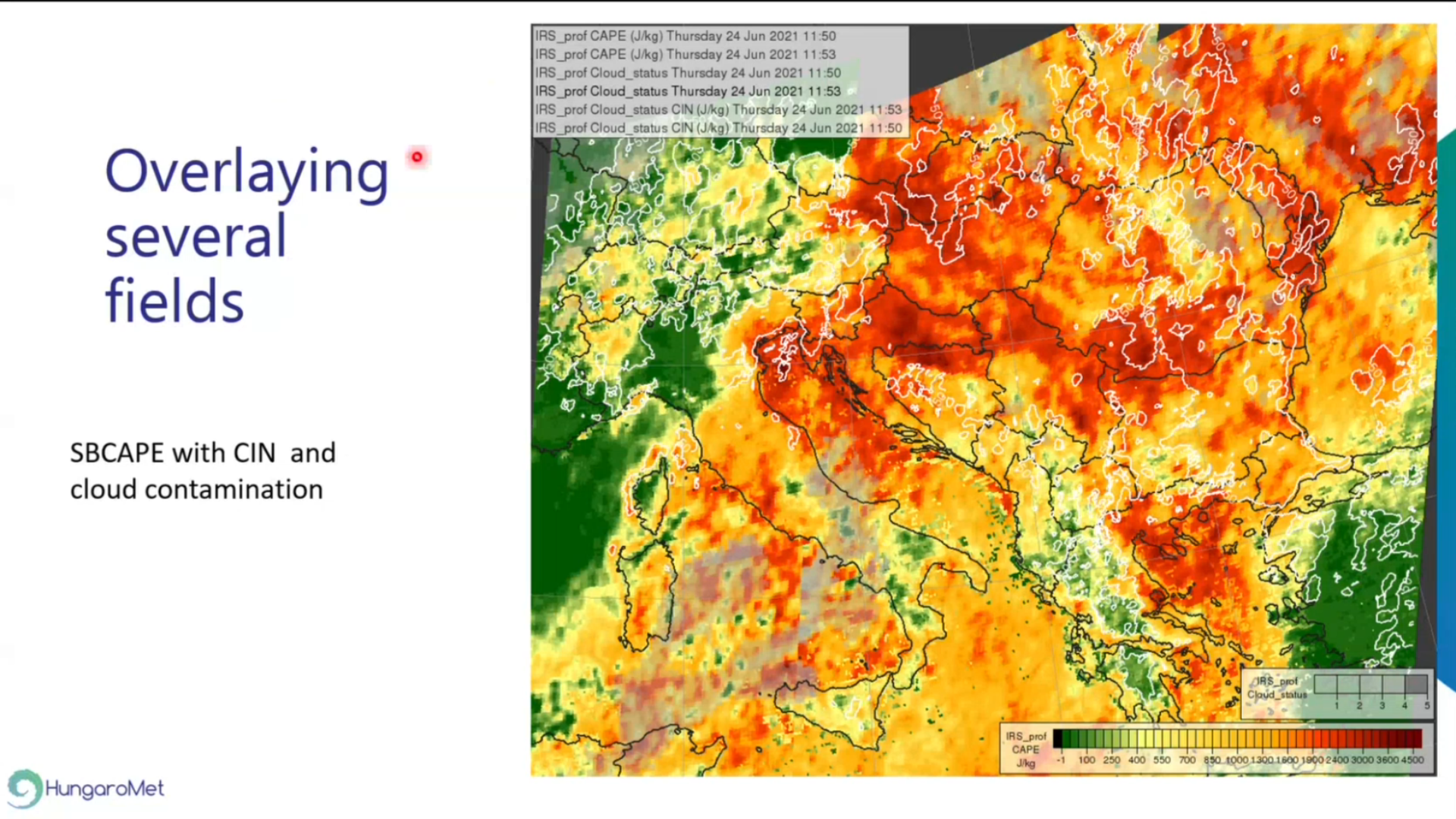
Zsofia Kocsis shows a wide range of possible visualizations using IRS Level-2 (L2) test data.
The Infrared Sounder (IRS) onboard the MTG-S1 is the first geostationary sounding instrument to perform measurements over Europe with a temporal resolution of 30 minutes. EUMETSAT will provide temperature and water vapour profiles, together with instability indices derived from these measurements, thereby offering complementary information to Numerical Weather Prediction (NWP) model outputs and radiosonde observations for nowcasting applications. In this talk we will show different visualization of IRS Level-2 (L2) test data.
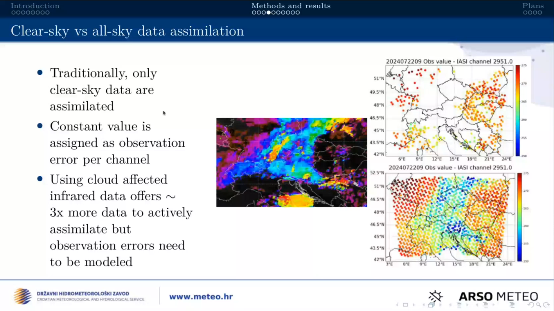
Suzana Panezic talks about using the Okamoto all-sky method in the regional numerical weather prediction model AROME using IASI radiances as proxy.
The InfraRed Sounder (IRS) on MTG-S1 will provide radiance measurements every 30 minutes across 1960 spectral channels, offering new opportunities to improve high-resolution weather forecasts. To fully exploit these data for operational use, assimilation methods are extended beyond clear-sky conditions to include observations affected by clouds. The Okamoto all-sky method is tested in the regional numerical weather prediction model AROME, employing IASI radiances as a proxy until IRS data are available.
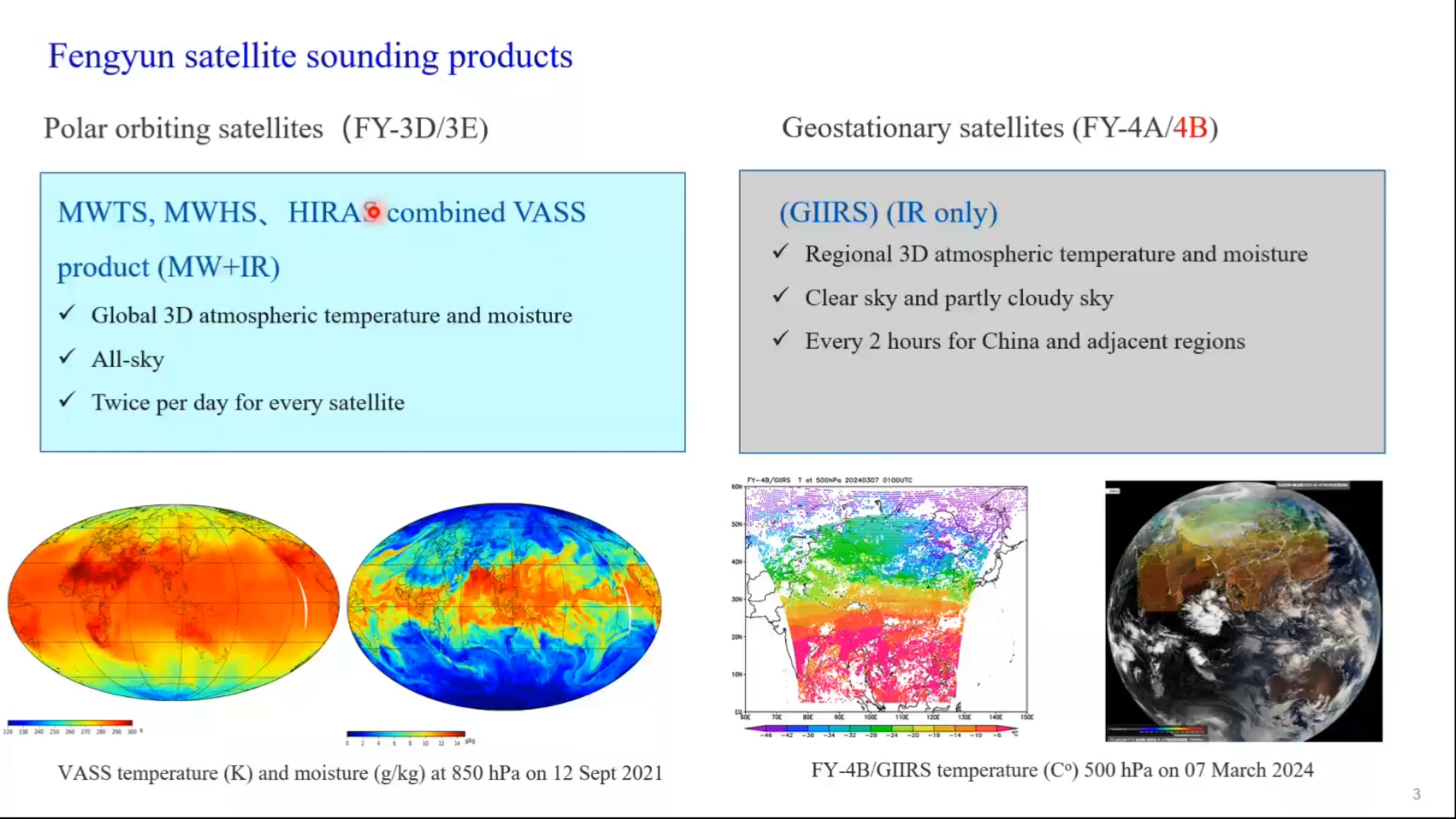
Jun Li shows applications of GIIRS onboard the Fengyun satellite in National Satellite Meteorological Center.
Progress has been made on the applications of high-temporal-resolution GIIRS observations. These include but are not limited to deriving three-dimensional (3D) wind fields for nowcasting and NWP assimilation, trending atmospheric instability for warning in preconvective environments, and monitoring diurnal variation of atmospheric composition. This presentation provides a summary on the current applications of GIIRS, discusses the data processing challenges, and provides perspectives on future development.
Ivan Smiljanic talks about shadows in FCI imagery, that are now better observed than ever due to high spatial resolution.
When light travels through the atmosphere it can interact with it or with the features in it, leaving shadows that can be taken as clues and signatures on that interaction. From that, experts can read about different properties of various features that interacted with light, giving out the shape, height, distribution, optical thickness and even the dynamics of the features. In this session you will hear how advanced resolution of FCI reveals many new shadows, previously not well (or not at all) observed with SEVIRI imager, and you will learn how these shadows can assist experts and operational meteorologists in their daily work.
Xavier Calbet talks about IRS and it's uses, specifically from NWC SAF side.
The MTG-S/IRS will be an infrared hyperspectral sounder in geostationary orbit, providing high spectral resolution radiances with a refresh rate of 30 minutes over the LAC-4 region (approximately the northern quarter of the IRS disk) and three consecutive slots every several hours over the rest of the LAC regions. The spatial resolution will be of 4 km at nadir. The MTG-S/IRS instrument will have close to 2000 channels in the thermal infrared which will allow the retrieval of temperature and water vapour profiles of the atmosphere at an unprecedented vertical resolution from geostationary orbit. The accuracy of the temperature and water vapour retrievals obtained from infrared sounders varies depending on the altitude, scene cloudiness and actual temperature and water vapour profile. The best accuracy and vertical resolution is typically obtained in the mid-troposphere, while the worst one is in the lower layers of the troposphere. Furthermore, retrievals show a good accuracy even over cloudy scenes reaching up to 80% cloud fraction. On average, the typical accuracy of infrared hyperspectral retrievals is approximately of 1 K in 1 km layers for temperature and 15% in 2 km layers for humidity.
Go to lecture slides