
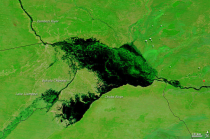
Basic Satellite Course: Areas of flooding
Competency Framework
WMO Satellite Skills
Application
Description
Learn how to recognize areas of flooding.
Content
In this module you will be able to identify geographical features and surface characteristics and conditions through images and satellite products. Although surface features are not the main purpose of meteorological forecasting, being able to identify and distinguish them from atmospheric features can be useful.
To access the resource click here.