Identify cloud types and their characteristics
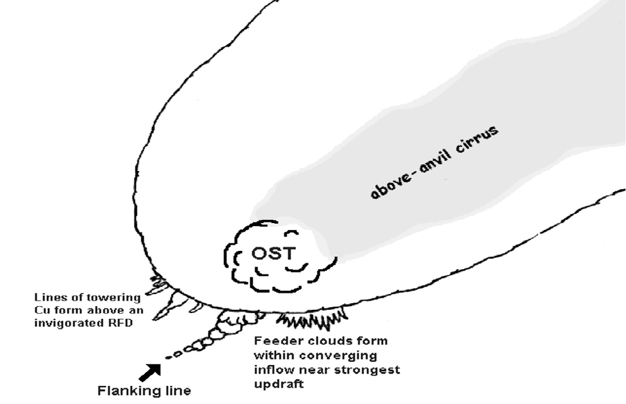
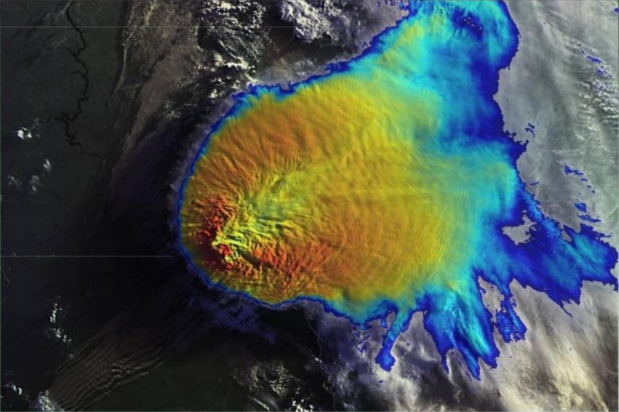
Dan Bikos from CIRA shows how to interpret satellite data in view of convective initiation and how to estimate the severity of MCS from cloud features.
Length: 55 min
Author: Dan Bikos
Dan Bikos received his BS in Meteorology at the State University of New York College at Brockport (1995), and MS in Meteorology from the University of Oklahoma (1998). His areas of interest include severe weather, lake-effect snow and applications of satellite imagery to weather forecasting, particularly on the mesoscale. Dan has been a research associate at CIRA since 1998 working for the Virtual Institute for Satellite Integration Training (VISIT) project in which he develops training for NWS forecasters. Distance learning software (VISITview) combined with a conference call are utilized to deliver the training to NWS forecast offices. Dan has instructed more than 300 hours of live teletraining sessions, primarily dealing with operational applications of satellite imagery.
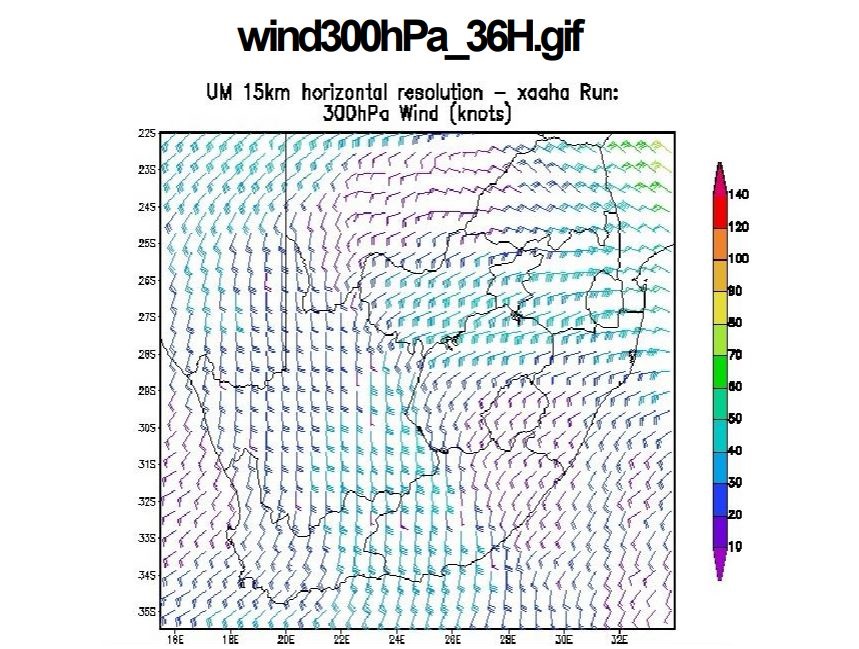
Lee-Ann Simpson and Jannie Stander from the South-African Weather Service started the first session of the WWW-Briefing. Lee-Ann gave a weather briefing for the South-African region and Jannie introduced the conceptual models of cold fronts and cut-off lows as they appear on the southern hemisphere.
Length: 50 min
Author: Lee-Ann Simpson, Jannie Stander
Lee-Ann Simpson is currently working as a meteorological trainer in the Regional Training Center (RTC) in Pretoria. She worked as an operational forecaster from 2003-2008, after which she started in the training department. She presently lectures to Post graduate forecasting students, focusing on specialized weather forecasting and satellite meteorology. Through the University of Pretoria, she lectures satellite meteorology and Tropical meteorology to honours students. Her interests lie in short term forecasting, severe weather and all satellite based interpretation of weather phenomena. She has a BSc (Hon) in Meteorology from the University of Pretoria and she is currently completing her MSc through the same institution.
Jannie Stander has worked as an operational weather forecaster from 1998 to 2005. Since 2006 Jannie has been working in the Regional Training Centre at Pretoria providing marine (2006-2008) and aviation forecaster training (2008-current). His main interests are aviation meteorology, synoptic meteorology and satellite interpretation and he is involved with several international working groups within these disciplines. He holds a BSc Hons degree in Meteorology at the University of Pretoria and is currently completing his MSc at the same University.
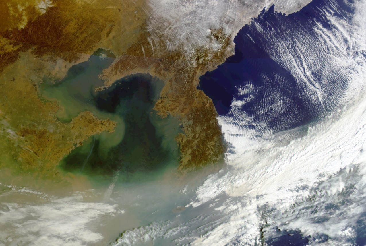
Ok Hee Kim holds the weather briefing for the South Korean region. Her topics are: Asian Dust, Typhoons and typical weather phenomena in East Asia.
Length: 50 min
Author: Ok Hee Kim
Ok Hee received her BSc in Astronomy at the Chungbuk National University at Chungchungbukdo the province of South Korea (1992), and MSc in Meteorology from the Seoul National University in Seoul South Korea (2004). She is preparing for the PhD. Her areas of interest include severe weather, lake-effect snow, Asian dust, fog and applications of satellite imagery to weather forecasting, particularly on the mesoscale. She worked at weather forecasting division as assistant for weather forecaster for 3 years from 1992 and satellite image analyst 3 years from 1996. She has been a research associate at NMSC (National Meteorological Satellite Center) KMA (Korea Meteorological Administration) since 2006. She is currently working as a meteorological satellite image trainer and analyzer of COMS (Communication Ocean Meteorological Satellite) image for KMA's weather forecaster in NMSC. Presently, she is trying to develop Conceptual Models which are applicated in East Asia after training SATREP in ZAMG.
Vesa Nietosvaara and Larisa Nikitina give a weather briefing for the European region, Larisa focusses on the preparations for the 2014 Olympic Games in Sochi.
Length: 55 min
Author: Vesa Nietosvaara, Larisa Nikitina
Vesa Nietosvaara has worked as an operational weather forecaster for twenty years in 1988-2008. Since 1998 Vesa has been working within several training projects and created learning resources for operational meteorologists. Particularly, he is interested in satellite image interpretation and conceptual models for weather diagnosis. Most of his career Vesa has done at the Finnish Meteorological Institute, but since 2012 he works as a Training Officer at EUMETSAT. He assists the EUMeTrain monthly weather briefing team and regularly participates or lead the European online weather briefings (ePort weather briefings).
Larisa (Lara) Nikitina has been working as aviation weather forecaster in Rostov aviation center (Rostov-on-Don, south Russia) since 1985 after training as a weather forecaster in Russian State Hydrometeorological University (RSHU). And since 2010 she became the weather forecaster for Sochi 2014 Winter Olympics. Her special interests are the satellite meteorology applications for nowcasting and distance learning.
Eunha Sohn gives a presentation on NWC-SAF products adapted to the Korean COMS satellite.
Length: 30 min
Author: Eunha Son (KMA)
Firstly, the characteristics of synoptic weather which convective cloud occurs over eastern Asian region will be mentioned and the thunderstorm monitoring system with radar data which KMA forecasters use will be also introduced. And then I will present our convective cases and explain them with satellite, radar and other NWP data.
Ralph Petersen discusses a new forecast tool.
Length: 30 min
Author: Ralph Petersen (University of Wisconsin)
Delineating areas where convection is most/least likely to develop can be difficult, especially in the next 3-9 hours. Knowing how forecasts can extend the usefulness of SEVIRI products from observations to forecasts can be equally challenging. This talk discusses a new forecast tool that addresses a number of questions: How can SEVIRI products be used to monitor and predict areas that are becoming more/less supportive for development of convection? Will the details in the SEVIRI observations be retained by short-range forecast tool? How do the derived SEVIRI forecast products relate to standard satellite forecasting conventions? Can IR satellite observations still be useful after convection has begun and clouds have formed? Are the SEVIRI projections useful for monitoring NWP performance?
Jan Fokke Meirink speaks about the algorithms developed for the retrieval of daytime cloud physical properties from MSG-SEVIRI.
Length:
Author: Jan Fokke Meirink (KNMI)
Within the CM SAF we have developed an algorithm for the retrieval of daytime cloud physical properties from MSG-SEVIRI. This algorithm and the retrieval products will be described. Furthermore applications will be discussed with a focus on convection.
Liliane Hofer presents alpine pumping as a major mechanism for convection related to orography.
Length: 30 min
Author: Liliane Hofer (ZAMG)
Mountainous regions tend to be the starting point for convective developments due to their elevated heat sources, the topographic amplifying factor or their role as a flow obstacle. In this presentation different synoptic situations and the consequent convection will be analyzed in the Alpine region on the hand of case studies.
Georg Pistotnik talks about the role of vertical wind shear in storm organization.
Length: 30 min
Author: Georg Pistotnik (ZAMG)
Next to sufficient instability, strong vertical wind shear is the main driver that promotes thunderstorms to organize into multicells, supercells or lines, which are more probable to attain a longer lifetime and to produce severe weather phenomena like hail or wind gusts. The role of vertical wind shear in storm organization is explained in this presentation, and selected case studies illustrate how favorable conditions for severe storms can evolve either by large-scale processes or, more challenging for forecasters, by local modifications of the wind systems and associated temperature and humidity changes.
An intensive training module on the operational use of RGBs in the forecasting room.
Technological advances and the increasing sophistication of weather forecasting have created a demand for more frequent and more accurate and higher resolution observations from space. To meet this demand on 28th August 2002 the first of four satellites known as Meteosat Second Generation (MSG) was launched.
MSG transmits more than 20 times the information of its predecessor. The improved resolution of frequency of data significantly contributes to the accuracy of both short-term and medium range weather forecasts. Since 2004, the MSG satellites have been providing full Earth disc images every 15 minutes, in 12 spectral bands.
Twenty times more information is also a challenge for the user to cope with. To present all of this extra data in a understandable way to the user, so-called RGB (red, green and blue) images were developed that allow you to easily make a qualitative analysis. In RGB images the different properties of the twelve spectral bands of MSG are combined in one powerful coloured image.
Fog, snow, atmospheric dust, SO2 clouds from erupting volcanoes, severe updrafts in convective systems, Potential Vorticity (PV) anomalies are just a few keywords and applications that we will teach you to recognise in satellite imagery. On several occasions questions and exercises will help you to test your gained knowledge.
Icing still represents a major threat to aviation. This CAL module focuses on the occurrence of icing in stratiform clouds. A method to detect icing probability from satellite images in combination with radar and radiosonde data is presented.
Ice formation on wings and inside of the jet engine of planes causes around 15% of weather related aircraft accidents. Most icing occurs inside cumulonimbus clouds when supercooled droplets freeze with contact of the aircraft body. But also in stratiform clouds icing represents a major threat to aircrafts during landing and take-off phase. In this CAL module, icing hazards related to stratiform clouds are examined. The introductory chapter focuses on the different types of icing and the physical principles leading to ice formation on aircrafts. Satellite products from geostationary and polar orbiting satellites help differentiating between ice and water clouds. A sample of satellite images and products illustrate this capability. Additional data sources like radiosoundings and radar imagery are useful completions to the satellite data. Interpretation of radiosoundings in view of icing occurrence is the main topic of chapter 4. The usefulness of radar data for detecting ice clouds is demonstrated. Three case studies complement the theoretical part of the training module, showing typical weather situations where severe icing represented a serious threat to aircrafts in the past. These case studies combine the above mentioned data sources in the frame of a practical situation. The CAL module finishes on a suggested procedure for nowcasting icing from stratiform clouds. Exercises offering the possibility to test the acquired knowledge form the end of this module.
In this CAL module you will learn to detect areas with the risk for Clear Air Turbulence (CAT). This will be done with the help of satellite images, soundings, flight reports and analyses of the airflow.
Clear Air Turbulence is one of the most frequent hazards for civil aviation. It is also one of the biggest challenges for forecasters to detect and warn for possible Clear Air Turbulence occurrence.
In this CAL module you will learn to detect areas with a high risk for Clear Air Turbulence (CAT). This will be done with the help of satellite images, soundings, flight reports and analyses of the airflow. Practical examples will show you how to apply your knowledge.

