
Satellite skills and knowledge for operational meteorologist
Listed here are other resources related to Satellite skills and knowledge for operational meteorologist tag:
Note: click on an image to open the Resource
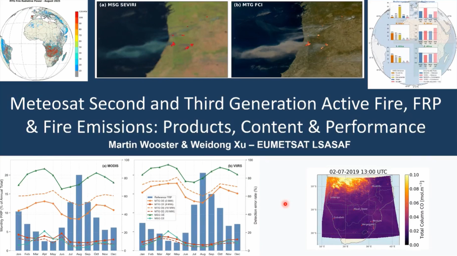
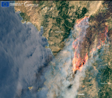
Martin Wooster discusses the LSA SAF Fire Radiative Power (FRP) product derived from geostationary satellite imagery and the improvements in active fire detection offered by MTG compared with MSG.
The session will cover the Geostationary FRP products from the EUMETSAT LSA-SAF that provide a record of active fire detections, fire radiative power (FRP) and smoke and carbon emissions over Europe, Africa and parts of South America, most recently from MTG with significant performance improvements compared to MSG. The methods used, the available products, and their performance will be reviewed in this session.
Carlos da Camara addresses the application of remote sensing for the development of an early warning system for fire danger.
In recent years, Europe has been affected by severe wildfires that are driven by vegetation stress and fire weather, and have severe impacts at social, economic and ecological levels. To assist fire managers and firefighters, the LSA SAF has developed an early warning fire danger system for Europe. The system relies on a set of regional models that provide forecasts of local meteorological fire danger based on statistical models of fire radiative power that use the so-called Fire Weather Index as a covariate. The rationale will be described in detail, and several case studies will be presented.
Célia Gouveia talks about LSA SAF vegetation data used for fire assessments and monitoring.
Fire-prone conditions and the impact of wildfires on vegetation dynamics and productivity are analysed using the land surface temperature (LST) and evaporatranspiration (ET and ETREF) and their impacts on vegetation and products such as Fraction of Absorbed Photosynthetically Active Radiation (FAPAR), Fraction of Vegetation Cover (FVC) and Gross Primary Production (GPP) disseminated by LSA SAF.
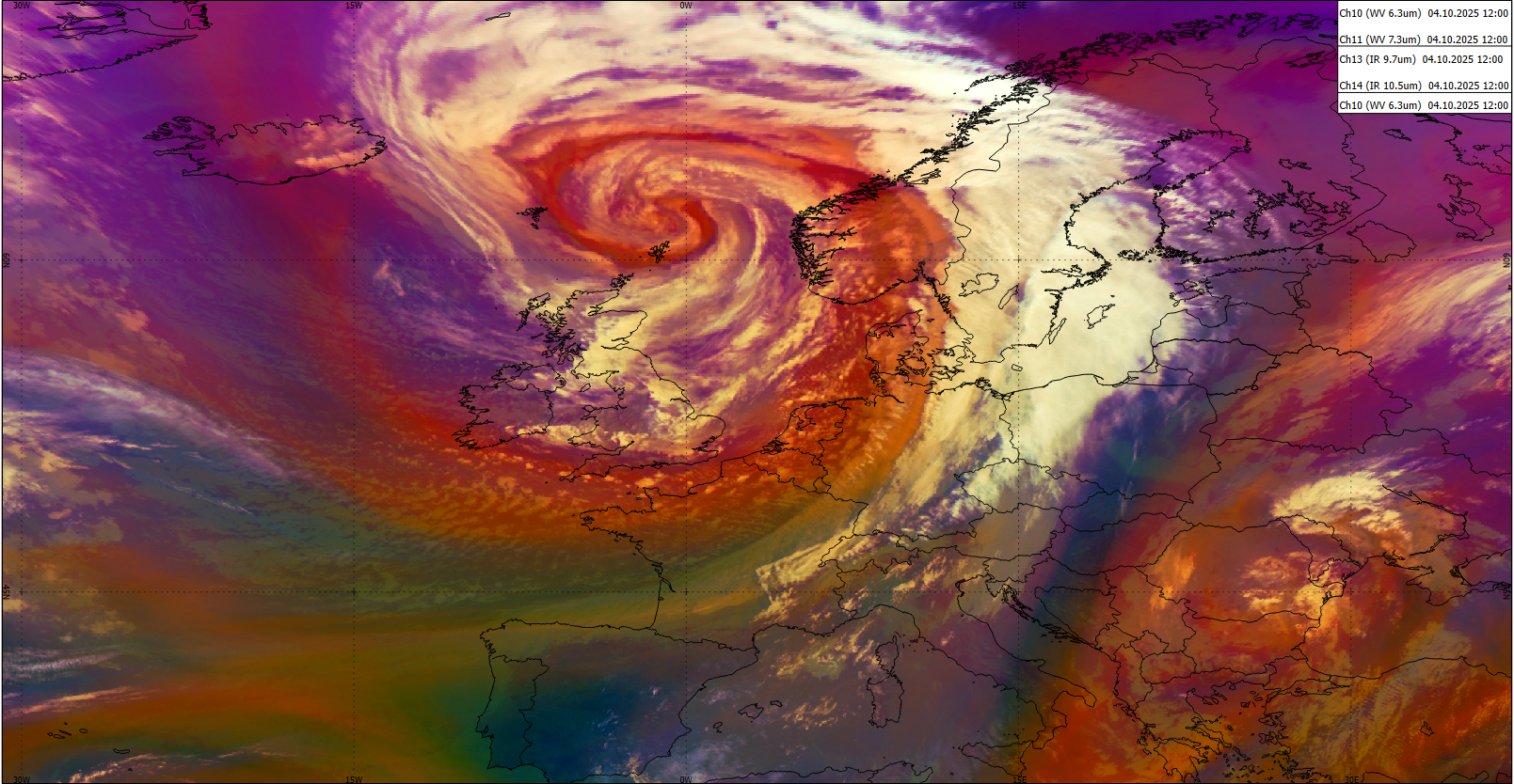
Have you ever wondered what an Atmospheric River is or how to recognize it in model or satellite data? The freshly released training module will assist you by guiding you step by step through the identification process.
First you will learn some basic facts on Atmospheric Rivers; how and where they are created, their typical characteristics and their appearance in satellite and model data. Step by step, you will then be guided through the identification process until you are certain that you are dealing with the phenomenon that is called an Atmospheric River.
Later stages of Atmospheric Rivers are sometimes tricky to identify as they are often merged with mid-latitude frontal systems. But here again, model fields and the timely evolution can give a precise answer whether there is an embedded AR or not.
And finally, it is well invested time going through this training module as ARs are responsible for many floods and heavy precipitation in Western Europe once they make a landfall.
The purpose of this Training Module is to provide step-by-step instructions for identifying Atmospheric Rivers.
This mini-module is part of a series of MTG mini modules produced by EUMETSAT/EUMeTrain with the aim of providing quick and useful learning experience about the new satellite products.
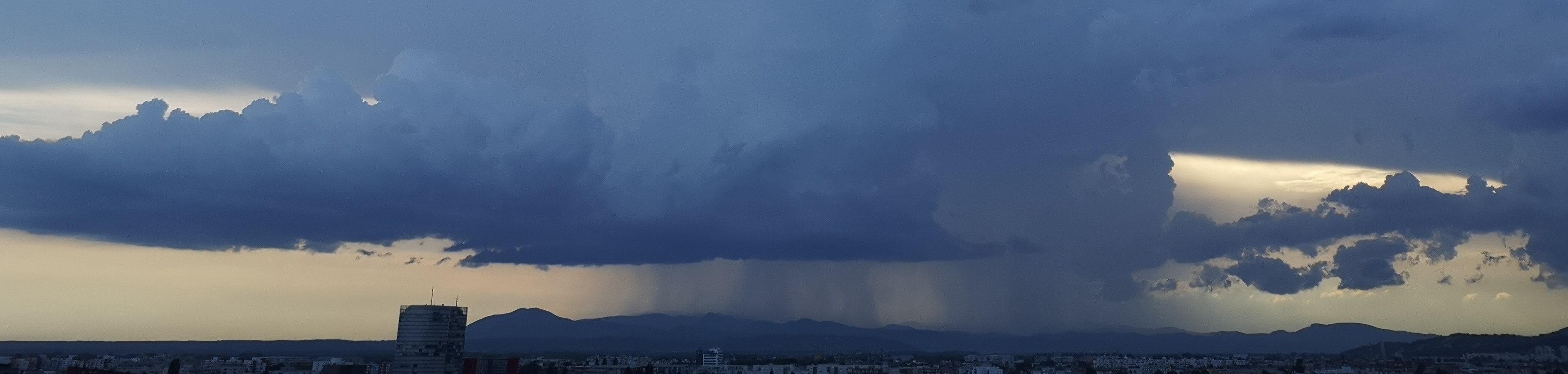
In this exercise you are giving forecast for a shipment route that could be affected by a convective event.
Enter the mini-module.
This mini-module is part of a series of MTG mini modules produced by EUMETSAT/EUMeTrain with the aim of providing quick and useful learning experience about the new satellite products.
In this exercise you will learn how to use LI data together with ground based measurements.
Enter the mini-module.
This mini-module is part of a series of MTG mini modules produced by EUMETSAT/EUMeTrain with the aim of providing quick and useful learning experience about the new satellite products.
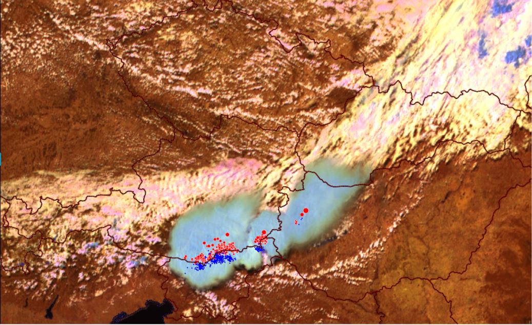
In this exercise you will learn how using MTG products can help you recognize convective initiation.
Enter the mini-module.
This mini-module is part of a series of MTG mini modules produced by EUMETSAT/EUMeTrain with the aim of providing quick and useful learning experience about the new satellite products.
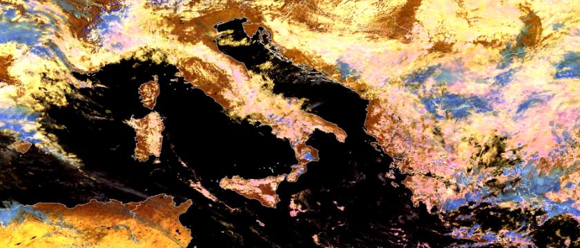
In this exercise you will learn how to detect fog and low clouds by using FCI products.
Enter the mini-module.
This mini-module is part of a series of MTG mini modules produced by EUMETSAT/EUMeTrain with the aim of providing quick and useful learning experience about the new satellite products.
In this exercise you will learn about detection of supercooled droplets which pose a problem for the air traffic.
Enter the mini-module.
This mini-module is part of a series of MTG mini modules produced by EUMETSAT/EUMeTrain with the aim of providing quick and useful learning experience about the new satellite products.
In this exercise you will learn about the improvements in fog & low cloud detection using the new FCI products.
Enter the mini-module.
This mini-module is part of a series of MTG mini modules produced by EUMETSAT/EUMeTrain with the aim of providing quick and useful learning experience about the new satellite products.
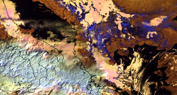
In this exercise you will learn about FCI ability to detect fires and how it compares to previous generation of satellite instruments.
Enter the mini-module.
This mini-module is part of a series of MTG mini modules produced by EUMETSAT/EUMeTrain with the aim of providing quick and useful learning experience about the new satellite products.
In this exercise you will learn about different MTG products for severe weather forecasting.
Enter the mini-module.