
Satellite skills and knowledge for operational meteorologist
Listed here are other resources related to Satellite skills and knowledge for operational meteorologist tag:
Note: click on an image to open the Resource
Presentation 4 from the Synoptic and Mesoscale Analysis of Satellite Images 2016
Length: 75 min
Author: Veronika Zwatz-Meise (former ZAMG)
Cyclogenesis and occlusion cloud bands are common meteorological phenomena which are tightly connected. While “cyclogenesis” is a process, describing the development of a low centre, which can last from few hours to several days, the occlusion cloud bands are the result of this cyclogenesis process. Occlusion cloud bands differ from cold and warm front bands because of their history as well as their physical status.
The two lectures start from the classical cyclogenesis (occlusion) processes which are related to the classical polar front theory and introduce then the conveyor belt view of these processes culminating in the warm and cold conveyor belt occlusion types.
The occlusion cloud band types are described and compared to cold and warm front types in their horizontal as well as vertical depiction.
Also special subtypes of occlusion processes like “instant occlusion” and “cold air development” are mentioned.
Presentation 3 from the Synoptic and Mesoscale Analysis of Satellite Images 2016
Length: 61 min
Author: Andreas Wirth and Liliane Hofer (ZAMG)
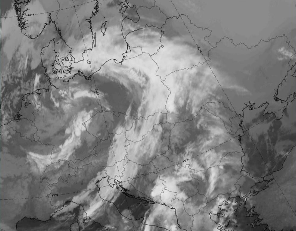
When observing the development of frontal zones in satellite imagery, forecasters should always keep an eye on frontal sub-structures like upper waves, front intensifications or rapid cyclogenesis. It is important to look for frontal substructures, because they often show new developments. NWP models sometimes catch the situation, sometimes not. Especially for rapid or small scale developments, model performance may leave a lot to be desired.
Here we focus on comparison of model outputs and satellite data regarding frontal substructures. Because the data are easily compared and show great results, satellite images are a good tool for model output verification.
Presentation 2 from the Synoptic and Mesoscale Analysis of Satellite Images 2016
Length: 52 min
Author: Ab Maas (former KNMI)
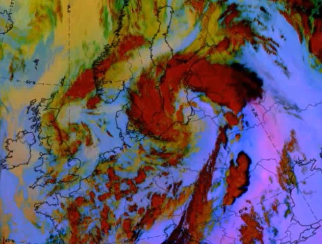
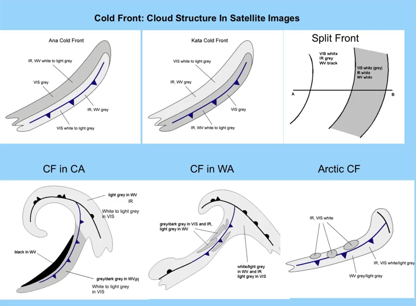
Fronts as described in the “Bergen school” by Vilhelm Bjerknes are early conceptual models. Parameters typical for the changing of air masses were named and used by forecasters to recognize transition zones (fronts) between air masses. Satellite information expressed how right Bjerknes was in his CM thinking, but this information showed also that fronts can have much more complicated structure and life cycle Bjerknes could imagine.
In SatManu there are 5 different types of cold- and 3 different types of warm fronts that are recognized and described.
In this lecture we concentrate on warm- and cold fronts and show how we can analyze them with help of CM thinking.
Presentation 1 from the Synoptic and Mesoscale Analysis of Satellite Images 2016
Length: 56 min
Author: Ab Maas (former KNMI)
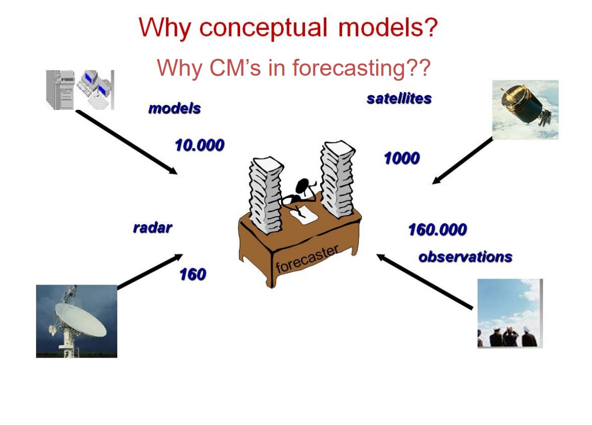
Getting a good, actual weather picture within short time is essential for a forecaster who has to react quickly and adequately on weather changing’s.
The huge amount of weather data which are available makes it almost impossible for a human being to handle. Thinking in conceptual models is the only way to deal with this problem
Meteorological satellites opened a whole new field in the conceptual model thinking in operational meteorology. Now there was an opportunity to recognize weather systems by detecting cloud patterns and verify this first guesses with observations and numerical parameters.
Within 20 years of the project fifty-three different conceptual models were described in a manual: Sat Manu. Also for the southern hemisphere, we have already fifteen CM’s described.
Presentation 11 in the MTG-I Event Week 2016
Length: 30 min
Author: Martin Setvak (CHMI)
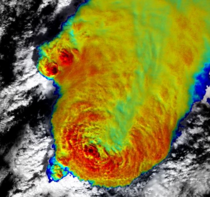
The presentation addresses some of the general impacts of the higher temporal and spatial resolution, available with the most recent or upcoming geostationary weather satellites. Main contribution of the higher scan frequency (of the order of 2.5 minutes or shorter) is in much better temporal coverage of evolution of rapidly developing weather systems, namely those associated with deep convection. The impact of shorter scan frequency will be demonstrated using data from the MSG 2.5-minute experiment. Spatial resolution affects not only the fidelity of imagery, but also (and more importantly) some of the quantitative characteristics of cloud tops - such as local cloud top brightness temperature minima, associated with overshooting tops. This effect will be demonstrated using high resolution polar satellite imagery.

Presentation 10 in the MTG-I Event Week 2016
Length: 30 min
Author: Geoffrey Stano (NASA SPoRT)
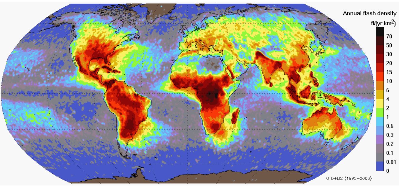
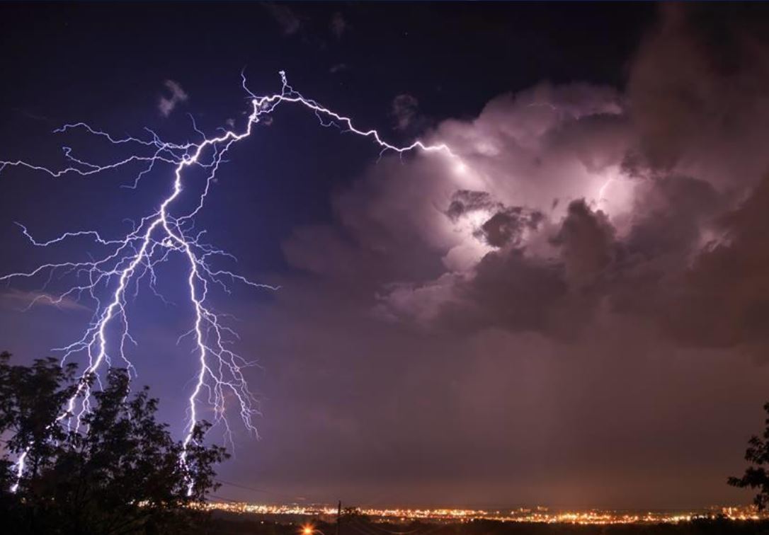
Short-term Prediction Research and Transition (SPoRT) Center, part of the United States’ NASA program, has been a leader in transitioning total lightning observations to operational forecasters. This effort began in 2003 with a single, NASA-owned ground-based lightning mapping array. The effort has since expanded to include multiple networks supporting a variety of end users for severe weather, safety, and aviation. This effort serves as the foundation for preparing the United States forecaster community for the Geostationary Lightning Mapper (GLM) set to launch aboard GOES-R. This presentation will discuss the GLM and its observations, what total lightning is, and how these data can be used operationally based on ongoing activities to prepare the United States for GLM. The GLM instrument is very similar to the Meteosat Third Generation’s Lightning Imager and presents an opportunity for collaboration between U.S. and EUMETSAT forecasters.
Presentation 9 in the MTG-I Event Week 2016
Length: 30 min
Author: Heikki Pohjola (EUMETSAT)
EUMETSAT is currently developing with ESA the geostationary Meteosat Third Generation (MTG) satellite system to continue and enhance the service currently provided by Meteosat Second Generation (MSG), from 2020 onwards. One of the new missions of MTG is the Lightning Imager (LI) mission, which is intended to provide a real time lightning detection and location capability in support to nowcasting of high impact weather. The LI measures the total lightning, i.e. the combined cloud-to-ground and intracloud/cloud-to-cloud lightning. One of the major tasks in the MTG program is to provide the Level 2 product processor. The initial L2 products are based on the detection of the optical pulses on top of clouds following a false event filtering and clustering of the detected triggered lightning events in time and space. These are composed to the initial L2 products, i.e. groups and flashes representing geophysical flashes and strokes. A further L2 product category is the Accumulated Products, which integrate the Flash products into a fixed 2 km grid (same as for the MTG Flexible Combined Imager IR channels) with a 30 sec accumulation period. These 30-sec periods can be further stacked by users. The products are disseminated as short duration chunks in order to meet the timeliness requirements.
Presentation 8 in the MTG-I Event Week 2016
Length: 60 min
Author: Daniel Rosenfeld (The Hebrew University of Jerusalem)
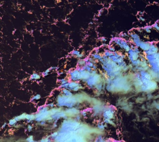
Major advancements of the MTG with respect to MSG are the superior resolution and the added 2.3 um channel, which in combination allow retrieving cloud particle effective radius and discerning cloud phase at the very high resolution of 500 m. These cloud properties determine whether a cloud would be precipitating, and if so whether it would be rain or snow. This information is particularly advantageous for observing small boundary layer clouds, which often produce rain showers in very clean air masses, such as at the Atlantic coast, but stop raining when polluted inland. This is also the case for post frontal clouds that may produce snow showers. It will be possible to detect it with the MTG.
The ability of retrieving high resolution cloud drop effective radius in convective clouds makes it possible to retrieve cloud drop concentrations, which are dominated by aerosol particle concentrations. The retrieved cloud drop concentrations can be reversed to infer the concentrations of particulate air pollution that occur under cloud decks that are rooted in the boundary layer. A proxy to the retrievals is an RGB color combination that can show the same qualitatively.
Furthermore, the inferred cloud drop concentrations has a predictive value for the nature of foretasted convective storms in that air mass, because the aerosols can invigorate the storms and make them more prone to producing lightning and hail.
Presentation 7 in the MTG-I Event Week 2016
Length: 30 min
Author: Gaëlle Kerdraon (Meteo France)
Meteosat Third Generation (MTG) will see the launch of six new satellites from 2021. MTG-I will embark a VIS/IR imager and a lightning imager. The talk details the improvement of NWCSAF/GEO cloud products using new MTG-I capabilities. The new channels will help for the detection of thin cirrus and will improve the cloud phase identification. Cloud products will take advantage of the enhanced spatial resolution, particularly, for the separation between cumuliform and stratiform clouds. Finally, the use of lightning imager should be useful for convection identification.
Presentation 6 in the MTG-I Event Week 2016
Length: 30 min
Author: Steven Goodman (NOAA)
The NOAA Geostationary Operational Environmental Satellite (GOES-R) series provides the continuity for the existing GOES system currently operating over the Western Hemisphere. The Geostationary Lightning Mapper (GLM) represents an advancement over current GOES by providing an entirely new capability for total lightning detection (cloud and cloud-to-ground flashes). The GLM will map total lightning continuously day and night with near-uniform spatial resolution of 8 km with a product latency of less than 20 sec over the Americas and adjacent oceanic regions. The total lightning is very useful for identifying hazardous and severe thunderstorms, monitoring storm intensification and tracking evolution. Used in tandem with radar, visible and infrared satellite imagery, and surface observations, total lightning data has great potential to increase lead time for severe storm warnings, improve aviation safety and efficiency, and increase public safety.
Presentation 5 in the MTG-I Event Week 2016
Length: 30 min
Author: Jochen Kerkmann (EUMETSAT)
The amount of data from the world’s weather satellites is overwhelming. While each type of data is valuable, it’s almost impossible to use them all operationally. It’s like trying to drink from a fire hose; there’s simply too much data to absorb, and much of it ends up not being used.
“Red, Blue, Green” or RGB processing is a simple but powerful technique that consolidates different channels of satellite imagery into single products that are easy for forecasters to use. RGB processing used to be a visualization technique used mainly in research. But due to its popularity, it is increasingly available to operational forecasters. A pre-requisite for this, however, is the standardization of RGB products, i.e. the selection of the most useful RGB products for operational forecasting, generated at each Meteorological Service with the same identical standard method/recipe.
The combination of individual images into RGB colour composites is modernizing the interpretation of satellite imagery. While black and white imagery still has its uses, it often cannot match the effectiveness of RGB products. In fact, RGB images are often more useful than traditional colour image enhancements.
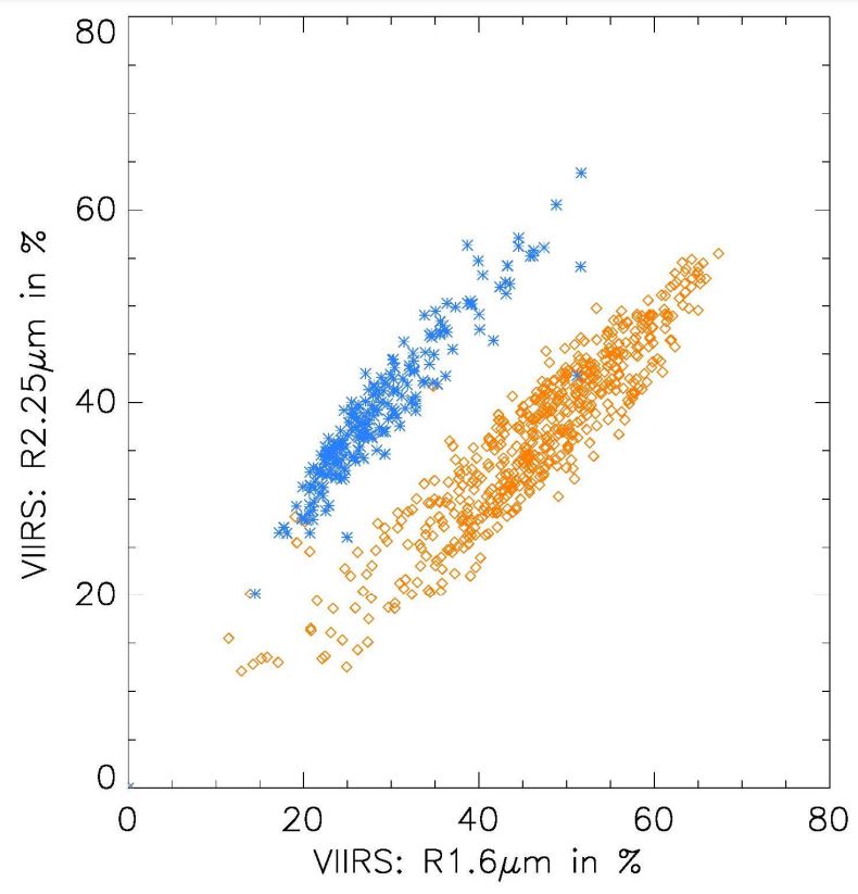
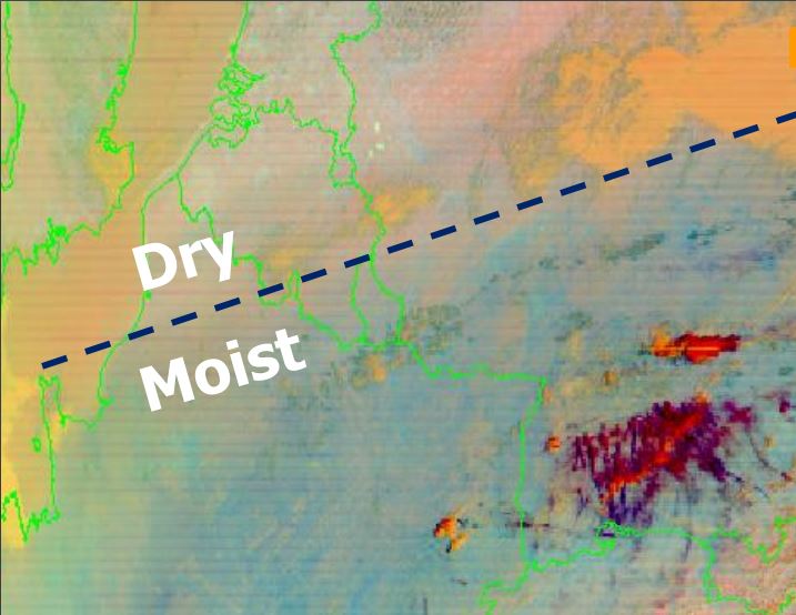
The Flexible Combined Imager (FCI) of MTG will open new possibilities of RGB products, with higher temporal and spatial resolution and better accuracy (less noise). Of particular interest will be the new NIR2.25 band that will improve cloud phase detection and detection of hot/large fires. Two new RGBs related to this channel will be presented. Furthermore, some standard RGBs will need to be tuned to account for the slight changes in central wavelength and band width. Some Himawari examples for this tuning will be given. Finally, the issue of local versions of RGB products will be addressed using the examples of “tropical” Night Microphysics and Airmass RGBs.
Presentation 4 in the MTG-I Event Week 2016
Length: 30 min
Author: Bodo Zeschke (BOM)
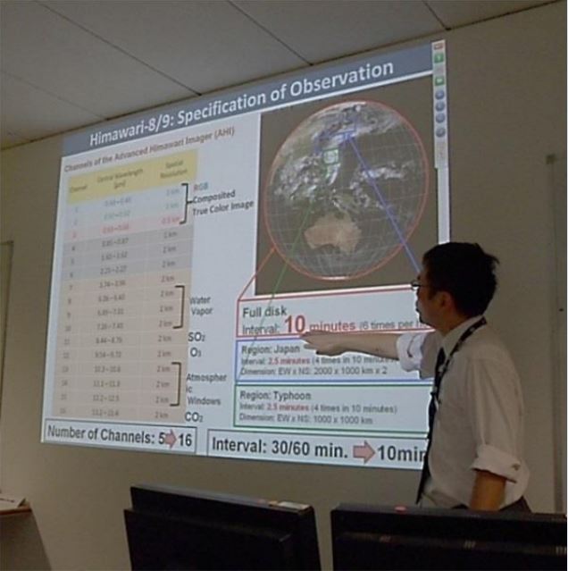
This presentation summarises the adaptation of WMO / EUMETSAT endorsed RGB products to Himawari-8 data over the Australasian-Pacific region by WMO RAV and RAII stakeholders from the perspective of the Australian VLab Centre of Excellence. The content includes the tuning of the RGB products to the Himawari-8 data, the training conducted to permit effective use of the RGB products. Evidence is provided of the effective stakeholder use and development of the RGB products, including the development of new RGB products.