Satellite skills and knowledge for operational meteorologist
Listed here are other resources related to Satellite skills and knowledge for operational meteorologist tag:
Note: click on an image to open the Resource
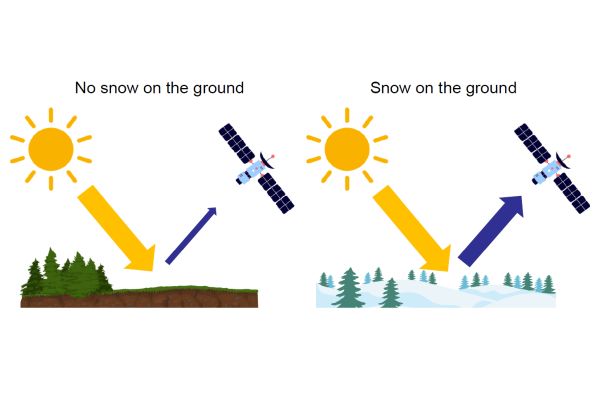
Kerttu shows how the snow and ice cover change during decades according to satellite data.
Snow and ice cover of the Northern Hemisphere (NH) are major factors in the global climate system.
Due to the large area and sparse in situ measurements, snow and ice cover monitoring at the continental scale is only possible from satellites. Estimating snow and ice cover at large scale is important for hydrological and climatological applications. As they greatly influence the entire climate system, changes in snow and ice cover will affect the surface energy balance, which in turn makes snow and ice cover important inputs for climate models.
Snow and ice cover in the Arctic are changing. There is a negative trend in the surface albedo due to negative trends in snow and ice cover. The extent and duration of snow and ice cover are decreasing, and the changes are most prominent in spring due to the strong surface albedo feedback. Snow water equivalent (SWE) also shows negative trends globally, but significant spatial variability exists especially in the Arctic.
Signe Aaboe presents the data and software that OSI SAF offers to users.
Ocean and Sea Ice Satellite Application Facility (OSI SAF) was initialised in 1997 and is one of eight EUMETSAT Satellite Application Facilities, which provide users with operational data and software products from meteorological satellites.
The OSI SAF programme has a focus on the ocean-atmosphere interface and derives ocean products of wind, temperature, radiative fluxes and several perspectives of the sea ice. This presentation will give an introduction to OSI SAF, - what it is, who is involved, and which products are derived. The main focus will be on sea-ice developments and products.
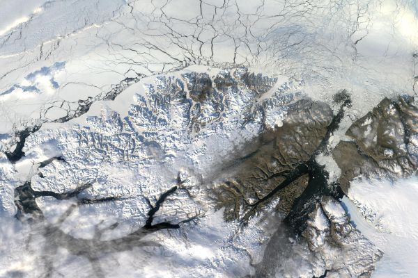
Jari Haapala explains how thermodinamical and dynamical factors affect the arctic sea ice characteristics.
The mass balance of the Arctic Sea ice depends on thermodynamical and dynamical factors. Thermodynamical and mechanical sea ice state variables are strongly coupled, but the strength of coupling varies in daily, seasonal, and climate time scales. When the ice pack is thick, solid, and compact, this coupling is strong and large areas of pack ice are mechanically connected. In these circumstances, the internal stress of pack ice accumulates and reduces differences in ice motion. In these conditions drift speed of the Arctic Sea decreases, the age of ice increases and the total mass of the ice pack increases. On the contrary, a thinner ice pack which includes cracks, leads, or larger open water areas is in turn mechanically weakly connected, exhibits larger variations in motions in shorter time and length scales drifts with higher speed, and exhibits shorter residence time in the Arctic. In this talk, the importance of ice dynamics on sea ice mass balance is reviewed and new findings based on the MOSAiC campaign are discussed.
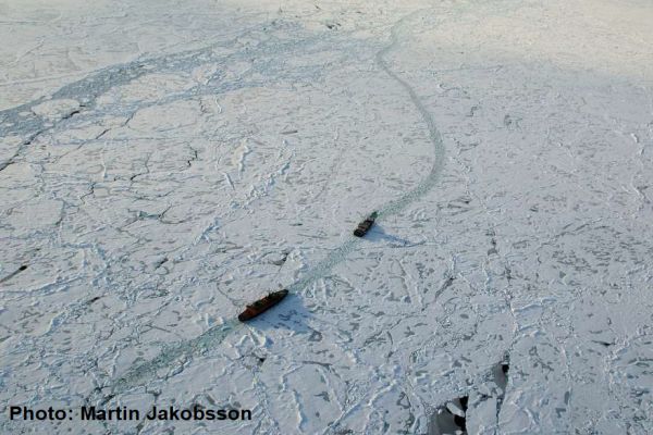
Patrick Eriksson speaks about monitoring sea ice in the very heavily trafficked Baltic Sea
The Baltic Sea, a relatively small semi-closed basin with brackish water, is one of the most heavily trafficked sea areas in the world. Thousands of vessels visit ice-infested ports every winter, which requires well organized icebreaking. To support this winter navigation operation, the Ice Service at FMI conducts monitoring and forecasting of the sea ice throughout the winter. An essential source of information is obviously satellite data. Imagery from several satellite platforms is not only processed to serve ice charting and reporting, but is also delivered in near-real-time straight to the bridges of the icebreakers. The dark and cloudy Nordic winter has proven the Synthetic Aperture Radar instruments (SAR) to be the most suitable when analysing the development of the sea ice. Different passive instruments are also used, light and cloudiness permitting. All satellite platforms bring their various strengths and limitations on the ice analyst’s desktop, causing constantly changing challenges to the charting of sea-ice features. So far, the analysis has been predominantly manual work, but the ever-increasing data volumes are setting a demand for AI-based automatic interpretation.
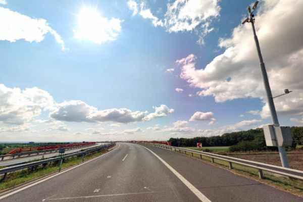
Vojtěch Bližňák presents how the satellite cloud data helps forecasting road surface temperature in Czechia.
The goal of the contribution is to assess an impact of extrapolated cloud cover derived from satellite observations on forecasts of road surface temperature (RST) performed by the road weather model (RWM) FORTE. Based on road weather station measurements and forecasts of the ALADIN numerical weather prediction (NWP) model, which are used as inputs to prepare initial and boundary conditions, the RWM generates a linearly continuous forecast of RST on selected Czech highways. The work will compare the evaluation of RST forecasts generated by two model runs using NWP and satellite-derived cloud cover estimation.
Vesa Nietosvaara showcases how the MTG's FCI instrument will improve the quality of satellite data, especially for users in high latitudes.
The first Meteosat Third Generation (MTG-I) satellite with Flexible Combined Instrument (FCI) was launched at the end of 2022. It will be followed later in 2024 by MTG-S Satellite with Infrared Sounder onboard. MTG will carry novelty instruments – Infrared Sounder, Lightning Imager and Ultraviolet Visible Near-infrared (UVN) Spectrometer - in the GEO orbit. Meteosat Third Generation aims to secure continuity and to increase the capabilities of the Meteosat satellites in response to requirements of the future forecast/nowcast systems. Altogether, the new and enhanced capabilities will allow us to make a huge step in better monitoring of our environment, and allowing development of new applications.
Reima Eresmaa presents how satellite data helps in numerical weather prediction systems to support meteorological applications in Finland and surrounding countries.
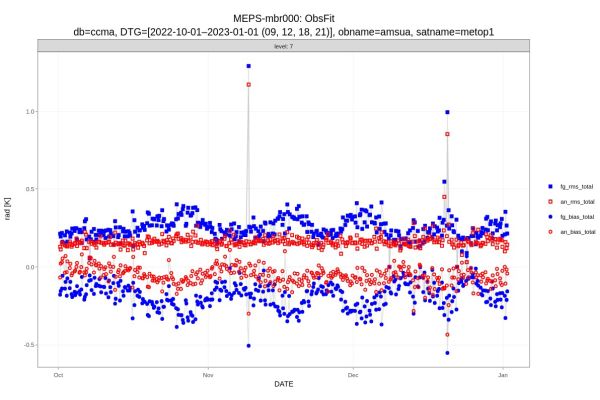
MetCoOp is a group devoted to developing and operating rapidly-updating kilometric-scale Numerical Weather Prediction (NWP) systems to support meteorological applications in Finland, Scandinavia and Baltic countries. There are currently two operational NWP systems: The MetCoOp Ensemble Prediction System (MEPS) and the MetCoOp Nowcasting System (MNWC). Forecasts are provided in a limited-area grid in 2.5 km horizontal resolution and on 65 levels.
MetCoOp NWP systems assimilate a variety of satellite-based data provided by polar orbiters of NOAA, EUMETSAT, and CMA. In particular, extensive use is made of radiance measurements in microwave and infrared wavelengths. Via three-dimensional variational data assimilation, such observations help constrain the NWP model state at the initial time of each forecast. The radiance observations provide information on temperature and humidity at different altitudes.
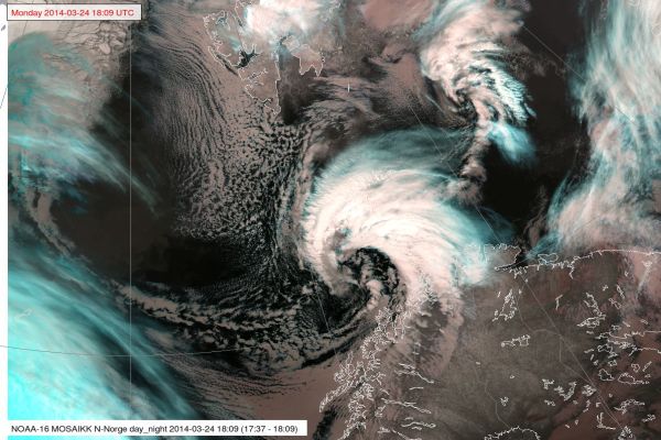
Gunnar Noer explains and showcases the nature of polar lows.
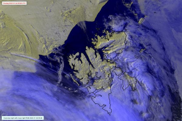
Polar lows are small but fairly intense low pressure systems that form in the Arctic marine regions during the winter season. They form in unstable air masses associated with cold air outbreaks from the Arctic ice cap. Polar Lows give rise to gale or storm force winds which, in combination with heavy snowfall, cause widespread traffic disruptions. In recent years, polar lows have caused several fatal incidents with snow avalanches. This lecture focuses on the key processes and the methodology for forecasting polar lows.
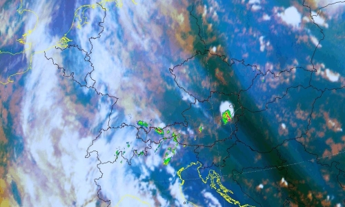
Thomas Krennert (ZAMG) talks about the importance of moisture gradients in analysing the possibility of development of deep moist convection.
The exact predictability of convection in the Alpine region in the absence of fronts in weak-surface-pressure-gradient-situations during the warm season remains challenging for forecasters. The development into single-cell deep moist convection SC-DMC under these conditions depends on the availability of well-known ingredients like low level moisture, steep tropospheric lapse rates and sufficient lift. Satellite studies have shown that favourable locations for the first onset of SC-DMC resulting from widespread shallow convection over mountainous terrain are water vapour gradients in the middle or upper troposphere UTMG (upper tropospheric moisture gradients, Krennert, et al., 2003, https://doi.org/10.1016/S0169-8095(03)00067-X). The contributions of the respective ingredients related to UTMG supporting the initiation of DMC are discussed. A focus is set on moist symmetric instability MSI as a possible mechanism for favouring the transition from shallow to deep moist convection.
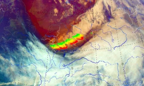
Wilfried Jacobs (DWD) explains the power of Airmass RGB in estimating the possibility of cold front transforming into a convective line.
Especially, the airmass RGB is a powerful tool for estimating the cold front’s tendency to transform to a convective line. Convective lines are connected with strong gusts, heavy precipitation sometimes with graupel or even hail. During this presentation the indications of convective lines will be outlined by considering the airmass RGB together with other means, e.g., radiosounding. Examples of two succeeding days will be discussed in detail whereas the first case did not lead to a convective line whereas the second example did. Typical differences of patterns in the corresponding airmass RGB and additional data sources will be related to a convective line’s probability.
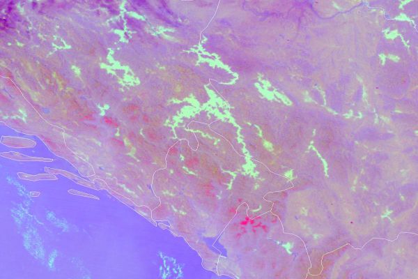
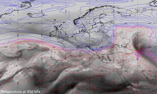
Andreas Wirth (ZAMG) presents the benefits of analysing the water vapour imagery to diagnose synoptic structures and weather patterns.
Water vapor (WV) imagery is very useful when it comes to visualize zonal and meridional transport of air masses, but it is also suited to get a rapid overview on vertical transport processes. This characteristic makes WV-imagery extremely helpful when it comes to diagnose fronts and cyclogenesis.
The presentation will focus on the dynamics of cyclogenesis and fronts and how they are reflected in WV-imagery. The concept of relative streams will be introduced in the context of cyclogenesis, ana- and kata fronts.
Meteorological products based on WV absorption bands such as the Total Precipitable Water product will be introduced and their usefulness will be demonstrated on case examples.
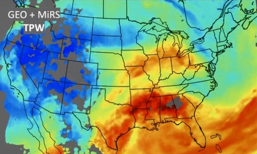
Ralph Petersen (University of Wisconsin) talks about forecasting satellite-derived moisture using all available observation data on moisture and Lagrangian methods to give forecasters more information on the possibility of storm formation.
The CIMSS Lagrangian NearCasts system 1) expands the utility of clear-air sounding and products related to the pre-convective environment (from MTG-IRS Sounder and MTG-Imager) into the 1-9 hours period before storm formation and 2) now combines Geostationary Infrared Products with less frequent microwave products from multiple Polar Orbiting systems to fill information gaps in cloudy areas. For a heavy precipitation event, quantitative measures of both retrieval and short-range forecast accuracy are provided, including a new, non-uniform bias correction approach, and explorations of predictive clear-sky RGBs.
Including “all-weather”, real-time MiRS retrievals not only provide a more visually pleasing product (improving coverage by 30-40%), but also exposes forecasters to here-to-fore underutilized POES observations over land.
Validation against hourly surface-based GPS-TPW observations testify to the ability of the Satellite-based products to capture observed small-scale moisture features properly. Results show error growth rates < 1%/hour (without initial shocks) and support applying non-uniform bias corrections derived over 5mm bands to assure realistic TPW distributions.
Because RGB presentations are more popular than quantitative retrieval product displays the parcel-based Lagrangian NearCast approach was also used to “predict” clear-air RGBs based on the projection of radiance, with quantitative values overlaid. Examples of initial tests will be shown.

