
Satellite skills and knowledge for operational meteorologist
Listed here are other resources related to Satellite skills and knowledge for operational meteorologist tag:
Note: click on an image to open the Resource
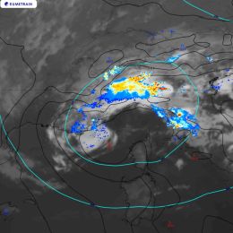
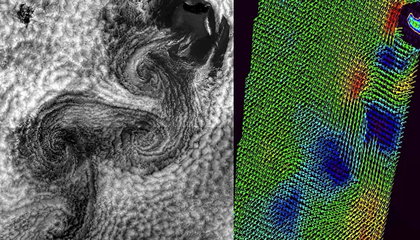
In this Training Module you will learn more about the genesis and the development of cyclones at the downwind side of the Alps.
This training module treats the developement of cyclones at the downwind side of a mountain range with a special focus on the Alps. The module deals with the physical facts that lead to the creation of a lee cyclone, from its very beginning as a low-level vortex in the vicinity of a mountain range until its final stage as a mesoscale cyclone. The module tries to give an answer, why some of the lee vortices never develop into a full-grown cyclone and instead remain a local wind phenomenon or at best a low-level vortex that soon dissipates when leaving the downwind area by looking at the triggers that form cyclones. Local winds like the Bora and the Mistral are often linked to Lee Cyclogenesis in the Gulf of Genua. They will be treated at the end of the module.
Anna Cinzia Marra presents applications of the H-SAF precipitation products.
Length: 29 minutes.
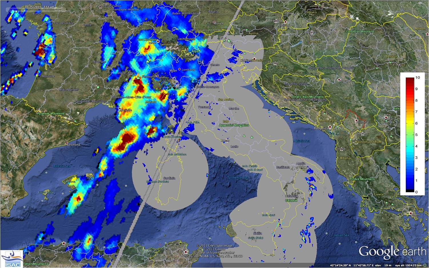
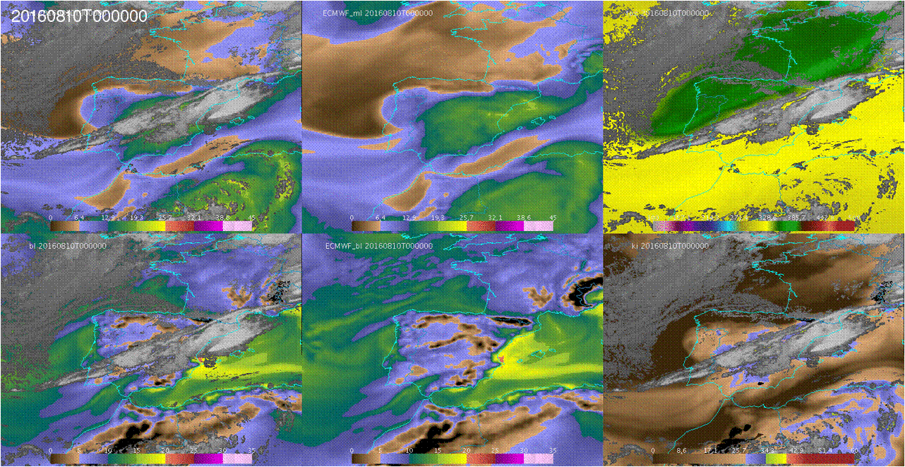
The Mediterranean region is often impacted by heavy precipitation events, that are responsible for damages and sometimes casualties, especially over the coastal areas. Because of its peculiar geographical characteristics, conventional ground-based instruments, such as raingauge and radar networks, cannot be fully exploited for the monitoring, characterization and forecasting of severe events, in particular during their offshore development. For these reasons in the last decades satellite observations, both over geostationary and Leo platforms, have been recognized as a powerful tool to overcome the limitations of ground-based observations
In this presentation we analyze severe events that have recently affected the Mediterranean area, causing damages at the ground, and have challenged observational and forecasting capabilities. Heavy precipitation systems are described and analyzed here by exploiting active and passive microwave measurements and state-of-the-art precipitation products available in the HSAF project during the Global Precipitation Measurement (GPM) mission era. We highlight how the HSAF satellite products specifically developed for the European area, and thus tailored for the Mediterranean region, show better performances than algorithms designed for global application. We also show few strategies to blend satellite data and products with conventional meteorological data, with the aim to increase the knowledge of severe systems in the Mediterranean area and to support operational forecasting activities in a climate change perspective.
Davide Melfi presents the H-SAF precipitation products.
Length: 24 minutes.
The EUMETSAT Satellite Application Facility in Support to Operational Hydrology and Water Management (HSAF) generates and archives high quality products for operational hydrological applications. HSAF focuses on geophysical products of precipitation, soil moisture and snow parameters and the exploitation of these datasets to mitigate hazards and natural disasters such as flash floods, forest fires and landslides, and to monitor drought conditions, improving water resources management.
HSAF promotes the systematic and periodic products review with the continuous refinement of algorithms, validating results during calibration campaign, implementing operational driven procedures and services monitoring accordingly user requirement.
The current status of the Precipitation Cluster and the challenges for the future, looking at MTG and EPS-SG in particular, are presented.
Jana Campa investigates the development and the impact of a convective situation on 8 June 2018.
Length: 42 minutes.
In early summer 2018 Central Europe was affected by several severe thunderstorms, many producing large hail. One of the most severe storms struck the town of Črnomelj, Slovenia. Interestingly, this storm did not look more severe in the remote sensing data than other storms on the same day. The presentation will investigate its development and impact. In addition, the preconvective environment of this and other severe storms of the last summer will be investigated with the help of satellite sounding data.
Maria Putsay analyses different convective cells with Radar and lightning data.
Length: 50 minutes.
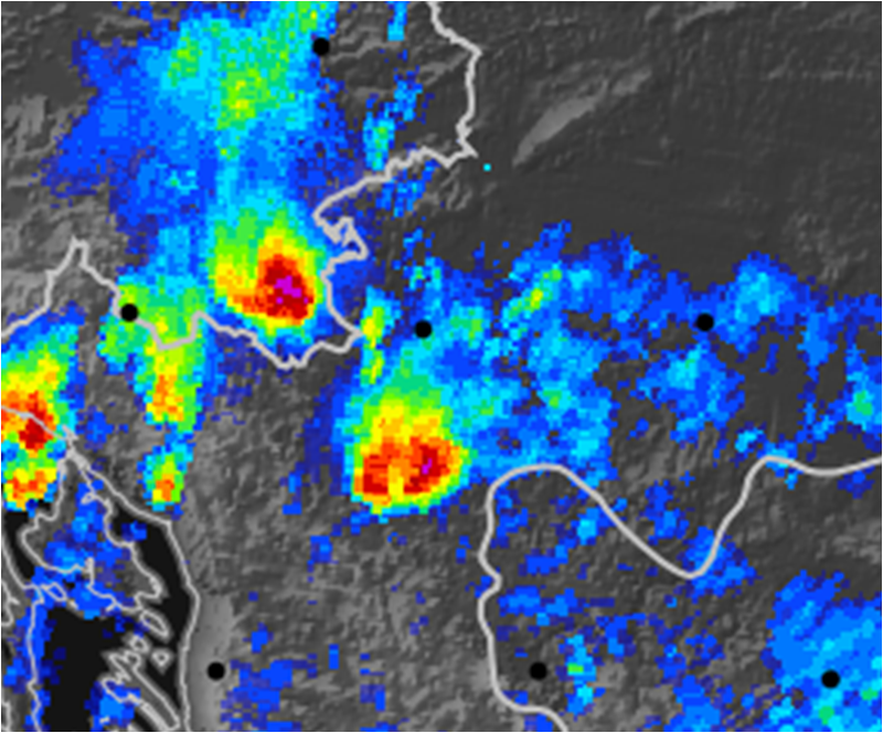
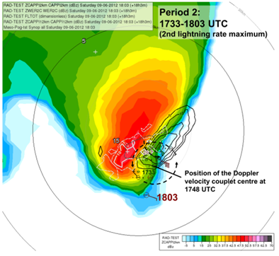
Detailed analyses of various types of storms using remote sensing (satellite, radar, lightning), in-situ and NWP data will be presented. Five cases for thunderstorms occurring in the Carpathian Basin were studied. We tracked the storms, to analyse the storms' temporal and spatial evolution and to see the possible relationships between lightning characteristics and severe convection development.
One frequent feature of supercell storms was that stronger lightning activity occurred in periods of mesocyclone intensification. This was probably also related to higher speed of updraft (or higher vertical acceleration) in these cases. Also in multicellular storms could be shown that the storm dynamics has major influence on the lightning activity (the number of lightning increased when signatures of strong convergence appeared in the Doppler radar velocity, though the radar reflectivity was not very high in that period).
Moist and conditionally unstable environments generally support development of severe storm with high electrification. However, some cases show that the storm’s dynamics and microphysics (e.g. distribution and type of the ice particle growth) can lead to large variability. For example, we found a case with tornadic thunderstorm, which exhibited much less lightning activity compared to other severe storms, despite of favourable environmental conditions concerning moisture or instability
José Lahuerta presents the NWCSAF products Convective Rainfall Rate (CRR) and CRR from cloud physical properties.
Length: 27 minutes.
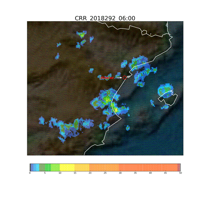
The Convective Rainfall Rate (CRR) and the Convective Rainfall Rate from Cloud Physical Properties (CRR-Ph) products are satellite derived rainfall products based on the MSG/SEVIRI channels and cloud top microphysical properties respectively. Both rainfall products have been developed within the NWC SAF context to provide with instantaneous rain rates and hourly accumulations associated to convective episodes. Last version of the NWCSAF software package includes a new version of the CRR-Ph for nigh time. CRR and CRR-Ph behaviour will be texted in different convective events.
Jean-Marc Moisselin presents the most recent developments of the NWCSAF convection products.
Length: 30 minutes.
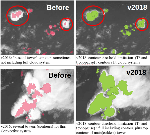
Météo-France develops and contiuously upgrades CI (Convection Initiation) and RDT (Rapidly Developing Thunderstorm) products. Both have been developed in the framework of NWCSAF.
CI is a pixel-based product that provides the probability for a pixel to develop in thunderstorm. The last delivery, v2018, has reached the "pre-operational" status in Eumetsat sense thanks to new developments (e.g. use of microphysics), tuning and validation effort. RDT is an object-based product that aims to detect, track, characterize and forecast the convective cells. Version v2018, includes new features like lightning jumps detection and is highly flexible and configurable. Status is "operational". RDT is very useful for aviation end users.
Hervé le Gléau focuses on cloud top height and micro-physics that can be retrieved from the NWCSAF/GEO software.
Length: 25 minutes.
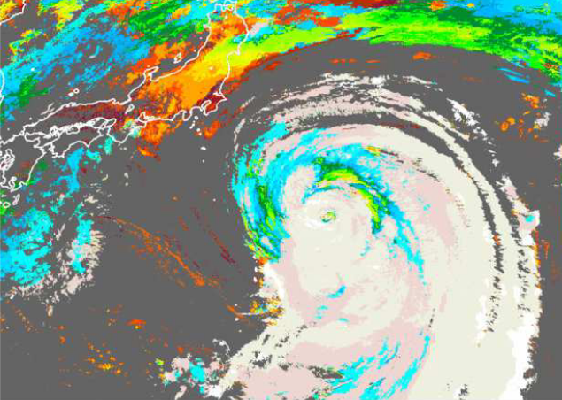
This talk focuses the cloud top height and microphysics that can be retrieved from the NWCSAF/GEO software. The algorithms will be outlined, the improvements implemented in the last version (v2018 just released this year) will be highlighted and some validation results will be shown. After having given some perspective for MTG-day1 release, a convective situation over France will be illustrated.
Miguel Martinez presents the new NWCSAF products iSHAI and PGE00.
Length: 26 minutes.
iSHAI (imaging Satellite Humidity and Instability) is the clear air product of the NWCSAF/GEO software that allows the monitoring in clear pixels of several key ingredients in convection; in addition, it allows to identify the regions where the numerical models used as input do not agree with the observation of the satellite. In version 2018, iSHAI has been adapted to Himawari satellites and it is being adapted for GOES-R class satellites.
PGE00 is an AEMET complementary tool that performs first the vertical, temporal and spatial interpolation (4D interpolation) of the profiles from NWP to the projection and time of the satellite images; allowing to generate for all the pixels the same fields that iSHAI. Second, PGE00 can be used to generate synthetic satellite images using RTTOV-12.1 in clear and cloudy conditions with a high degree of realism using the ECMWF model at hybrid levels. In addition to the comparison with real satellite images, synthetic images can be used to generate new developments and for preparation of MTG era through the generation synthetic MTG-FCI and MTG-IRS images.
The NWCSAF products and services for the future MTG-IRS will be also briefly presented.
The lecture dels with the characteristics of satellites carrying instruments for measuring winds and with the logic behind the calculations of winds using satellites.
Length: 51 min
Author: Ad Stoffelen (KNMI)
The lecture deals with modelled winds and winds derived from instruments onboard satellites like Metop-A and Metop-B in low orbits around the Earth (polar orbits). Today's models are evolving at a rate that is faster than the increase of density of observations and that presents a problem for forecasts. Here stands the question 'Will meteorology continue to develop and improve?'. The lack of observed data is thus filled with the data from satellites, although this data also has its own constraints due to the way it is derived. In the lecture the characteristics of the satellites carrying instruments for measuring winds and waves will be explained and the logic behind the calculations of winds using satellites will be discussed.
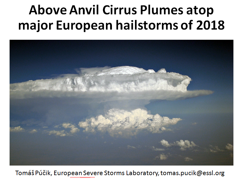
Tomas Pucik investigates the relation between AACP and hail occurrence.
Length: 23 minutes.
Above anvil cirrus plumes (AACPs) have been established in the scientific literature since 1980s. Recent improvements in the temporal and spatial resolution of the satellite data brought back attention to their potential use as an indicator of severity of convective storms. In 2018, we have identified 26 days, where damaging hail reaching at least 5 cm, causing significant economic or societal impact was reported to the European Severe Weather Database. For the selected hailstorm days, where rapid-scan imagery with 5-minute temporal resolution was available, we identified 29 very large (>= 5 cm) hail producing storms. 25 of these hailstorms did show an AACP, but only 12 of these plume producing storms could be clearly identified using the visible imagery. The range of lead time of the AACP appearance to the first hail report was very large and in about half of the cases, the plume occurred only during or after the time of the first large hail report. Due to the limited number of cases, the main purpose of the presentation is, rather than drawing conclusions, to open a discussion on the operational usability of AACPs in warnings for convective storms.
Silvia Puca presents how satellite products impact the efficiency of hydro-meteorological warning.
Length: 28 minutes.
Many severe meteorological events occurred in Europe during the last decade and caused casualties and damages to the historical heritage and natural environment. Protection of civilians and safeguard of the territory are the kay mandates of a civil Protection (CP) agency. This is achieved through activities that mitigate hydro-meteorological risks, such as flooding and droughts. European CP agencies, supported by meteorological and hydrological institutes, aim to assess risk scenarios, to monitor and supervise events and risk levels, providing early warning to National and local authorities.
Near real time accurate estimations of hydrological variables such as precipitation and soil moisture are invaluable to the CP agencies, enable them to issue early warnings and plan for disaster relief at the local level.
Besides measurements of key hydrological variables by ground-based instruments, often affected by a limited spatial coverage, advanced satellite-based precipitation and soil moisture products developed within different international programs as H SAF, are available and accessible to users in near-real time.
In this study, recent severe meteorological events are selected in order to understand how the main satellite product characteristics, i.e. accuracy, spatial pattern and resolution, update frequency and latency, impact the efficiency of a hydro-meteorological early warning system at a local level in an operational framework.