Satellite skills and knowledge for operational meteorologist
Listed here are other resources related to Satellite skills and knowledge for operational meteorologist tag:
Note: click on an image to open the Resource
During the night from 24 to 25 September 2010 heavy rain caused flash-flooding of the town of Pula and the surrounding area.
The case study shows that the flash floods in Pula were the result of a convective system which developed in the convergence zone caused by a specific placing of two Mediterranean cyclones. Generally, the Mediterranean region is recognized as one of the most cyclogenetic regions in the world. Mediterranean cyclones are classified in 3 major types: Genoa cyclones, Adriatic cyclones and non-Genoa cyclones. Although it is rather rare, the major-type cyclones can exist simultaneously belonging to the theoretical category of twin or eyeglass cyclones. The most common twins are the simultaneous Genoa and Adriatic cyclones (Brzovic, 1999), therefore classified as the 4th type of Mediterranean cyclones. Depending of the season and general synoptic conditions, the paths of the cyclones in the Mediterranean basin are diverse. On their way through this complex geography, they can produce a range of extreme weather phenomena such as heavy orographic precipitation, thunderstorms, supercells and mesoscale convective systems.
At 18 August 2011 a severe thunderstorm system developed over Belgium. This case study investigates the synoptic situation in which the windstorm developed using satellite, radar, NWP fields and lightning data.
On 18 August 2011 a severe thunderstorm system developed over Belgium. It initiated over France and then passed over Belgium, the Netherlands and Germany. The studied thunderstorm grew fast and was long-lived. It was extremely severe; particularly the downdraft was extremely strong. The most intense part of the windstorm hit the Pukkelpop festival organized close to the city of Hasselt. There were 60 thousand people at the festival, staying mainly at the camping site. The strong wind flattened tents, uprooted trees, brought down festival light towers and TV screens, and caused a stage to collapse. Five people were killed and 140 people injured in the storm, ten of them seriously. The aim of this case study is to describe the synoptic situation in which the windstorm was initiated and developed, and to describe its characteristics by means of satellite, radar and lightning data and numerical simulation.
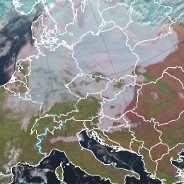
This case study presents an analysis of radiation fog event over the Pannonian Basin that took place from 18th to 20th November, 2011.
This case study presents an analysis of radiation in a fog event over the Pannonian Basin that took place from 18th to 20th November, 2011. It is an example of the conceptual model of fog and stratus cloudiness. Special attention is dedicated to the analysis of vertical atmospheric profiles (temperature, humidity and wind) combined with satellite observation.
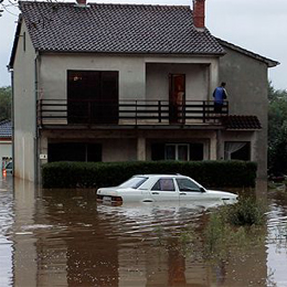
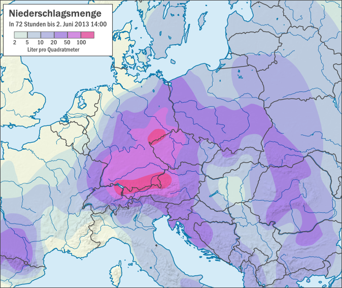
This case study is analysing floods that occurred in central Europe during the period of June 2013.
The case study is analyzing floods in central Europe during the period of June 2013. The case starts with the development of a trough over central Europe on 22 May, seven days before the floods. From 29 May on, the trough intensified the rainy weather, causing southern and southeastern Germany to experience continuous rain over several days. Altogether the countries of Germany, Poland, Czech Republic and Austria were seriously affected by floods and the damages in Bavaria (Germany) only were estimated to 1.3 billion euros.
From 20 August to 2 September 2013 the Caramulo Mountains in central Portugal experienced a series of three large and devastating forest fire events.
From 20 August to 2 September 2013 the Caramulo Mountains in central Portugal experienced a series of three large and devastating forest fire events that caused a total burned area of about 9415.5 ha and 6 casualties. The Caramulo fires had overwhelming ecological, social and economic consequences that will be felt for several years. They were the result of a complex combination of variables from human factors to adverse meteorological and topographic conditions. This case study will address these variables of the Caramulo fires, which lead to environmental disaster.
The case study treats a series of wildfire that rage across Madeira Island.
In early August 2016, a series of wildfires raged across Madeira Island, in the North Atlantic Ocean, prompting the evacuation of more than one thousand people, destroying about 105 homes as well as a five-star hotel in Funchal, the main city in Madeira, and causing the death of 4 people. Flights at Madeira airport were disrupted due to the smoke. The fires caused ca. 60 million euros in losses. An area of ca. 3000 hectares was burned. This case study investigates the synoptic background that lead to this natural disaster.
In this module, we will introduce the concept of Total Precipitable Water (TPW) and show how satellite-based products help in estimating the amount of water vapour in the atmosphere.
In this module, we will introduce the concept of "Total Precipitable Water" (TPW) and show how satellite-based products help in estimating the amount of water vapour in the atmosphere. The module starts with an overview on measuring principles and algorithms on how to retrieve the water vapour content of the atmosphere. In the second chapter, you will learn more about the different TPW products from geostationary and polar orbiting satellites. Finally you will see some practical applications of TPW products in nowcasting precipitation events.
Go to the Product Tutorial ...
The purpose of this tutorial is to help the reader understand and use the SEVIRI Physical Retrieval (SPhR) product of the EUMETSAT Nowcasting SAF.
The purpose of this tutorial is to help the reader understand and use the SEVIRI Physical Retrieval (SPhR) product. SPhR's purpose is to provide information on convective environmental parameters, particularly on moisture content and atmospheric instability. These parameters are crucial in studying the potential for deep convection, and in predicting the development of convective clouds. Moisture, instability and a lifting (trigger) mechanism are needed for the formation of deep convection.
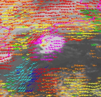
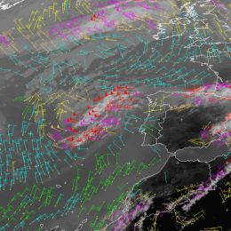
The purpose of this tutorial is to give an introduction into the topic wind measurement from satellite.
Knowledge of atmospheric motion is essential for many applications. Information on high-level atmospheric winds is of great importance for forecast models as the current state of the atmosphere has to be specified before the future state can be predicted. Winds in the upper levels can be observed using radiosondes or aircraft measurements, but those observations are limited in time and space. As satellites provide worldwide and continuous data, they are the ideal data source for regular upper atmospheric wind information.
The purpose of this tutorial is to give an introduction into the topic of land surface temperature retrieval.
In this module we focus on the land and clarify the meaning of Land Surface Temperature (LST), a parameter often confused with air temperature, aerodynamic temperature or soil temperature. The term "Land Surface Temperature" is widely used by distinct research communities such as those of climate, numerical modelling or boundary layer studies while referring to different physical meanings. We take a deep look at LST by considering how this temperature can be obtained from satellite measurements and how it compares to other temperatures.
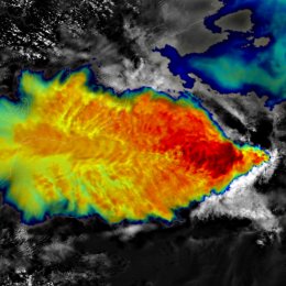
Sandwich products help to detect and analyse various cloud top features of storms (storm systems) in their mature phase.
This training module describes the Sandwich Products. These products help to detect and analyse various cloud top features of storms (storm systems) in their mature phase. It eases the detection of specific cloud-top features related to storm dynamics and microphysics, structure, and possible storm severity - such as overshooting tops, cold-U/V (enhanced-V) or cold-ring features, embedded warm spots/areas, gravity waves, above-anvil ice plumes, areas composed of very small ice particles, etc. These products directly support monitoring and nowcasting of convective storms. In areas with no, or poor, weather radar and surface observation coverage, this product is essential for proper storm detection.
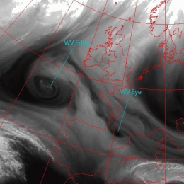
Vortices at different scales in the WV image; small scale dark circles (eyes) represent sinking stratospheric air.
WV Vortices in the northern hemisphere are cyclonically rotating and therefore associated with a trough or low in the upper levels of the troposphere. This can also be seen in PV fields, which show high values near the centre of the vortex. High values of PV are related to low tropopause height, which explain the Dark Stripe in the WV image. The Dark Stripe implies that relatively dry stratospheric air is penetrating down into the higher levels of the troposphere. Within the Dark Stripe, a local maximum of PV can often be seen. Because of the local maximum, the cyclonic circulation is enhanced. Therefore, the Dark Stripe is being deformed and the moister air spirals around the dryer air. This process either leads to the formation of a WV structures. Investigation of about 100 cases over a period of two years shows that a distinction can be made between different WV structures. The two prevailing structures are the so-called WV Eddies and WV Eyes.

