Satellite skills and knowledge for operational meteorologist
Listed here are other resources related to Satellite skills and knowledge for operational meteorologist tag:
Note: click on an image to open the Resource
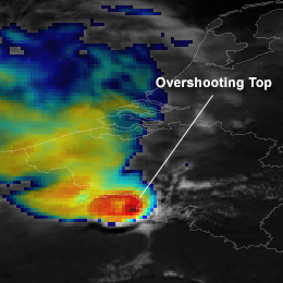
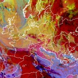
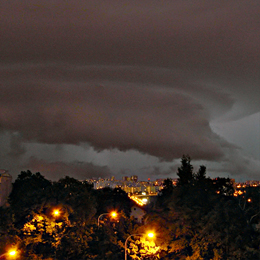
A severe convective outbreak with big hail and thunderstorms occurred over parts of western and central Europe on Monday, May 25th 2009.
A severe convective outbreak with big hail and thunderstorms occurred over parts of western and central Europe on Monday, May 25th 2009. Overnight, a strong squall-line developed that produced gusts in excess of 35 m s-1 across Northern France, Belgium and the Netherlands uprooting trees and causing considerable damage to property. In addition hail with diameter of 10 cm. was recorded.
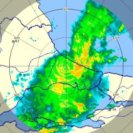
The 23rd of July was marked by a fast transition of a cold front (about 80 km/h) from west to east which went along with severe thunderstorms and hail.
The 23rd of July was marked by a fast transition of a cold front (about 80 km/h) from west to east which went along with severe thunderstorms and hail. The catastrophic event caused enormous agricultural damage and the Austrian farmer alliance reported that about 60 000 hectare arable lands were devastated. The destruction mostly caused by hail was estimated to sum up 15 million euro. On this account people insist on investigations to find out what exactly caused the event. Besides on the meteorological perspective there is always great interest in improving forecast methods and forecast tools. In principle the following report provides a detailed analysis of the weather event. Basically the high potential of prefrontal thunderstorms was known, although there were diverse estimations about its development. It was the change of the wind direction due to the interaction between the convergence line and the foehn that induced the following weather development. Contributing to the wiki case studies this report should lead to a better understanding of the atmospheric conditions that special day and introduce new now casting-products (GII and SAI).
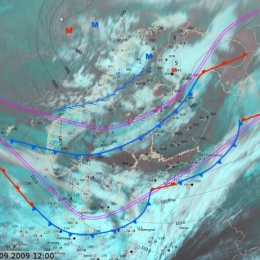
Torrential rainfall during the second week of September caused floods in the Istanbul area in Turkey.
Torrential rainfall during the second week of September caused floods in the Istanbul area in Turkey. As a result there were 32 casualties. Below we have pictured some satellite images with NWP. Striking is the Upper Level Low found over Central Turkey. This results in the advection of moist, unstable airmass from the Black Sea and topographic uplift which result in numerous rounds of showers and thunderstorms in the region. The cold temperatures found in the upper layers of the cold core low and its contrast to the warm surface causes the CBs to grow extreme in the vertical and producing lots of rain. Moreover, a weak wind field results in the slow storm movements.
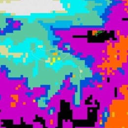
A particular strong wind event took place on 29 Sepetmber 2009. The event was characterized by a mesoscale convective line which was not reflected in any of the operational models.
A cold air outbreak took place in Finland on September 29, 2009. The most interesting part of this particular cold air outbreak was unexpectedly strong wind gusts. Operational models, except one, did not give a hint about strong wind gusts. The strongest observed gust was 30 m/s but fortunately no hazards or problems were reported from the sea areas around Finland. Newspapers reported some fallen trees and observations of roofs being blown off properties in southwest Finland. In this article, this particular event is evaluated and presented together with observational and operational model data.
Strong wind gusts also affected the standard measured 10 minute average wind speeds, so that the forecasted maximum was 12 m/s and the observed 20 m/s, which is close to official storm wind speed threshold in Finland. Operational forecaster on duty corrected forecasts quickly after observations showed higher than forecasted wind speeds.
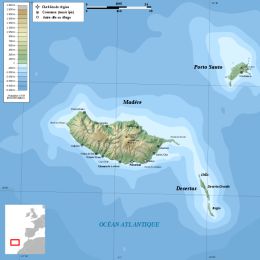
On 1st October 2009 almost 60 mm of precipitation have fallen in 6 hours on a mountain station in Madeira Island.
On 1st October 2009 almost 60 mm of precipitation have fallen in 6 hours (16-22 UTC) on a mountain station in Madeira Island (Areeiro, with a height of 1510m), which fitted the orange warning criteria (40 to 60 mm in 6 hours) used at the time at the Portuguese Met. Service. In a 24 hour period (12UTC on 1/10/2009 to 12 UTC on 2/10/2009) a total amount of 101 mm was recorded at the same weather station. An old large-scale low-pressure system was located over the Azores, to which a clear convective activity was related. These convective events were taking place to the northwest of Madeira Island and no special signal could be detected in satellite imagery at a first look over the island. Therefore, this episode could be considered to be kind of silent for this mean of observation.
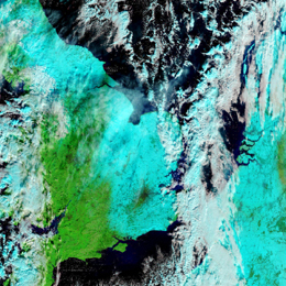
A cold air outbreak during the second half of December 2009 brought mayhem to Western Europe and Croatia.
A Cold Air Outbreak directed by a strong anticyclone near Greenland directed polar air towards Europe. With the still relative warm waters of the North Sea and the genesis of several small scale disturbances over Scandinavia and Germany the ingredients were in place for many centimeters of snow in the UK, Netherlands and Germany.
The largest impacts the snow brought were experienced from 16 to 20 December. The largest railway station in the Netherlands (Utrecht CS) was closed on 17 December due to snowfall leaving thousands of passengers stranded. During the morning rush hour of 18 December there was a record breaking 671 kilometers of traffic jam. In England the snowfall had also lead to chaos when motorists were stuck on the A21 during the evening and night of 17 to 18 December. The next night five international EUROSTAR trains were stuck in the tunnel under the English Channel leaving 2.000 passengers trapped for 16 hours.
From a meteorological point of view this cold air outbreak is interesting as many parts of Europe were affected and that there were different conceptual models responsible which can be distinguished using satellite and numerical weather data. All of these are described in detail in this case study.
A cyclone developed over Spain causes heavy snowfall in the Mediterranean and Central Europe.
Between 10 and 12 February 2010 a Mediterranean low caused extreme snowfall in Styria and Carinthia, the south of Austria. This case study describes the synoptic situation and the further weather development during that time period. The comparison of the expected with the actual precipitation should show the accuracy of the forecast. On the basis of this case, an overview of the difficulties of precipitation forecast, especially for snowfall, is given.
During early morning and morning on 20th February 2010 an extreme and rare flash flood event has occurred in the Portuguese island of Madeira.
In the coastal city of Funchal an amount of 111.5 mm (05:10-11:10 UTC) occurred in a 6-hour period (with a 24h amount of 144.3 mm). Higher amounts were recorded in the mountainous weather station Pico do Areeiro, at 1510 meters, with a 6-hour peak of 272.1 mm (08:50-14:50UTC). This mountain area is right upstream of Funchal, therefore, the precipitation in the mountain simply flowed downslope along rivers that are usually small, summing up to an already high amount of water in lower altitudes. A precipitation time-lag between Funchal and Areeiro is clearly depicted in the temporal evolution of 10-minute precipitation. Note values in excess of 10 mm/10 minutes in Funchal and 15mm/10 minutes in Areeiro during the most intense time periods. The Portuguese met. service followed this extreme event issuing gradually higher levels of precipitation warnings since the day before: yellow warning at 19:27 UTC on 19th, orange warning at 08:53 UTC on the 20th and red warning one hour later, at 10:03 UTC.
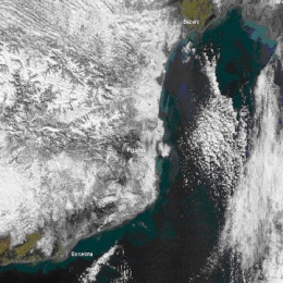
An upper level low causing heavy snowfall in the Mediterranean and Eastern Europe.
An upper level cold core low depresses due to heavy cold air advection backside of the trough over the Iberian Peninsula. Heavy Snowfall in the Mediterranean area and in the following days in Austria and East Europe was the result of an intense cyclogenesis over the relatively warm Mediterranean Sea.
In addition to the heavy snowfall a very strong Bora established in the east Adriatic coast due to the great temperature and pressure gradient over the Dinaric coastal mountain. As a result of the very strong wind even some infrastructure was damaged in this area.
The storms, which occurred on August 15th 2010 in parts of central and eastern Europe, were interesting from many aspects, some of which are described briefly in this case study.
The storms, which occurred on August 15th 2010 in parts of central and eastern Europe, were interesting from many aspects, some of which are described in this case study. Given the highly variable appearance and characteristics of these storms the need existed to further examine in detail and to use the case for testing of various convection-related algorithms.
This case initially attracted our attention because of the severe hailstorm in Prague in the early evening, which caused an estimated 180 million EUR damage to property in less than one hour. This alone would not be a reason for focusing on this case; the main reason was the appearance of this storm\'s cloud top. From the MSG satellite perspective the storm could have easily been overlooked due to its relatively warm cloud top and small size, as seen in the Meteosat 8 IR10.8 BT image below.
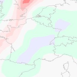
On September 12th 2010 a major PV anomaly, in the rear of a cold front, moved over France and hit Germany and Switzerland in the late evening and also Austria during the night. On the front side of this anomaly convective cells developed and brought some rain showers and thunderstorms.
On September 12th 2010 a major PV anomaly, in the rear of a cold front, moved over France and hit Germany and Switzerland in the late evening and also Austria during the night. On the front side of this anomaly convective cells developed and brought some rain showers and thunderstorms. At first the ECMWF-model, especially the 00 UTC run from September 12th, was lacking performance shifted the PV maximum more westward. In this case study we analyse not only the synoptic situation, but also the model error. In the following we take a look at the MPEF (Meteosat Product Extraction Facility) Divergence product, how it works and whether it would have been helpful in this case as a nowcasting tool.
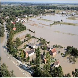
This case study will present the circumstances and explain the processes that led to severe flooding in both Slovenia and Croatia in September 2010.
Last days of summer 2010, Slovenia and Croatia were marked by heavy rainfall and floods. The precipitation amounts in some parts of Slovenia was exceeding all recorded rainfall amounts in the last 100 years causing immense property damage and even human casualties. In the western part of Slovenia locally more then 500 mm of rain fell in 48 hours. Huge part of Slovenian territory was flooded, which included also more than 8200 houses.
The amount of rain in Croatia was not so great. In Gorski Kotar region (mountain area in the western part of Croatia) and in Istria in three days 200 to 300 mm of rain was reported causing mostly flash floods. The main problem in Croatia was the water that was brought by Sava river from Alpine region. Because of the instantaneous unit hydrograph the southern part of Zagreb was flooded for several days.
Even though the prognostic material was giving the clear sign of a probability of heavy rain and the warnings were issued several days in advance, the amount of precipitation was so big that the damage was not possible to avoid.
This case study explains the processes that led to severe flooding and specialty of this study is that it brings and introduces H-SAF as a tool for detail monitoring which is of great help to the meteorological and hydrological specialists during and after the event. In this case study products of H-SAF are explained and some samples are presented.

