
Satellite skills and knowledge for operational meteorologist
Listed here are other resources related to Satellite skills and knowledge for operational meteorologist tag:
Note: click on an image to open the Resource
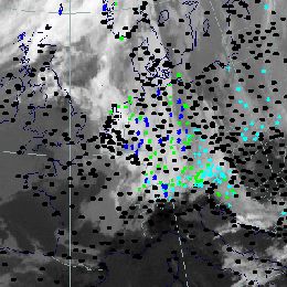
Flood catastrophe in Central and Eastern Europe due to an Upper Level Low.
Flood catastrophe in Central and Eastern Europe due to an Upper Level Low. Convective precipitation and barrage effects lead to extraordinary precipitation events.
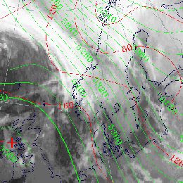
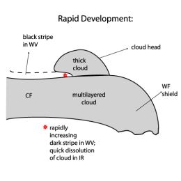
This case study treats a convergence cloud band in front of a cold front over central and eastern Europe.
This case study shows numerous cloud bands from west to central and eastern Europe are described. Special attention is drawn to the convergence cloud band in front of a cold front over central and eastern Europe, containing pronounced convective cloud features.
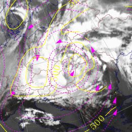
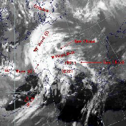
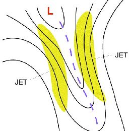
This case study treats the delay in rapid cyclogenesis over the Atlantic through the development of an upper level low.
This case study shows a delay in rapid cyclogenesis over the Atlantic through the development of an upper level low. Analysis of cloud features for separation of two CMs acting together.
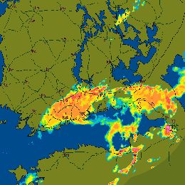
This case study treats prefrontal convection over western Europe and France. Numerous CB clusters and a dominating MCS are described.
This case study shows prefrontal convection over western Europe and France. Numerous CB clusters and a dominating MCS are described.
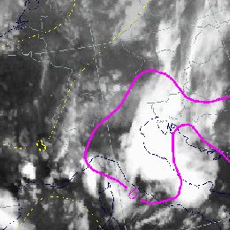
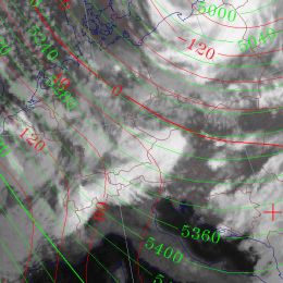
This case study shows the life cycle of an upper level low over the Bay of Biscay and the Iberian Peninsula.
This case study shows the life cycle of an upper level low over the Bay of Biscay and the Iberian Peninsula. Associated convective activity causes heavy precipitation and flooding in Spain.
Frontal system across Europe with Wave development over South and South eastern Europe and a Front Intensification over Spain.
A frontal system located over Europe shows a wave development over south and south-eastern Europe and a front intensification over Spain between 12 and 13 November 1997. Special interest is focused on convective developments within the prefrontal area and the thickness ridge over the Balkan.
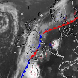
Arctic cold air outbreak over western Scandinavia and successive Rapid Cyclogenesis at the Lee side of the Scandinavian mountains.
Arctic cold air outbreak over western Scandinavia and successive Rapid Cyclogenesis at the Lee side of the Scandinavian mountains. The further development and severe weather events are investigated under the light of frontal connected jet streaks.
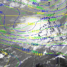
The chronologically changing behaviour of CMs during a cold air outbreak in the Mediterranean is the focus of interest.
Case study of various CMs over Eastern Europe and a WV Eye over the Mediterranean. Chronologically changing behaviour of CMs during a cold air outbreak in the Mediterranean is the focus of interest.
In this case study a Mesoscale Convective System associated to a convergence line is described.
In this case study a Mesoscale Convective System associated to a convergence line is described. The zone of strong convective activity initially extends from Estonia to Russia. During the life cycle it propagates to the North and finally reaches Southern Finland and causes heavy precipitation.
In this case study a low pressure systems with associated cloud bands over Eastern, Northeastern and Southern Europe is described.
Typical summer time distributions of low pressure systems with associated cloud bands over Eastern, Northeastern and Southern Europe (Black Sea Low). Development of frontal parameters and weather events relevant for Scandinavia are discussed in detail.
Christmas Storms development over Western and Central Europe due to successive Rapid Cyclogenesis development.
Christmas Storms over Western and Central Europe due to successive Rapid Cyclogenesis development.
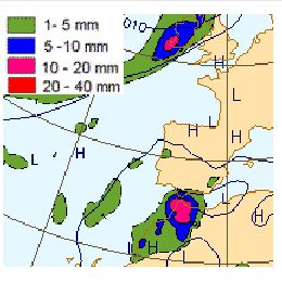
Avalanche catastrophe in the Alpine Area. Extraordinary high amount of snow fall due to persisting barrage effect at the Alps.
Avalanche catastrophe in the Alpine Area. Extraordinary high amount of snowfall due to persisting barrage effect at the Alps.