Weather
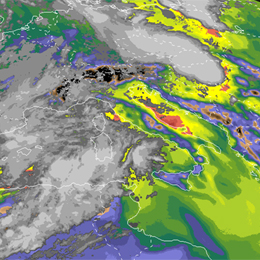
Presentation on some of the typical convective scenarios with the focus on the usage of the background NWP fields and convective parameters in combination with satellite imagery.
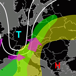
Zoltan Polyanszky from the Hungarian Meteorological Institute, presents some of the typical convective scenarios with the focus on the usage of the background NWP fields and convective parameters. The role of the operational work of the forecaster who is responsible for issuing warnings is highlighted and concluding a reflection is discussed on what has been learned from the situations over the recent years.
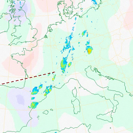
Presentation during the event week on Convection in June 2011 by Helge Tuschy on the European Forecasting Experiment (ESTOFEX).
Presentation by Helge Tuschy from Deutscher Wetterdienst (DWD). He is one of the forecasters producing the valuable ESTOFEX forecasts and this lecture is on the basics of convection and how the convective outlooks in ESTOFEX are prepared.
Webcast on the influence of the the Black Sea on the initiation of convective storms in South Eastern Romania.
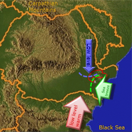
Presentation by Aurora Bell on the influence of the the Black Sea on the initiation of convective storms in South Eastern Romania. Several cases with Doppler radar and satellite images were presented in combination with other integrated data. The presentation was oriented towards forecasters and Aurora explained the role of the sea breeze in bringing together the right ingredients.
Nowcasting SAF presenting the new developments of cell tracking with SEVIRI satellite data in the SAF product, Rapid Developing Thunderstorm.
Presentation during the Convection Week 2011 by Jean-Marc Moisselin on the update to the Rapid Developing Thunderstorm (RDT) product of the NWC SAF.
The Physical Retrieval algorithm of NWC SAF retrieves the atmospheric temperature and moisture profiles as well as surface skin temperature.
The SEVIRI Physical Retrieval (SPhR) algorithm retrieves the atmospheric temperature and moisture profiles as well as surface skin temperature for one clear sky SEVIRI pixel, or a Field-Of-Regard (FOR) with contains M x M pixels. The central aim of the SPhR is to provide information on the water vapor contained in a vertical column of unit cross-section area in several layers in the troposphere and to provide some instability indices. These parameters are calculated from the retrieved profiles of temperature and humidity.
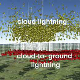
Vera Meyer discusses research on Cell tracking and Nowcasting using 3D lighting- and radar data in Southern Germany.
Vera Meyer (ZAMG) presents her PhD research on Cell tracking and Nowcasting using 3D lighting- and radar data in Southern Germany. Research conducted at DLR.
Presentation on the use of the MPEF Divergence Product for diagnosing the divergence associated with upper-level wind field disturbances that produces forcing for ascent and favours the development of deep moist convection.
Presentation by Christo Georgiev during the Event Week on Convection in June 2011. The presentation concentrates on the use of the MPEF Divergence Product for diagnosing the divergence associated with upper-level wind field disturbances that produces forcing for ascent and favours the development of deep moist convection.
Nefodina is an effective model designed to detect convective system evoluting in the Mediterranean basin.
Davide Melfi (CNMCA) presents the development on the NEFODINA product. This is an effective model designed for the detection and the forecasting of the convective systems evolution in the Mediterranean area. It is composed by a system of neural networks and a varying temperature threshold method. It is able to detect not only the convective clusters but also all the convective cells inside them. He explained the product and gave some examples of how the products are used.
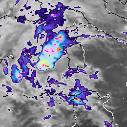
Webcast on the detection and monitoring of convective storms by using MSG imagea and products.
Aydin Erturk (TSMS) present on the "Detection and Monitoring Convective Storms by Using MSG Image and Products". The MSG SEVIRI is crucial data source for the nowcasting applications. Storm top features with IR imagery were well defined and published. MSGView software being operationally used for detection and monitoring convective storms at Turkish State Meteorological Service. Two case studies (a cold U/V and a cold ring shape) were demonstrated and discussed in this presentation.
Webcast on the use of IR8.7 for the detection of deep moisture convection.
Presentation given by Thomas Krennert (ZAMG) on the use of the IR8.7 channel for the detection of deep moisture convection (DMC) on marked WV boundaries.
Presentation by Pieter Groenemeijer, director of ESSL, the European Severe Storms Laboratory about the activities.
Presentation by Pieter Groenemeijer, Director of ESSL, the European Severe Storms Laboratory. Pieter explained about the activities of ESSL and what the organization does for the meteorological community, such as supporting research in convective weather, offering a platform to discuss convective weather via the ECSS conferences and the operation of a European Severe Weather Database.
The EUMETCAL High Impact Weather group addressed a series of convective events over Europe during the summer 2010.
The EUMETCAL High Impact Weather group addressed a series of convective events over Europe between 5 and 9 August 2010. This events affected many countries from southern areas - Mediterranean/Balkans - to northern areas - Baltic/Scandinavia. In the 30 minute presentation the group analyzed the events, combining the analysis of convection, namely by satellite, with the impacts perspective.

