Satellite skills and knowledge for operational meteorologist
Listed here are other resources related to Satellite skills and knowledge for operational meteorologist tag:
Note: click on an image to open the Resource
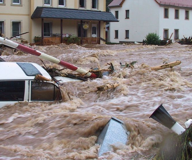
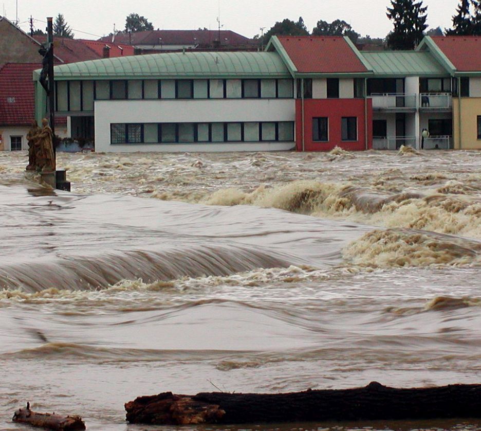
On 18 September 2007 Slovenia received 303 mm of rain in shy 24 hours. The result were flash floods and huge material damage.
This case-study presents the analysis of catastrophic flash floods in Slovenia that occurred on 18 September 2007. The flooding caused five casualties and huge material damage, estimated to more than 150 million Euro.
NWP models forecasted precipitation amounts of up to 100 mm/24h. That was the reason that the forecaster issued a warning for the precipitation at a rate of more than 100 mm/day, but the real values were much higher.
Besides analyzing synoptic and mesoscale conditions, that caused the extreme amount of precipitation, the objective of this study is also to show how nowcasting material can help a forecaster to issue additional warnings.
The synoptic analysis shows that on the day of the catastrophic event the area of low pressure was situated over the Northern Europe. A cold front was approaching the Alps and over Slovenia a series of prefrontal convective developments took place. In many regions in Slovenia the precipitation values were extremely high (>100 mm/day) with the maximum precipitation of 304 mm/24h officially measured in Kneske Ravne.
On 4th October 2007 a large Mesoscale Convective System hit the Balearic Island of Mallorca. Although the NWP model output did predict high convective activity, it did not expect it to take place near Mallorca.
On 4th October 2007 at 1530 UTC, a large Mesoscale Convective System (Mesoscale Convective System), passed over the Balearic Island of Mallorca. Associated to the Mesoscale Convective System an F2 tornado was reported. The Mesoscale Convective System was accompanied by severe wind gusts that spread the damage in numerous areas of the island. The longevity of the Mesoscale Convective System was quite remarkable (approx. 12 hours!), and in some stages of its life cycle, it showed a fast movement, taking a very short time, less than 1 hour, to cross Mallorca island.
A severe thunderstorm occurred at 5th of November 2007 in Cameli in the Western part of Turkey.
A severe thunderstorm occurred at 5th of November 2007 at Cameli town at the western part of Turkey. After the thunderstorms phone calls have been made by persons from the municipality of Cameli and with eye-witnesses. According to them, a small-scale tornado has been observed and three villages in the suburbs of Cameli have been affected.
Case Study on what happens when dry and cold air is transported over warmer seawater and moisture is picked up.
This a new example of the Conceptual Model, Convergence Lines over Seas and Lakes, is about a cloudstreet, developing into a well pronounced convergence line over the Sont, the narrow strait between Denmark and the southwest coast of Sweden. The evolution downstream over the west part of the Baltic Sea into the northwest part of Poland is studied as well. Coastal Convergence Lines, the other CM about developing convective clouds in cold air advection over warmer seawater, has a great similarity to convergence lines over sea and lakes. - Cloud streets, developed over sea, may intensify over land at a much larger distance from the coastline into an active squall line with embedded TS. An example of this side effect is presented as well.
From 29 February to 1 March 2008 storm Emma causes damage at several regions in Middle Europe. During only 12 hours a cold front and a succeeding convective line crossed Germany.
From 29 February to 1 March 2008, partly heavy thunderstorms with severe gusts and hail caused damages at several regions in Middle Europe. During only 12 hours a cold front and a succeeding convective line crossed Germany.
The storm Emma was a typical example of line convection with downbursts during a southeast movement of a storm field over the North Sea. The average velocity of the convective line was 110 km/h, sometimes 150 km/h. Behind the cold front dry atmospheric air (equivalent to high Potential Vorticity (PV)) could be recognised in the Airmass RGB.
Based on satellite imageries and numerical parameters the development of this event can be observed.
Case Study from China! On the 22nd of July 2008 was marked by a motion of a vortex with several convective cells along a frontal cloud band.
The 22nd of July 2008 was marked by a motion of a vortex with several convective cells along a frontal cloud band. At the leading edge of a frontal cloud system, lots of thunderstorms reported on the ground stations, and heavy rain, strong wind and lighten were observed. All of this weather events with caused enormous agriculture damage and economical lost. As the movement of vortex, several convective cells emerged and became a larger MCC because of merging each other, then the MCC was merged with a north MCC and brought severe weather in cloud area. So in this case, two different merging were analyzed in this case, first is the merger of cells and the second is a MCC merging with another one.
On 15 August 2008, at about 17 UTC, a sea wave flooded the harbour of Mali Losinj on the island Losinj in the northern Adriatic.
On 15 August 2008, at about 17 UTC, a sea wave flooded the harbor of Mali Losinj on the island Losinj in the northern Adriatic. The flood was about 50 to 80 cm high above the ground what, together with the height of the ground above mean sea level, gives the wave height (trough-to-crest) of more than 2 m. This study is aimed to show that the flooding was caused by a Meteo Tsunami.
Case study on the abundant rainfall on 23 September 2008 in Valencia and Alicante.
On 23 September 2008 an amazing amount 326 mm in three hours was recorded in Sueca in the Province of Valancia. The convective events leading up to this event are discussed in this small case study by Ramon Vazquez. The satellite images as well as the radar and data from the ground are presented and discussed.
On 7th October 2008 a cold front crossed northwestern part of the Iberian Peninsula, producing large amounts of precipitation and causing disruption of same activities in the affected areas.
In northwestern Portugal, a maximum of 41 mm in 6 hours was obtained in an automatic weather station (AWS) in a mountain area and a maximum of 20 mm in 1 hour in a coastal area, both reaching the orange warning lower threshold for meteoalarm (40mm in 6 hours and 20mm in 1 hour, respectively). The Portuguese meteorological service (IM) issued a yellow warning with 24 hours advance, and the orange warning has been issued 7 hours before the beginning of the period of heaviest precipitation.
The Winter Storm Klaus occured from 23 to 24 January and has been one of those rare cyclones which leaved a serious path of damage, especially in northern Spain and southern France.
Reaching explosive development rates as high as 34 mb in 24 hours, and registered maximum surface wind gusts of the order of 200 km/h. Klaus cyclone, as a system with a clear surface pressure signal, approximately started on day 23 about 00 UTC, in the middle of the Atlantic, at position shown below, with a minimum MSLP value of 1000 mb, according to ECMWF / HIRLAM analysis. The track of the cyclone was purely zonal and its speed was markedly high, reaching values above 100 km/h. A minimum surface pressure of about 964 mb at cyclone center took place on day 24 at about 00 UTC, more or less maintained for several hours during the warm seclusion phase of the system.
On 25th April 2009, a possible but unusual pattern called von Karman vortex developed to the Lee of Pico-island on the Azores.
On 25th April 2009, a possible but unusual pattern called von Karman vortex developed to the lee of Pico island. Very common in Madeira or Canary islands, this feature is not so common in the Azores Islands mainly due to their location in Atlantic Ocean. Note that MSG Infra-red 10.8 and visible 0.6 channels on usual 3km sub-satellite pixel resolution can depict the pattern reasonably well in comparison to NOAA 1km resolution.
On 21st May 2009 a dense advection fog coming from the Gulf of Finland caused low visibilities across the region around Helsinki.
On 21st May 2009 a dense advection fog coming from the Gulf of Finland caused low visibilities across the region around Helsinki. The fog started to move inland from the Gulf around 1700 UTC and persisted until next morning on land areas while coastal water areas cleared during daytime.
These kind of fog situations typically occur in the Southern coast of Finland in April-May when the sea temperature is still cold and warm humid air is advected over the water from Central Europe or the Baltic area (and in the autumn months in reverse fashion as the water is still warm and land cold). This case study is focused on comparing how a global model (ECMWF) and a local model (AROME) performed in forecasting this situation.


