
Polar Lows
Presentation 8 from the Synoptic and Mesoscale Analysis of Satellite Images 2016
Length: 51 min
Author: Justyna Wodziczko (MetNo)
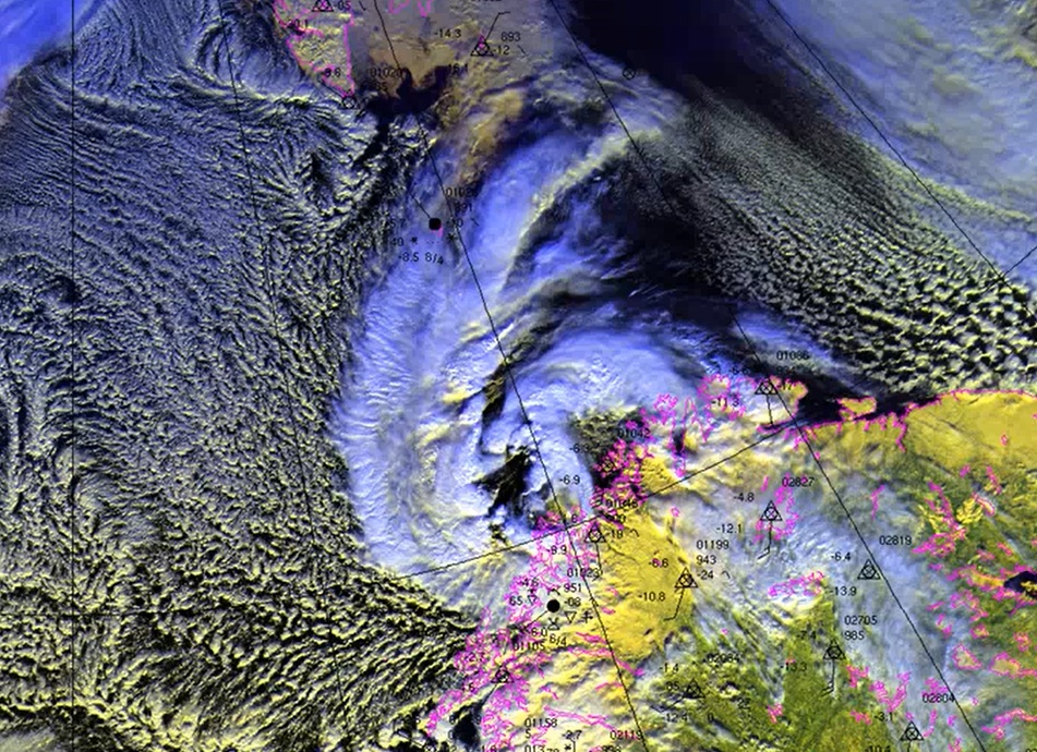
Polar Lows are generally characterized by severe weather in form of strong winds, snow showers sometimes even hail, which sometimes results in loss of lives, especially on the sea. Sometimes these systems are also connected with the term Arctic Hurricane, which had been used for especially intense Polar lows. Compromising definition of Polar low is: small, but fairly intense low in northern maritime regions.
The polar lows are formed in cold air outbreaks, north of the polar front, mostly in the regions east of 0°E and south of 75°N. Favorable season for them is the cold part of the year. By size, they are smaller (200-600 km) than ordinary synoptic lows with life-span typically around 18 hours, and with very intense change of weather.
Why was it difficult to forecast polar lows and what are the improvements in that area since 2000? In my presentation I will also show you how we are forecasting Polar lows, which models we are using and of course satellite products.