
Satellite skills and knowledge for operational meteorologist
Listed here are other resources related to Satellite skills and knowledge for operational meteorologist tag:
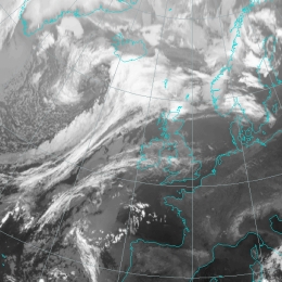
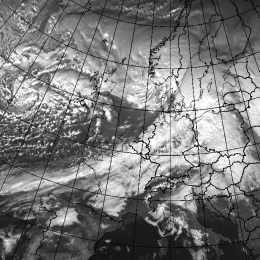
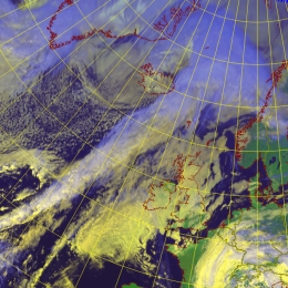
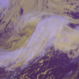
Note: click on an image to open the Resource
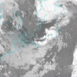
Small scale lines of convective cells as a result of confluence in a land/sea system.
The coastline generally represents a marked discontinuity in surface roughness. The resulting mechanical forcing leads to a secondary circulation in the boundary layer, leading to localised vertical motion which may, in turn, have a strong influence on weather in the coastal zone. This conceptual model describes a flow in which friction is the main driving force for cloud development. In contrast Stau Cloudiness and Lee Cloudiness conceptual models describe circulations primarily caused by more distinct orography (mountains and hills). It has to be kept in mind, however, that other factors besides friction, such as the differential heating between land and sea or the topography and shape of the coast have a marked influence on the dynamics of Coastal Convergence. Purely thermally driven circulation on the coast is called the Sea-Breeze. The most intensive Coastal Convergence by friction is induced when the wind blows parallel or in small angle onshore, the lower pressure being to the left of the wind component parallel to the coast.
Dan Bikos from CIRA shows how to interpret satellite data in view of convective initiation and how to estimate the severity of MCS from cloud features.
Length: 55 min
Author: Dan Bikos
Dan Bikos received his BS in Meteorology at the State University of New York College at Brockport (1995), and MS in Meteorology from the University of Oklahoma (1998). His areas of interest include severe weather, lake-effect snow and applications of satellite imagery to weather forecasting, particularly on the mesoscale. Dan has been a research associate at CIRA since 1998 working for the Virtual Institute for Satellite Integration Training (VISIT) project in which he develops training for NWS forecasters. Distance learning software (VISITview) combined with a conference call are utilized to deliver the training to NWS forecast offices. Dan has instructed more than 300 hours of live teletraining sessions, primarily dealing with operational applications of satellite imagery.
A Comma is an active, mesoscale cloud spiral in the cold air behind frontal cloud bands, often with significant weather.
A Comma is a very prominent cloud feature developing and xisting in cold air. In order to distinguish the Comma from other features in cold air, the Comma cloudiness is defined as a small to meso-scale cloud spiral consisting of white (i.e. cold) cloud cells partly overlaid by cirrus shields. In most cases the strongest convection can be found in the Comma tail. The scale of a Comma lies between 200 and 1000 km, i.e. much smaller than a fully developed depression or a cyclone. Larger Commas can be a sign of a development process called Cold Air Development, where a Comma increases in size and finally gains some frontal characteristics.
Small cloud cells arranged in parallel lines often found in cold air cloudiness.
Cold Air Cloudiness is the result of mesoscale shallow convection (1-2 km deep) and has distinctive appearances: Linear and Hexagonal. The former is called Cloud Streets, which will be discussed more deeply and can be roughly regarded as 2-dimensional convection. The latter, generally called in the literature Mesoscale Cellular Convection, is characterized by 3-dimensional convection which can be divided in two types: Open and Closed Cells. Cloud Streets occur over both water and land surfaces. The satellite image shows several parallel cloudbands with a length of 20-200 km and width of 2-10 km. Especially over the sea, the streets become wider with increasing distance from shore. The cloud bands consist of individual cumuli which are lined up like pearls on a string. The organisation of clouds into rows can be explained by the existence of horizontal roll vortices in the boundary layer. The clouds are formed in the upward parts of this roll system. The formation of Cloud Streets by this roll development are mainly caused by two types of instability: dynamic (inflection) and thermal instability.
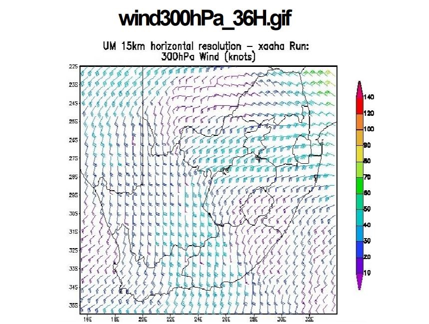
Lee-Ann Simpson and Jannie Stander from the South-African Weather Service started the first session of the WWW-Briefing. Lee-Ann gave a weather briefing for the South-African region and Jannie introduced the conceptual models of cold fronts and cut-off lows as they appear on the southern hemisphere.
Length: 50 min
Author: Lee-Ann Simpson, Jannie Stander
Lee-Ann Simpson is currently working as a meteorological trainer in the Regional Training Center (RTC) in Pretoria. She worked as an operational forecaster from 2003-2008, after which she started in the training department. She presently lectures to Post graduate forecasting students, focusing on specialized weather forecasting and satellite meteorology. Through the University of Pretoria, she lectures satellite meteorology and Tropical meteorology to honours students. Her interests lie in short term forecasting, severe weather and all satellite based interpretation of weather phenomena. She has a BSc (Hon) in Meteorology from the University of Pretoria and she is currently completing her MSc through the same institution.
Jannie Stander has worked as an operational weather forecaster from 1998 to 2005. Since 2006 Jannie has been working in the Regional Training Centre at Pretoria providing marine (2006-2008) and aviation forecaster training (2008-current). His main interests are aviation meteorology, synoptic meteorology and satellite interpretation and he is involved with several international working groups within these disciplines. He holds a BSc Hons degree in Meteorology at the University of Pretoria and is currently completing his MSc at the same University.
A typical location for the development of Cbs and Mesoscale Convective Systems is at the leading edge of frontal cloud bands.
Mesoscale Convective Systems frequently develop at the leading edge of frontal cloud bands. This is most likely the situation where there is a specific vertical distribution of air mass and conveyor belts: a warm conveyor belt at low levels in front of the front and a dry intrusion in the layers above. Such a situation develops when a jet streak crosses the front; dry air on the cyclonic side of the jet axis overruns the frontal cloud band and reaches its leading edge. Whilst the relative streams of the dry intrusion are sinking behind the frontal cloud band, they change to rising during the crossing of the front.
Cloud bands of Cold Fronts in Warm Advection are very similar to those of Cold Fronts, but because of their relation to temperature advection are often weaker and have a higher tendency for weakening.
CF in WA forms, when a Cold Front encounters warm air advection related to an another approaching system. Most often this happens, when a new wave forms within a Cold Front. Cold Fronts in Warm Advection, abbreviated CF in WA, are principally like normal Cold Fronts, but they are wholly within warm advection. The warm advection is generally weak, and it is weaker behind the frontal zone than ahead of it. In summer the Cold Fronts in Warm Advection are nearly as common as Cold Fronts in Cold Advection, but in winter they are rare. CF in WA forms, when a Cold Front encounters an area of warm advection connected to another, approaching system. Usually this system is a Warm Front, either a wave forming within the Cold Front, or another cyclone catching up the Cold Front. It can also be Detached Warm Front, Warm Conveyor Belt, Baroclinic Boundary, or an Occlusion with warm advection ahead of it. CF in WA is often a relatively old, weakening front. This stage does not last long (typically less than 12 hours), and it soon turns into some other type of Cold Front or a Wave, or just disappears.
A preferred area for the initial development of deep convection is the boundary of Dark Stripes in the WV images.
Analyses of satellite images and loops show that the first appearance of deep convection in fair weather conditions can be associated with the transition zone between relatively humid and dry air at levels above 600 hPa. Because of the absence of a frontal cloudband or any extensive cloud area this type of convection is called convection under fair weather conditions. Deep moist convection depends on the available moisture, conditional instability and a source of lift. This lift needs to be sufficient in order to move an air parcel to its level of free convection, initiating the process of deep convection.
A Split Front is very similar to a Cold Front cloud band but shows a distinct double structure with cold (high) tops at the leading and warm (low) tops to the rear.
A Split Front is accompanied by a cyclonically curved cloud band, which, contrary to a classical Cold Front, contains a distinct double banded structure with cold cloud top temperatures at the leading edge and warmer cloud top temperatures at the rear edge. The conceptual model of a Split Front is strongly associated with jet streaks and sinking of very dry stratospheric air. The initial stage of a Split Front is generally an Ana Cold Front type. In contrast to the Ana Cold Front, the Warm Conveyor Belt is overrun aloft by the relative stream of the dry intrusion. This process takes place as the warm air ascends ahead of the surface cold front with a forward component relative to the frontal system.
Cloud bands of Cold Fronts in Cold Advection are very similar to those of Cold Fronts, but because of their relationship with temperature advection, they are often weaker and have a higher tendency for weakening.
Usually Cold Fronts are associated with cold advection behind the frontal zone and warm advection ahead of it, but sometimes the whole front is under cold advection. These are called Cold Fronts in Cold Advection. Cold Fronts in Cold Advection form mostly over the Atlantic, and are more common in the winter than during the summer season. The stage of Cold Fronts in CA last generally 0,5-2 days. In the earlier stages there is often a significant dark stripe behind the front due to the very cold dry air.
Cold Fronts are accompanied by synoptic scale multilayered cloud bands.
Fronts generally form within a baroclinic boundary between cold and warm air masses. The main physical process for the development of Cold Fronts is the movement of the cold air against warm air. The warm air ascends along the boundary while the cold air sinks below it. If there is enough humidity, the upward motion leads to condensation and to the development of clouds and precipitation. Cold Fronts can be devided into two types: Ana and Kata Cold Fronts. The main feature which separates the different types of Cold Front is the orientation of the jet relative to the front in the middle and upper levels of the troposphere. It is generally considered that a Kata Cold Front evolves from an Ana Cold Front. As baroclinic disturbances often develop over the Atlantic, the newly developed Ana Fronts can mainly be found there, whereas older, continental fronts are mostly Kata type. Another reason for the spatial differences might be that the lower parts of the front are decelerated due to the friction of the continent, while the upper parts continue with higher speed.
A CCB Occlusion is accompanied by a distinct cloud spiral; the cloud of the CCB Occlusion protrudes below the WF-CF cloud band and has lower tops.
An occlusion cold conveyor belt is characterized by a lower ceiling in comparison to the corresponding frontal system. In satellite imageries this lower cloudiness seems to be separated to the frontal cloud band. This is a result of the cold conveyor belt that transports cold sinking air into that region. Additionally the jet crosses the boundary between frontal system and the occlusion which is in contrast to general frontal systems. In consequence in the area of the occlusion the upper leves are rather dry (dry intrustion) due to sinking of dry, stratospheric air masses. This is the second reason why the occlusion cold conveyor belt appears in darker shades of grey than the corresponding frontal system.