
Volcanic Ash
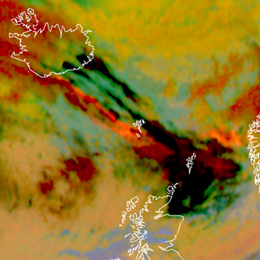
This module provides a guideline on how to assess the threat of volcanic ash. Therefore several tools based on satellite data can be consulted. Prominent examples are the Ash RGB or the use of IASI data.
Extreme weather conditions such the presence of volcanic ash can put aircraft navigation into major difficulties. If an aircraft encounters volcanic ash the navigation gets extremely challenging. Between 1975 and 1994 more than 80 jet airplanes were damaged due to unplanned encounters with clouds of volcanic ash. Seven of these encounters caused in-flight loss of jet engine power, putting the passengers lives at severe risk. Therefore the correct assessment of the weather conditions is essential to ensure save flight conditions. This training module is dedicated to forecasters/aviation forecasters. The main intention is to provide a guideline on how to assess the potential of hazardous weather events such as volcanic ash. For this purpose several tools based on satellite data can be consulted.