
Weather
Presentation during the event week on Convection in June 2008.
Marianne Koenig (EUMETSAT) demonstrated the GII product. For the forecaster this was a very interesting talk as it showed the advantages the use of GII has to a model. Case studies saw the potential the GII product has and which added value(!) the GII has to a normal model run.
The lecture was followed by Maurice Schmeitz from KNMI on the development and verification of a new model output statistics (MOS) system, which is intended to help the forecasters to decide whether a weather alarm for severe thunderstorms should be issued.
Presentation during the event week on Convection in June 2008.
Marianne Koenig (EUMETSAT) demonstrated the GII product. For the forecaster this was a very interesting talk as it showed the advantages the use of GII has to a model. Case studies saw the potential the GII product has and which added value(!) the GII has to a normal model run. The session was followed by Jenni Teittinen from the Finnish Meteorological Institute who talked about warnings and the assessment of warnings in Finland.
Presentation during the event week on Convection in June 2008.
Guy Kelman (Hebrew University of Jerusalem) also showed some more examples of nowcasting convection over the States. The session was followed by a very good presentation of Natasa Strelec Mahovic (DHMZ) who in depth presented what material and products the Forecaster have available in Croatia when they start their working day and the day turns out to be convective.

Presentation during the event week on Convection in June 2008.
Guy Kelman (Hebrew University of Jerusalem) explained the relationship between cloud top temperature and effective radius and emphasised the advantage this can have on the lead time and the possibility to nowcast areas with a high potential of severe convection. The session was followed by Wilfried Jacobs (DWD) on the Automatic weather and product monitoring (Automon).

Presentation during the event week on Convection in June 2008.
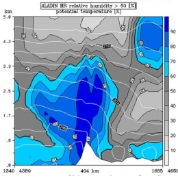
The session includes presentations from Martin Setvak dealing with the MSG observations of cold-ring shaped storms and their comparison with CAPPI radar data. More information is found in this Power Point. The session is continued by the Austrian Meteorological Service (ZAMG) on severe convection and hail warnings.
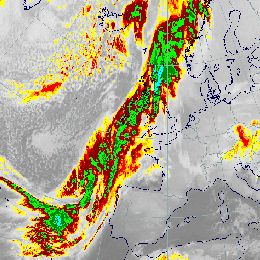
This case study a pronounced frontal system over west and central Europe causing strong precipitation.
Pronounced frontal system over West and Central Europe, causing strong precipitation. All associated Conceptual Models and the development of a Back Bent Occlusion are addressed in detail.
This case study treats a dominating cold front over Western Europe.
This case study shows a dominating cold front over Western Europe. Special attention is drawn to the substructures within the frontal cloud band associated with the jet streak: Front Intensification and Wave.
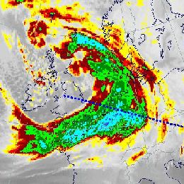
This case study shows an extended long frontal cloud band west of Europe consisting of cold front in cold advection and cold front in warm advection is diagnosed.
This case study shows an extended long frontal cloud band west of Europe consisting of cold front in cold advection and cold front in warm advection is diagnosed. Frontal substructures and a succeeding rapid cyclogenesis over the Atlantic are analysed.
This case study shows a cold front with a distinct wave over France and a special investigation about a rapid cyclogenesis over the northern Atlantic.
This case study shows a cold front with a distinct wave over France and a special investigation about a rapid cyclogenesis over the northern Atlantic.
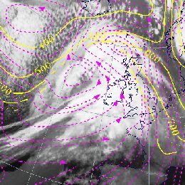
This case study shows a pronounced frontal system over the Atlantic and western Europe.
This case study shows a huge frontal system over the Atlantic and western Europe. A rapid cyclogenesis is associated with this system but deviating from the initial CM.
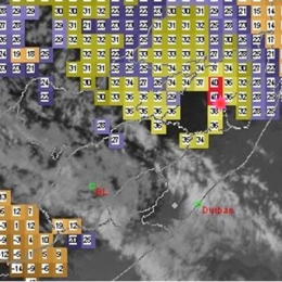
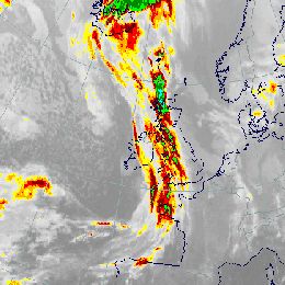
This case study treats a cold front containing strong convective activity over Western Europe.
This case study shows a cold front containing strong convective activity over western Europe. The development and life cycle of the convective cloud features are examined in detail.
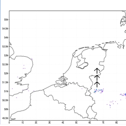
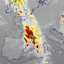
Flood catastrophe in Central and Eastern Europe due to an Upper Level Low.
Flood catastrophe in Central and Eastern Europe due to an Upper Level Low. Convective precipitation and barrage effects lead to extraordinary precipitation events.