
Luca Brocca (Italian National Research Council / Research Institute for Geo-Hydrological Protection / H SAF) - Combined use of multiple satellite-derived variable (precipitation, evapotranspiration, soil moisture, and snow) for monitoring drought
Luca Brocca shows how to combine multiple satellite derived variables to monitor drought.
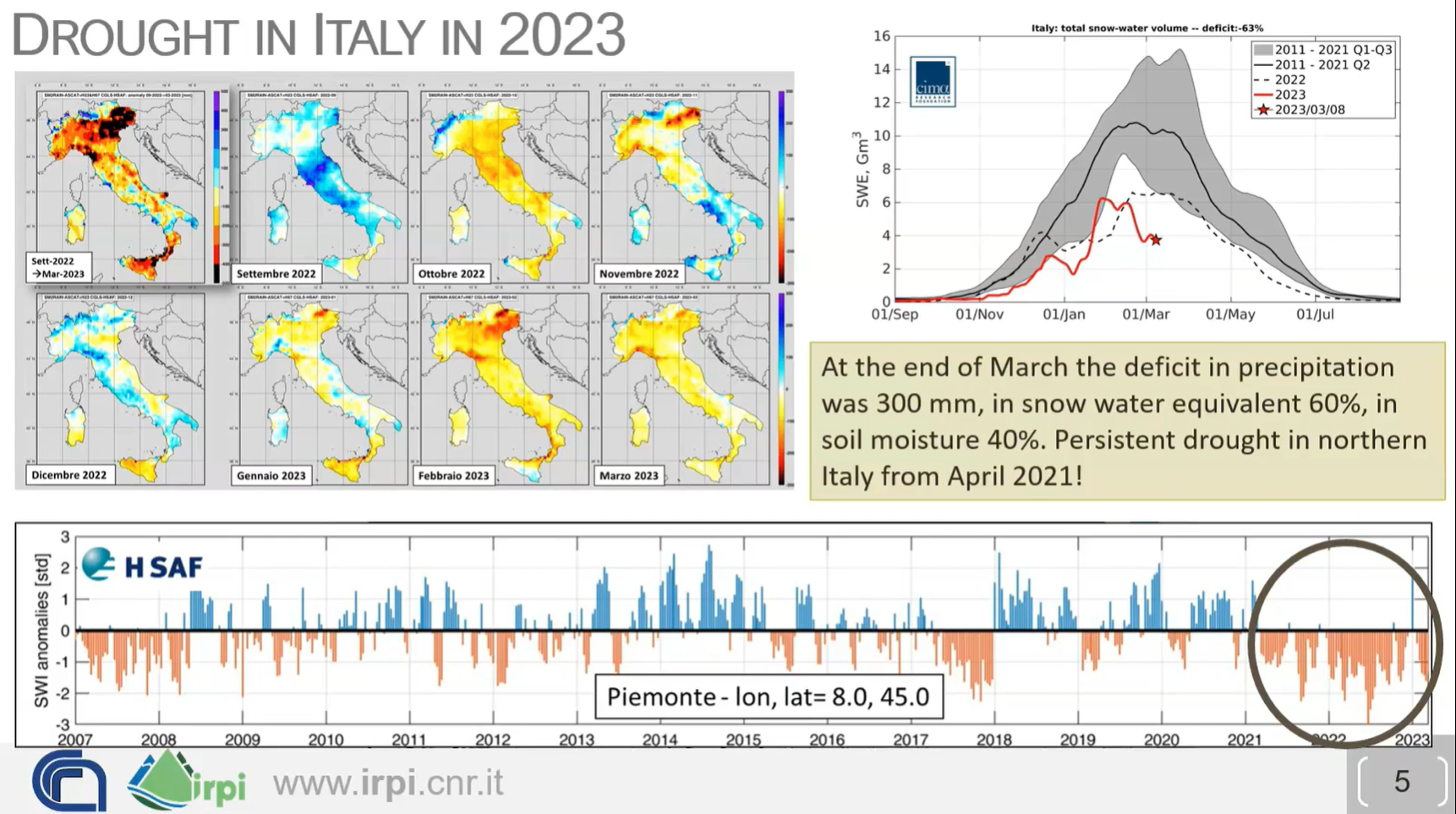
How do we monitor drought? Is it enough to use only precipitation data and calculate the SPI (Standardized Precipitation Index)? New satellite-derived products (precipitation, evaporation, soil moisture and snow) offer additional ways to monitor drought in space and time, to assess WHERE the water is (surface soil, root zone soil, snowpack), and thus to know WHEN the water will be available. Real-world case studies will be analyzed together with the participants, also using an interactive platform (https://explorer.dte-hydro.adamplatform.eu/). The objectives of the lecture are: (1) to assess drought risk based on (new) satellite observations, and (2) to translate drought risk information into real-world decisions for water resources management (e.g., reservoir management, irrigation, hydropower generation).