
Alois Holzer (ESSL) - New opportunities for better nowcasting severe convection by using MTG
Alois Holzer talks about what MTG means for convection forecasting/nowcasting and goes over the topic of lightning imager in more detail.
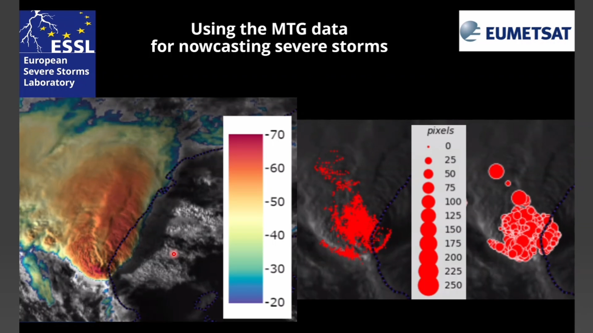
MTG offers a number of both improved and new opportunities for nowcasting severe thunderstorms. For the pre-convective phase, the new 0.9 micron channel allows for the first time for a high-quality 2D visualization of total column moisture, more specifically under cloud-free daylight conditions. By looping such imagery, forecasters can follow the buildup or advection of atmospheric moisture in currently 10-minute and soon 2.5-minute steps, i.e. near real-time, which can be important information under certain weather conditions. For convection initiation, again under daylight conditions, the new Cloud Phase and Cloud Type RGBs offer a clear distinction between water droplets and ice crystals, i.e. give clear indication on the glaciation of growing cumulus clouds providing potential extra lead-time before the first lightning flash can be detected. The lightning imager (LI) will complement this information with a good ability to detect early intra-cloud lightning, typically before the first cloud to ground strike does occur for both day and night. During the mature phase of convective storms, the improved spatial (and soon also temporal) resolution of FCI compared to SEVIRI allows us much better than before to see storm-top features strongly indicative for severe convective storms – like distinct OTs and AACPs (for example in Sandwich imagery). The LI point data with its pseudo-high resolution that provides much finer data than one would expect from the nominal pixel grid (based on the principle of radiance-weighted centroids) has demonstrated to highlight especially severe hailstorms with distinctive ringlike features.