
Identify cloud types and their characteristics
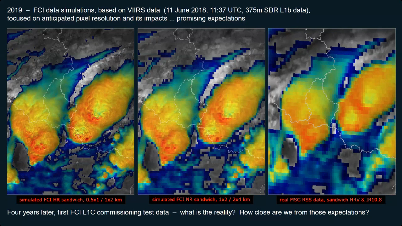
Martin Setvak demonstrates comparison between new FCI data with MSG and VIIRS, focusing on convective storms.
The presentation will address preliminary comparison of the MTG-I1 FCI imagery (based on FCI commissioning data) with MSG SEVIRI and NPP/JPSS VIIRS data, with focus on convective storms.
Cloud Phase RGB is a new product for European users of GEO satellite data, which can be constructed using data from the Flexible Combined Imager (FCI) on the Meteosat Third Generation (MTG) satellite system. The aim of this RGB is to provide improved microphysical information on cloud tops, in particular discrimination between thick water clouds and thick ice clouds, and cloud top particle size.
This extended guide is about the Cloud Phase RGB, a new product for European users of GEO satellite data, which can be constructed using data from the Flexible Combined Imager (FCI) on the Meteosat Third Generation (MTG) satellite system. It uses one of the new FCI channels, not available with the SEVIRI instrument. This document is an extended guide discussing its characteristics in detail; a quick guide is also available on the EUMeTrain webpage. In this guide, the imagers of Japanese and American geostationary satellites (Himawari/AHI and GOES/ABI) and polar satellites (NPP and NOAA-20/VIIRS) are used to provide proxy data for the FCI.
Identify clouds made of water droplets, ice particles or a mixture and discriminate between clouds with small or large cloud particles.
In this part of the course you will not only learn more about the identification of clouds such as Stratus, Cumulus and Cirrus from satellite images, and you will also discover various methods to derive cloud height information. Microphysical properties of clouds like cloud phase and cloud particle size are also addressed.
To access the resource click here.
Note: all resources are provided as an external link which redirects you to https://eumetcal.eu where you will need to create a user account in order to gain access to the course
Deduce cloud top heights based on brightness temperatures, surface observations and sounding data.
In this part of the course you will not only learn more about the identification of clouds such as Stratus, Cumulus and Cirrus from satellite images, and you will also discover various methods to derive cloud height information. Microphysical properties of clouds like cloud phase and cloud particle size are also addressed.
To access the resource click here.
Note: all resources are provided as an external link which redirects you to https://eumetcal.eu where you will need to create a user account in order to gain access to the course
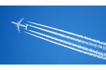
Identify contrails and ship trails.
In this part of the course you will not only learn more about the identification of clouds such as Stratus, Cumulus and Cirrus from satellite images, and you will also discover various methods to derive cloud height information. Microphysical properties of clouds like cloud phase and cloud particle size are also addressed.
To access the resource click here.
Note: all resources are provided as an external link which redirects you to https://eumetcal.eu where you will need to create a user account in order to gain access to the course

Identify fogs and discriminate between fog and low cloud.
In this part of the course you will not only learn more about the identification of clouds such as Stratus, Cumulus and Cirrus from satellite images, and you will also discover various methods to derive cloud height information. Microphysical properties of clouds like cloud phase and cloud particle size are also addressed.
To access the resource click here.
Note: all resources are provided as an external link which redirects you to https://eumetcal.eu where you will need to create a user account in order to gain access to the course
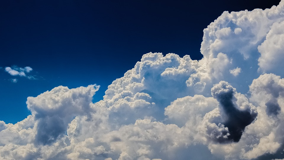
Identify cumulonimbus clouds and their characteristics.
In this part of the course you will not only learn more about the identification of clouds such as Stratus, Cumulus and Cirrus from satellite images, and you will also discover various methods to derive cloud height information. Microphysical properties of clouds like cloud phase and cloud particle size are also addressed.
To access the resource click here.
Note: all resources are provided as an external link which redirects you to https://eumetcal.eu where you will need to create a user account in order to gain access to the course
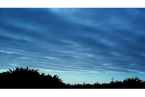
Identify stratiform, cumuliform and cirriform cloud regions and individual cloud forms and their characteristics.
In this part of the course you will not only learn more about the identification of clouds such as Stratus, Cumulus and Cirrus from satellite images, and you will also discover various methods to derive cloud height information. Microphysical properties of clouds like cloud phase and cloud particle size are also addressed.
To access the resource click here.
Note: all resources are provided as an external link which redirects you to https://eumetcal.eu where you will need to create a user account in order to gain access to the course
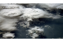
Pia Isolahtenmaki (stepping in for Robert Makitie) presents how FCI proxy data help in differentiating cloud types in low-cloud conditions.
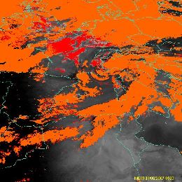
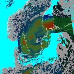
On the 11th of September an almost stationary frontal system occurred over southern Finland leading to development of a large fog cloud over the Gulf of Finland and the Baltic Sea. The fog later moved slowly over southern Finland, where Finland’s busiest airport, Helsinki-Vantaa airport, is located. The fog cloud that occurred over the Gulf of Finland was hard to spot from SEVIRI images due to different layers of middle and high clouds. When thinking about the future, the question arises, would the FCI have spotted something more in this situation?
Joseph Sienkiewicz gives a presentation on satellite altimeters. He compares the satellite altimeter data from different sensors with NWP forecast data.
Conventional observations of wind and wave data from ships and buoys are limited by coverage. Due to the increasing size of ships, observers are more removed from the ocean surface and wave estimation is more difficult. Satellite altimeters are a downward pointing radar that scan the oceans and provide very accurate observations of wave height, wind speed, sea surface height anomaly. Our understanding of sea level-rise is due in large part to the record of altimeter based sea level data.
Forecasters responsible for ocean and coastal waters must rely on any information for situational awareness and to keep forecasts relevant. Satellite altimeters provide very accurate coincident measures of significant wave height and wind speed. Integrated data display and product generation systems offer the opportunity for forecasters to compare a variety of observations, imagery, and numerical model predictions to enhance awareness and communicate hazards to mariners. This session will discuss the use by forecasters of altimeter wave and wind data with other sources in an operational forecast center.
Hervé Le Gléau and Thomas Krennert give an overview on the NWC-SAF cloud products and their applications.
In this 30 minutes presentation, Hervé Le Gléau (MFL) gives an overview of the cloud products that can be retrieved from the MSG/NWCSAF software. These products are the cloud mask (including dust and volcanic ash flag), the cloud type (including the cloud thermodynamical phase), and the cloud top temperature and height. The algorithms will be outlined and some validation results presented. Finally short information will be given on the new cloud microphysics product planned in the NWC/GEO software version 2015.
In a second talk, Thomas Krennert from ZAMG will present case studies using the NWCSAF Cloud Products.
Anna Eronn gives an overview on the NWC-SAF PPS products and their applications, Thomas Heinemann presents the Eumetcast system.
The PPS package for Polar orbiting satellites produces Cloud Products for NOAA, METOP and the NPP-Suomi satellites. Products available are Cloud mask (CM), Cloud Type (CT), Cloud Top Temperature and Height (CTTH) and Cloud Physical Properties (CPP) during day CPP validated outputs are cloud phase and cloud liquid water path, as well as the auxiliary output fields cloud optical thickness, effective droplet radius and ice water path.
While the software package was originally aimed at producing NWC products for local satellite receiving stations, a subset of cloud products (CT and CTTH) are now also available in near real time via EUMETCAST within the NWC-EARS service.
In a second talk, Thomas Heinemann will present the EARS-NWC service. Data from the SAFNWC PPS package are computed at EUMETSAT headquarter and distributed via Eumetcast service to end-users.