
Satellite skills and knowledge for operational meteorologist
Listed here are other resources related to Satellite skills and knowledge for operational meteorologist tag:
Note: click on an image to open the Resource
Presentation 3 in the MTG-I Event Week 2016
Length: 30 min
Author: Toshiyuki Sakurai (JMA)
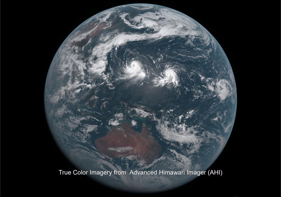
The new-generation geostationary meteorological satellite of the Japan Meteorological Agency (JMA), Himawari-8, started operation in July 2015. Himawari-8 features a new imager, Advanced Himawari Imager (AHI), with 16 bands. The imager's spatial resolution and observation frequency is improved comparing with its predecessor satellites, MTSAT-series. This presentation will be an overview of Himawari-8/9. It will focus on the imaging capabilities and the data distributions.
Presentation 2 in the MTG-I Event Week 2016
Length: 30 min
Author: Daniel Lindsey (NOAA)
The next generation of geostationary satellite, GOES-R, is scheduled for launch in November, 2016. NOAA has been preparing for the data from its Advanced Baseline Imager and Geostationary Lightning Mapper for over 10 years, but recently JMA launched Himawari-8, a geostationary satellite with a similar imaging instrument. This presentation will show how Himawari-8 data has been used to prepare for similar data to begin flowing in early 2017. Meteosat Third Generation (MTG) will also carry a similar imager, so lessons learned from Himawari and GOES-R will be helpful for MTG data users.
Presentation 1 in the MTG-I Event Week 2016
Length: 30 min
Author: Jochen Grandell (EUMETSAT)
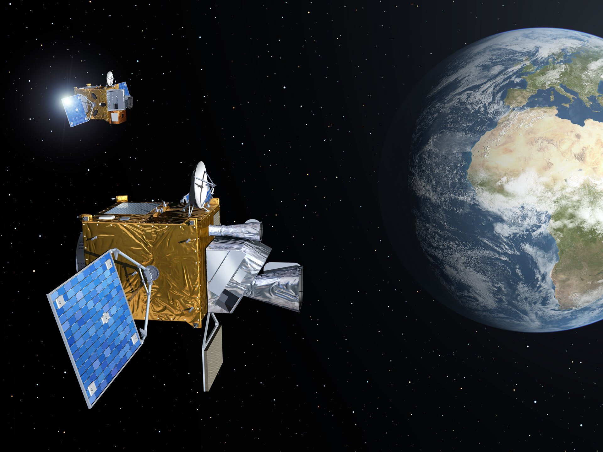
Jochen Grandell starts his presentation by introducing the Meteosat program from the beginning. Then he explains what the MTG mission is and what kind of instruments will be on-board the MTG satellites. He introduces the Flexible Combined Imager (FCI) and the Lightning Imager (LI). The differences between SEVIRI on-board MSG and FCI are discussed in more detail. The measurement technique of the LI is shown together with the role of this very new instrument.
Presentation 1 of the Environment Event Week 2016
Length: 30 min
Author: Oleg Dubovik (University of Lille)
The GRASP (Generalized Retrieval of Aerosol and Surface Properties) algorithm has been developed for enhanced characterization of the properties of both aerosol and land surface from diverse remote sensing observations. The overall concept of the algorithm is described by Dubovik et al. (2014), while the detailed are given in the paper is by Dubovik et al. (2011). The algorithm is based on highly advanced statistically optimized fitting implemented as Multi-Term Least Square minimization (Dubovik, 2004) and deduces nearly 50 unknowns for each observed site. The algorithm derives a set of aerosol parameters similar to that derived by AERONET including detailed particle size distribution, the spectral dependence on the complex index of refraction and the fraction of non-spherical particles. The algorithm uses detailed aerosol and surface models and fully accounts for all multiple interactions of scattered solar light with aerosol, gases and the underlying surface. All calculations are done on-line without using traditional look-up tables. In addition, the algorithm can use the new multi-pixel concept - a simultaneous fitting of a large group of pixels with additional constraints limiting the time variability of surface properties and spatial variability of aerosol properties. This principle provides a possibility to improve retrieval for multiple observations even if the observations are not exactly co-incident or co-located. Significant efforts have been spent for optimization and speedup of the GRASP computer routine and retrievals from satellite observations. For example, the routine has been adapted for running at GPGPUs accelerators. GRASP inherits many aspects used in AERONET retrieval. At first GRASP has been developed for POLDER/PARASOL multi-viewing imager and later adapted to a number of other satellite sensors such as METEOSAT/MERIS at polar-orbiting platform and COCI/GOMS geostationary observations. It can be equally applied to ground-based AERONET and lidar observations. The results of numerical tests and results of applications to real data will be presented.
Presentation 2 the Environment Event Week 2016
Length: 30 min
Author: Rudiger Lang (EUMETSAT)
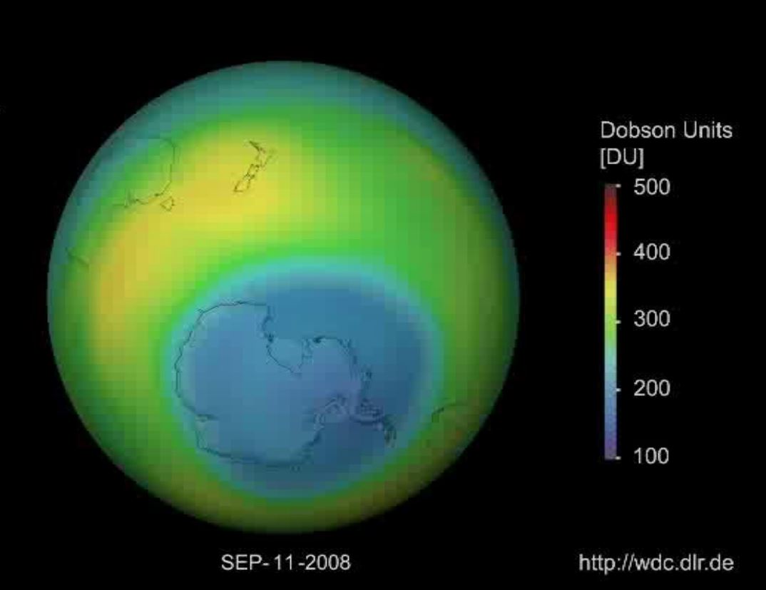
The monitoring of trace-gases, pollution and aerosols is important both for the quality of current and future weather forecast model output, as well as for the direct monitoring of aircraft safety, pollution levels, and other health related issues. Satellite instruments on-board EUMETSATs operational platforms, like on the Low-Earth Orbit (LEO) Metop platform, or the Geostationary Orbit (GEO) MSG platform, and their future successors EPS-SG and MTG, provide unique long-term monitoring capabilities of atmospheric composition addressing many of these issues. We will introduce the capabilities of instruments on these platform to retrieve trace-gases from ozone to nitrogen dioxide, CO and of greenhouse gases like methane, as well as their capability to retrieve aerosol optical and microphysical properties including volcanic ash. We will provide examples on how these products are used in current and future versions of numerical forecast models which include atmospheric chemistry processes, like in the model provided by the Copernicus Atmospheric Monitoring Service (CAMS).
Presentation 3 the Environment Event Week 2016
Length: 30 min
Author: Tommi Bergman (FMI)
The aerosols have recently been incorporated into increasing number of global climate models. Aerosol models in global climate models are validated using variety of ground-based observations and satellite retrievals. Both data have their own advantages and disadvantages. For example, in-situ observations of particle size and composition give exact information on the aerosol distribution for small regions on the ground while satellite retrievals give a broader view on the global distribution of aerosols. In both cases the rather coarse spatial and temporal resolution of the global models increase the difficulty of using these data for their validation. I will demonstrate the limitations of the satellite retrievals and in-situ observations when comparing with models and demonstrate how, for example, collocation of the data can help to improve the match between models and observations.

Presentation 4 the Environment Event Week 2016
Length: 30 min
Author: Stefan Schneider (ZAMG)
Droughts are one of the most severe natural hazards with regard to affected people, spatio-temporal extension and economic losses. At the same time, population growth is expected to put global agricultural production under increasing pressure. Thus, drought monitoring and forecasting systems would be essential for large parts of the globe, and satellites are a valuable data source to establish such monitoring systems.
The presentation will give examples on the relevant parameters measured by satellites, whereas the focus will be on soil moisture. Furthermore, the combination of satellite measurements and model forecasts will be described to point out the state-of-the-art possibilities in forecasting drought events. Examples from an existing system will be presented for the region of Eastern Africa.
Presentation 5 in the Environment Event Week 2016
Length: 30 min
Author: Helen Worden (NCAR, Boulder)
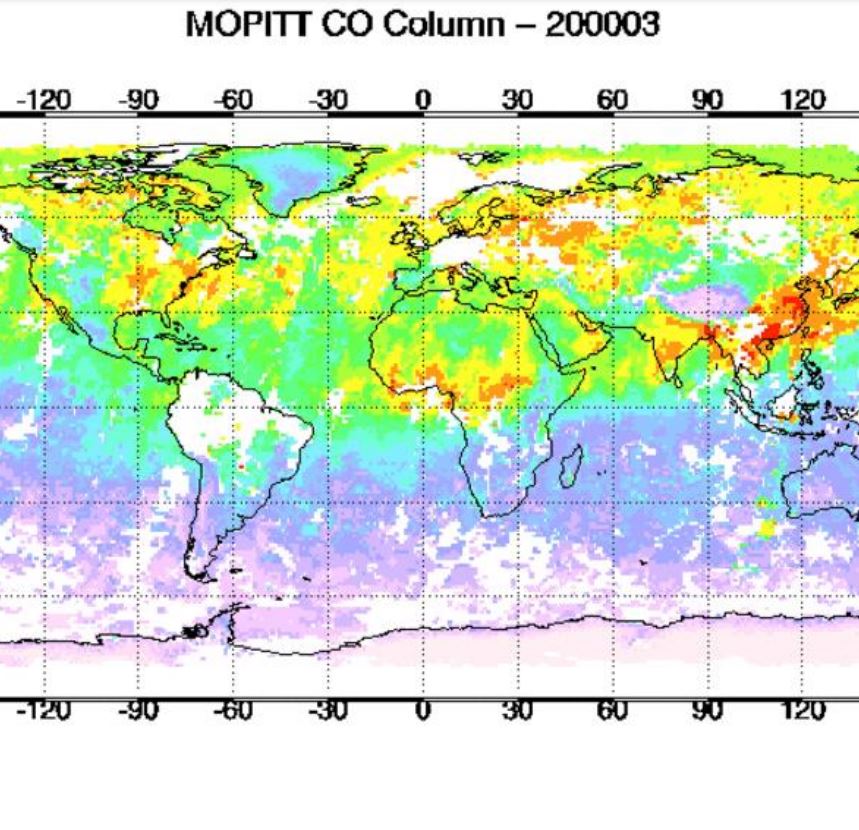
Measurements Of Pollution In The Troposphere (MOPITT) on the NASA Terra spacecraft has been measuring the global atmospheric abundance of carbon monoxide (CO) since March 2000. Carbon Monoxide is mainly produced by incomplete combustion from both natural fires and anthropogenic activities and is also a product of chemical reactions with other air pollutants. These pollution sources have a large effect on both local and downwind air quality, as well as climate change. We will show how satellite measurements of carbon monoxide are used to understand how pollution is emitted and transported globally, from large scale fires to urban sources.
Presentation 6 in the Environment Event Week 2016
Length: 30 min
Author: Mike Fromm (NRL)
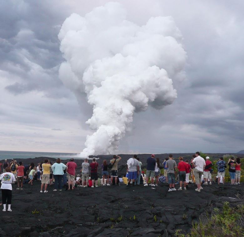
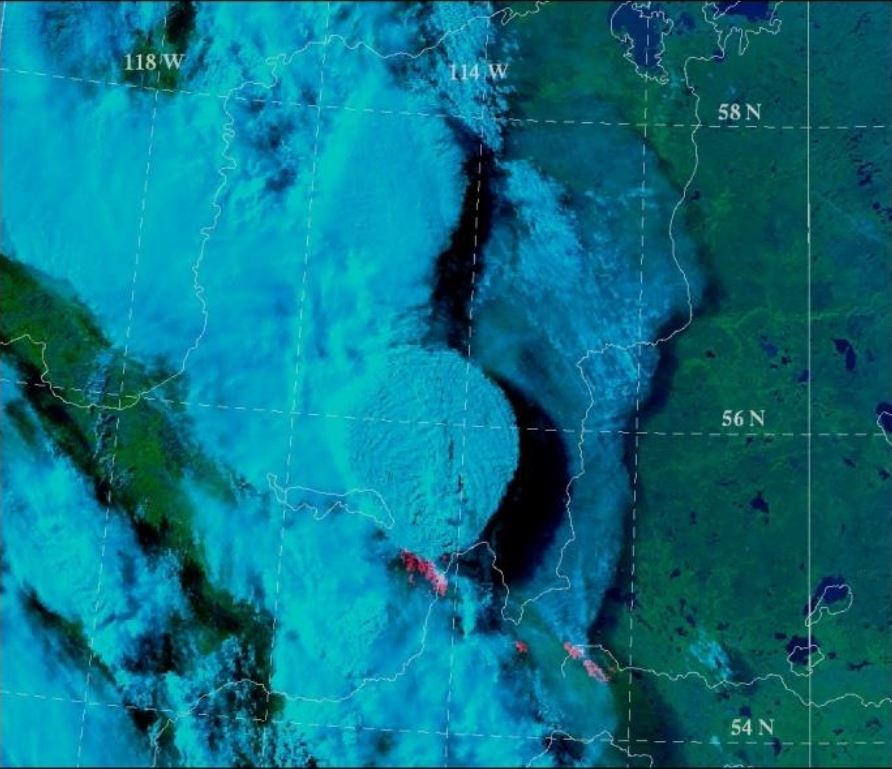
Pyroconvection is not a new concept. However, the idea that pyroconvection can be explosive enough to inject a smoke plume into the stratosphere that pollutes hemispherically, goes against the grain of textbook atmospheric physics. Since the discovery of forest fire smoke in the stratosphere, skepticism has given way to acceptance, understanding, excitement, and wonder. That is because pyrocumulonimbus (pyroCb for short) research continues to make more discoveries, involve growing collaborations, and invite new questions.
This presentation will be an overview of pyroCb research. It will focus on observations from satellite sensors. Emphasis will be on platforms such as MODIS, AVHRR, GOES, TOMS, OMI, GOME 2, and CALIPSO. Also to be explored will be the curious historic connection between pyroCb and volcanic eruptions.
Presentation 7 in the Environment Event Week 2016
Length: 50 min
Author: Mike Willmott (BOM)
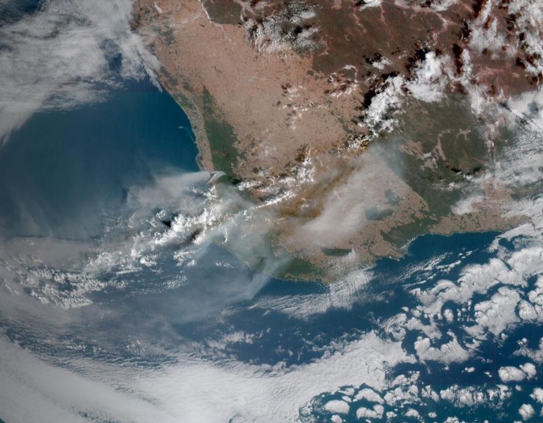
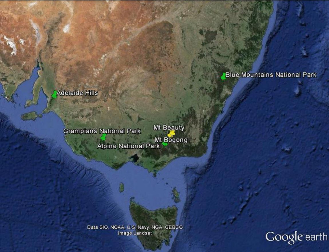
Apart from the central desert areas, the Australian landscape, from the tropics of Far North Queensland to the southern tip of Tasmania has climatic conditions and vegetation which are conducive to wildfires throughout the year. The most volatile of these areas being the south eastern parts of Australia which includes the states of South Australia, Victoria, New South Wales and Tasmania. Australia has large tracts of wilderness which can only be monitored by aircraft and satellite and as such, remote sensing for bushfires within the landscape is virtually mandatory throughout the dry season in the tropics and the summer periods for the southern states. This talk looks at some of the ways that Satellite Remote Sensing has assisted emergency managers for preparedness, response and recovery, the three most important factors for any emergency operation.
Presentation 8 in the Environment Event Week 2016
Length: 30 min
Author: Kerstin Schepanski (TROPOS)
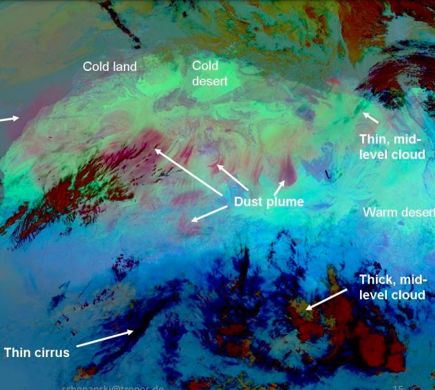
Dust sources are mostly located in remote areas and satellite observations are very suitable for their identification. Different methods inferring active dust sources have been developed in the recent past, which roughly can be separated into direct (e.g., back-tracking of dust plumes to their place of origin) and indirect methods (e.g., frequency of high atmospheric dust loading). Thereby, the accuracy of the identification methods varies with the temporal and spatial resolutions and the ambiguities of the satellite dust retrieval used. In concert with satellite-based dust source characterization, model simulations allow for a holistic assessment on dust sources and their controlling mechanism - ultimately providing insight into the multifaceted nature of the atmospheric dust life-cycle.
Presentation 9 in the Environment Event Week 2016
Length: 30 min
Author: Nan Hao (DLR)
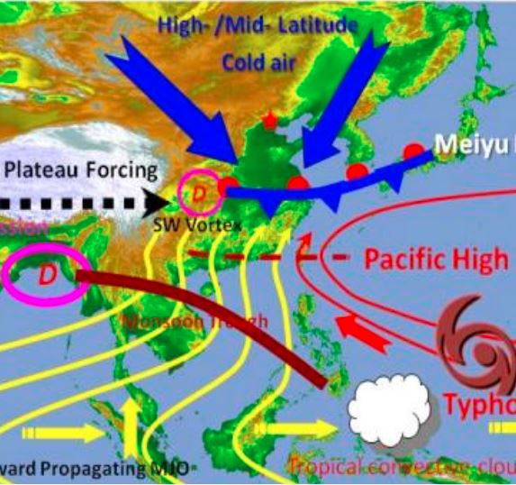
Air pollution is one of the most important environmental problems in developing Asian countries like China. In this region, studies showed that the East Asian monsoon plays a significant role in characterizing the temporal variation and spatial patterns of air pollution, since monsoon is a major atmospheric system affecting air mass transport, convection, and precipitation. Knowledge gaps still exist in the understanding of Asian monsoon impact on the air quality in China under the background of global climate change. For the first time satellite observations of tropospheric ozone and its precursors will be integrated with the ground-based, aircraft measurements of air pollutants and model simulations to study the impact of the East Asian monsoon on air quality in China.