
Satellite skills and knowledge for operational meteorologist
Listed here are other resources related to Satellite skills and knowledge for operational meteorologist tag:
Note: click on an image to open the Resource
Presentation during the event week on Fog and Low Clouds in January 2009.
Wilfried Jacobs (DWD) will talk about COST-722. A project in which 14 countries worked together from November 2001 to May 2007. After an inventory phase about the requirments of customers and forecasters a research and development phase followed during which advanced methods of very short range forecasts of fog, visibility and low clouds were developed. In this presentation an overview about activities and the most important results will be given.
Presentation during the event week on Fog and Low Clouds in January 2009.
Andreas Frank, a forecaster from ZAMG, will give a presentation on the forecast experience of fog at the Austrian Weather Institute. A good description of the different input data is presented and how these add up to make a forecast.

Presentation during the event week on Fog and Low Clouds in January 2009.
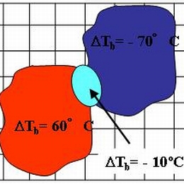
Andreas Wirth (ZAMG) will start the event week with a presentation about fog and low stratus detection from SEVIRI and AVHRR images. The presentation will deal with fog detection during night-time and day-time conditions. A recipe for daytime low cloud detection using several SEVIRI channels will be presented. A rough comparison between different low cloud detection products is planned.
Presentation during the event week on Convection in June 2009.
In 2008 the Slovakian Meteorological Institute (SHMU) has successfully implemented GII in their forecasting room. The difference being that the ALADIN model is used which provides a higher resolution being helpful to the forecasters. Jan Kanak will present this concept and show some examples.
This talk will be followed by Teodoro La Rocca from Italy on the use of air masses classification in the identification of synoptic conditions favourable to the development of convective phenomena.
Presentation during the event week on Convection in June 2009.
Luiz Machado will talk about the use of SEVIRI satellite on the nowcasting of convection in Brazil and Africa.
After this presentation it is back to Europe with a presentation by Maria Putsay from Hungary on the use of MSG SEVIRI data to nowcast convection at her institute. She will speak on the benefit of Meteosat-8 Rapid Scan data.
Presentation during the event week on Convection in June 2009.
Fritz Woelfelmaier from ZAMG (Austria). Using statistical methods from several convection parameters from the LAM model ALADIN AUSTRIA he has developed a severe convection index, which was verified/correlated with lightning data and hail analysis from weather radar data. In the presentation Fritz will explain this method in more detail and show a case studies to demonstrate this benefit. The usefulness of this method has been proven and will subsequently become operational to the forecasters in Austria in the near future.
The session will be continued by Jari Tuovinen from Finnish Meteorological Institute on the Investigation on hail occurrences in MSG.
Presentation during the event week on Convection in June 2009.
Christo Georgiev from the Bulgarian Meteorological Service will talk about Deep moisture convection (DMC) with the thermodynamic context as seen in WV channels 6.2 and 7.3 of Meteosat Second Generation.
The talk will be followed by a practical session done by Estelle deConing from the South African Weather Service who will talk about the successful implementation of GII (Global Instability Index) and the operational use of it, at their weather service using their model as first guess.
Presentation during the event week on Convection in June 2009.
Presentation from DLR where Tobias Zinner and Caroline Forster will present the topic Synthetic satellite images based on COSMO. The talk will be divided in two halves. First, RTTOV implementation into COSMO is explained and Tobias will show applications of synthetic satellite data in the DLR remote sensing and weather forecast groups. Afterwards, Caroline Forster would present her work on the combination of satellite based nowcasting and COSMO forecast via synthetic satellite data.
The second part of this session will be done by Mateja Irsic Zibert from the Environmental Agency of the Republic of Slovenia. The title of her presentation will be on convection in Slovenia: Remote sensing data on selected examples.
Presentation during the event week on Convection in June 2009.
The recent version of NWCSAF has seen a whole list of updates and improvements of the products. One of this is the Convective Rainfall Rate (CRR). This product was developed by AEMET in Spain. Cecilia Marcos will explain the products, the algorithms behind it and show case studies.
The presentation will be followed by Ramon Vazquez who acts as a trainer to AEMET. He will talk about operational nowcasting and monitoring of convection at AEMET.
Presentation during the event week on Convection in June 2008.
Kris Bedka (University of Wisconsin) and John Mecikalski (University of Alabama) gave a presentation on the Convective Initiation (CI) method. The CI product identifies cumulus-type clouds within an MSG image and uses the temporal evolution of the related MSG observations to identify rapidly growing cumulus as likely candidates to evolve into potentially strong convective storms up to one hour in the future.
This session was continued by the Portuguese Met Service (IM). Besides the diagnostic tools from Numerical Weather Prediction models currently in use, satellite and radar products were addressed, including automatic warnings, e.g. for hail.
Presentation during the event week on Convection in June 2008.
Marianne Koenig (EUMETSAT) demonstrated the GII product. For the forecaster this was a very interesting talk as it showed the advantages the use of GII has to a model. Case studies saw the potential the GII product has and which added value(!) the GII has to a normal model run.
The lecture was followed by Maurice Schmeitz from KNMI on the development and verification of a new model output statistics (MOS) system, which is intended to help the forecasters to decide whether a weather alarm for severe thunderstorms should be issued.
Presentation during the event week on Convection in June 2008.
Marianne Koenig (EUMETSAT) demonstrated the GII product. For the forecaster this was a very interesting talk as it showed the advantages the use of GII has to a model. Case studies saw the potential the GII product has and which added value(!) the GII has to a normal model run. The session was followed by Jenni Teittinen from the Finnish Meteorological Institute who talked about warnings and the assessment of warnings in Finland.