
violet
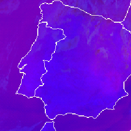
Land surfaces are depicted in medium blue or violet colours in the Severe Storm RGB. Note that if the land is covered by snow the colour will change considerably.
The Severe Storms RGB was developed to highlight the characteristics of the thick ice clouds. The other phenomena are just ‘background’. Cloud-free land and water are blue or violet in this RGB type, having good colour contrast with the colours of ice clouds (red, yellow). See for example the image below.
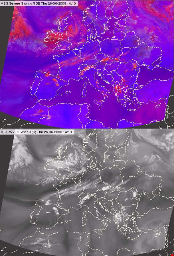
Meteosat SEVIRI Severe Storm RGB image (up) and the (WV6.3-WV7.2) difference image (down) for 26 June 2008 14:10 UTC
In the red colour beam the (WV6.2-WV7.3) channel difference is visualised. The structure of the (WV6.2-WV7.3) channel difference appears also in the cloud free areas - with reddish tones in the blue background. In the figure above both the RGB and the WV channel difference are shown. Land is medium blue on areas with less reddish tones, and violet on areas with more reddish tones.
Explanation of the colours of land surfaces not covered by snow (see the recipe):
• The (WV6.2 – WV7.3) difference is negative for cloud free areas. This results low to medium signal in the red colour beam, (higher signal for dry than for wet mid troposphere).
• The (IR3.9 – IR10.8) difference is around zero for land surfaces resulting almost zero signal in the green colour beam.
• The (NIR1.6 – VIS0.6) difference is positive, resulting strong signal in blue colour beam, (stronger for desert than for vegetated area).
As a consequence the signal will be low to medium in red, almost zero in green and high in blue colour beams for land surfaces.
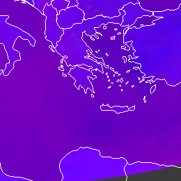
Water surfaces are depicted in dark blue or violet colours in the Severe Storm RGB. Note that if the sea is covered by ice the colour will change considerably.
The Severe Storms RGB was developed to highlight the characteristics of the thick ice clouds. The other phenomena are just ‘background’. Cloud-free land and water are blue or violet in this RGB type, having good colour contrast with the colours of ice clouds (red, yellow). See for example the area of the Mediterranean Sea in the image below.
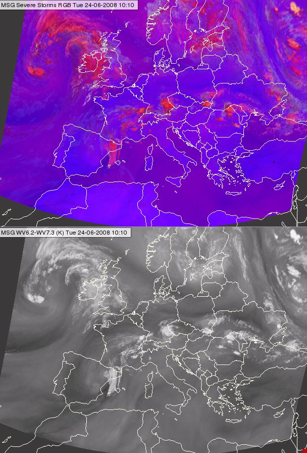
Meteosat, SEVIRI Severe Storm RGB image (up) and the ( WV6.3-WV7.2) difference image (down) for 24 June 2008 10:10 UTC
In the red colour beam the (WV6.2-WV7.3) channel difference is visualised. The structure of the (WV6.2-WV7.3) channel difference appears also in the cloud-free areas - with reddish tones in the blue background. In the figure above both the RGB and the WV channel difference is shown. Water is dark blue on areas with less reddish tones, and violet on areas with more reddish tones.
Explanation of the colours of water surfaces (not covered by ice) (see the recipe):
• The difference (WV6.2 – WV7.3) is negative for cloud free areas. This results low to medium signal in red. (Higher signal for dry than wet mid troposphere).
• The difference (IR3.9 – IR10.8) is small negative for water surfaces resulting almost zero signal in the green colour beam.
• The difference (NIR1.6 – VIS0.6) is small negative, resulting a stronger than medium signal in blue colour beams. (For land it is even stronger.)
As a consequence for water surfaces the signal will be low to medium in red, almost zero in green and stronger than medium in blue colour beams.