
dark blue
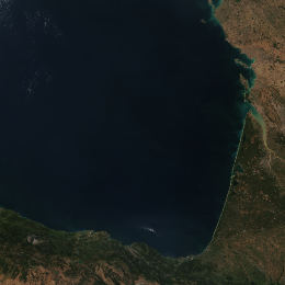
Deep, clean water bodies - most parts of oceans and seas – usually appear dark blue, almost black in the VIIRS True Colour RGB images, except the area of sunglint which is blurred greyish, sometimes whitish.
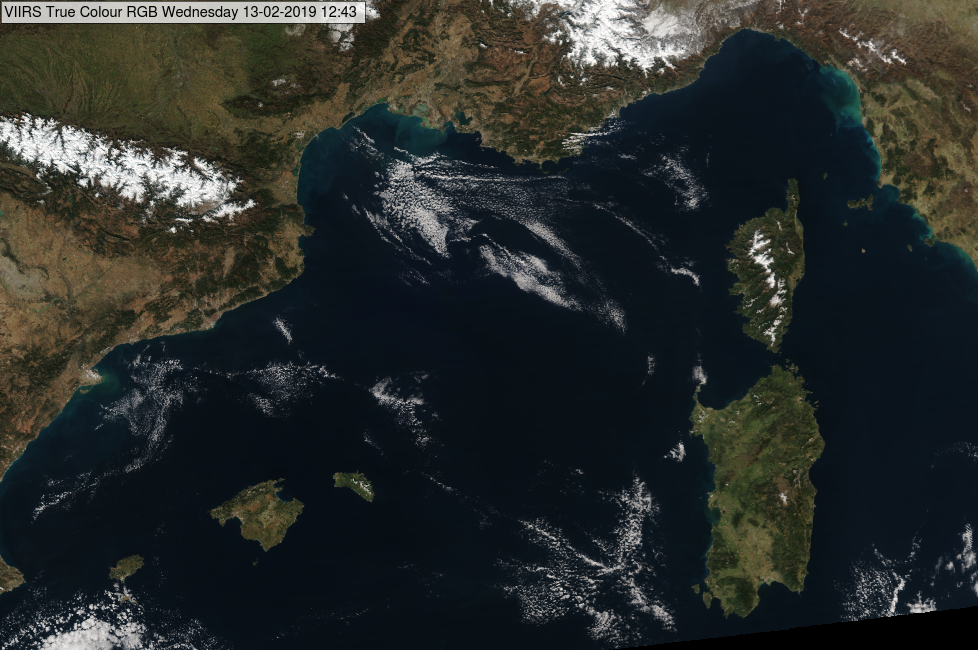
The next images show the Atlantic Ocean and the Mediterranean Sea.
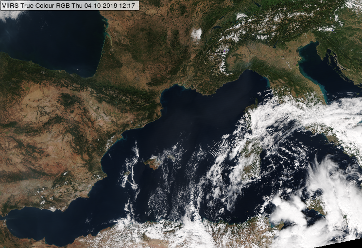
NPP, VIIRS True Colour RGB image for 04 October 2018, 12:17 UTC
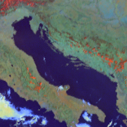
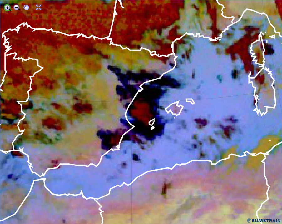
NPP, VIIRS True Colour RGB image for 31 July 2013, 16:29 UTC
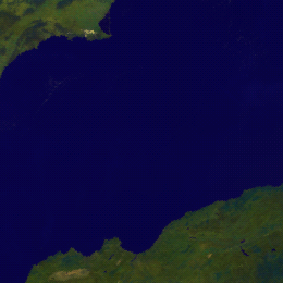
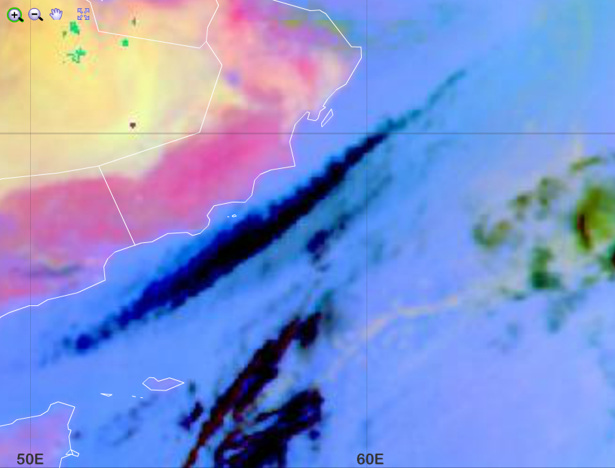
The image below shows sunglint, see the blurred greyish straight strip. A sunglint is the mirror-like reflection of the Sun from a water surface. Sunglint has more complicated structure in case of higher surface roughness (high waves). In the image below the brownish grey area east of the sunglint is dust cloud and the white patches are water and ice clouds.
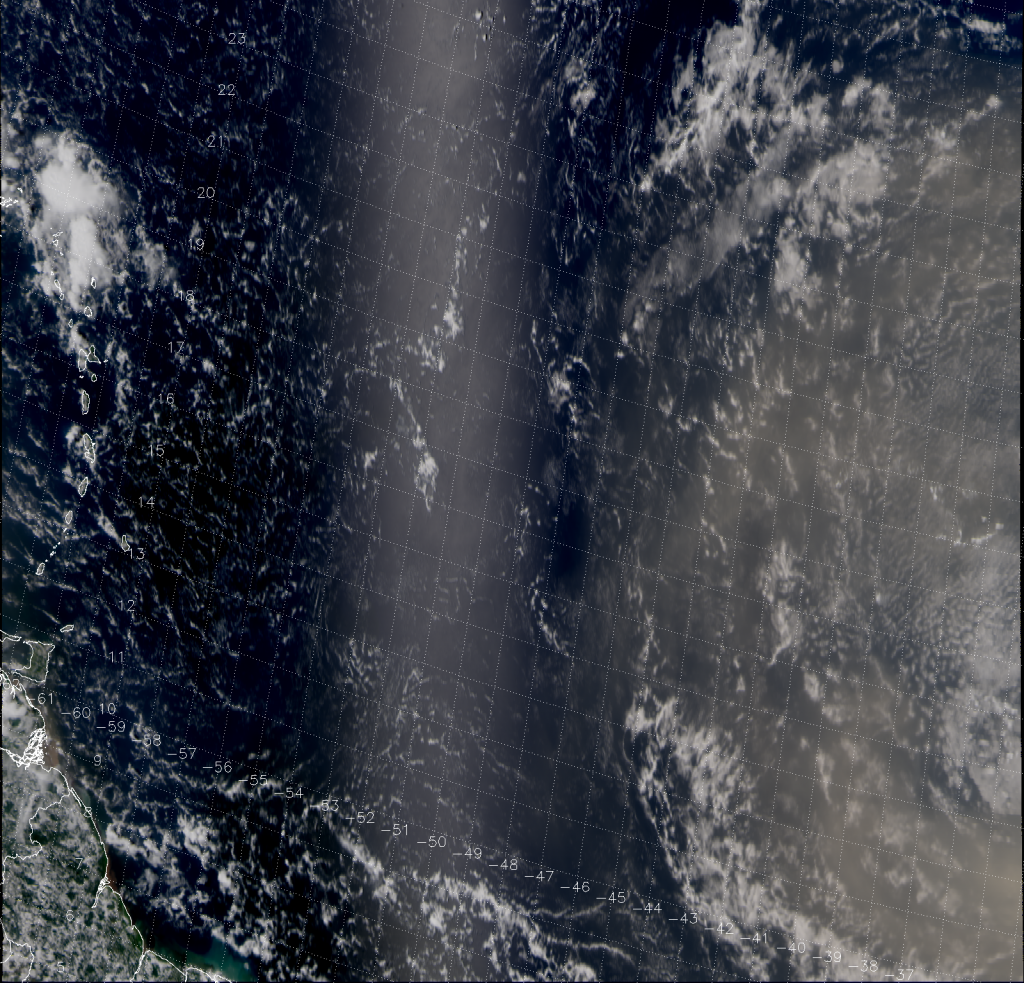
NPP, VIIRS True Colour RGB image for 31 July 2013, 16:29 UTC
(source: http://rammb.cira.colostate.edu/projects/npp/blog/index.php/uncategorized/abafado-bruma-seca/)
Note that:
• The water reflectivity depends not only on the water characteristics but as well as on the solar and satellite viewing directions. Towards the edge of the swath the water colour may be brighter, while along the sub-satellite track it might be darker.
• Sea ice appears whitish.
• If the water is not deep and clean then its colour modifies, see examples separately.
• If there is high concentration aerosol plume above the sea (such as lofted dust, smoke) the colour of the sea trough the aerosol layer turns to greyish/brownish.
Explanation of the colour of deep, clean water bodies in the True Colour RGB (see the recipe):
The reflectivity is very low in all three visible channels, but still a bit higher at lower wavelengths, and so the deep, clean water bodies appear dark blue, almost black in the True Colour RGB.
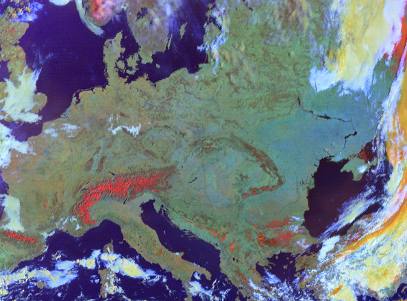
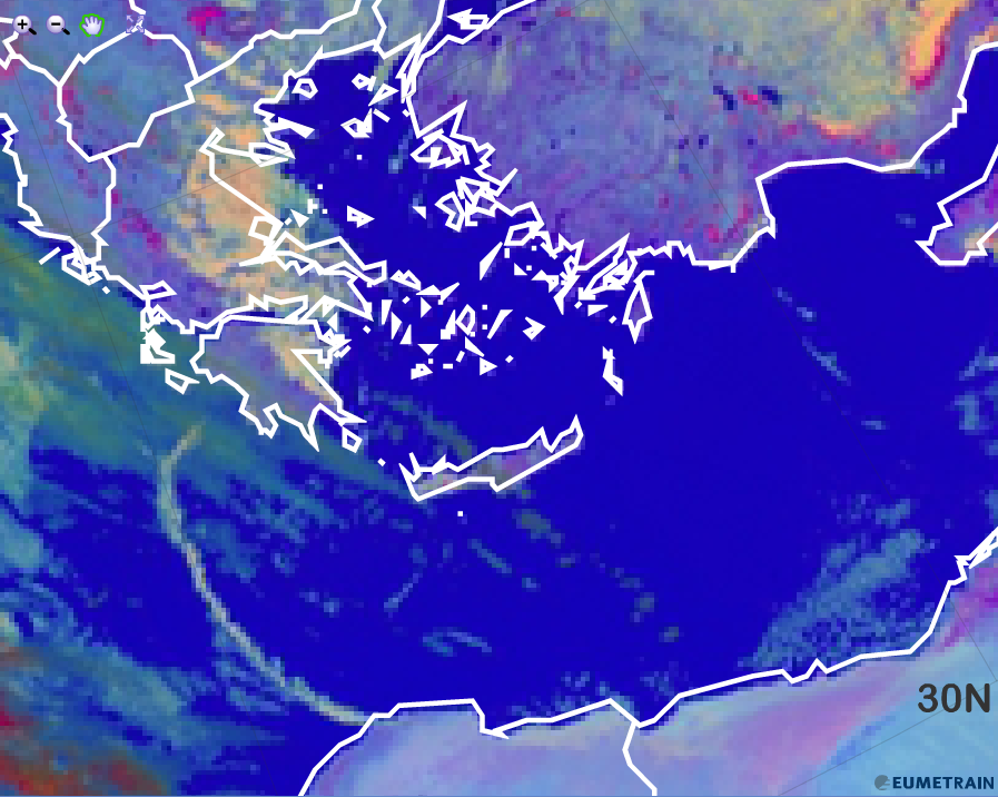
Open water surfaces appear dark blue in the AVHRR Cloud RGB images.
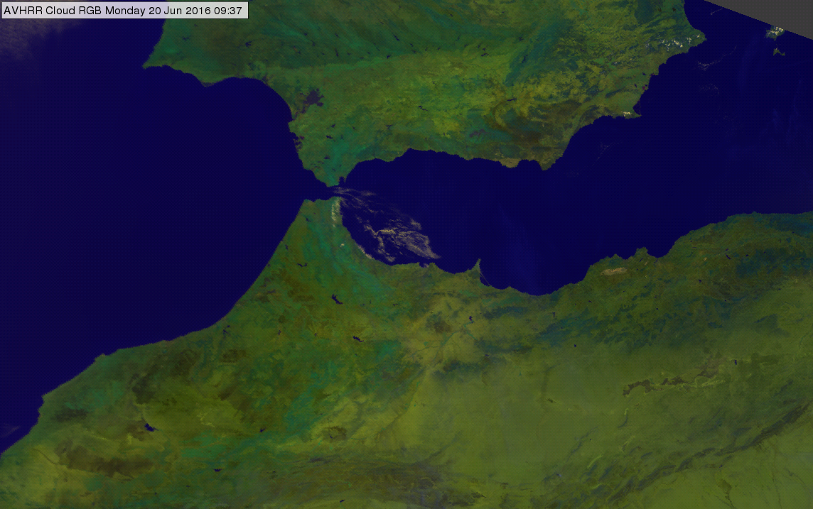
AVHRR Cloud RGB image of the Gibraltar region for 20 June 2016 at 09:37 UTC
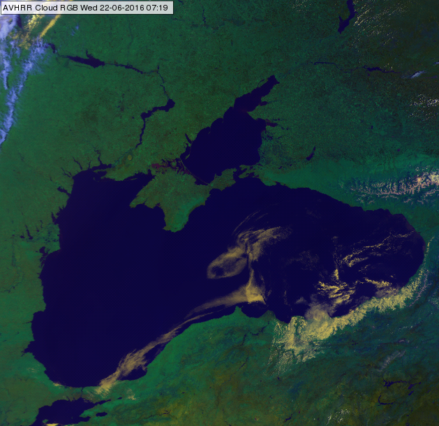
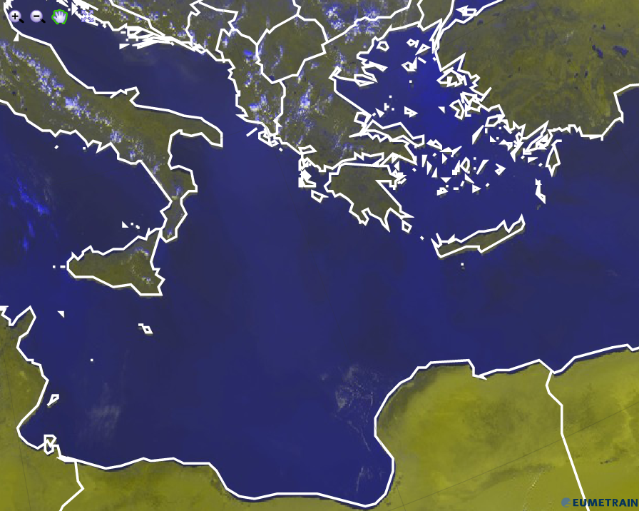
AVHRR Cloud RGB image of the Black Sea and the Dnieper River for 22 June 2016 at 07:19 UTC
Note that:
• If the water is (partly) covered by cloud, fog, ice, snow on ice or vegetation, then its colour modifies.
• In case of sunglint the colour of the water turns yellowish, see example separately.
• In case the water is shallow and/or turbid, its colour may have some magenta tone. The example below shows the Caspian Sea. Close to its east coast the water has a slight magenta tone.
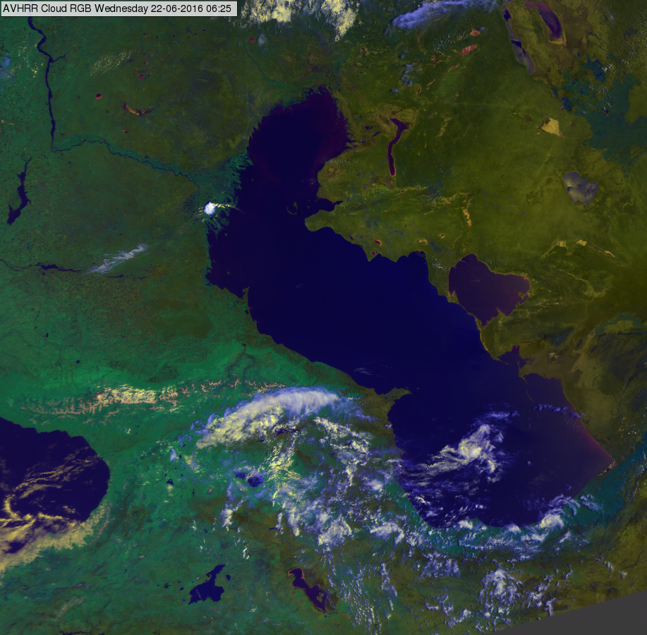
AVHRR Cloud RGB image of the Caspian Sea region for 22 June 2016 at 06:25 UTC
Explanation of the colours of open water surfaces (see the recipe):
• The water strongly absorbs the radiation around 0.87 micron, so its reflectivity is very low in this channel, thus the green component is almost zero.
• For deep, clear water bodies the VIS0.63 reflectivity is usually also very low thus the red component is also weak.
• As the temperature of the open water surfaces is positive, so the brightness temperature derived from IR10.8 is usually between 303 and 270 K, thus the blue component is lower than medium, but not as low as the green component.
As a consequence, open water surfaces appear dark blue. Colder water surfaces, and open water surfaces close to the edge of the swath (scanned with high satellite zenith angle) are slightly brighter blue, but still darker than medium blue.
For shallow and/or turbid water bodies the VIS0.63 reflectivity increases, the red component became higher than the green component. Such water bodies may appear dark blue with some magenta tones.
Sea, lakes, rivers (open water surfaces) appears dark blue in the Snow RGB images.
See for example the Mediterranean Sea, Black Sea, Baltic Sea and North Sea in the image below.
Meteosat, SEVIRI Snow RGB for 12 March 2014 07:55 UTC
The next image shows a closer look on the Black Sea and the Dnieper River.
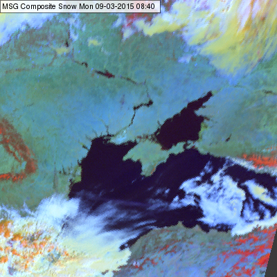
Meteosat, SEVIRI Snow RGB for 09 March 2015 08:40 UTC
Explanation of the colours for snow covered land (see the recipe):
• The reflectivity is very low in all three channels.
• After performing the linear stretching and the gamma correction the signals are still very low in all three channels. In most of the cases the blue component is slightly higher that the green and red components, so the open water surfaces appear dark blue, sometimes almost black.
High and thick Cirrus clouds depict in black in the Night Microphysics RGB images. Thin Cirrus clouds turn into blue.
For high and thick Cirrus clouds, none of the colour beams is contributing.
The brightness temperature difference BTD (IR12.0 - IR10.8) is used for the detection of Cirrus clouds. When they are present, the BTD turns negative, the contribution from the red colour beam is near zero.
The same is valid for the BTD (IR10.8 - IR3.9), used to detect low water clouds. When Cirrus clouds are present, the BTD is near zero and the contribution from the green colour beam null.
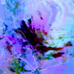
The contribution from the blue colour beam is related to the amount of radiation measured by the SEVIRI instrument at 10.8 micrometer. For thick and cold ice clouds, the contribution of the blue colour beam is null, but when these ice clouds become thinner and are located over a warm surface (e.g. sea), they turn into blue (see image below).
Night Microphysics RGB from 10 January 2016, 00:00 UTC
Explanation of the black colour of Cirrus clouds in the Night Microphysics RGB (see the recipe):
• For high and thick Cirrus clouds, none of the colour beams contribute. In case of thin Cirrus over a warm ground, it turns into blue.
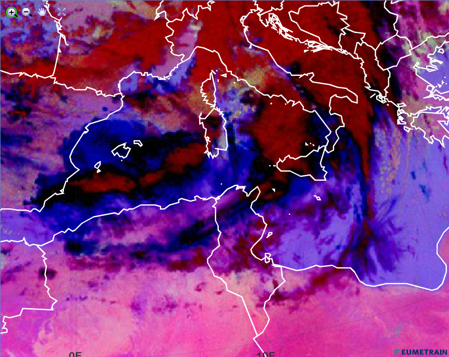
Water surfaces are depicted in dark blue or violet colours in the Severe Storm RGB. Note that if the sea is covered by ice the colour will change considerably.
The Severe Storms RGB was developed to highlight the characteristics of the thick ice clouds. The other phenomena are just ‘background’. Cloud-free land and water are blue or violet in this RGB type, having good colour contrast with the colours of ice clouds (red, yellow). See for example the area of the Mediterranean Sea in the image below.
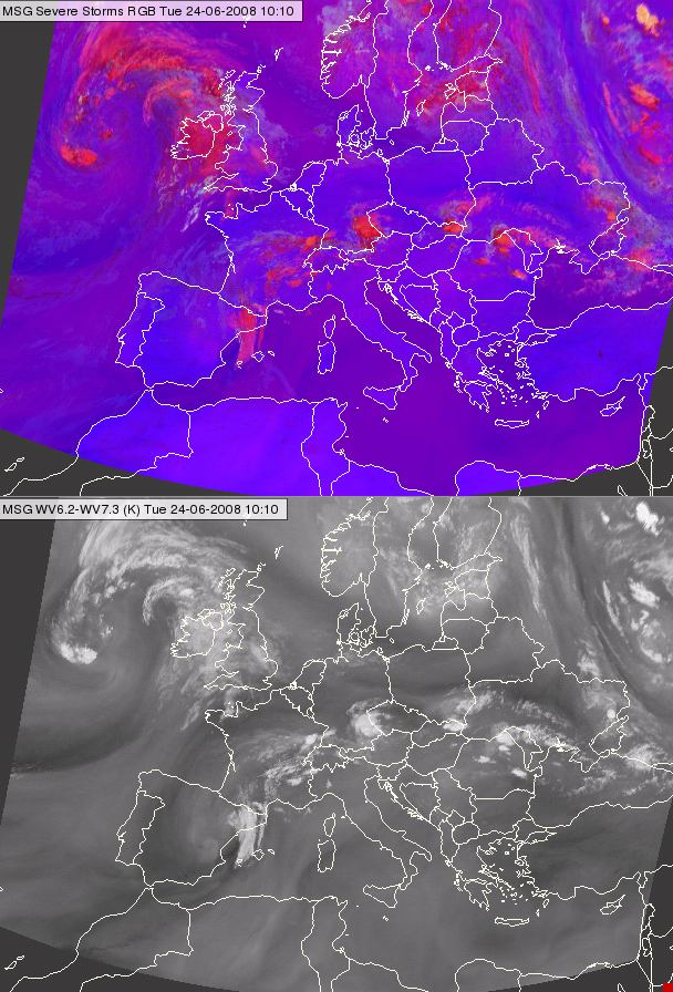
Meteosat, SEVIRI Severe Storm RGB image (up) and the ( WV6.3-WV7.2) difference image (down) for 24 June 2008 10:10 UTC
In the red colour beam the (WV6.2-WV7.3) channel difference is visualised. The structure of the (WV6.2-WV7.3) channel difference appears also in the cloud-free areas - with reddish tones in the blue background. In the figure above both the RGB and the WV channel difference is shown. Water is dark blue on areas with less reddish tones, and violet on areas with more reddish tones.
Explanation of the colours of water surfaces (not covered by ice) (see the recipe):
• The difference (WV6.2 – WV7.3) is negative for cloud free areas. This results low to medium signal in red. (Higher signal for dry than wet mid troposphere).
• The difference (IR3.9 – IR10.8) is small negative for water surfaces resulting almost zero signal in the green colour beam.
• The difference (NIR1.6 – VIS0.6) is small negative, resulting a stronger than medium signal in blue colour beams. (For land it is even stronger.)
As a consequence for water surfaces the signal will be low to medium in red, almost zero in green and stronger than medium in blue colour beams.
Oceans, lakes and rivers appear dark blue in the Day Microphysics RGB images.
Water acts almost as a black body for short wave solar radiation, hence the albedo is near zero and there is no contribution from the red and green colour beam.
The blue colour beam reflects the water temperature. Water not covered by ice contributes only little with blue colour, but since the red and the green contribution are almost zero, the overall colour hue is dark blue.
The image below shows the eastern Mediterranean Sea early March 2013. Only a few clouds cover the sea surface.
Day Microphysics RGB from 5 March 2013, 12:00 UTC
Explanation of the dark blue colour of oceans, lakes and rivers in the Day Microphysics RGB (see the recipe):
The dark blue colour of oceans, lakes and rivers is formed by a moderate contribution of IR10.8 only.
Oceans, lakes and rivers appear dark blue in the HRV Cloud RGB images.
Water acts almost as black body for short wave solar radiation, hence the albedo is near zero and there is no contribution from the red and green colour beam.
The blue colour beam reflects the water temperature. Water not covered by ice contributes only little with blue colour, but since the red and the green contribution are almost zero, the overall colour hue is dark blue.
HRV Cloud RGB from 21 July 2015, 12:00 UTC
Explanation of the dark blue colour of oceans, lakes and rivers in the HRV Cloud RGB (see the recipe):
• As the albedo of water is near zero, only the blue colour from the IR10.8 channel contributes to the HRV Cloud RGB. The blue contribution is very small.
High and thick Cirrus clouds depict in black in the Dust RGB images. Thin Cirrus clouds turn into blue.
For high and thick Cirrus clouds, none of the colour beams is contributing.
The brightness temperature difference BTD (IR12.0 - IR10.8) is used for the detection of Cirrus clouds. When they are present, the BTD turns negative and the contribution from the red colour beam is near zero.
The same is valid for the BTD (IR10.8 - IR8.7), used to detect low water clouds. When Cirrus clouds are present, the BTD is near zero and the contribution from the green colour beam null.
The contribution from the blue colour beam is related to the amount of radiation measured by the SEVIRI instrument at 10.8 micrometer. For thick and cold ice clouds, the contribution of the blue colour beam is null, but when these ice clouds become thinner and are located over a warm surface (e.g. sea), they turn into a dark blue.
Dust RGB from 10 January 2016, 00:00 UTC
The image below shows an elongated Cirrus cloud over the Indian Ocean. The south-western part of the cloud turns into blue. This is a clear sign that the Cirrus cloud gets thinner.
Dust RGB from 5 February 2016, 00:00 UTC
Explanation of the black colour of Cirrus clouds in the Dust RGB (see the recipe):
For high and thick Cirrus clouds, none of the colour beams contribute. In case of thin Cirrus over a warm ground, black turns into dark blue.