
Use of satellite precipitation products for landslide mapping: people and pixels in Brazil
Humberto Barbosa talks on the use of satellite precipitation products for mapping land slides in Brazil.
Length: 50 minutes.
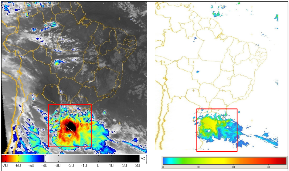
Research during the past decade has documented the importance of satellite precipitation products to the overall workings of the tropical landslide susceptibility. Several types of satellite precipitation products are used for landslide assessment but the area they see, and the frequency of observations, varies. Two complementary types are particularly relevant to landslide management. Polar-orbiting satellites fly in a relatively low orbit (often at around 1000km above the ground), providing relatively high spatial resolution. But they only collect data over the same point once every few days. Geostationary satellites are positioned at a much higher altitude (about 36,000km). They orbit the Earth at the same speed as the Earth rotates on its axis, in effect remaining stationary above the ground and viewing the whole earth disk below. Their spatial data is much coarser, but is collected at the same point every 15 minutes. Moreover, rainfall-triggered landslides tend to be local-scale features, but ground conditions are also very important. When they destroy people's lives and livelihoods, they become natural disasters. Thus, Understanding the nature of spatial and temporal variability of rainfall events in developing countries is important to improve the landslide-prediction science. This seminar will present an overview of recent landslide examples in Brazil and applications of satellite precipitation products. A key satellite input dataset for the integrated applications is the EUMETSAT’s Satellite Application Facility on Support to Operational Hydrology and Water Management.