
Operational use of RGBs (part 2)
An intensive training module on the operational use of RGBs in the forecasting room.
The new generation satellite data contains more and more information offering increased insight into cloud and air mass characteristics. This poses a challenge: figuring out how to extract, distill and package the data into products that are easy for forecasters to interpret and use.
One might create numerous different kinds of RGB images. Satellite experts developed some optimally tuned RGB types for highlighting specific features. These are the so called standard RGBs recommended by EUMETSAT. The advantage of using standard RGBs is their easy comparability.
The aim of creating RGBs is to provide fast, easily understandable VISUAL information. A 'good' RGB should convey information that would be difficult or time consuming to assess visually from one or more individual single channel images. RGB image should be unambiguous and use intuitive colours to help highlighting important meteorological and surface features. RGBs provide useful information to forecasters, in particular when looking at animated image sequences. They preserve the "natural" look-and-feel of "traditional" satellite images, e.g. they preserve texture, and the patterns are continuous in time.
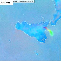
In this module you will learn more about the EUMETSAT standard RGBs: HRV Fog RGB, Snow RGB, Night Microphysics RGB and the Ash RGB.