
Vegetation Products
Presentation giving an overview on the use of satellite data, particularly that from Meteorological satellites, for monitoring vegetation cover and properties.
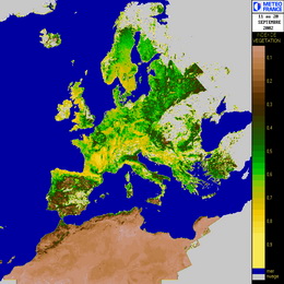
The current presentation gives an overview on the use of satellite data, particularly that from Meteorological satellites, for monitoring vegetation cover and properties. Some basic physical principles are first presented and then some RGB images are shown, allowing to identify different features in the surface of the earth. Further information on vegetation is given by a wide range of empirical indices, from which one of the most used is the NDVI. There are however some disadvantages on using such vegetation indices. Other parameters more related to vegetation properties and health than these conventional empirical indices are available from the LSA SAF. These are the Fractional Vegetation Cover (FVC), the Leaf Area Index (LAI) and the Fraction of Absorbed Photosyntetically Active Radiation (fAPAR). The algorithm rationale for deriving such parameters is explained and some validation results are presented. Finally, the use of these products in several applications is shown.