Introduction into conceptual models
Convection at the leading edge of cloud bands
This severe weather was intensified by convection at the leading edge of cloud bands. For this reason a short introduction into the conceptual model is of great interest.
MCs frequently develop at the leading edge of frontal cloud bands. This is most likely the situation where there is a specific vertical distribution of air mass and conveyor belts: a warm conveyor belt at low levels in front of the front and a dry intrusion in the layers above. Such a situation develops when a jet streak crosses the front. Dry air on the cyclonic side of the jet axis overruns the frontal cloud band and reaches its leading edge. Whilst the relative streams of dry intrusion are sinking behind the frontal cloud band, they change to rising during the crossing of the front.
Indicators:
- Frontal conditions indicated by TFP, a zone of high thickness gradients, a downward inclined gradient of isentropes, a frontal circulation created through convergence and upward vertical motion
- A rising warm conveyor belt in low to middle layers along the leading edge of the frontal cloud band
- A (rising) dry intrusion in the middle high layers along the same leading edge of the frontal cloud band
- The effect of both conveyor belts lying on top of each other leads to the unstable stratification of the troposphere
As described before the cold front is situated over Switzerland at 18 UTC. Observing the infrared-picture there are several MCs in front of the cold front. The vertical cross section ranging from the Atlantic coast to Poland also shows the front as well as the MCs. The light blue isolines indicate the upward motion (omega) the blue and red isolines the temperature advection. MCS tend to form at the high thickness gradients, indicated by the thermal front parameter (below).
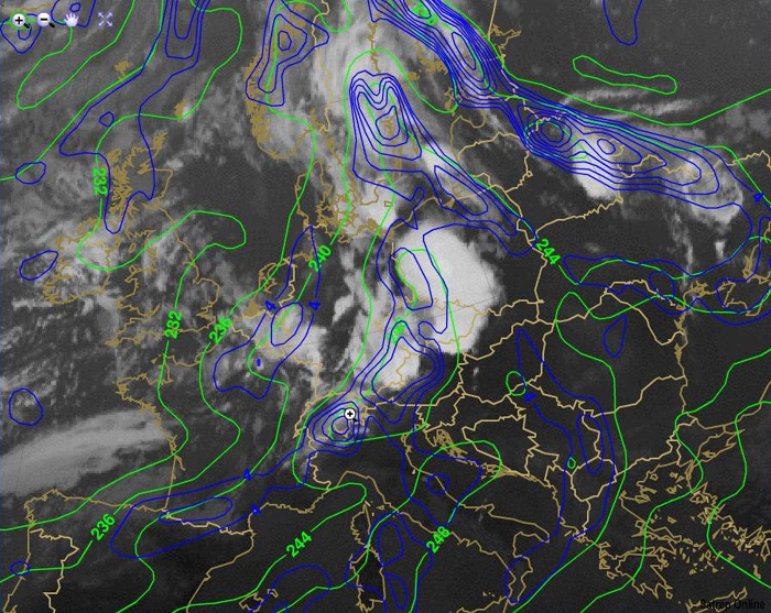
Figure 14: Meteosat 9 IR10.8 with Equivalent thickness and thermal front parameter
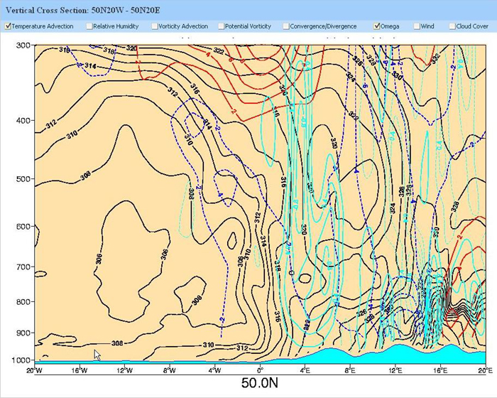
Figure 15: Vertical cross section