Synoptic situation
Short introduction into the general weather situation - Friday 23rd July 2009/ 00 UTC
ECMWF-analysis: Europe is dominated by a pronounced trough and its upper low pressure zone north of Iceland. There is also a split off upper low in the West of Ireland. This configuration causes that Western Europe is located on the front side of the upper trough implying high PVA-values. Considering the equivalent thickness layer Austria is situated in a warm air tongue reaching from North Africa to Europe. The mean layer temperature exceeds 288 Kelvin which is indicating a very warm surface temperature. The high temperatures are further intensified on the north side of the Alps due to the impact of foehn. Moreover there is a cold front stretching from West of France to the Netherlands which is shifting eastwards. Due to the advection of subtropical air masses there is high potential for the development of thunderstorms, even prefrontal.
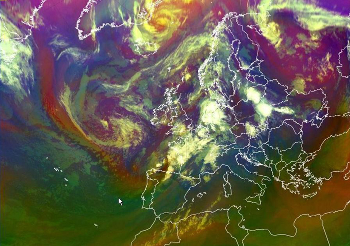
Figure 3: Airmass-RGB/00 UTC: The reddish stripe indicates dry descending stratospheric air which contains two important features. It is rather dry and provides high potential vorticity. For this reason it is considered as source for the further development of convective systems. For this case study we just have to keep in mind that there is obviously a source of energy
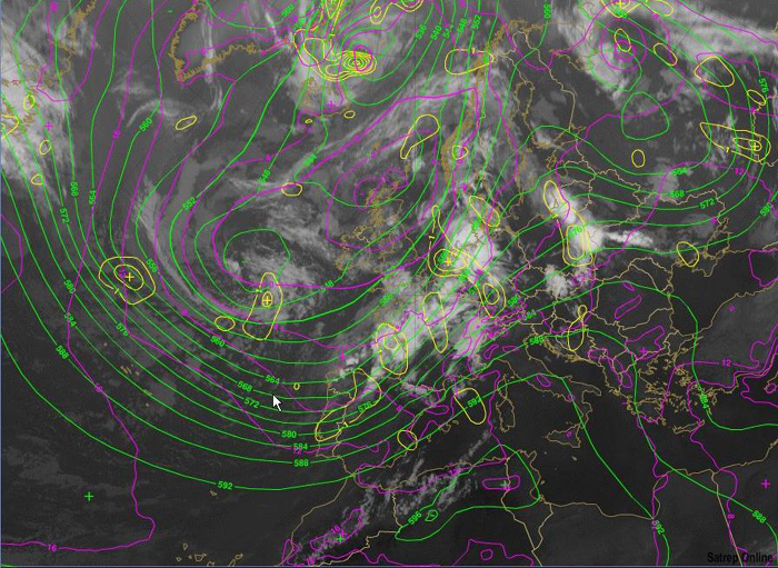
Figure 4: Overlay: 1000hPa- und 500hPa pressure zones/00UTC: If the upper low and the surface low are not situated in the same geographical area, there is the possibility of further development. Otherwise there would be convergence at both levels, resulting in a weakening system. (figure: yellow: PVA500, green:H500, lila:H1000)