Chapter I: Introduction
Table of Contents
- Chapter I: Introduction
- Introduction
Introduction
The 23rd of July was marked by a fast transition of a cold front (about 80 km/h) from west to east which went along with severe thunderstorms and hail. The catastrophic event caused enormous agricultural damage and the Austrian farmer alliance reported that about 60 000 hectare arable lands were devastated. The destruction mostly caused by hail was estimated to sum up 15 million euro. (Source: Austrian hail insurance). On this account people insist on investigations to find out what exactly caused the event. Besides on the meteorological perspective there is always great interest in improving forecast methods and forecast tools. In principle the following report provides a detailed analysis of the weather event. Basically the high potential of prefrontal thunderstorms was known, although there were diverse estimations about its development. It was the change of the wind direction due to the interaction between the convergence line and the foehn that induced the following weather development. Contributing to the wiki case studies this report should lead to a better understanding of the atmospheric conditions that special day and introduce nowcasting-products (GII & SAI).
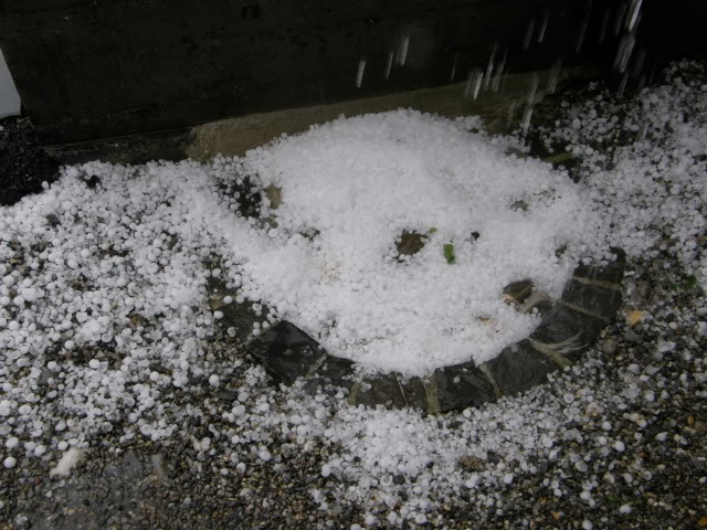
Figure 1: Hail in Vorarlberg (Skywarn)
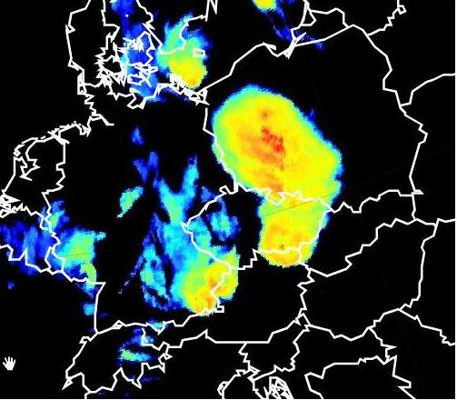
Figure 2: Enhanced IR10.8 (Meteosat9)/ 18 UTC