
Severe convection
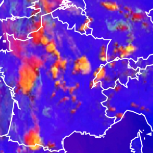
Thick ice clouds in convective cells are depicted in red or yellow colours in the Severe Storms RGB images. The areas where the particle size is small and/or the cloud top is very cold will appear in yellow colours. When ice particles become large and/or the cloud top warmer the cloud colour will turn into red. Transitional colours (e.g. orange) will also appear.
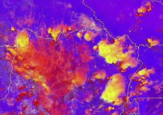
Developing, active thunderstorms with strong updraft usually have bright yellow colours (beside red and orange) on its top, mainly at the location of the updraft region. This RGB can be used to locate the active parts of extended convective cells.
The yellow colour can be caused by:
• Very cold cloud top temperature, e.g. very cold overshooting tops caused by strong updraft.
• Small ice crystals on (or above) the cloud top. Strong updrafts bring small ice particles up to the cloud top. Due to the strong updraft the water particles formed at the cloud base have not much time to become larger by coagulation before freezing. (Note that the small ice crystals may belong to an above anvil cirrus cloud, as well.)
• The combined effect of very cold cloud top temperature and small ice crystals.
If the yellow colour is caused by the presence of small ice crystals resulting from strong updrafts and spreading along the anvil, then first the updraft area, i.e. the overshooting top, turns into yellow. When the updrafts persist, the yellow area enlarges gradually.
The images below show severe convective systems over Central Europe.
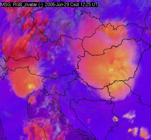
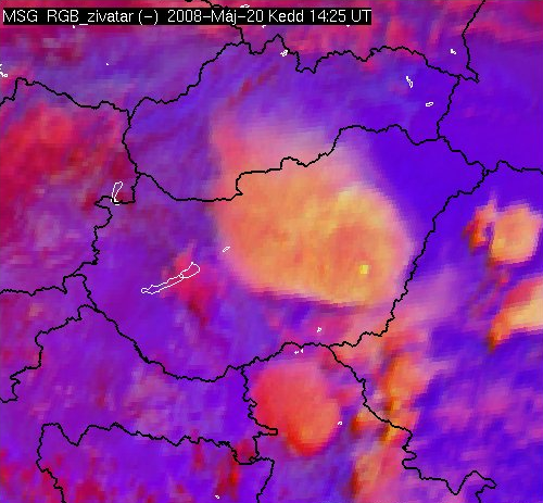
Meteosat, SEVIRI Severe Storms RGB images for 29 June 2006 12:25 UTC (left) and 20 May 2008 14:25 UTC (right)
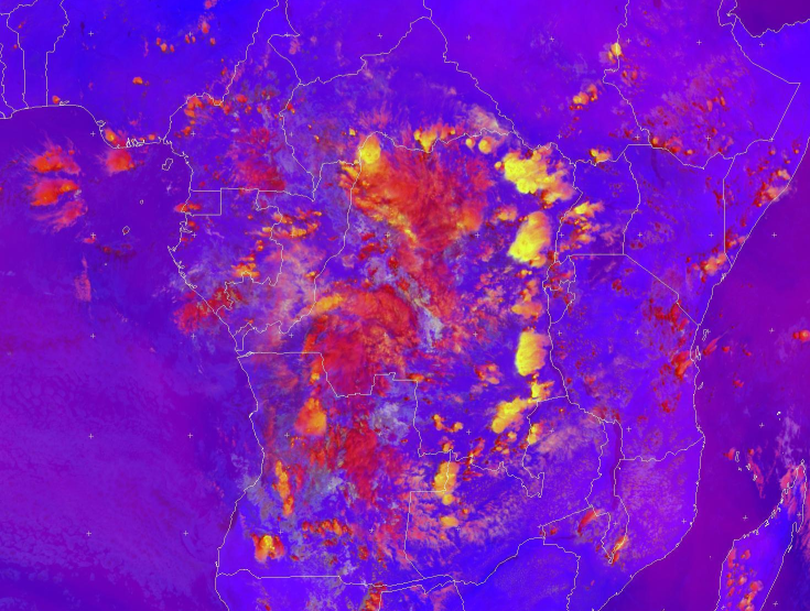
The image below shows convection above Africa.
Note that small ice crystals may form not only due to intense updraft. Small ice crystals can be as well observed: on the tops of storms with cold (high) cloud base, in high level lee clouds and on the tops of polluted thick ice clouds.
Explanation of the colours of thick ice clouds (see the recipe):
• The difference (WV6.2 – WV7.3) is usually negative, but for high ice clouds it is around zero resulting intense signals in the red colour beam.
• The difference (IR3.9 – IR10.8) is high in case the cloud top is very cold and/or it consists of small particles, otherwise it is lower. (This difference serves as an approximation of the 3.9 micrometer reflectivity value - small ice crystals reflect more solar radiation than large ones. However, it depends on the cloud temperature as well.)
• The difference (NIR1.6 – VIS0.6) is large negative because the reflectivity values of ice clouds are much lower around 1.6 micrometer than around 0.6 micrometer. This gives low signal in the blue colour beam.
As a consequence the signal will be intense in red and low in blue colour beams for thick ice clouds. The difference of the (IR3.9 – IR10.8) determines whether the resulting colour will be red or yellow or some colour in between.