
Semitransparent ice clouds
Semitransparent ice clouds appear greyish in the HRV Fog RGB images. Thicker cirrus clouds are grey with cyan tones. Thinner cirrus clouds appear as thin greyish veils (potentially with some week cyan tones).
The image below shows stratiform thin cirrus clouds over sea and land.
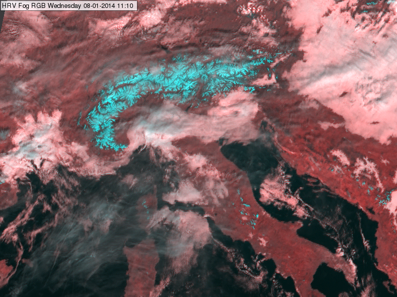
Meteosat, SEVIRI HRV Fog RGB image for 8 January 2014, 11:10 UTC
The image below shows thicker cumuliform cirrus clouds over sea and land.
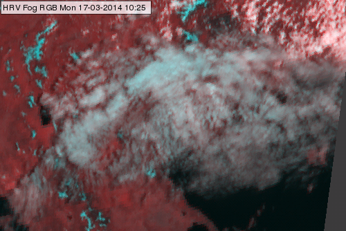
Meteosat, SEVIRI HRV Fog RGB image for 17 March 2014, 10:25 UTC
The next image show the transition from thick ice clouds to thinner and thinner ice clouds.
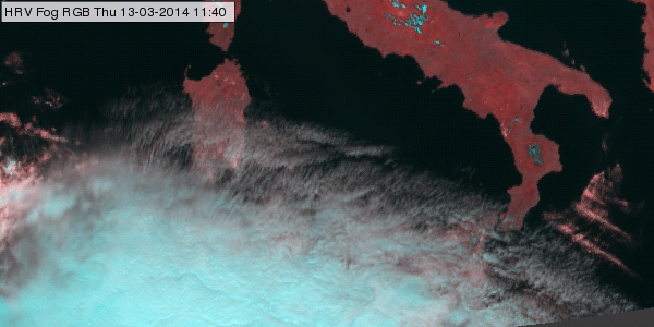
Meteosat, SEVIRI HRV Fog RGB image for 13 March 2014, 11:40 UTC
Explanation of the colours of the semitransparent clouds (see the recipe):
In case of semitransparent clouds the satellite measures mixed radiation consisting of the radiation emitted or reflected by the semitransparent cloud itself and the radiation originated from below and transmitted through it. That is why the colour of a semitransparent cloud depends not only on the characteristics of the cloud itself, but also on the transparency and the colour of the underlying surface.
• The colour of the almost thick semitransparent cloud approximates the colour of the thick ice clouds (cyan with some grey tones).
• The colour of the very thin cirrus clouds approximates the colour of the underlying clouds or surface.
• The colour of the thin cirrus is between the colour of the thick ice cloud and that of the underlying cloud or surface. – It appears as a thin greyish veil (potentially with some week cyan tones).