
Johannes Häkkinen (FMI): Precipitation Type and Satellite Images for High Latitudes
Description
Johannes Häkkinen presents forecasting different precipitation types and using satellites together with weather models in aviation.
Content
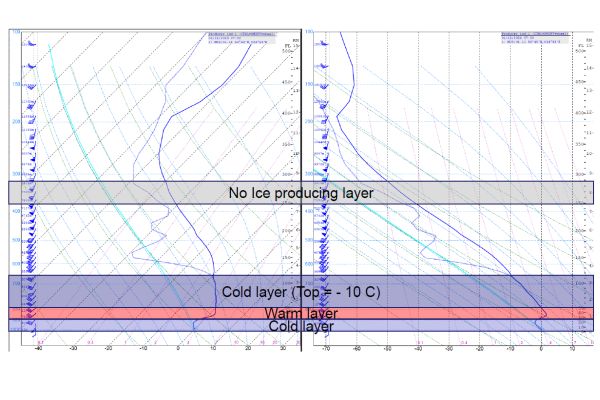
The presentation will go through different precipitation types, forecasting the precipitation types, and supporting the weather model with satellite images. The precipitation types are estimated from a model sounding by top-down method. Satellite imagery is mainly used for estimation of the cloud top. The focus is on aviation weather and short-term forecasts.