Improvement on EUMETSAT H-SAF H35 effective snow-covered area product by Multivariate Adaptive Regression Splines
Semih Kuter talks about improvement of the EUMETSAT H-SAF H35 effective snow-covered area product by Multivariate Adaptive Regression Splines.
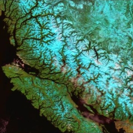
The pre-operational daily H35 effective snow-covered area product of H-SAF spatially spans the Northern Hemisphere and it is the successor of the operational Pan-European H12 product. Both products are at ~1 km resolution and developed through the H-SAF project of EUMETSAT by exploiting AVHRR channels. During the AS activity (i.e., H_AVS_18_03), an alternative machine learning-based approach is applied on H35 product to improve its accuracy. The new version of H35 product is realized through multivariate adaptive regression splines (MARS) algorithm. AVHRR reflectance data, as well as the well-known snow and vegetation indices (i.e., NDSI and NDVI), are used as predictors to generate the new MARS-based H35 product. The reference fractional snow-covered area (fSCA) maps are obtained from higher resolution Sentinel 2 imagery. Rigorous assessment on the final MARS-based H35 is performed over the Northern Hemisphere within a temporal domain from Nov 2018 to Nov 2019 by using i) Sentinel 2 derived reference fSCA maps, ii) ERA5-Land snow depth data, iii) MODIS MOD10A1 NDSI snow cover data, and iv) in-situ snow depth data. An additional visual assessment is also carried out by comparing MARS-H35/MODIS false-color and MARS-H35/Sentinel 2-derived reference fSCA image pairs over various geographic regions.

