
Thin high-level clouds
Thin high-level clouds appear bluish in the AVHRR Cloud RGB images.
Note that the AVHRR Cloud RGB contains information on transparency and temperature, but it has no information on cloud phase.
The images below show thin high-level clouds over sea, land and water clouds.
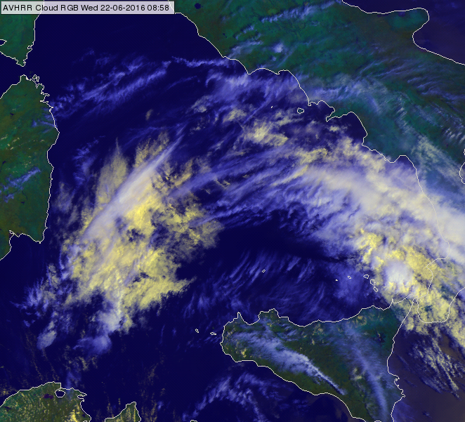
MetOp-B, AVHRR Cloud RGB of the Tyrrhenian Sea region for 22 June 2016 at 08:58 UTC
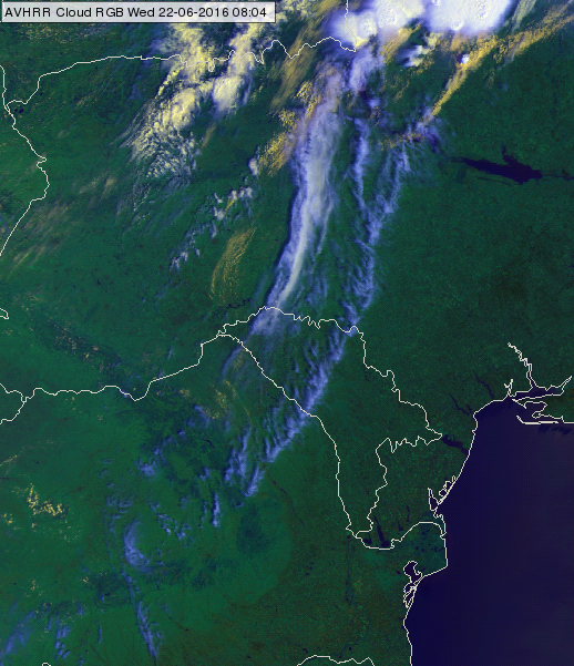
MetOp-A, AVHRR Cloud RGB over Ukraine, Moldova and Romania for 23 June 2016 at 08:04 UTC
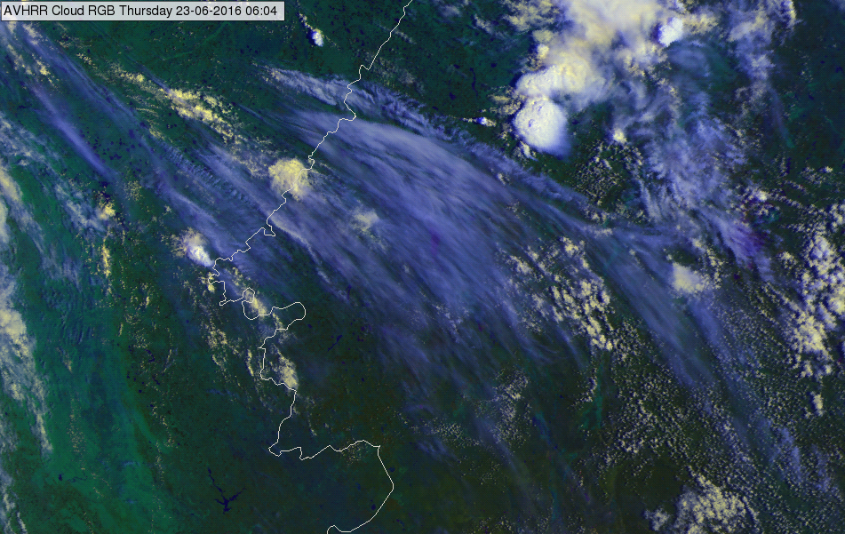
MetOp-A, AVHRR Cloud RGB over the border of Russia and Kazakhstan for 23 June 2016 at 06:04 UTC
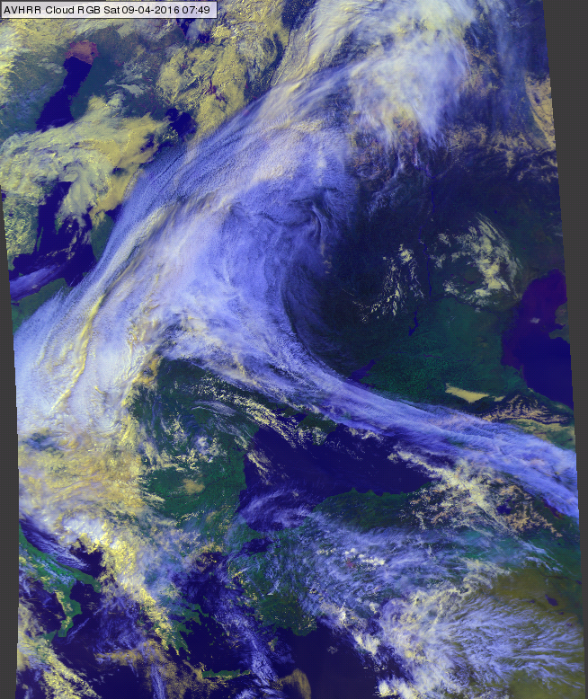
AVHRR Cloud RGB image of eastern Europe for 09 April 2016 at 07:49 UTC
The image below shows a convective system with large, extended thin cirrus anvil.
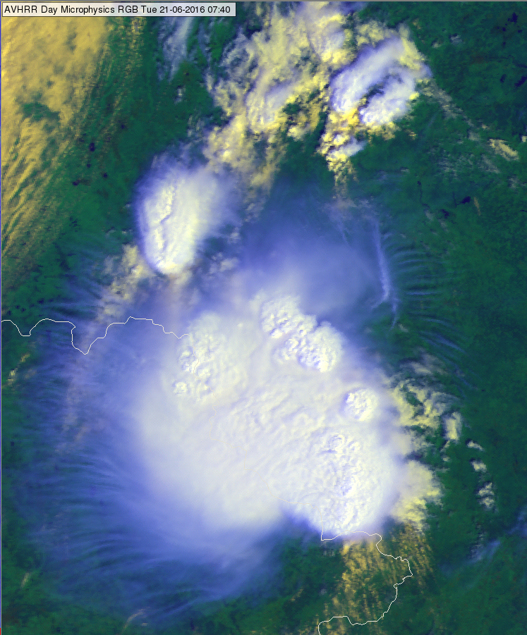
MetOp-B, AVHRR Cloud RGB over the border of Russia and Belarus for 21 June 2016 at 07:40 UTC
Explanation of the colours of thin high-level clouds (see the recipe):
• The reflectivity values of the thin high-level clouds are low both in VIS0.63 and NIR0.87 channels. Thin cirrus clouds do not reflect much – as they are thin.
• The brightness temperature of the cirrus cloud is between the cirrus cloud temperature and the temperature of the underlying surface, (the ‘weighting’ depends on the transparency).
Thin cirrus clouds are usually better seen in the thermal infrared region than in the shortwave channels. As a consequence, thin cirrus clouds appear bluish in the AVHRR Cloud RGB.
The high-level semi-transparent clouds add a bluish tone to the colour of the underlying surface. The colour of the semi-transparent clouds depends on the colour of the underlying surface (land, sea or lower lever clouds) and on its transparency. The thinner the cirrus clouds the closer is its colour to the colour of the underlying surface.